


Showcase your capabilities
If you design, build or supply Software & Autonomy, create a profile to showcase your capabilities and connect with visitors who have an active requirement for your solutions.


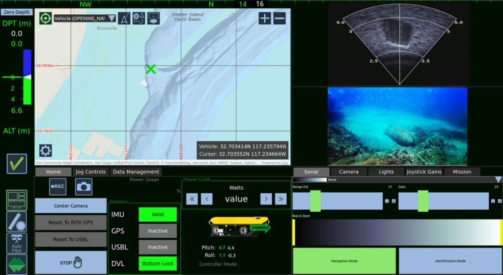
Cutting-Edge Acoustic Positioning & Subsea Imagery Solutions for Unmanned & Robotic Systems
High-Accuracy Navigation & Positioning Solutions for Unmanned & Autonomous Vehicles


Precision Positioning & Orientation Solutions for Unmanned Applications
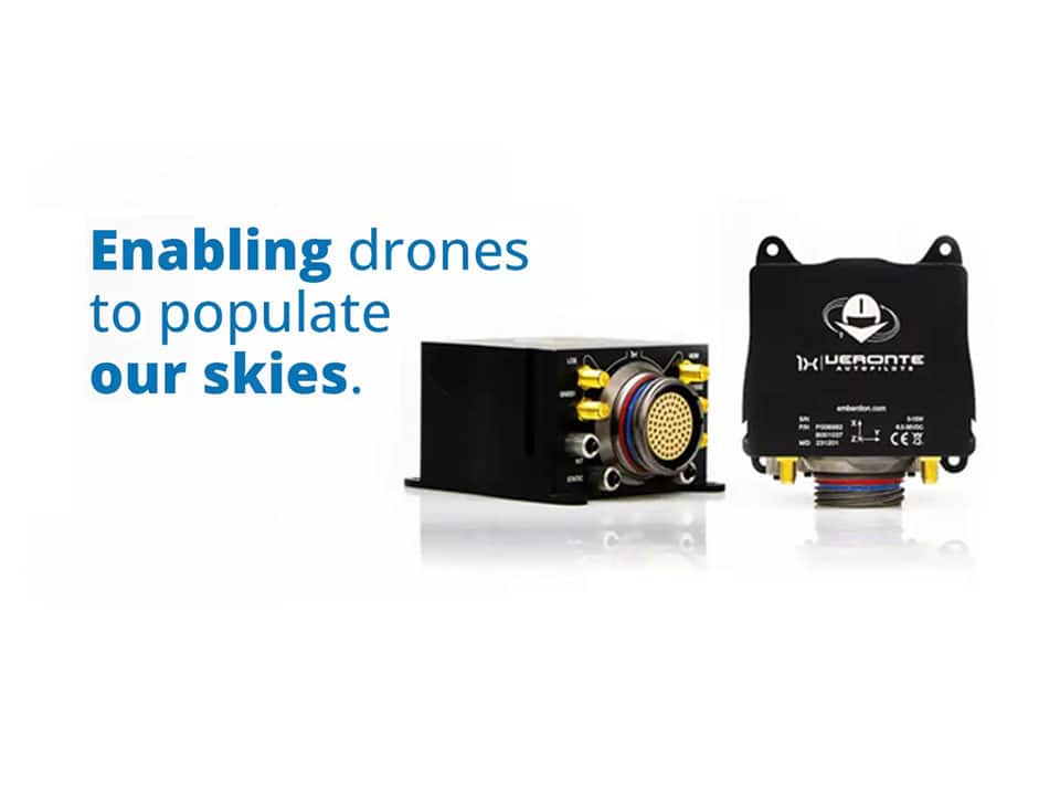
Military-Grade UAV Autopilot Systems for Advanced & Ultra-Reliable Flight Control
Fully Autonomous Multirotor Drones & Hybrid VTOL UAVs With AI Capabilities
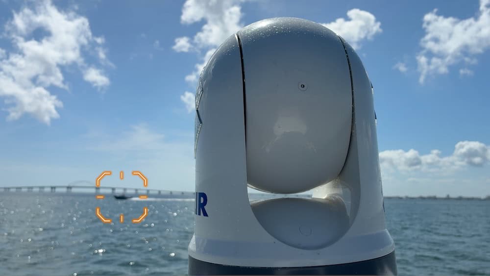
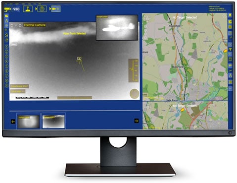
Multi-Sensor Imaging Gimbals, Searchlights and VMS Software for Air, Land & Maritime Platforms
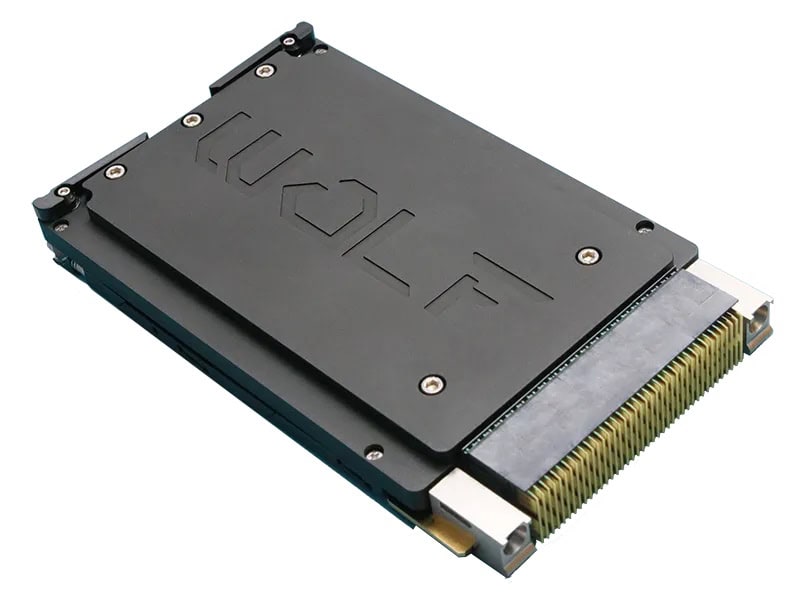
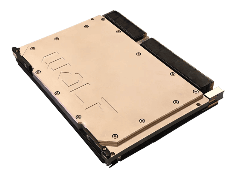
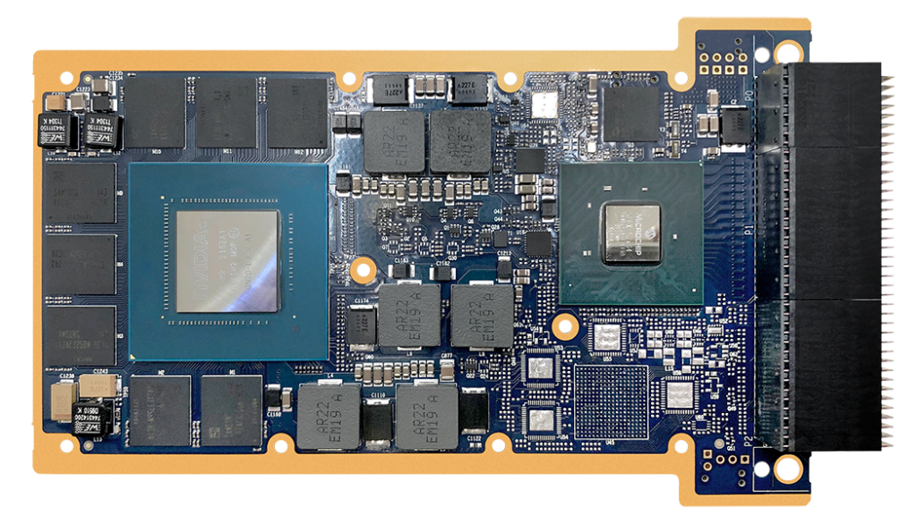
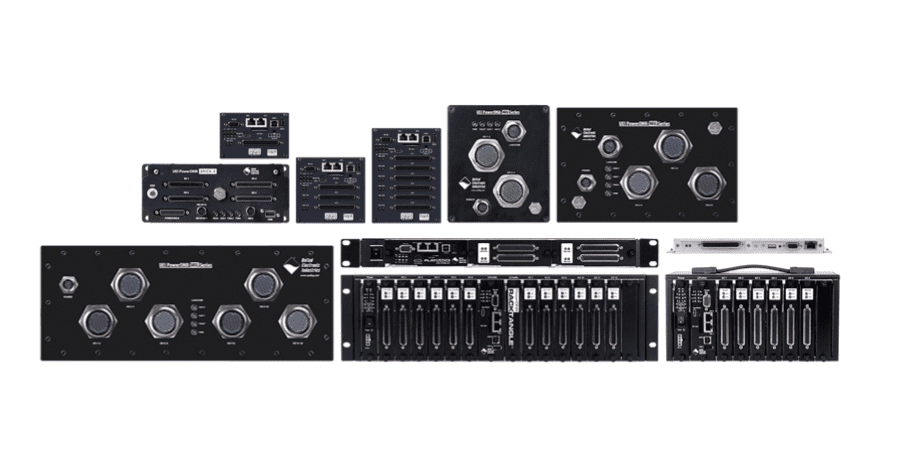
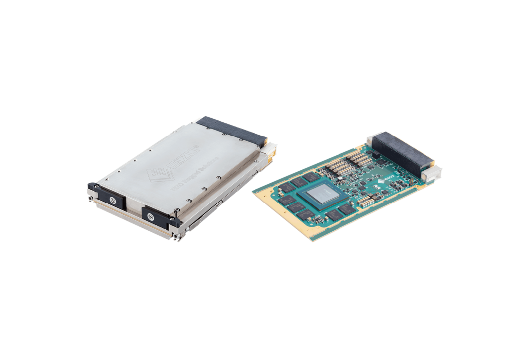
Rugged Computing and Video I/O Modules: 6U & 3U VPX, XMC, VNX+, and other Small Form Factors and Custom Solutions

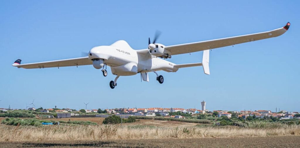
BVLOS Solutions for UAS & UAM: Fuel Cells, Radar, Navigation Sensors, Flight Control & SATCOM
UAV Gimbal Payloads - EO & EO/IR Drone Camera Gimbals for Tactical UAS
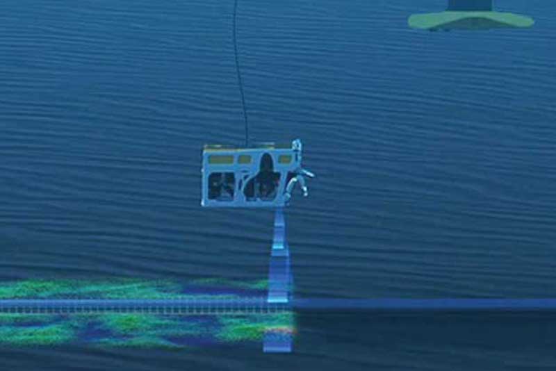
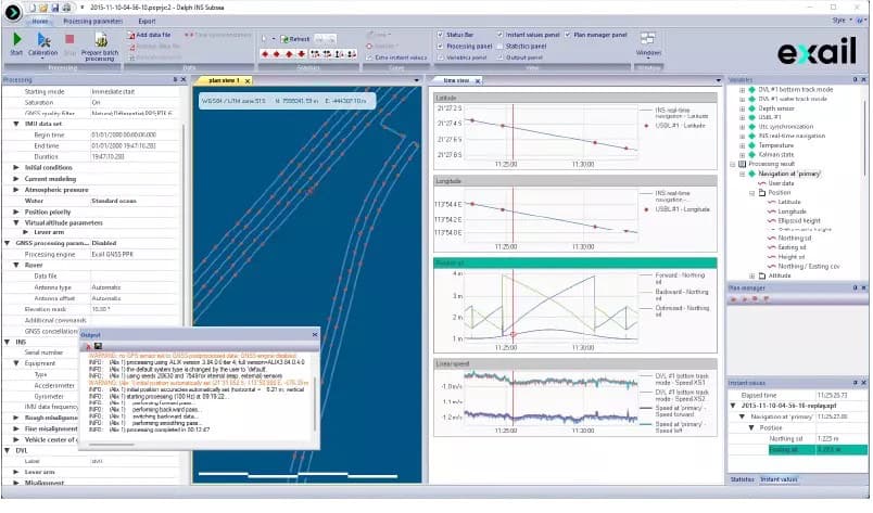
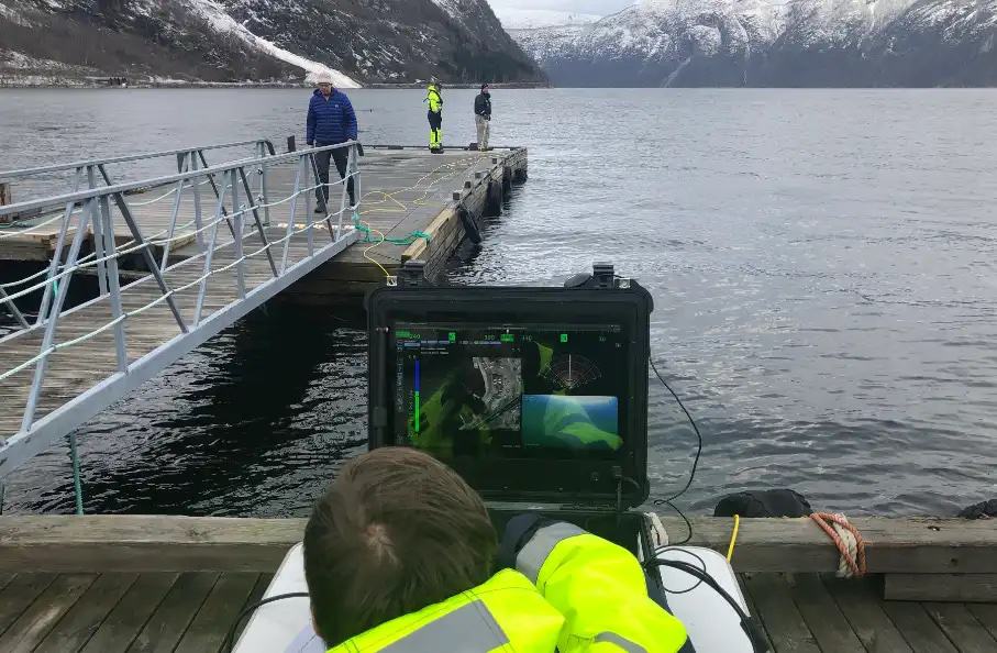
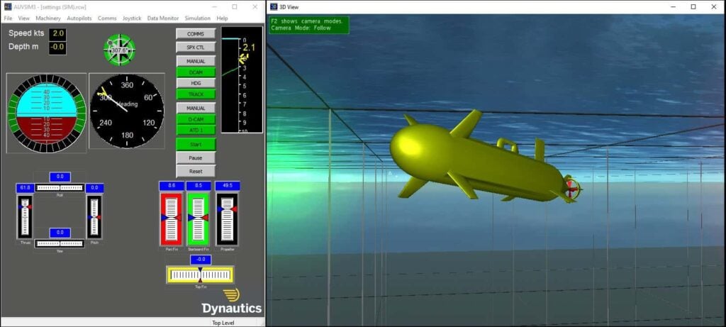
Robotics and Subsea Technologies for Defense, Commercial & Science Applications
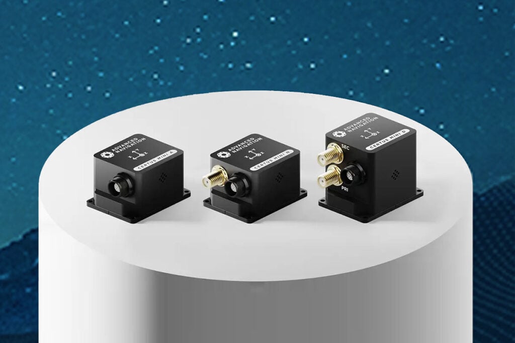
Inertial Navigation Systems, INS/GPS, AHRS, and IMU Sensors for Unmanned Systems

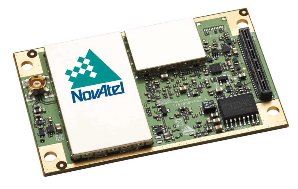
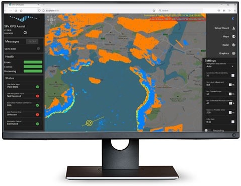
Precise Positioning for Unmanned Vehicles: GPS & GNSS Receivers, Antennas & Inertial Systems

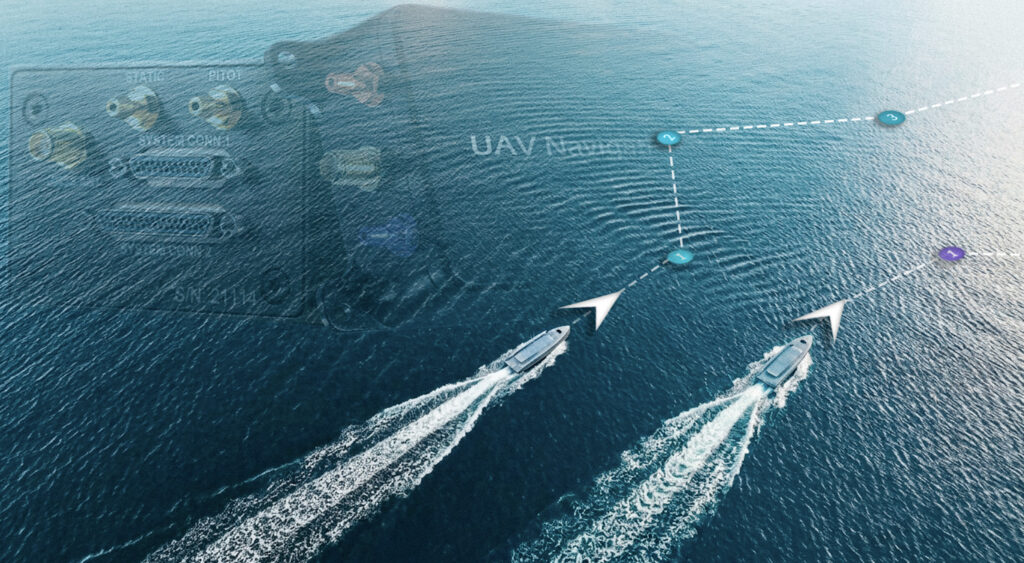
Integrated Electric Propulsion & Vessel Autonomy Solutions for Enabling Autonomous Maritime Operations

Software Development Toolkits With Compilation, Verification & Compliance Support

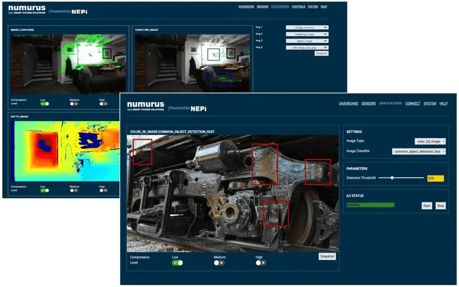
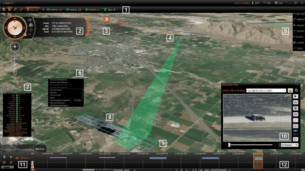
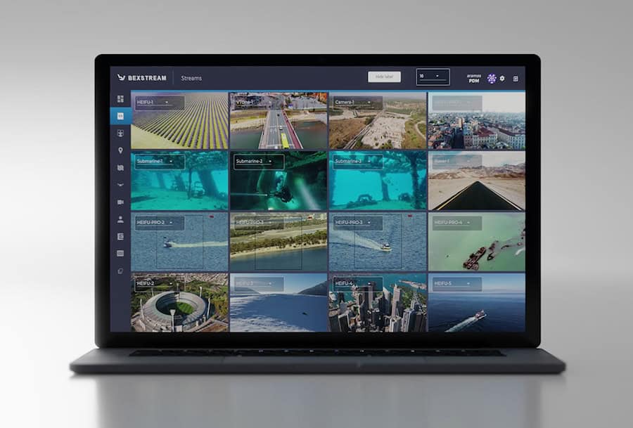
Edge AI Video Processing & Streaming Solutions Providing Real-Time Situational Awareness for Mission-Critical UAVs & Unmanned Systems

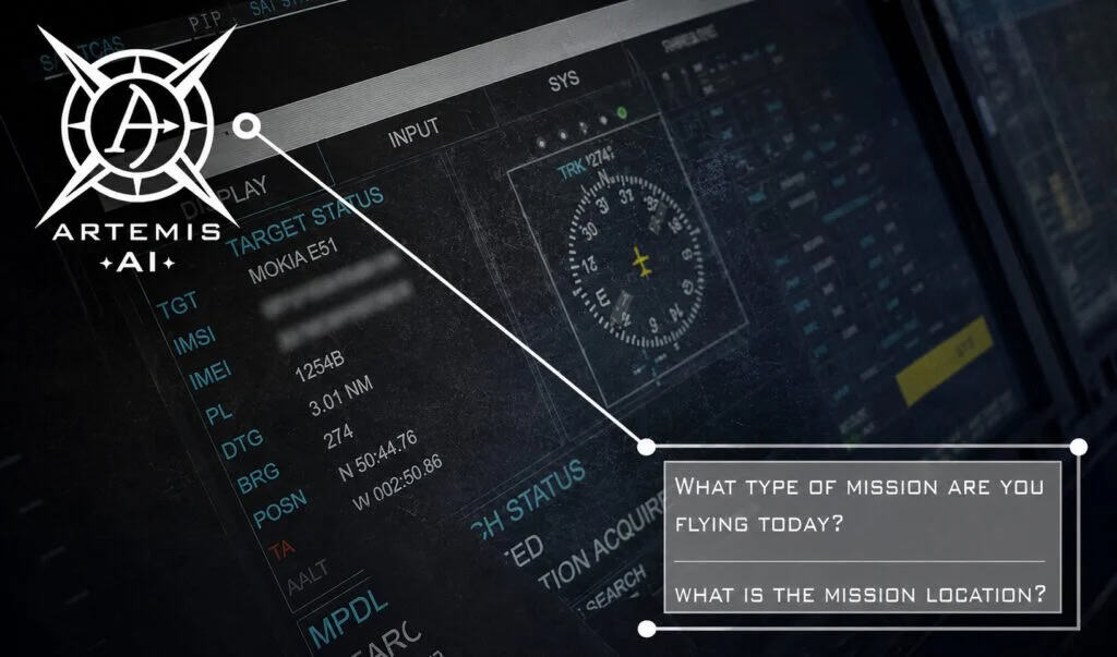
Cutting-Edge AI-Powered Digital Assistant for Drone Industry Professionals: UAS Regulations, Compliance & Technical Documentation
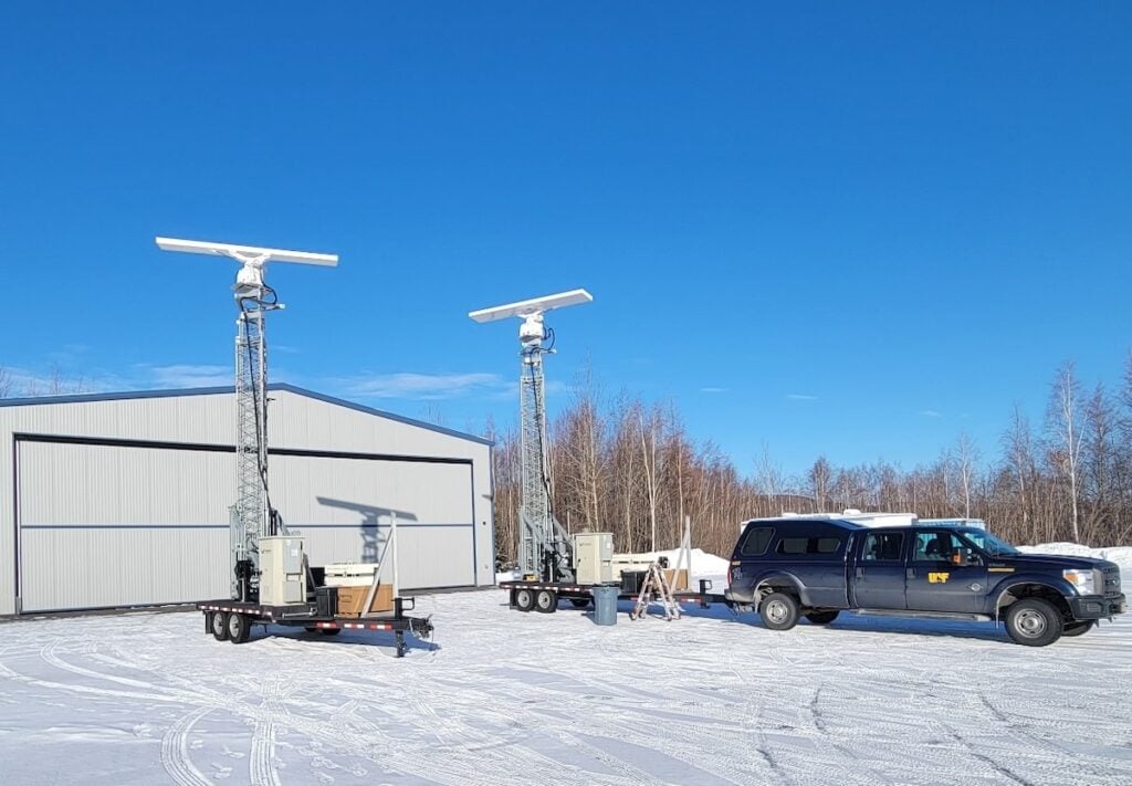
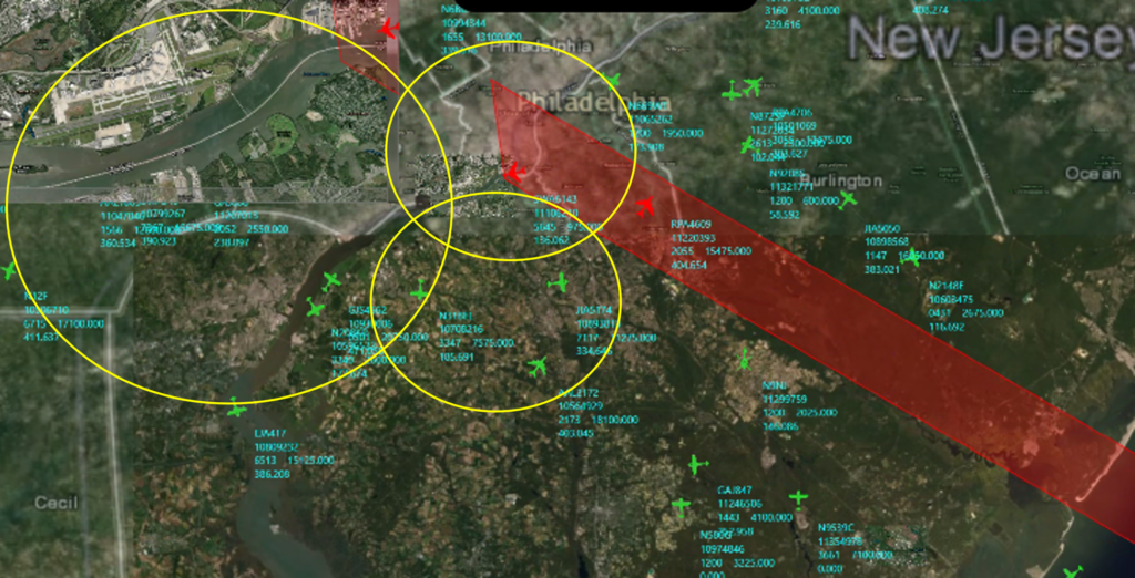
Cutting-Edge Unmanned Systems-based Sensing Solutions & Counter-UAS Systems for Military & Defense Forces

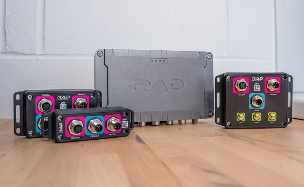
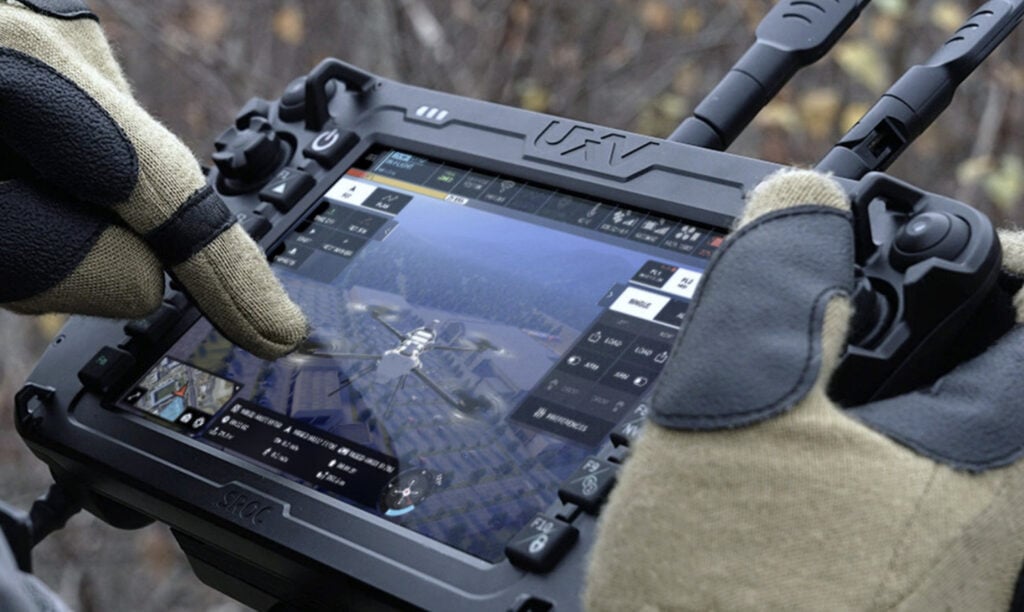
Mission-Critical Hardware & Software Technologies for Tactical UAVs & Unmanned Systems Operating In All Domains
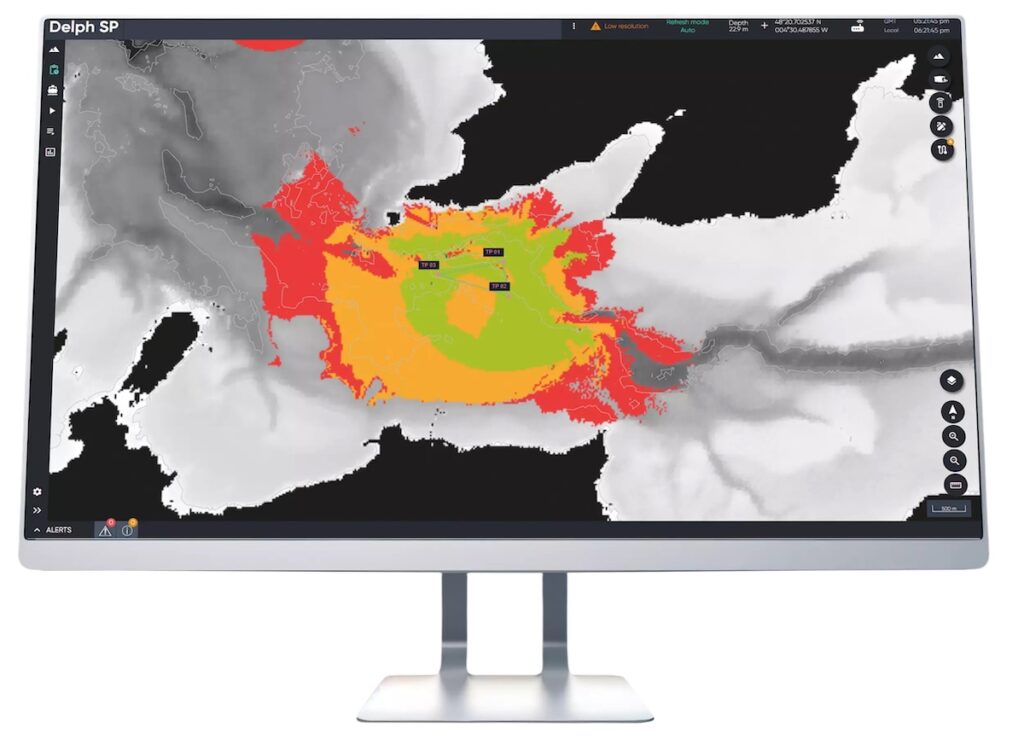
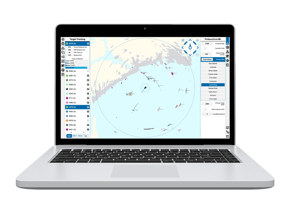
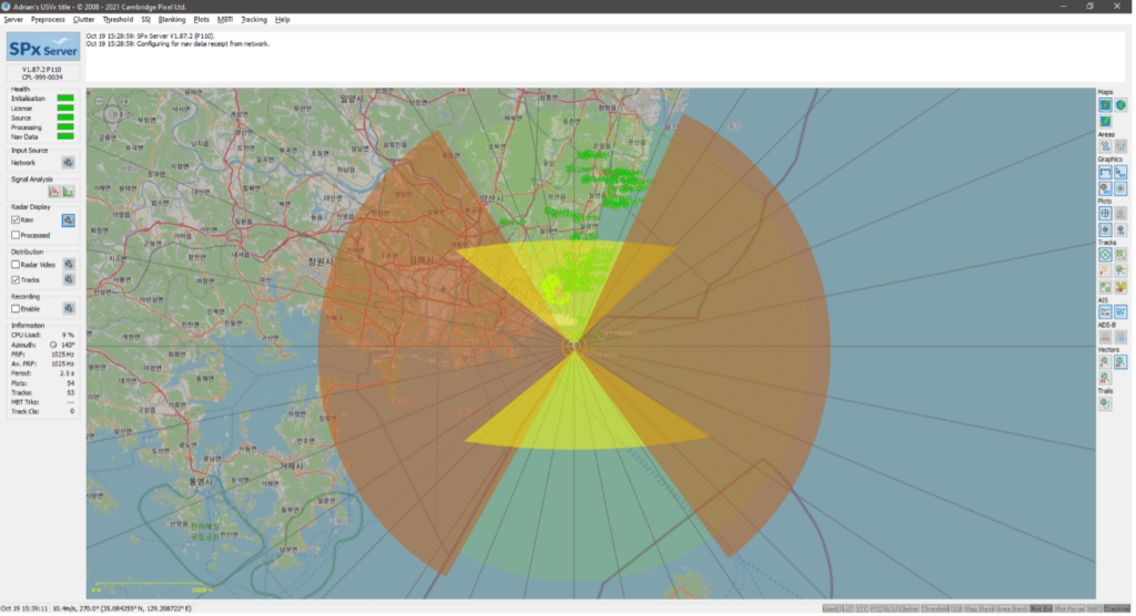
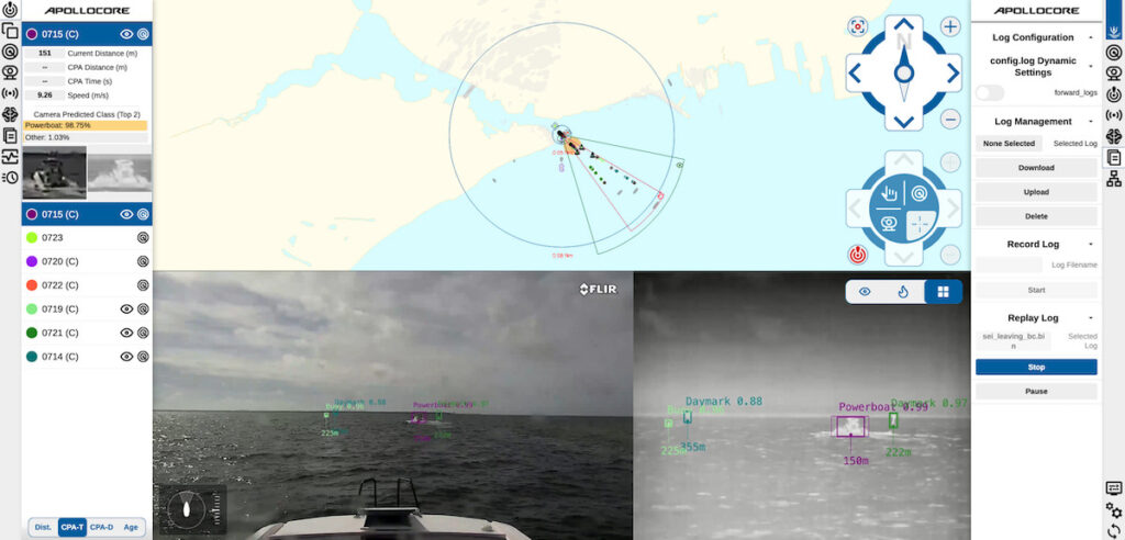
Smart Marine Radar Processing Solutions: Advanced Perception & Situational Awareness for Uncrewed & Autonomous Vessels
Innovative Turnkey UAS Solutions for Mission-Critical Civilian & Defense Applications

Ultra-Low-Bandwidth Real-Time Video Streaming Solutions for UAVs, Unmanned & Robotic Systems
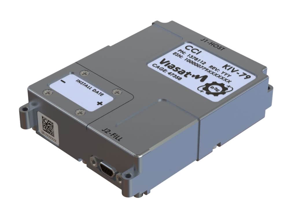
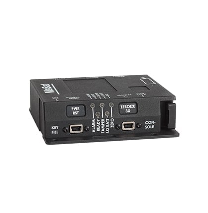
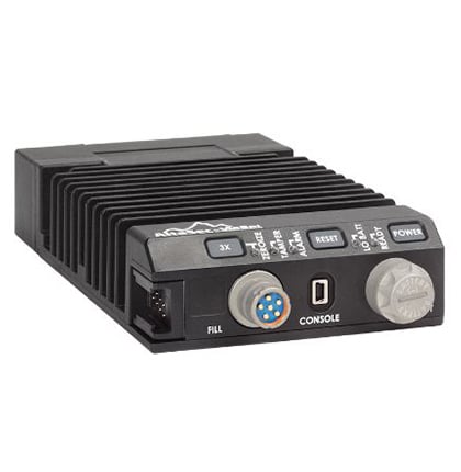
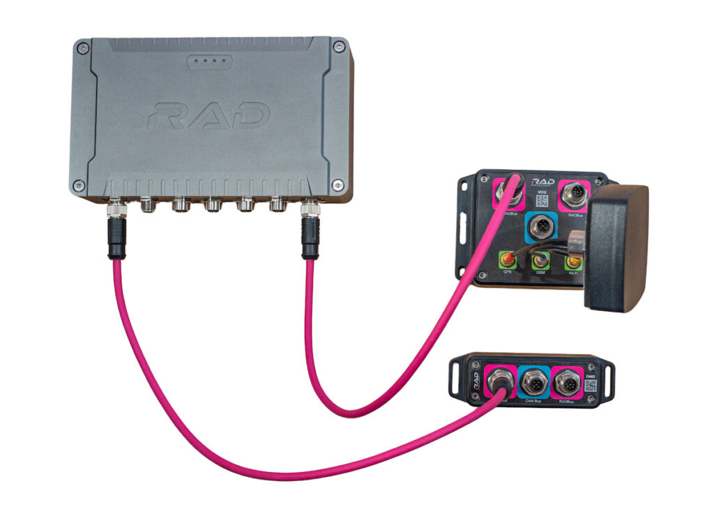
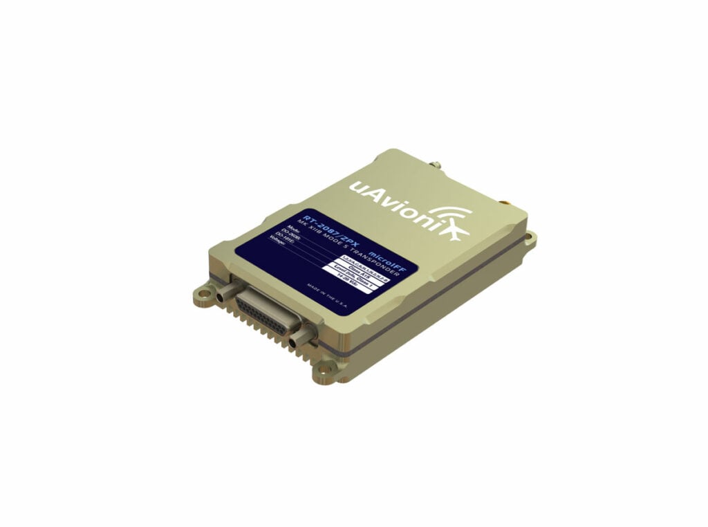
Secure Network Connectivity Solutions & IFF Mode 5 Encryptor Devices for Military & Government UAVs & Unmanned Systems
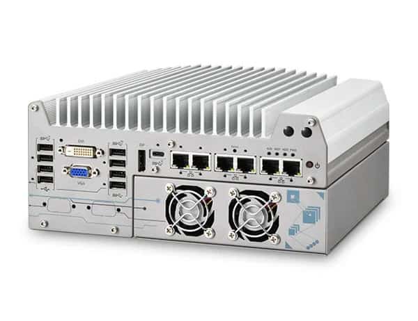
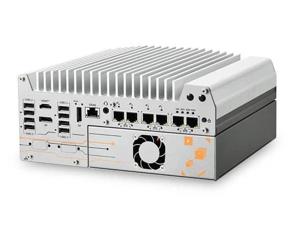
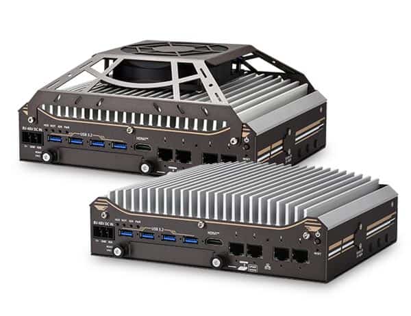
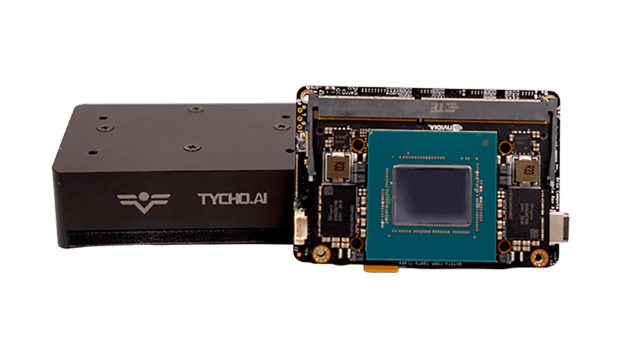
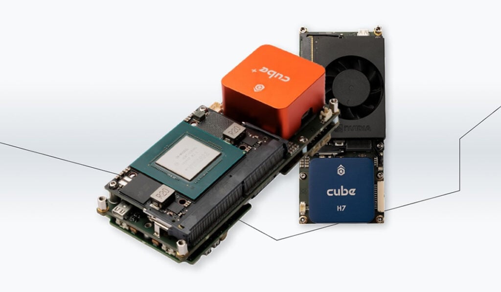
Industrial-Grade Embedded Computer Systems for AI Edge Computing & Machine Learning

Experimental Aircraft | Advanced Manufacturing | Autonomy | Flight Testing

GNSS Positioning Systems, 3D SLAM & Mobile Mapping, Unmanned Surface Vehicles

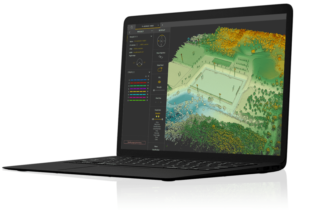
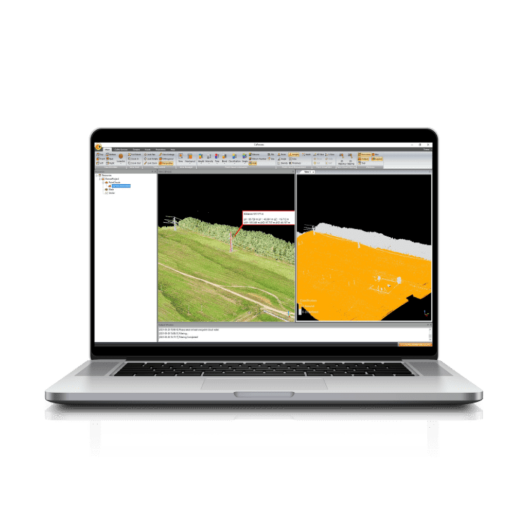
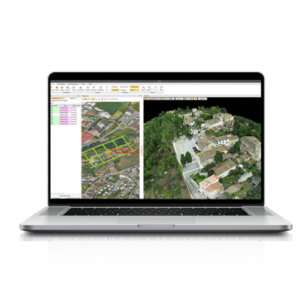
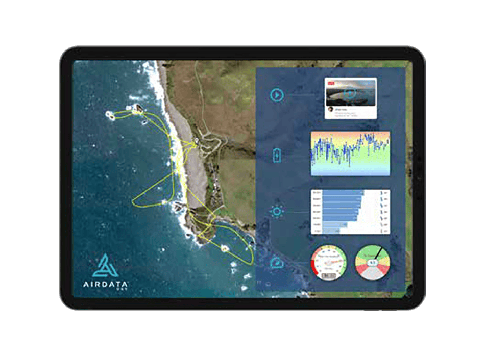
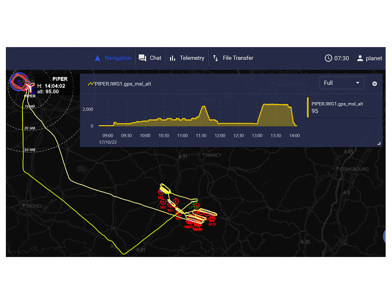
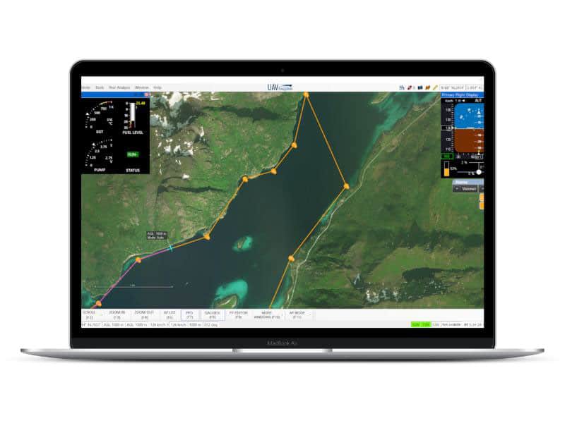
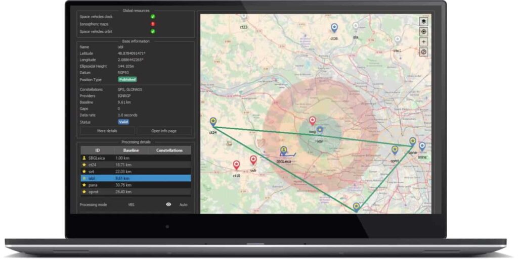
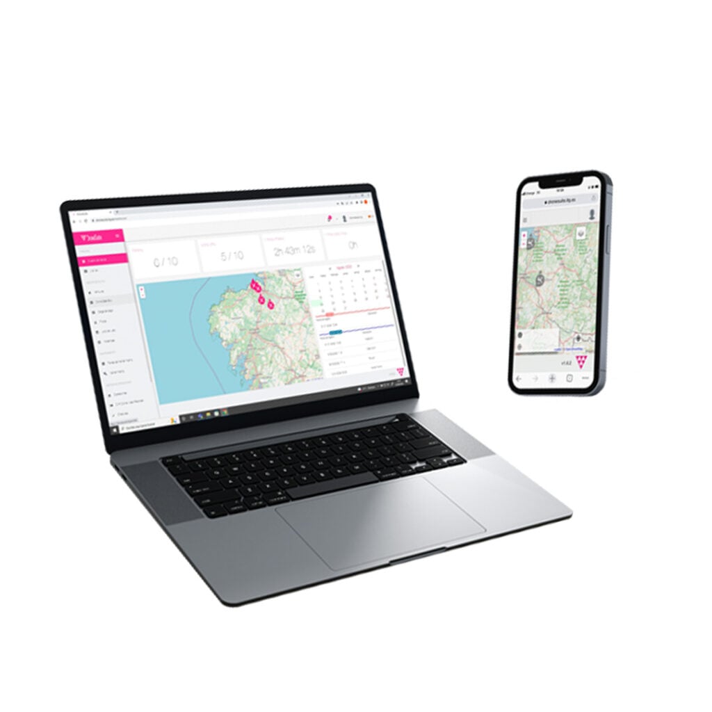
Geospatial Software for Real-Time Mapping, Data Visualization & Situational Awareness
UAV Autopilot Flight Controllers, Ground Stations, ESC Controllers & Tracking Antennas
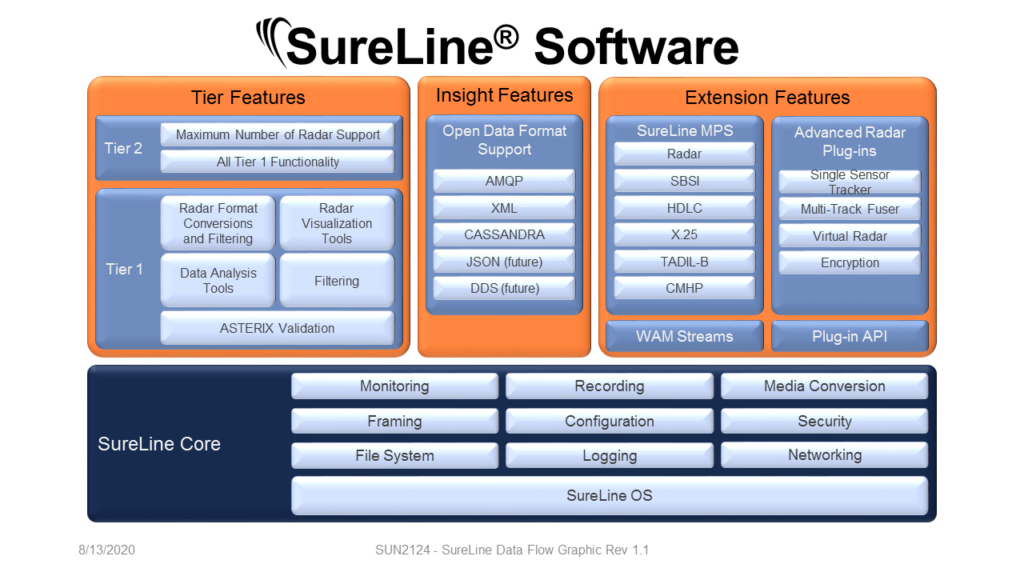
Radar Software & Sensor Processing Solutions, Maritime Radar Control, Tracking & Visualization for USV

Drone Thrust Stands for Motors, Propellers & Gas Engines, Wind Walls for Drone & Aircraft Wind Tunnel Testing
Certified UAV Communications, Navigation, Control, Surveillance, and Combat ID Solutions

Certifiable Situational Awareness & BVLOS Solutions for Uncrewed Aircraft Systems in the Defense & Civil Industries

Onboard Video Processing Software and Hardware for Unmanned Systems
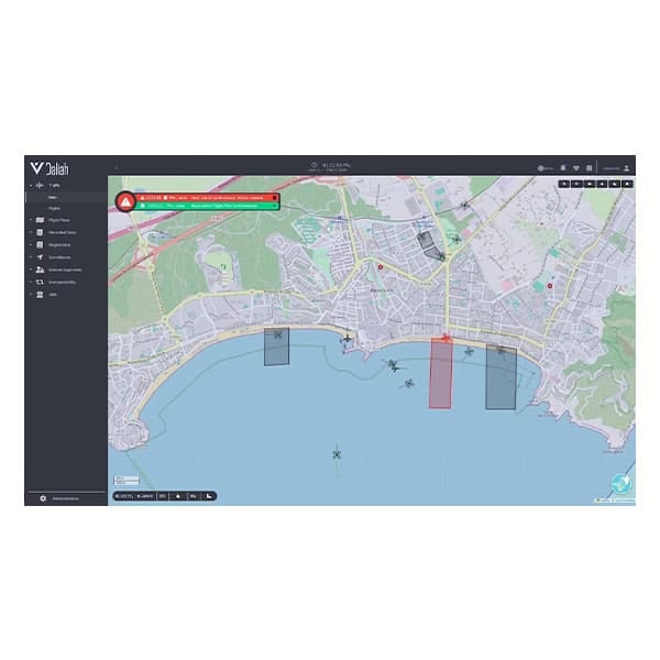
Comprehensive Hardware & Software Solutions for Drone Operations & Airspace Integration
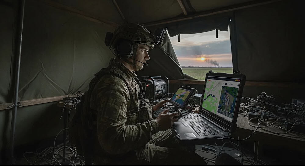
Advanced UAV & Unmanned Systems for Challenging Missions in Government, Defence & Commercial Applications
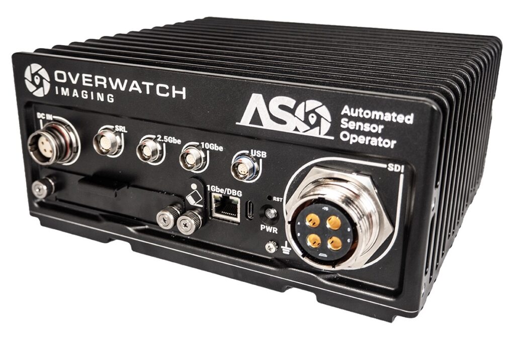
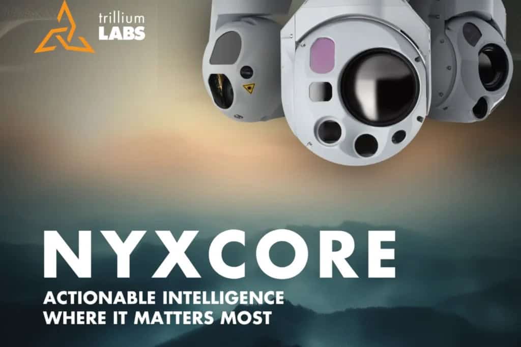
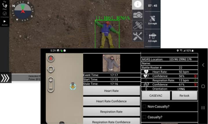
Advanced Imaging & Sensor Autonomy for Time-Critical Airborne Intelligence Missions

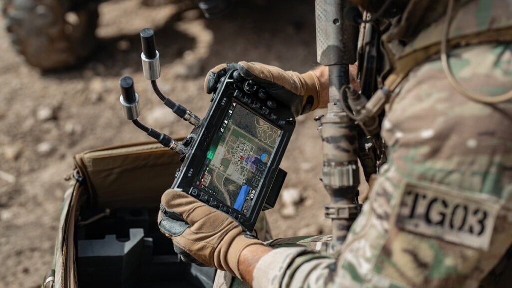
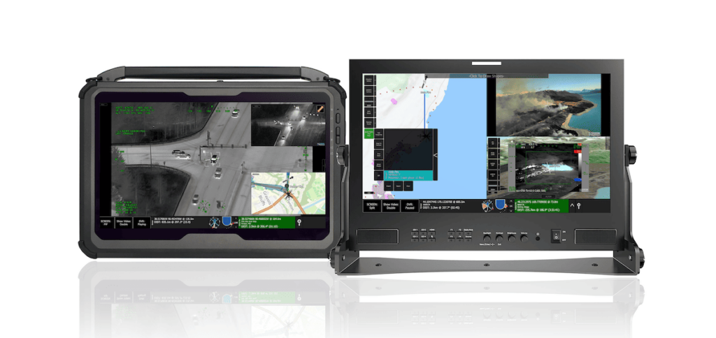
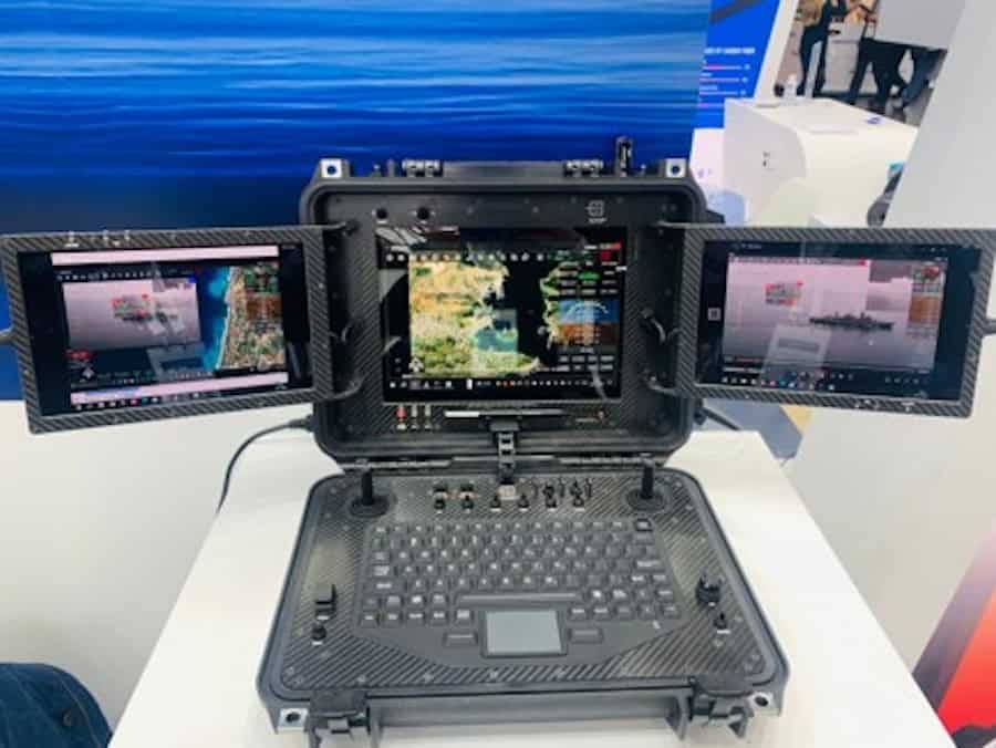
High-Performance Rugged Displays & Custom HMI Solutions for Mission-Critical Unmanned Systems

Innovative Wireless Mesh Networking Technology: Ultra-Reliable & Low-Latency Connectivity for Drones & Mobile Robotics

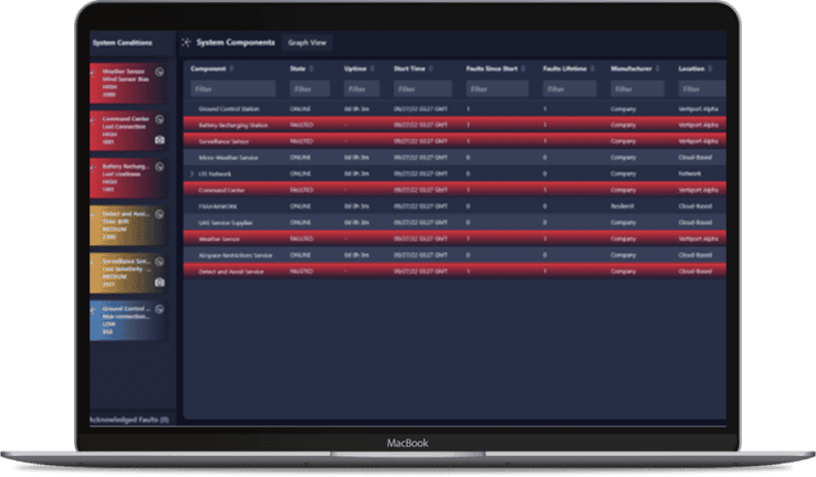
Safety Assurance Solutions for The Next Generation of BVLOS Drone & Autonomous Vehicle Operations
Cutting-Edge Drone Autopilots & UAS Platforms | Hardware & Software Solutions for Drones & Unmanned Systems

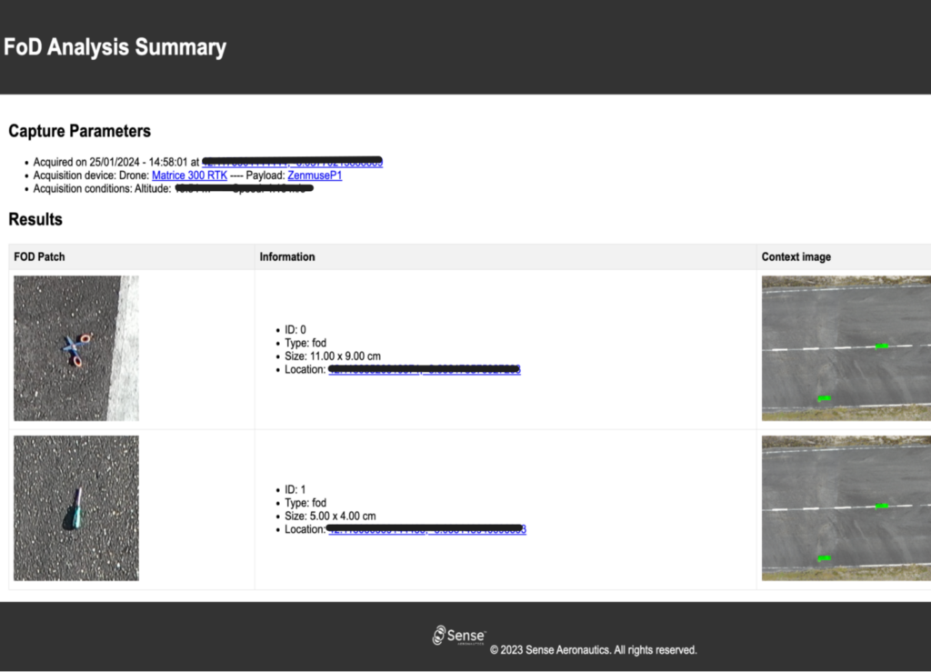
Cutting-Edge AI-powered Drone Video Analytics Solutions for Object Detection
AI-Powered Autonomous Drone Solutions for Public Safety, Defense, and Industrial Inspection

Edge-Based Visual AI Software Platform for Defence & Security Camera Automation

Remote ID & Airspace Awareness Solutions for UAV Pilots, Drone Manufacturers & Law Enforcement Units
Drone Software Engineering Consultancy Providing Comprehensive UAV Platform Development Services
High-Performance Drone Batteries, Power Management Systems, Fleet Management Software, Solar MPPT Integration, Celular C2 & Payload Communications

Embedded Systems Software Development, Firmware Programming & Drone Software Design/Testing Services
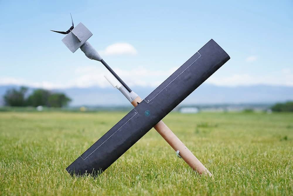
High-Performance Autonomous Drones for Mission-Critical Civilian & Military Applications
Embedded Controllers, Avionics Testing, HIL Simulation & Data Acquisition Systems for UAV/UAS Applications

Connecting High-Performance Spatial Analysis in the Office with Reliable Execution in the Field
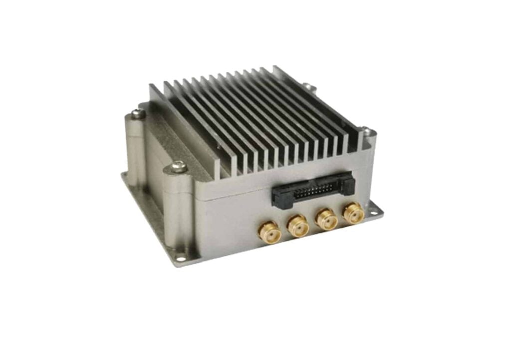
SDR Technology, UAV Data Links & Tracking Antennas for Long-Range Communications
High-Performance Video Graphics, GPGPU, AI/ML Processing & Display Solutions for C5ISR Applications


GNSS Positioning & Navigation Systems, Mobile Mapping UAV LiDAR & Unmanned Surface Vehicles
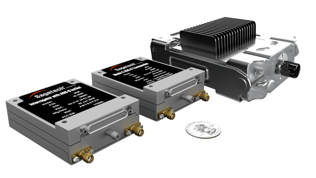
Radar & ADS-B Surveillance Data Fusion, Integration & Display | UAV Tracking & ATC Integration
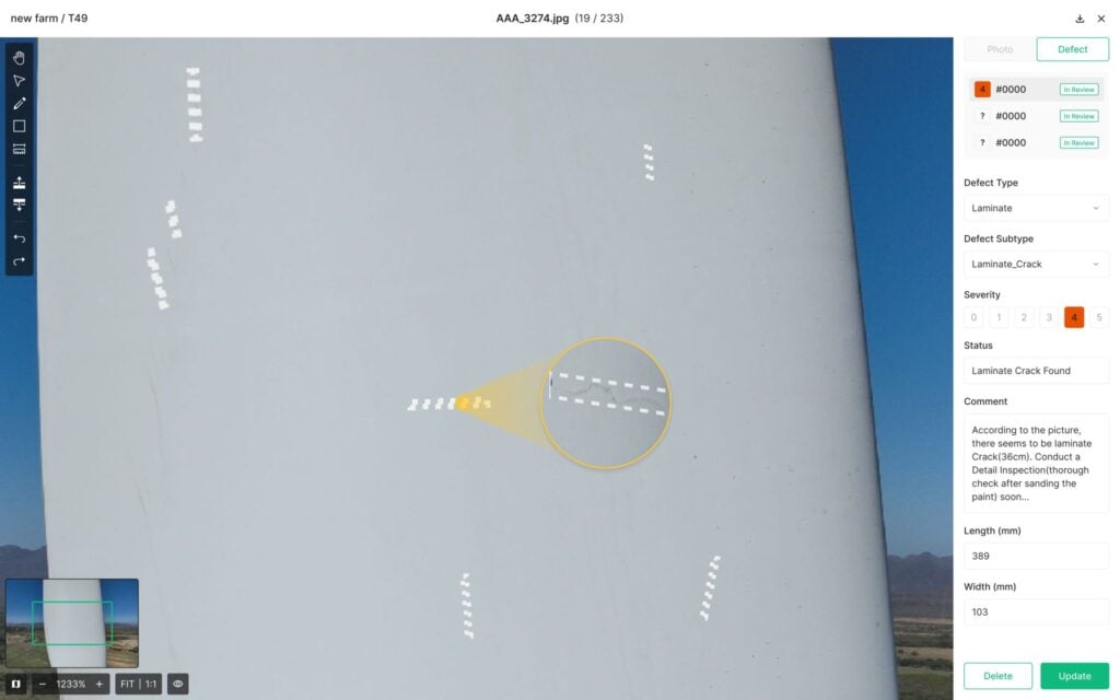
Autonomous UAS, Research & Inspection UAVs for Industrial Inspection, Survey & Mapping
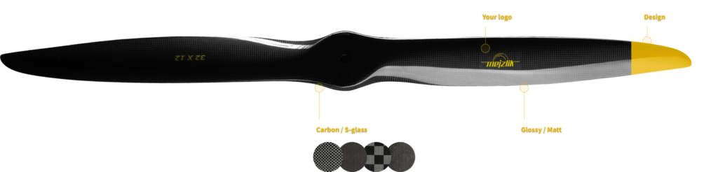
Custom-Designed Carbon-Fiber Drone Propellers for OEM Manufacturers

Marine Autopilots, Unmanned Surface Vehicle Communications, Power Management Modules & Marine Simulators & Software

Miniature ADS-B Technology (Transceivers/Receivers) and Drone Tracking Transponders for sUAS & UTM/U-Space
If you design, build or supply Software & Autonomy, create a profile to showcase your capabilities and connect with visitors who have an active requirement for your solutions.

 Searching Companies & Products

 Subscribe to the Weekly eBrief
The latest engineering and technical developments straight to your inbox - join thousands of engineers who receive it.
Subscribe to the Weekly eBrief
The latest engineering and technical developments straight to your inbox - join thousands of engineers who receive it.