Find suppliers and manufacturers of Radar Processing Software, including Radar Tracking and Data Visualisation Software for unmanned aerial, ground and marine radar systems
If you design, build or supply Radar Processing Software, create a profile to showcase your capabilities and connect with visitors who have an active requirement for your solutions.
Radar processing & target tracking software for USVs
Radar processing & target tracking software for USVs
...rver is a COTS radar data extraction and target tracking software suite for USVs that examines polar... ...rated into the processing workflow, allowing for custom solutions that use SPx as the integrating...
Radar processing software takes in data from radar sensors on board UAVs (unmanned aerial vehicles) and unmanned systems and turns this data into useful actionable intelligence. As part of a wider unmanned systems software ecosystem, these solutions can be integrated with other drone software platforms to support mission planning, autonomy, data management and operational workflows. Depending on the size and capabilities of the unmanned vehicle, this software may be installed on board and interfaced directly with the radar, or work with radar data that has been sent over a communications link or downloaded after the mission.
Radar processing software for UAVs
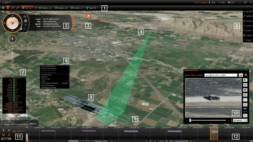
IMSAR’s Lisa 3D – C2& PED Software for actionable intelligence
Radar processing software may be installed on a UAV’s embedded computing system as part of a detect-and-avoid (DAA) capability. Such capabilities allow UAVs to navigate safely in shared airspace, avoiding collisions with manned and unmanned aircraft as well and buildings and infrastructure. They are essential for autonomous flight and BVLOS (beyond visual line of sight) operations.
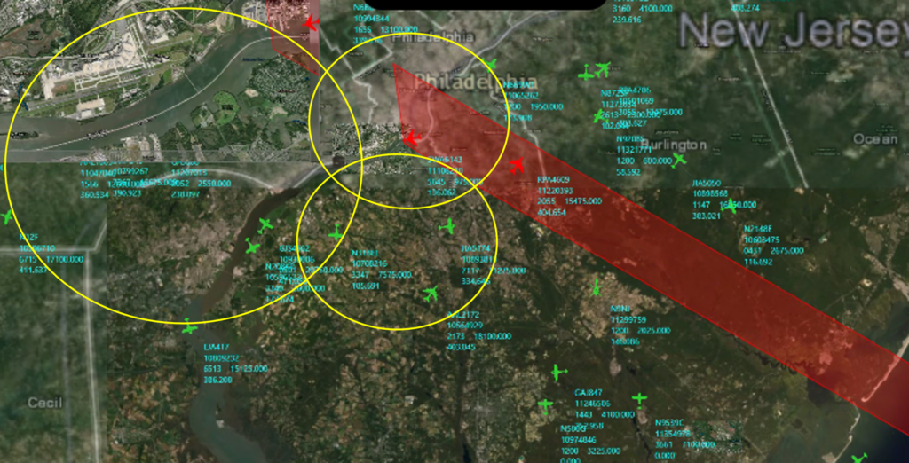
Radar is also used by ground control stations (GCS), unmanned traffic management (UTM) systems and counter-UAS systems for drone tracking and surveillance. Tracking software may combine radar data with other sources of information such as ADS-B feeds, and display the result on a real-time map, showing historical tracks for each target as well as predicted trajectory.
Radar processing for USVs
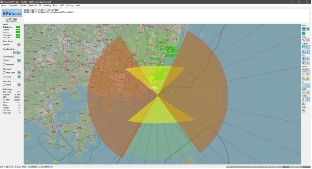
Cambridge Pixel’s SPx Tracking Server – Radar Processing Software
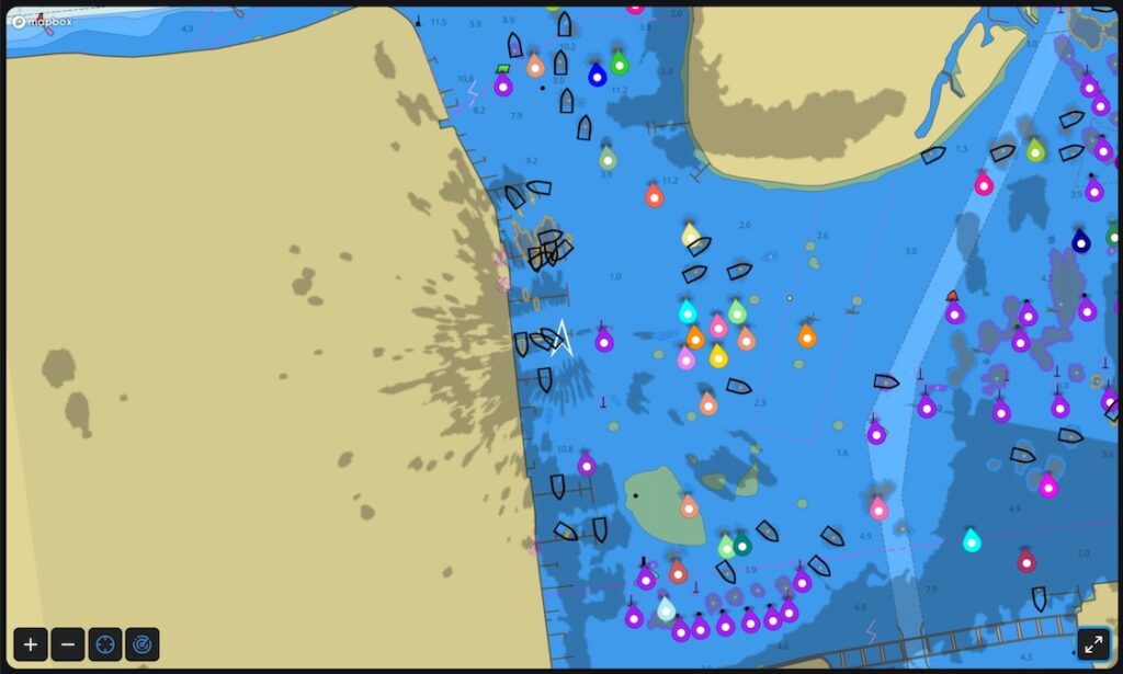
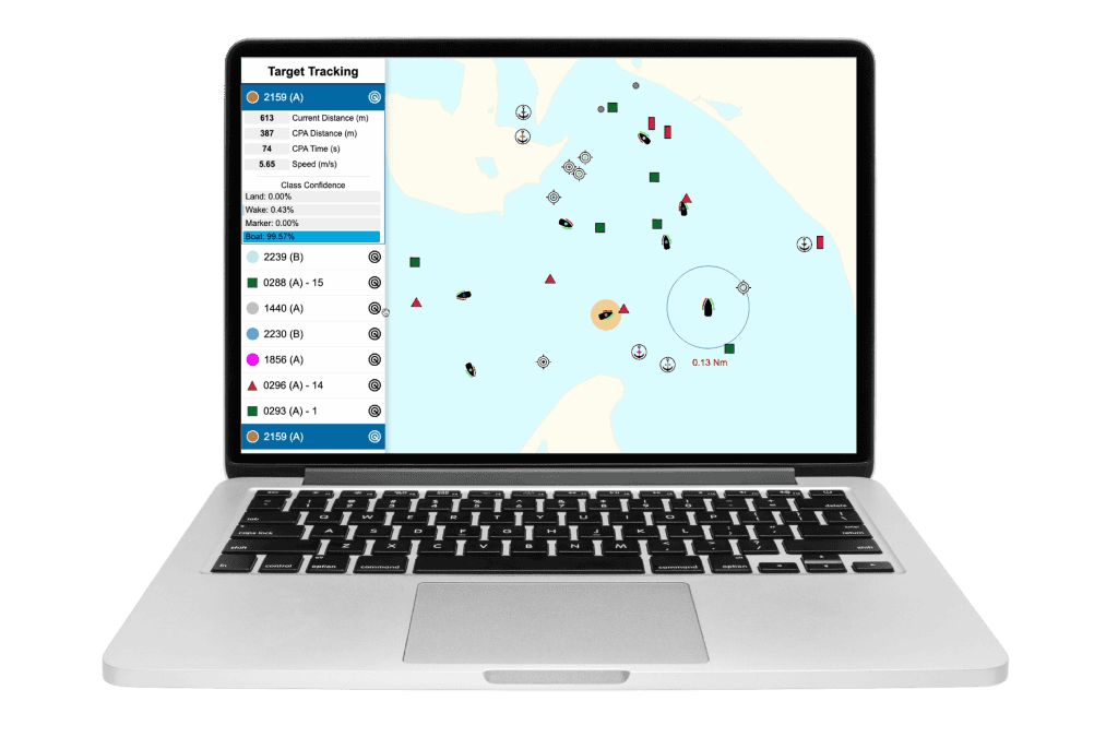
USVs (unmanned surface vessels) use radar for navigation, collision avoidance and target detection. Maritime radar processing software may blend onboard radar data with output from EO/IR sensors, GNSS/GPS information, INS (inertial navigation system) stabilization data, and secondary sources of information such as AIS (Automatic Identification System).
In addition to providing autonomous capabilities for the USV, tracking radar software may allow operators to track the vessel and its targets, displaying these tracks on a real-time map. Other facilities built into maritime display and data visualization software may include collision warning alarms, calculation of predictive vectors, and mission recording and playback.
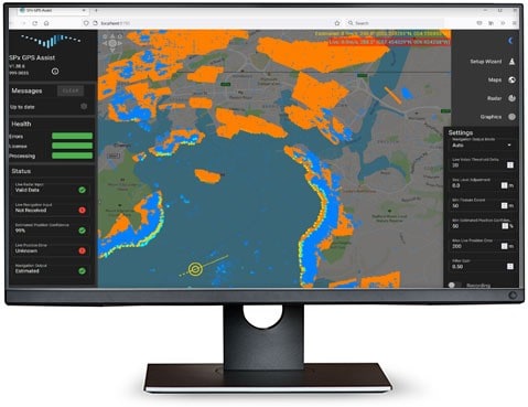
Cambridge Pixel has updated its radar processing and tracking software with the release of SPx Server V2, adding proximity detection for autonomous navigation, TAK and SAPIENT interoperability, AI-assisted configuration and ARM-based system support
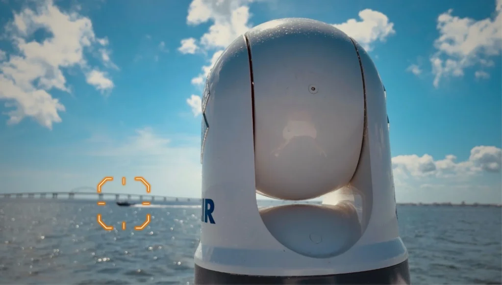
Tocaro Blue has introduced ApolloCore™, a machine learning software solution that enhances off-the-shelf PTZ marine cameras with real-time detection, tracking, stabilization, and radar fusion for autonomous vessel operations
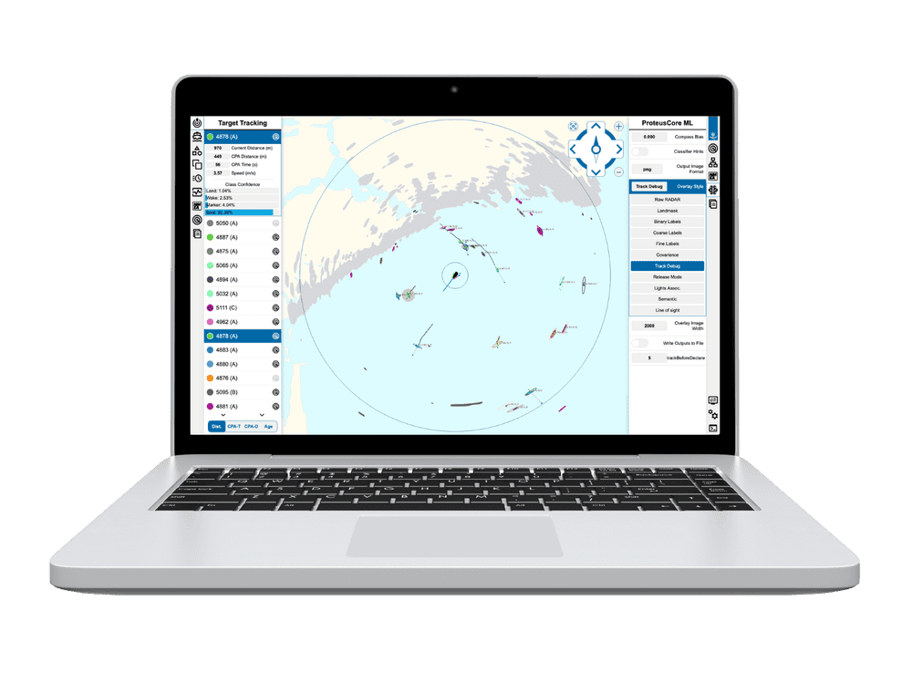
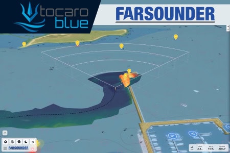
Tocaro Blue’s ProteusCore™ uses machine learning to enhance standard radar, delivering real-time detection, classification, and tracking outputs that support autonomous systems and monitoring of surrounding vessel activity
Tocaro Blue outlines how ProteusCore™ ML radar processing enables advanced filtering, automatic tuning, target classification, and OEM integration for marine navigation interfaces
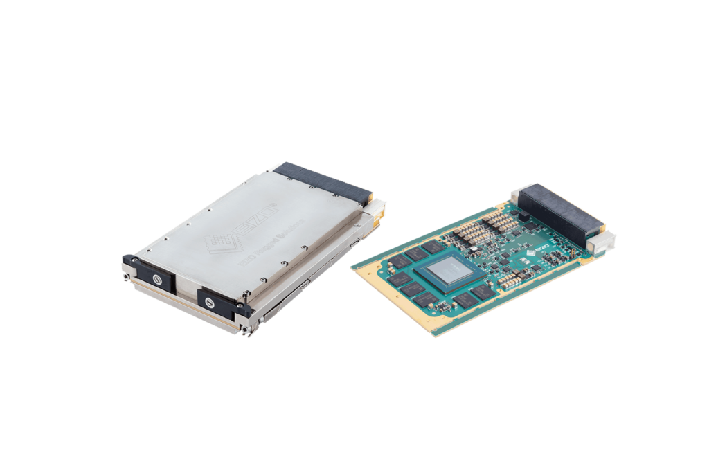
Cambridge Pixel has revealed the HPx-700, an ARM-based Radar Input & Signal Processor designed to modernize analogue radars with edge-based digital processing while removing the need for host PCs
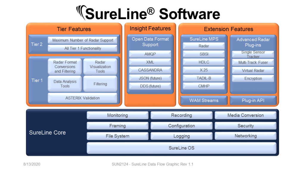
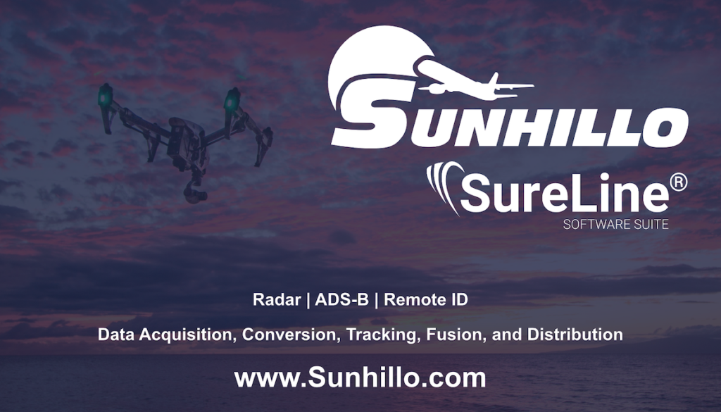
Sunhillo Corporation has joined ResilienX on the MICH-AIR BVLOS System program, delivering cloud-based SureLine surveillance fusion of radar and ADS-B for crewed and autonomous aircraft operations
Metal Shark and Tocaro Blue are collaborating to integrate advanced radar processing software into a high speed unmanned surface vessel platform for ISR and situational awareness missions
Dec 19, 2025
Advancing Unmanned Systems Through Strategic Collaboration
UST works with major OEMs to foster collaboration and increase engagement with SMEs, to accelerate innovation and drive unmanned systems capabilities forward.