


GPS Assist is a radar-based solution designed to provide a backup navigation capability for USVs (uncrewed surface vessels) in the event of GPS signals being jammed, spoofed or otherwise compromised. Working with existing maritime radars on board the vessel, it compares terrain and coastline information with predicted radar images from a database in order to provide continuous high-accuracy estimates of latitude and longitude.
The system compares estimates with reported GPS position in order to detect spoofed, jammed or missing satellite information. GPS Assist can generate an alarm that informs another subsystem of the situation, or can generate its own NMEA-0183 stream of corrected data to ensure continued safe navigation.
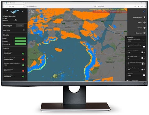
An intuitive web browser interface provides configuration tools and the ability to view live and predicted radar video images. GPS Assist runs as an unattended server application under Windows or Linux, and provides network status messages and a runtime control interface.


