New Zealand’s MetService is utilizing Cambridge Pixel’s SPx Radar Coverage Tool Pro (RCT Pro) to plan and optimize a vital weather radar network across the Pacific region.
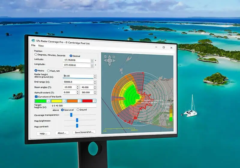
The project focuses on ensuring maximum coverage across vast and remote geographical areas, including key locations such as Tonga, the Solomon Islands, and Samoa. To achieve this, the Meteorological Data Services team is employing the Pro version of the software, which provides an interactive method for calculating precise line-of-sight visibility for both new and existing weather radar sites using high-resolution terrain elevation data.
A critical feature for the MetService team is the application’s ability to manage multiple radar sites simultaneously. The software allows for the export of resulting coverage map data in KML format, enabling the data to be easily imported and visualized within external Geographic Information Systems (GIS), such as Google Earth. This integration provides a comprehensive overview of the Pacific Infrastructure project.
Collin Quarrie, Senior Project Manager of Pacific Infrastructure at Meteorological Data Services, said, “Using RCT Pro has allowed us to overcome the challenges of mapping radar sites in complex terrains and remote locations. This gives us greater confidence in our network planning and helps us commission the weather radar needed by our Pacific partners to enhance their weather forecasting services.”
The SPx Radar Coverage Tool Pro is designed as a planning instrument for system integrators and developers across various sectors, including maritime surveillance, air traffic control, security, and meteorology. It offers a fast and accurate method to determine the optimal placement of radar and other line-of-sight sensors.
Andrew Haylett, Principal Engineer at Cambridge Pixel, added, “We are pleased that RCT Pro is providing vital support for MetService’s critical work in the Pacific. Supporting multi-radar usage projects for weather applications demonstrates the versatility and robustness of our software. With the successful mapping of all locations the team was working on, our radar planning capability has achieved full round-the-world coverage.”