Showcase your capabilities
If you design, build or supply GCS Software, create a profile to showcase your capabilities and connect with visitors who have an active requirement for your solutions.


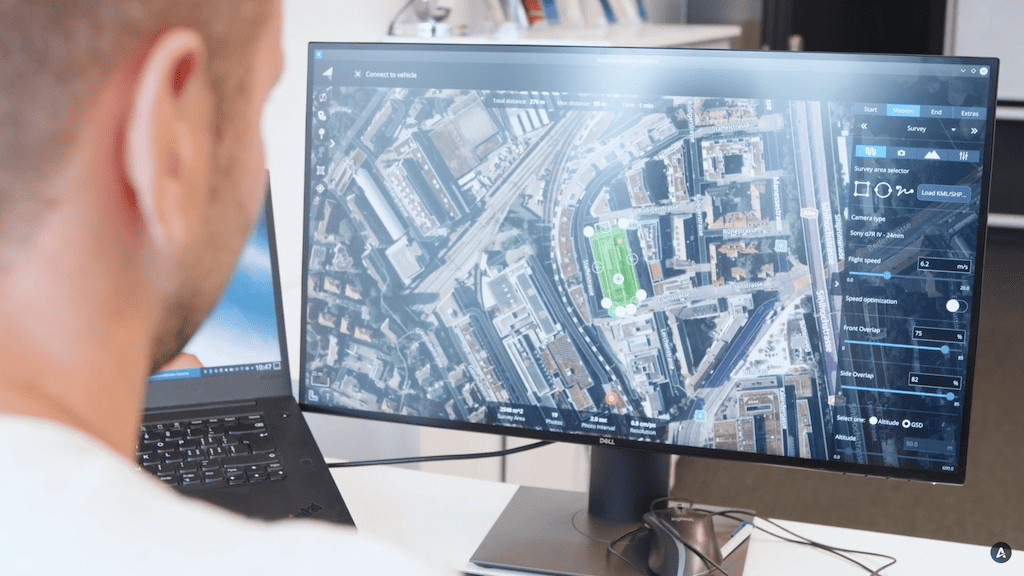
Select UAV ground control station software from leading manufacturers and suppliers supporting commercial drone operations, defense UAS systems, and advanced unmanned aerial vehicle programs. UAV ground control station software provides the command-and-control, flight planning, telemetry monitoring, and real-time flight tracking capabilities required to manage single- or multi-drone platforms across complex missions.
Read the Technology Overview
Military-Grade UAV Autopilot Systems for Advanced & Ultra-Reliable Flight Control
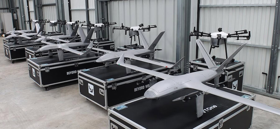
Fully Autonomous Multirotor Drones & Hybrid VTOL UAVs With AI Capabilities
Multi-Sensor Imaging Gimbals, Searchlights and VMS Software for Air, Land & Maritime Platforms
Innovative Turnkey UAS Solutions for Mission-Critical Civilian & Defense Applications

Geospatial Software for Real-Time Mapping, Data Visualization & Situational Awareness
Comprehensive Hardware & Software Solutions for Drone Operations & Airspace Integration
Advanced UAV & Unmanned Systems for Challenging Missions in Government, Defence & Commercial Applications
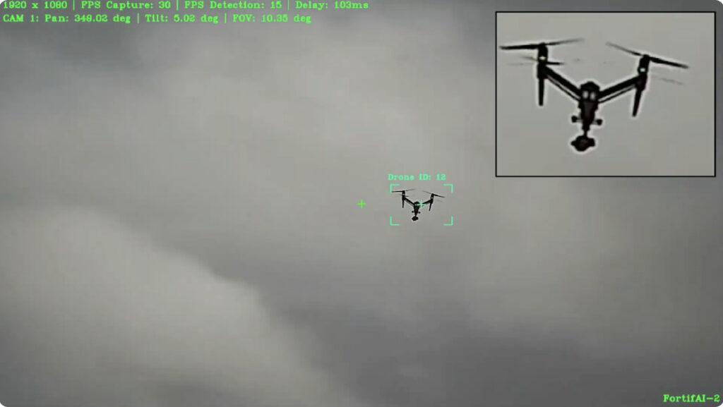
Edge-Based Visual AI Software Platform for Defence & Security Camera Automation
Drone Software Engineering Consultancy Providing Comprehensive UAV Platform Development Services
High-Performance Drone Batteries, Power Management Systems, Fleet Management Software, Solar MPPT Integration, Celular C2 & Payload Communications

Autonomous UAS, Research & Inspection UAVs for Industrial Inspection, Survey & Mapping
If you design, build or supply GCS Software, create a profile to showcase your capabilities and connect with visitors who have an active requirement for your solutions.

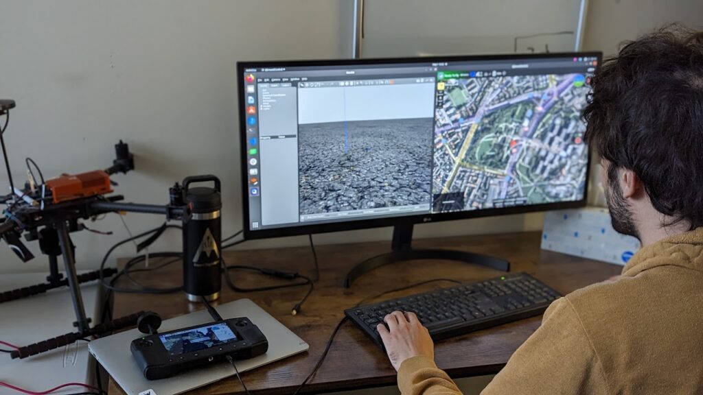
UAV ground control station software forms the core of a ground control station (GCS), delivering the graphical user interface, telemetry software, databases, and communication interfaces required to operate unmanned aerial vehicles safely and efficiently. Deployed on fixed or portable systems, it enables flight planning, vehicle health monitoring, payload management, and secure data links. Modern UAV GCS software uses modular architectures with APIs and SDKs to integrate with AI software, mapping engines, and command-and-control (C2) systems.
Similar architectures support unmanned ground and maritime platforms, with shared mission planning, telemetry monitoring, encryption, and logging capabilities.

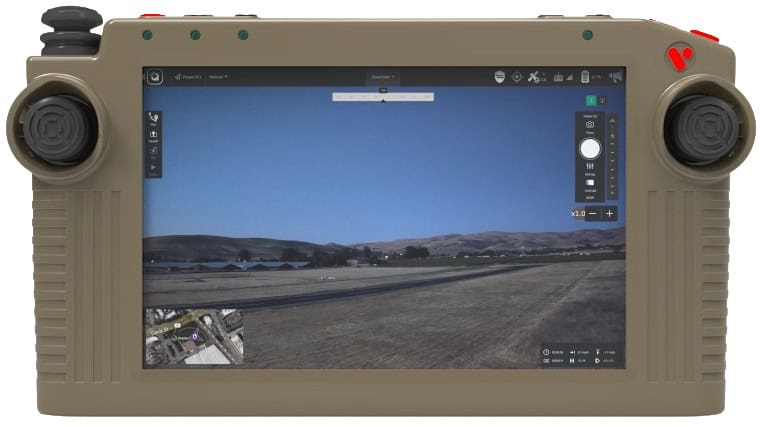
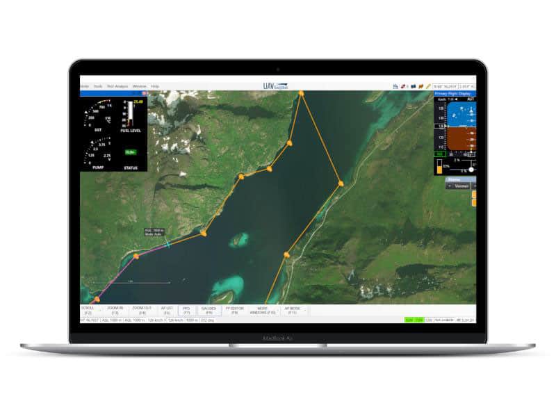
Visionair GCS software by UAV Navigation-Grupo Oesía.
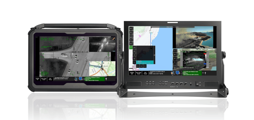
Designed for deployment in control rooms or mobile command vehicles, these GCS systems emphasize robust databases, expanded user interfaces, and integration with external command-and-control systems.
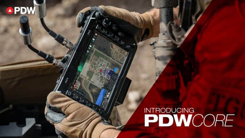
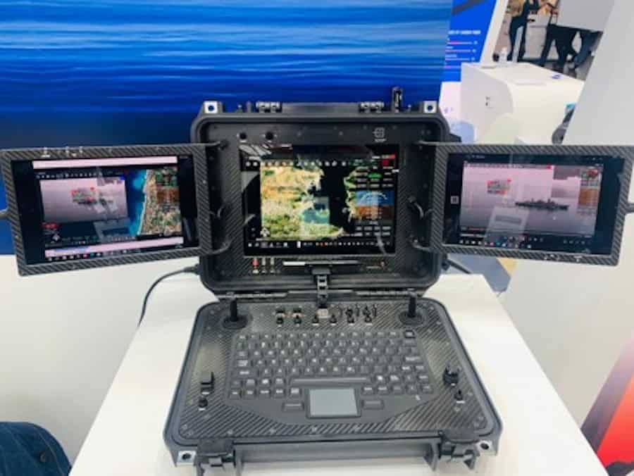
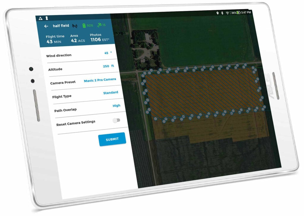
Optimized for rugged laptops or tablets, portable UAV ground control software prioritizes lightweight deployment, a streamlined GUI, and secure communication interface modules.
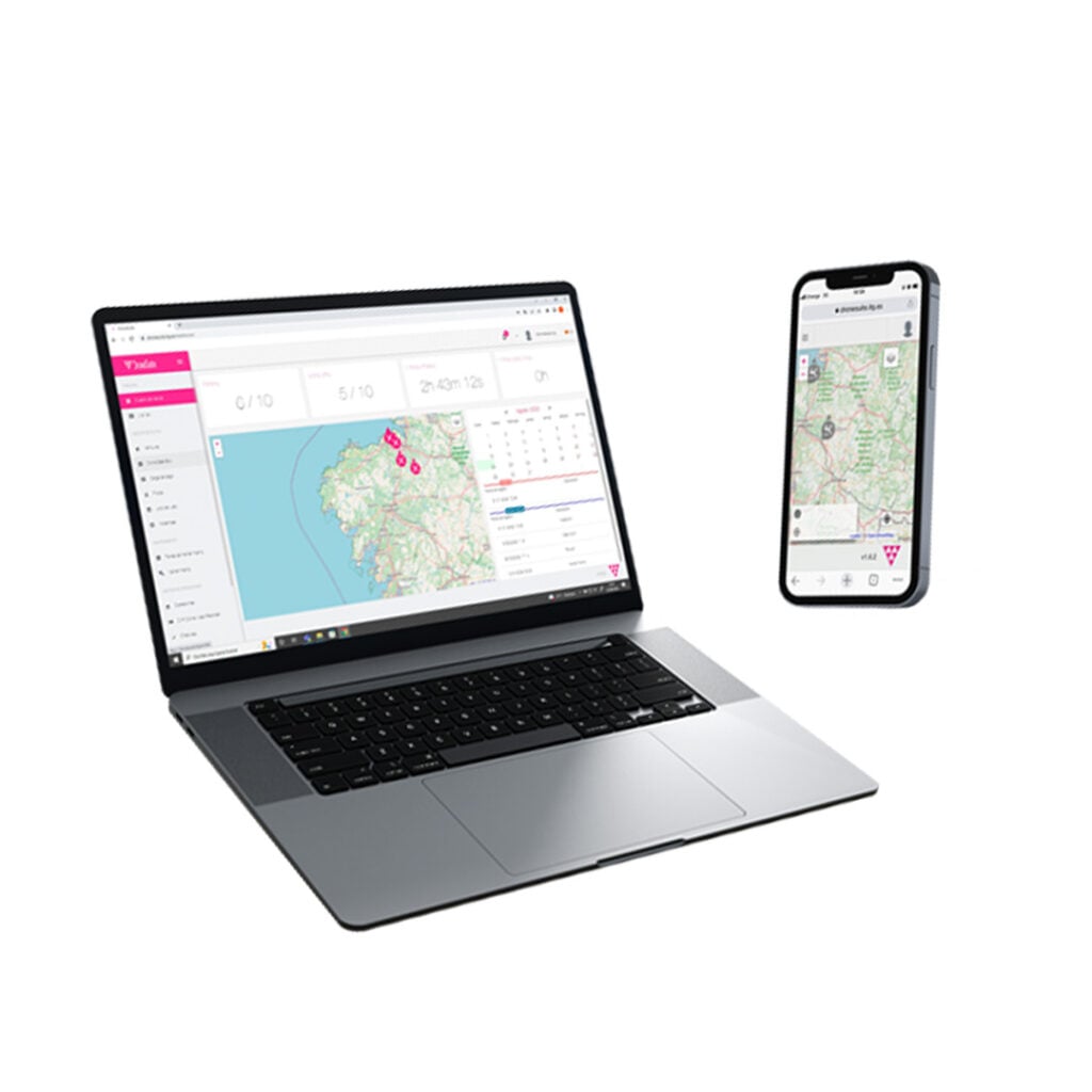
Cloud-integrated drone operations platforms support distributed teams, centralized data storage, and remote real-time flight tracking. These systems often include advanced logging systems and analytics engines.
Platforms that offer SDKs and software development kits enable extensive customization. Open APIs support integration with third-party payload management software, mapping engines, and external telemetry systems.
Multi-drone control software enables simultaneous management of several UAV platforms from a single ground control station. These systems are suited for coordinated missions and large-scale drone operations.
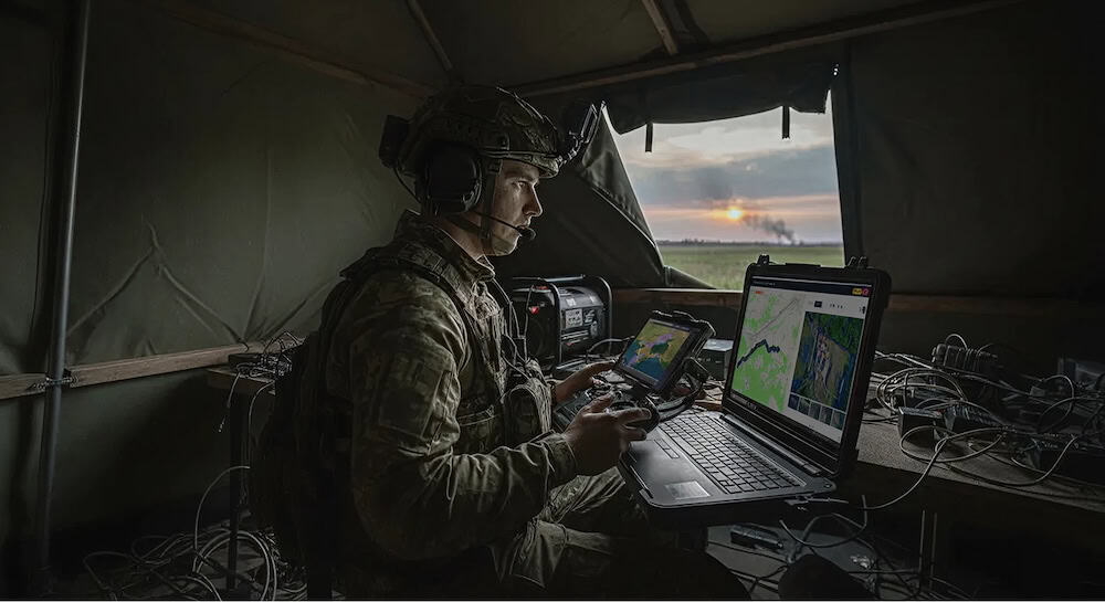
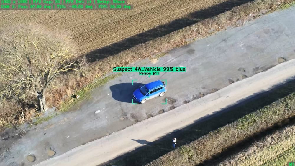
UAV ground control station software enables secure drone command and control, encrypted data link software, and real-time flight monitoring for military drones in contested environments. Integration with military C2 software supports mission coordination and intelligence workflows.
Ground control software for UAV platforms supports inspection, mapping, agriculture, and infrastructure monitoring. Drone fleet management software capabilities enable multi-drone control from a unified GCS.
For BVLOS operations, UAV ground control stations incorporate UTM integration and telemetry systems to ensure airspace awareness and compliance. Real-time monitoring software and alert systems enhance operational safety.
UAV software with configurable APIs and software development kits supports rapid prototyping and experimentation. Engineers can integrate custom application programming interfaces and AI software modules into existing ground station software frameworks.

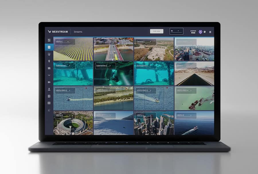
IRIS GCS ground control station software by Kongsberg Geospatial.
Ground control stations for drones can share architectural similarities with control stations for UGVs and USVs. Common graphical user interfaces and command-and-control software simplify training and enable cross-platform interoperability.
Ground control station software for UAVs typically includes:
These capabilities allow operators to manage unmanned aircraft systems across line-of-sight and BVLOS operations while maintaining situational awareness and regulatory compliance.
UAV ground control station software varies in architecture, scalability, and integration depth. Standalone systems may provide tightly integrated hardware and software solutions optimized for specific UAV platforms. In contrast, modular and open architecture solutions support interoperability across diverse unmanned aircraft systems and third-party subsystems.
Closed systems can simplify deployment and certification, particularly in regulated environments. However, open systems with application programming interfaces and database module access offer greater flexibility for integrators developing customized drone software ecosystems.
Another key distinction involves cybersecurity systems. Advanced GCS software incorporates encryption modules, authentication controls, and hardened communication interfaces to protect against unauthorized access and data interception. For defense and critical infrastructure missions, the integration of cybersecurity modules is a primary criterion for evaluation.
UAV command and control increasingly requires interoperability with broader C2 systems and unmanned aircraft system architectures. Modern ground control stations support standardized data exchange protocols and API connectivity, enabling seamless coordination with external command-and-control software.
Integration priorities often include:
This system-level integration transforms UAV ground station software from a standalone control tool into a central node within a larger operational network.
UAV ground control station software must align with aviation authority regulations governing unmanned aircraft systems, particularly for BVLOS operations and commercial drone operations. Compliance considerations may include secure data handling requirements, airspace integration mandates, and operational logging standards.
In defense applications, interoperability with established command-and-control systems and adherence to military cybersecurity frameworks are critical. While requirements vary by program and geography, encryption systems, audit logging modules, and resilient telemetry software architectures are commonly mandated.
As unmanned aerial vehicles continue to scale in capability and autonomy, UAV mission control and mission planning software will play an increasingly central role in ensuring safe, secure, and efficient drone operations across the civil, commercial, and defense sectors.

 Searching Companies & Products


 Subscribe to the Weekly eBrief
The latest engineering and technical developments straight to your inbox - join thousands of engineers who receive it.
Subscribe to the Weekly eBrief
The latest engineering and technical developments straight to your inbox - join thousands of engineers who receive it.