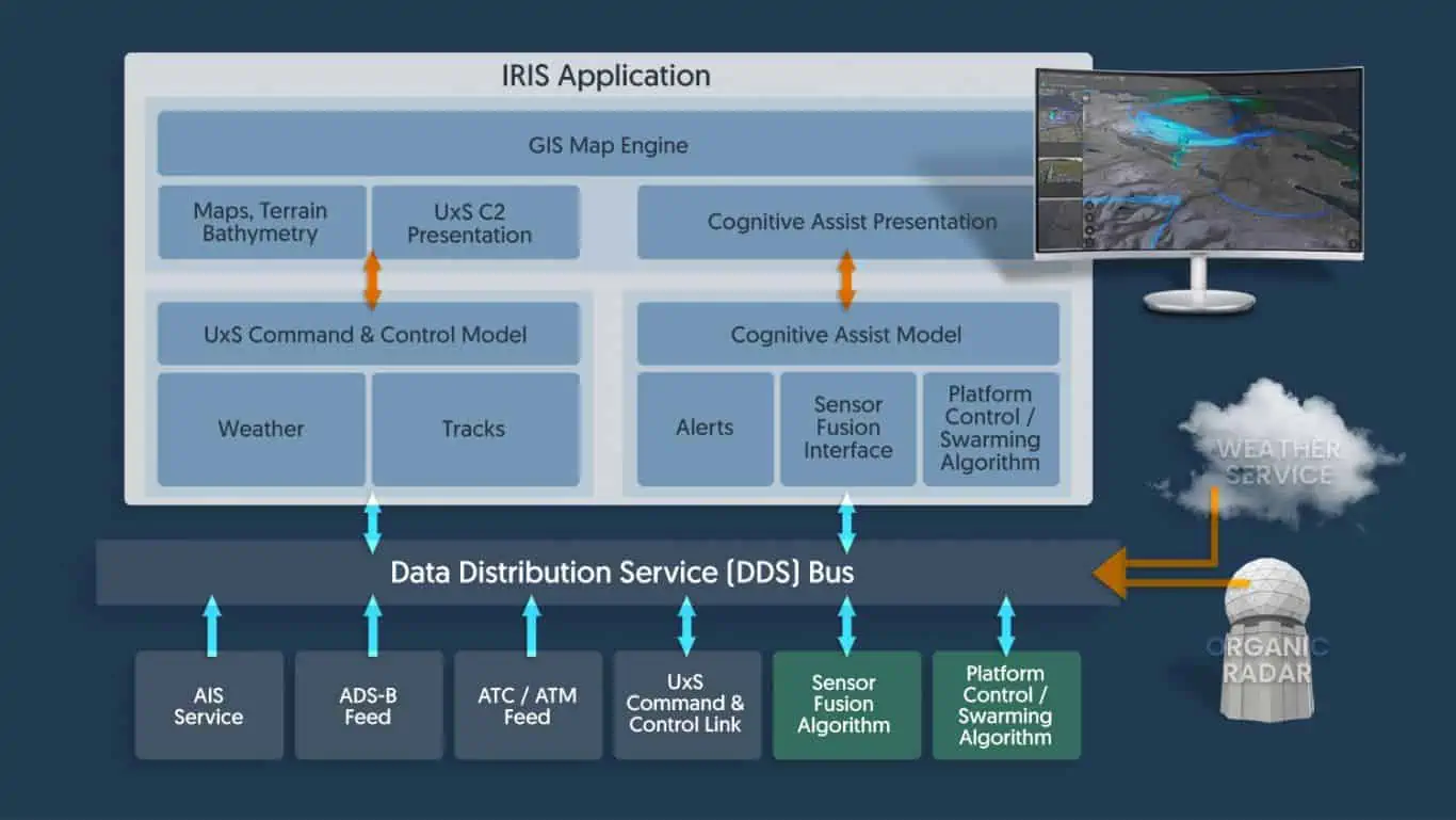
IRIS GCS is a full-featured ground control station software package that provides vital situational awareness for UAVs operating beyond visual line of sight (BVLOS). It is also ideal for USVs (unmanned surface vessels) and UUVs (unmanned underwater vessels), and can display marine navigational data or underwater bathymetric information.
Providing the ability to track multiple vehicles in real time, IRIS GCS integrates 2D and 3D map and terrain data, aeronautical information, data from sensors, cameras and drone telemetry.
The IRIS GCS system is also compatible with a wide range of autopilots, allowing full control of fleets of fixed-wing and multirotor UAS directly from the console, and with many-to-one drone operation embedded at the core.
Advancing Unmanned Systems Through Strategic Collaboration
UST works with major OEMs to foster collaboration and increase engagement with SMEs, to accelerate innovation and drive unmanned systems capabilities forward.