Navigation Radar & Radar Altimeters

Find suppliers and manufacturers Navigation Radar and Radar Altimeters for Drones, UAVs, UAV & Unmanned Systems.
Overview Navigation Radar & Radar Altimeters
By Staff Writer Last updated: October 20th, 2023

Navigation Radar Technology for Drones

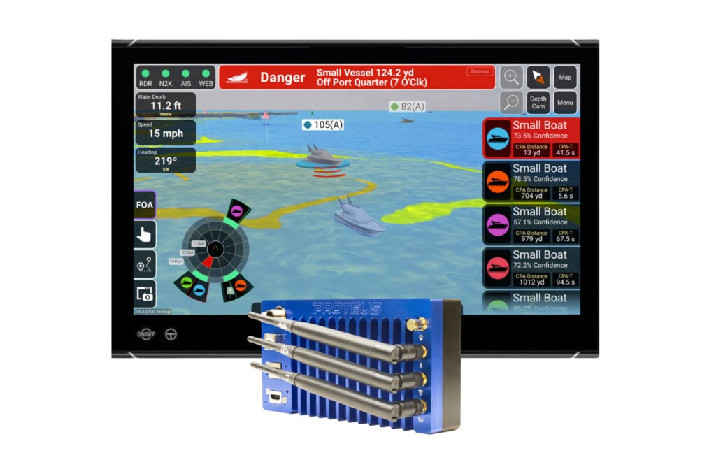
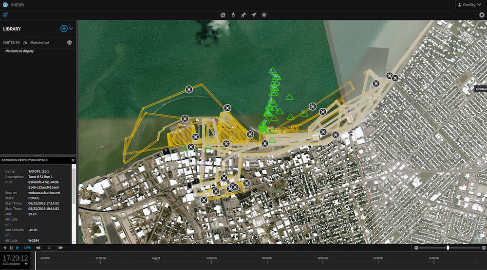
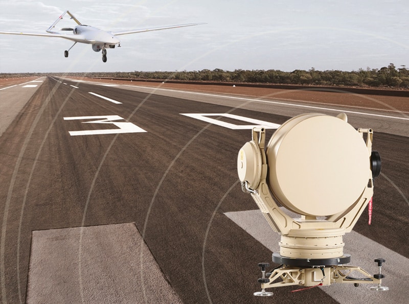
Radar can be a useful technology for UAV navigation as it can operate in GNSS-denied environments, and unlike many camera-based technologies, will still work at night or under severe weather conditions. Although radar technology was reserved for a long time for only the largest drones due to bulk and power requirements, modern developments in ultralight radar technologies have allowed smaller UAVs to also take advantage of the technology.
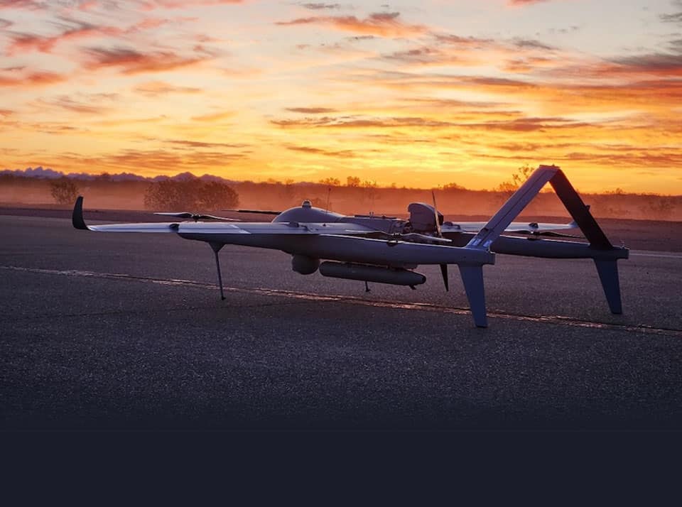
Radar can be used for simple obstacle detection by measuring the time-of-flight of reflected pulses and thus the distance from objects. More sophisticated navigation capabilities can be implemented by using a technique known as radar odometry, which compares successive radar images to estimate aircraft velocity and height, combining these with INS (inertial navigation system) measurements to provide enhanced accuracy.

Multi-Sensor e-Positioning by iXblue with Nav Radar

Radar Altimeters

Radar altimeters are commonly used by drones and unmanned aircraft. These devices use radar pulses to measure the altitude above the terrain that is directly below the aircraft, and can feed this data to the UAV autopilot to aid in automated takeoff and landing. They are particularly useful for BVLOS flights where the aircraft may be operating far away from its base station, and can provide automated terrain-following capabilities and sea-skimming when a UAV may have to maintain a constant height above land or water.

Radar altimeters are used for applications such as automated cargo delivery, where a drone may have to release a package from a predefined altitude, or precision agriculture, where seed spreading or crop spraying may have to be performed at a certain height.

Products (4)

US-D1 Radar Altimeter

Compact all-weather radar altimeter for UAVs

Compact all-weather radar altimeter for UAVs
...ht and compact radar altimeter that is ideal for a wide range of drone platforms, featuring easy...
LR-D1 Pro Radar Altimeter

Dual-band radar altimeter for larger VTOL drones

Dual-band radar altimeter for larger VTOL drones
...is an advanced radar altimeter utilizing two antennas and sophisticated sensor fusion to provide...
LR-D1 Radar Altimeter

Long-range airborne radar altimeter for commercial, industrial & tactical drones

Long-range airborne radar altimeter for commercial, industrial & tactical drones
...s a long-range radar altimeter that delivers high-accuracy data even in low visibility and the most...
GPS Assist

Continuous navigation for USVs during GPS signal loss, jamming or spoofing

Continuous navigation for USVs during GPS signal loss, jamming or spoofing
...PS Assist is a radar-based solution designed to provide a backup navigation capability for USVs...

Related Articles

Advanced Radar Software to Enhance Autonomous Research Vessel

Cambridge Pixel is set to provide its SPx Tracking Server application and SPx Fusion Server as part of a radar system upgrade for the Mayflower Autonomous Ship (MAS)

Aug 08, 2024
Cambridge Sensoriis Wins Grant to Deliver oDART Technology

Onboard Detection and Avoidance Radar Tracking (oDART) leverages micro radar technologies that have been specifically developed for low altitude flight onboard uncrewed aerial systems (UAS) and will adapt and introduce these into crewed aircraft

Dec 11, 2023
Radar Altimeters for UAVs & Autonomous Vehicles

Ainstein's radar sensing technologies enable intelligent flight and navigation for drones and robotics

Sep 15, 2023
Fully Autonomous Drone Landing with ARC Radar Sensors

Cambridge Sensoriis' ARC radar sensor devices have been integrated with Evolve Dynamics' Sky Mantis unmanned aerial vehicle (UAV) to achieve autonomous landing, loitering and zonal position hold

Sep 12, 2023
Echodyne Joins OneSky Future of Flight Program

Echodyne’s MESA radars create high-precision airspace data that is invaluable for the advanced air mobility industry to design aircraft and operate services to high levels of safety and reliability

May 12, 2023
High-Performance Radar Enables Situational Awareness for Unmanned Systems

The MatrixSpace Radar is designed to address the need for a long-distance sensing, tracking, monitoring and inspection solution for large-scale use cases, including robots, drones, and eVTOLs

Apr 20, 2023
Advanced Navigation GNSS Compass Selected for Nortek Surveying Solution

In this case study, Herman Huitema, VM Product Manager at Nortek, explains how his team used Advanced Navigation’s GNSS Compass...

Feb 13, 2023
Micro-Radar for BVLOS Drone Flights & Airspace Management

Cambridge Sensoriis' radar solutions support a variety of UAS & autonomous vehicles applications including automated landing and last-mile delivery

Jan 11, 2023
Cambridge Sensoriis Receives Prestigious Grants for Drone Navigation Technology

The company has received funding worth more than £500,000 for its radar technology for drones and autonomous vehicles as part of Phase 3 of the UK Research and Innovation Future of Flight Challenge

Jul 18, 2022
Ainstein

Radar Sensors for UAVs and Drones: Accessible, Scalable and Reliable

Cambridge Pixel

Radar Software & Sensor Processing Solutions, Maritime Radar Control, Tracking & Visualization for USV

Meteksan Defense

UAV Components: SAR, Radar Altimeter, Data Links, Telemetry, GNSS Products & C-UAS | Tactical USVs

Exail

Inertial Navigation & Positioning Technology for Unmanned, Autonomous Systems

Platinum Partners
Gold Partners
Silver Partners
Related Categories