Blue Nose Aerial Imaging, a veteran-founded, nationwide drone services network, provides precision aerial imaging, data collection, and analytics across a variety of key sectors.
In this exclusive Q&A, UST spoke with Tanner Harris, Founder & Managing Member of Blue Nose Aerial Imaging, to discuss how the company is scaling standardized drone operations nationwide, the growing demand for thermal imaging and LiDAR services, and how advanced aerial data is helping organizations improve safety, efficiency, and operational decision-making.
Blue Nose has grown to more than 45 franchise locations nationwide – how do you ensure consistent operational standards and data quality across such a distributed network?
Consistency is one of the biggest challenges in the drone services industry, and it’s something we’ve been intentional about since day one. Blue Nose Aerial Imaging isn’t simply a collection of independent drone pilots operating under a common brand. We’ve built a standardized operating system that combines training, technology, quality assurance, and repeatable workflows.
Every franchise owner completes onboarding through our Blue Nose Academy and follows established standards for flight operations, data collection, safety, client communications, and deliverable production. We also leverage centralized technology platforms that allow us to maintain consistency across the network, whether a project is being completed in Denver, Miami, Seattle, or Savannah.
Equally important is our culture. We emphasize professionalism, accountability, and continuous improvement. By combining standardized processes with a collaborative nationwide network, we’re able to deliver the same level of quality and reliability regardless of which Blue Nose location is performing the work.
What industries are currently seeing the fastest adoption of drone-based thermal inspection and LiDAR services, and what is driving that demand?
We’re seeing particularly strong adoption across utilities, energy, telecommunications, transportation infrastructure, construction, and facility management.
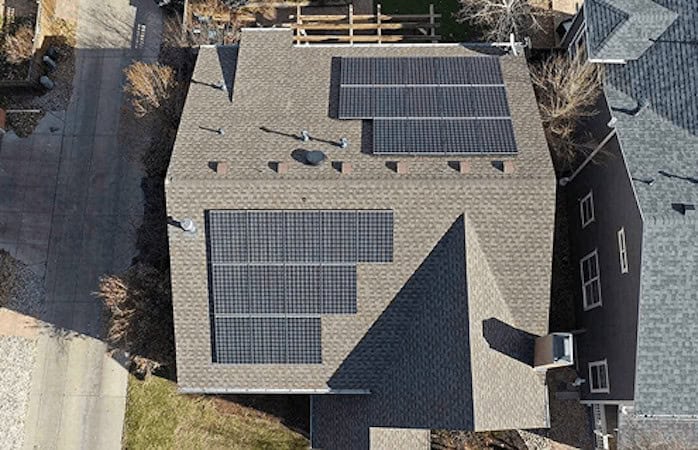
For thermal inspections, the primary driver is preventative maintenance. Organizations are under increasing pressure to identify problems before they become failures. Whether it’s electrical infrastructure, solar assets, roofing systems, or industrial equipment, thermal imaging allows operators to detect anomalies early and prioritize repairs before they become costly outages or safety concerns.
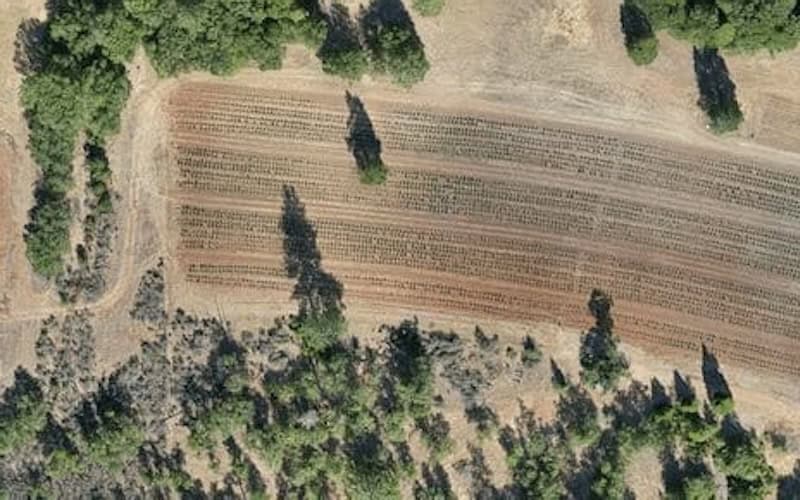
For LiDAR, the growth is driven by the need for highly accurate geospatial data. Engineering firms, surveyors, civil contractors, and infrastructure owners are looking for faster ways to capture detailed terrain information, vegetation analysis, volumetric measurements, and digital twins. Drone-based LiDAR can often collect data significantly faster and more safely than traditional methods while providing exceptional accuracy.
Across both technologies, the common theme is that organizations want better data, delivered faster, with less risk and lower cost.
What advantages do drone-based inspections provide over traditional methods for sectors such as utilities, oil & gas, and transportation infrastructure?
The biggest advantages are safety, speed, cost efficiency, and data quality.
Historically, many inspections required personnel to climb structures, access confined spaces, work near energized equipment, or shut down operations to gather information. Drones allow organizations to significantly reduce those risks while capturing data from perspectives that were previously difficult or expensive to obtain.
In the utility sector, drones can inspect transmission lines, substations, and distribution assets without exposing personnel to unnecessary hazards. In oil and gas, they can assess tanks, flare stacks, pipelines, and remote facilities while minimizing operational disruptions. Transportation agencies can evaluate bridges, rail corridors, and roadway infrastructure more efficiently than traditional inspection methods.
Beyond the safety benefits, drone inspections create a permanent digital record. Clients aren’t simply receiving photographs; they’re receiving data that can be analyzed, compared over time, and incorporated into broader asset management strategies.
Can you share an example where thermal imaging or LiDAR data helped a client prevent a costly failure or improve operational efficiency?
One example involved a commercial facility where a routine thermal roof inspection identified areas of trapped moisture beneath the roofing membrane that were not visible during a standard visual assessment. By identifying the problem early, the facility owner was able to perform targeted repairs rather than waiting for widespread water intrusion that would have resulted in significantly higher repair costs and operational disruption.
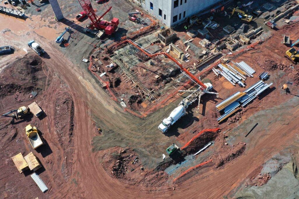
We’ve also seen substantial efficiency gains on construction and earthwork projects through drone mapping and LiDAR. Instead of relying solely on periodic ground surveys, project teams can access frequent, high-resolution site data to track progress, validate contractor performance, measure stockpiles, and monitor grading activities. This allows stakeholders to make decisions based on current conditions rather than assumptions, often saving both time and money throughout the project lifecycle.
What makes these examples powerful is that the value isn’t in the drone itself—it’s in providing information early enough for clients to act before a problem becomes expensive.
How is Blue Nose transforming aerial imaging and sensor data into actionable insights that improve customer decision-making?
Collecting data is only the first step. The real value comes from helping clients understand what the data means and what actions they should take next.
Our approach is centered on turning raw imagery, thermal data, LiDAR point clouds, and mapping products into clear, decision-ready information. Depending on the application, that may involve identifying thermal anomalies, quantifying earthwork volumes, monitoring construction progress, documenting asset conditions, or creating detailed digital models for engineering and planning purposes.
We focus heavily on presenting information in a way that supports operational and business objectives. Clients don’t need millions of data points—they need answers. By combining advanced sensor technologies with standardized reporting and visualization tools, we help organizations make faster, more informed decisions that reduce risk, improve efficiency, and maximize the value of their assets.
Looking ahead, what new drone technologies, sensors, or service capabilities are you most excited to bring to the market over the next few years?
We’re entering an exciting period where the conversation is shifting from simply collecting data to automating intelligence.
I’m particularly excited about advancements in autonomous drone operations, remote asset monitoring, AI-assisted analytics, and next-generation sensor integration. The ability to deploy drones from automated docking stations and perform scheduled inspections with minimal human intervention has the potential to fundamentally change how infrastructure owners monitor critical assets.
We’re also seeing tremendous progress in LiDAR, thermal imaging, multispectral sensing, and high-resolution digital twin technologies. As these systems become more powerful and accessible, organizations will gain deeper insights into the condition and performance of their assets than ever before.
At Blue Nose, our focus is on helping clients move beyond traditional inspections toward continuous situational awareness. The future isn’t simply collecting more data, it’s delivering the right information, at the right time, so organizations can make smarter decisions with greater confidence.
Thank you for your time, Tanner. It has been a pleasure speaking with you, and we look forward to following Blue Nose Aerial Imaging’s continued growth and innovation in drone operations, thermal imaging, LiDAR, and aerial data intelligence.