Drone utility inspection services employ UAVs and payload technologies to deliver accurate, repeatable assessments of power infrastructure, pipelines, and substations. By combining visual, LiDAR, and thermal imaging data, these inspection platforms enhance network reliability, minimize risk to personnel, and reduce downtime compared to manual or helicopter-based surveys.
This category highlights drone utility inspection service providers that deliver real-time data acquisition, detailed asset documentation, and rapid assessment capabilities essential for identifying degraded or damaged energy infrastructure.
If you design, build or supply Drone Utility Inspection Services, create a profile to showcase your capabilities and connect with visitors who have an active requirement for your solutions.
Drone services for aerial data collection & inspection operations
Drone services for aerial data collection & inspection operations
... comprehensive droneservices for commercial and industrial projects requiring aerial imaging,... ...space delivers drone-based solutions for construction and engineering, defense, infrastructure,...
AI-enabled aerial intelligence service for connected urban and regional operations
AI-enabled aerial intelligence service for connected urban and regional operations
...le Drones as a Service (DaaS) platform tailored for smart-city and regional networks. The AI-enabled... ...d right-of-way inspection; flood and storm assessment; traffic monitoring....
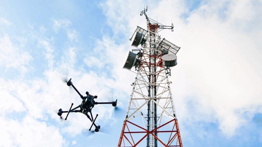
Drone utility inspection services have made it considerably easier and more cost-effective for utility companies to monitor, maintain, and restore their electrical infrastructure. These services utilize Unmanned Aerial Systems (UAS) equipped with high-resolution cameras, thermal sensors, LiDAR, and advanced imaging technologies to thoroughly inspect power lines, transformers, substations, and related components.
The use of drones for utility inspection offers a safer and more cost-effective alternative to manual or helicopter-based operations. Utility providers can now identify potential failures, such as low-hanging wires, broken power lines, or sparking equipment, before they cause outages or safety hazards. Drone utility services also support faster response during emergencies, providing accurate, real-time visuals to assess damage from storms, wildfires, or other disruptions that may lead to blackouts.
For operators that want inspection capability without building an internal UAS program, many of these missions are now delivered via Drone-as-a-Service (DaaS) providers.
Types of Drone Utility Inspection Services for Energy Distribution Companies
Companies offering aerial utility inspection services typically provide end-to-end solutions tailored to the needs of utility operators. These often include:
These capabilities enable utility teams to make informed decisions more quickly, improving both safety and uptime.
Technology Used in Aerial Utility Inspection
Drone Utility Inspection Services by Blue Nose Aerial Imaging
Utility inspection drones vary by platform and payload. Fixed-wing models are used for long linear stretches, while multirotor drones are favored for precision hovering and detailed inspection of confined areas. Many of these drones integrate GPS, obstacle avoidance, and AI-powered analytics to assist in identifying anomalies such as corrosion, conductor damage, or insulator issues.
Thermal imaging is especially effective for detecting overheating equipment or faulty connections, while LiDAR scans generate high-precision infrastructure models for comparison over time. Additionally, automated flight planning software allows operators to cover extensive grid sections with repeatable precision, minimizing human error and maximizing efficiency.
Benefits of Drone Utility Inspection Over Traditional Methods
Conducting utilities inspection with drones drastically reduces the need for risky manual climbs or costly helicopter flights. Inspections can be completed in a fraction of the time, with minimal disruption to live lines or surrounding areas. Drone inspection services also enable more frequent checks, improving proactive maintenance and helping prevent major outages or costly failures.
In contrast to ground teams, drones can access difficult terrain and dangerous environments without risking personnel. Their ability to transmit high-resolution data instantly supports rapid decision-making, especially in critical response scenarios such as electrical emergencies or during power outage restoration efforts.
Aerial Utility Inspections Across the Power Grid
Drone power line inspection is applicable to both transmission and distribution infrastructure. It supports long-range assessments of rural corridors and precision inspections of densely packed urban systems. During a widespread blackout or in the aftermath of a storm, drone services can rapidly locate the source of damage and help coordinate restoration efforts.
Utilities also use these services to document system health over time, which is vital for regulatory compliance and long-term planning. Archived inspection imagery allows for trend analysis, vegetation management, and preventive maintenance programs to be executed more strategically.
Drone inspections deliver fast, actionable insights into power line safety concerns, such as sparking equipment, downed wires, or low-hanging conductors. This supports improved public safety responses and faster communication with emergency responders.
Choosing the Right Drone Utility Inspection Company
The market for drone companies in construction and utilities for inspection or manipulation is expanding, but not all providers offer the same level of technical expertise, certifications, or utility-specific experience. Reputable drone inspection services cater specifically to utility companies, offering FAA-compliant operations, experienced pilots, and platforms customized for high-voltage environments.
Many top providers also offer data integration services, which seamlessly add inspection results to utility asset management systems. This enables deeper analysis and facilitates data-driven maintenance decisions. When selecting a provider, utility managers should look for proven experience in aerial utility inspection, comprehensive documentation capabilities, and the ability to scale across a large power grid footprint.
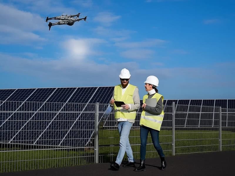
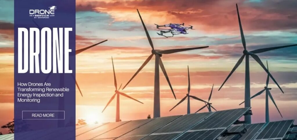
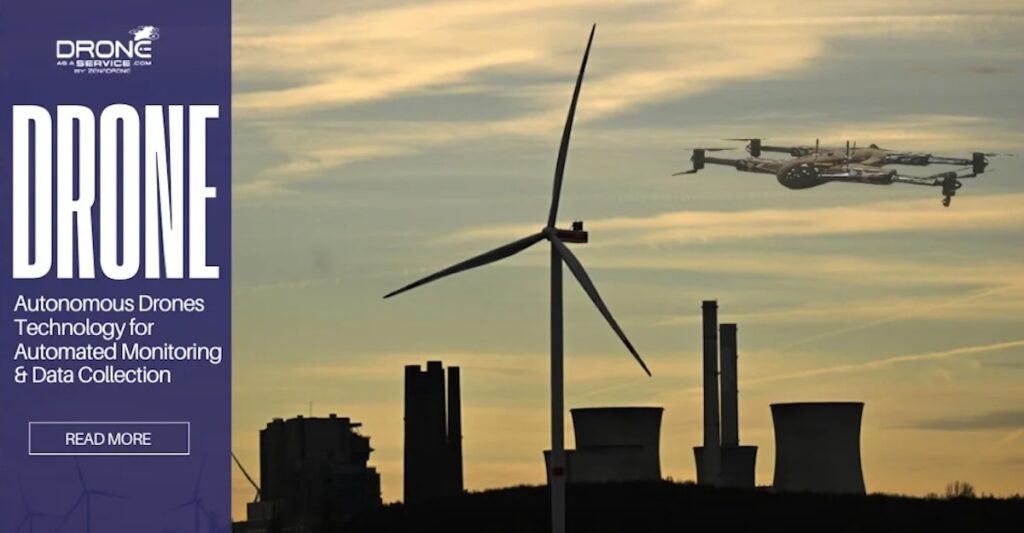
Drone as a Service by ZenaDrone outlines how drone-based inspection improves safety, reduces downtime, and enhances monitoring across large-scale renewable energy infrastructure
Drone-as-a-Service by ZenaDrone outlines how drone data analytics transforms aerial data into actionable insights, enabling predictive maintenance, improved safety, and greater operational efficiency across renewable energy assets
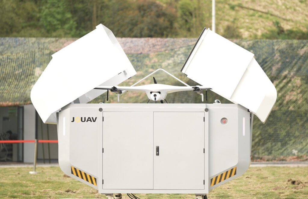
JOUAV and the Guangxi Power Supply Bureau have launched China’s first "Fixed + Mobile" UAS inspection system, advancing power grid monitoring with autonomous drones, VTOL hangars, and real-time data transmission
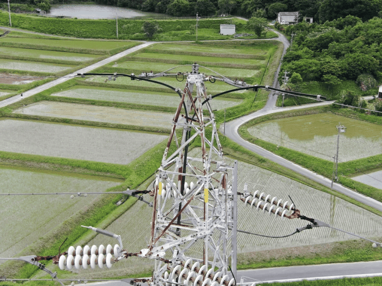
SENSYN ROBOTICS and Chubu Electric Power Grid's newly developed AI detects rust and bolt dropout, automating drone inspections for power transmission towers
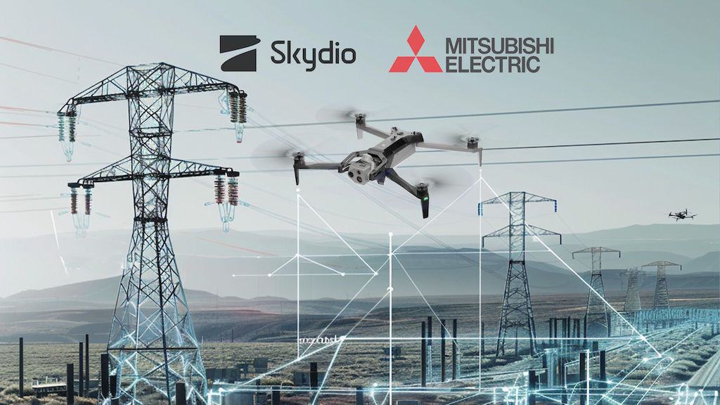
Skydio drones and MEPPI’s Power-I platform provide an end-to-end solution enabling utilities to collect and analyze volumes of data with efficiency, consistency and accuracy while being safer
The new mode for tracking power lines by SENSYN ROBOTICS, analyzes the shooting data in real-time and automatically adjusts the shooting angle based on line sag, keeping the power lines within the onboard cameras field of view
Jan 25, 2023
Advancing Unmanned Systems Through Strategic Collaboration
UST works with major OEMs to foster collaboration and increase engagement with SMEs, to accelerate innovation and drive unmanned systems capabilities forward.