Showcase your capabilities
If you design, build or supply Mapping Software, create a profile to showcase your capabilities and connect with visitors who have an active requirement for your solutions.


Find developers of Mapping Software for Drones & suppliers of unmanned aerial vehicle (UAV) software solutions for drone survey, mapping & inspection
Read the Technology Overview

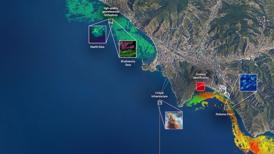
Geospatial Software for Real-Time Mapping, Data Visualization & Situational Awareness

Connecting High-Performance Spatial Analysis in the Office with Reliable Execution in the Field

GNSS Positioning & Navigation Systems, Mobile Mapping UAV LiDAR & Unmanned Surface Vehicles
If you design, build or supply Mapping Software, create a profile to showcase your capabilities and connect with visitors who have an active requirement for your solutions.

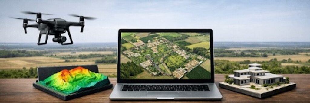
Drone mapping software allows unmanned aerial vehicles (UAV) to successfully execute missions during which aerial imagery and/or LiDAR data are captured for the purpose of creating 2D and 3D maps and models. Using drones for this purpose provides significant cost and time savings compared to using a manned aircraft or ground surveying techniques.
The software may be installed on a dedicated drone Ground Control Station (GCS), or on a standard device such as a laptop, tablet or mobile phone. Basic mapping software for UAV will allow users to program autonomous drones with waypoints or routes to follow during the mission, and some interfaces may provide the ability to define an area to be mapped by drawing a boundary on a touchscreen. Different types of mission will require different survey patterns – for instance the mapping of linear assets such as power lines and railways may only require corridor patterns.
Global Mapper, drone mapping software by Blue Marble Geographics
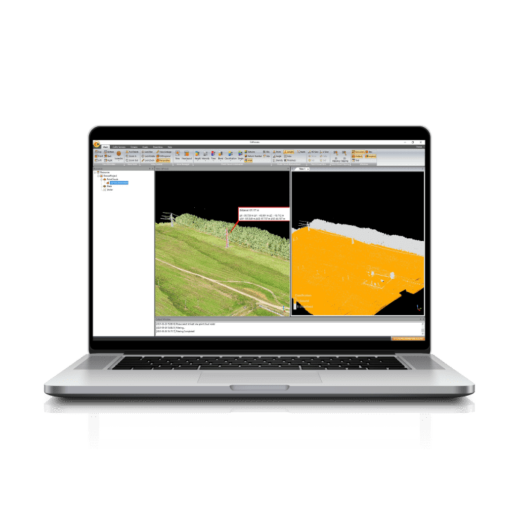
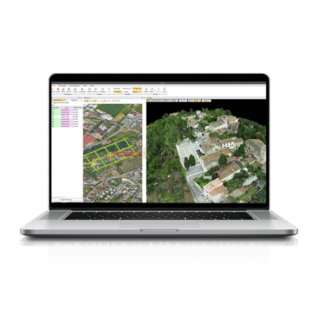
Mapping software for drones may provide facilities that allow it to fit into the workflow of photogrammetry and post-processing software, exporting the captured images so that deliverables such as digital surface models (DSMs), digital terrain models (DTMs), point clouds and orthomosaics can be created.
Mapping software is used for various unmanned applications including aerial mapping and drone survey, oil and gas pipeline inspection and agricultural monitoring. Aerial imagery can also be used to perform volumetric calculations, in order to gauge levels of available raw materials for construction projects or calculate the amount of earth needed to fill in a hole.
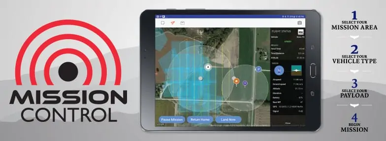
HCS Mission Control App Flight Planning Software by HiTec
All-in-one software solutions for drone mapping are available that combine both flight planning and post-processing capabilities, with options for processing aerial imagery either on local hardware, on a network or using a cloud-based service.

 Searching Companies & Products


 Subscribe to the Weekly eBrief
The latest engineering and technical developments straight to your inbox - join thousands of engineers who receive it.
Subscribe to the Weekly eBrief
The latest engineering and technical developments straight to your inbox - join thousands of engineers who receive it.