


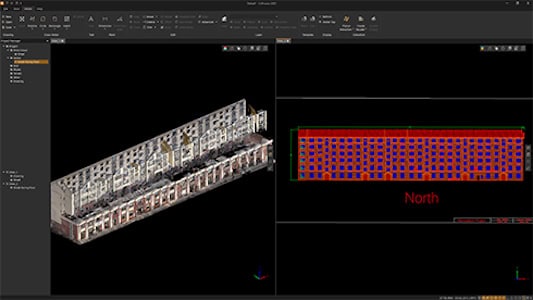
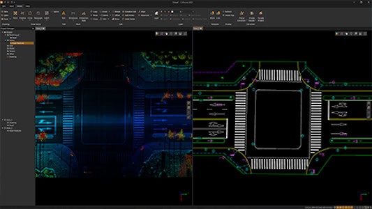

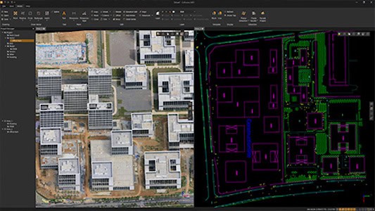
CHCNAV CoProcess 2025 is a comprehensive CAD environment designed for professional LiDAR and photogrammetry data workflows. Built on CHCNAV’s advanced software framework, it enables engineers and survey professionals to manage, visualize, and model exceptionally large point cloud datasets without preprocessing or data thinning. Users can draw directly within a DWG-native workspace, synchronizing vector drafting and elevation generation while maintaining full compatibility with standard CAD layers and templates.
The platform combines intelligent point extraction and geometry recognition with fast visualization tools, allowing real-time slicing, model overlays, and contour drafting. CoProcess 2025’s performance-driven engine efficiently handles point clouds exceeding 100 GB on standard workstations, supporting accurate reconstruction of building facades, floor plans, and topographic features. By merging LiDAR and image-derived models, the software ensures continuous, occlusion-free representations ideal for survey-grade mapping, renovation design, and infrastructure documentation.


