verifiedThis business has been claimed by YellowScan and verified by UST.Verified companies work with us to ensure we display the most up-to-date and comprehensive product information, articles and other material to help you choose the right solution for your requirements.
High Precision, Long-Range UAV LiDAR & Drone LiDAR Mapping Solutions France
High Precision, Long-Range UAV LiDAR & Drone LiDAR Mapping Solutions
YellowScan is a leading developer of professional integrated UAV (unmanned aerial vehicle) LiDAR solutions for surveying.
Our LiDAR sensor packages for fixed-wing and multirotor drones are ideal for mappers, surveyors, UAV service providers and drone OEMs.
Our lightweight survey-grade LiDAR technology has been used for a diverse range of drone mapping and surveying applications, including civil engineering, forestry, environmental research, mining and archaeology.
Please get in touch for help with selecting a LiDAR solution for your needs – our expert team can propose a proof of concept for your unique requirements.
Expert fully integrated hardware – State-of-the-art LiDAR with laser scanner, IMU, GPS, embedded processing, batteries and data storage inside
YellowScan CloudStation – intuitive LiDAR point cloud post-processing software providing georeferenced point cloud visualization and generation in the projection of your choice (output format in .LAS or .TXT)
YellowScan LiveStation – real-time in-flight LiDAR monitoring software, designed by surveyors for surveyors for complex and long-endurance operations
Flight trajectory correction
Comprehensive suite of customer services – including system calibration, on-site training, remote health check, upgrades, warranty and worldwide support.
LiDAR Hardware System Comparison
Our lightweight, high-precision LiDAR hardware solutions are fully-integrated, with embedded batteries.
NDAA-compliant UAV LiDAR for survey-grade aerial mapping
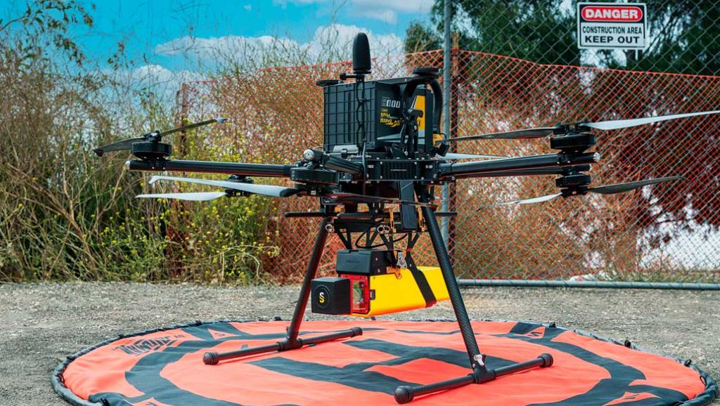
The YellowScan Venturer is an NDAA-compliant UAV LiDAR engineered for professional drone mapping and geospatial data collection. Designed for rapid field deployment, the system combines seamless integration with multi-UAV compatibility, enabling operators to transition between platforms without complex configuration workflows. Its architecture supports fully local data processing, allowing teams to retain control of mission data while accelerating turnaround times for deliverables.
Built to achieve survey-grade performance, the Venturer UAV LiDAR system integrates a Riegl miniVUX-3 laser scanner with an Applanix APX-RTX 20 GNSS-inertial solution to deliver consistent, high-precision point clouds across diverse terrain types. Flexible scanning modes, including burst operation, support dense data capture in complex environments while maintaining operational efficiency. With a lightweight form factor and broad input voltage range, the system is optimized for unmanned aircraft conducting infrastructure inspection, corridor mapping, topographic surveying, and vegetation analysis.
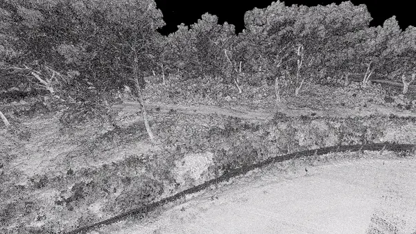
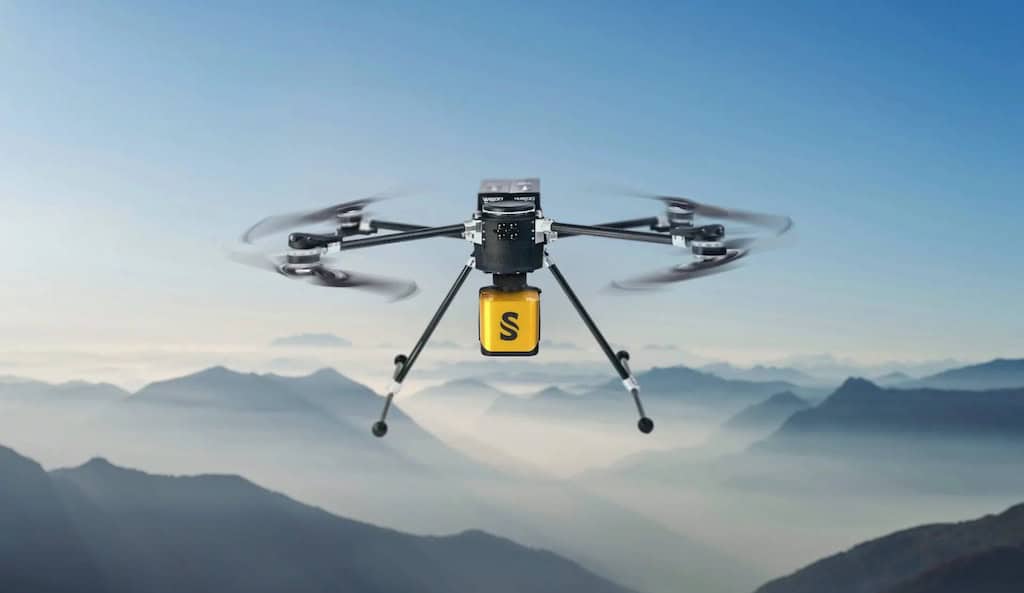
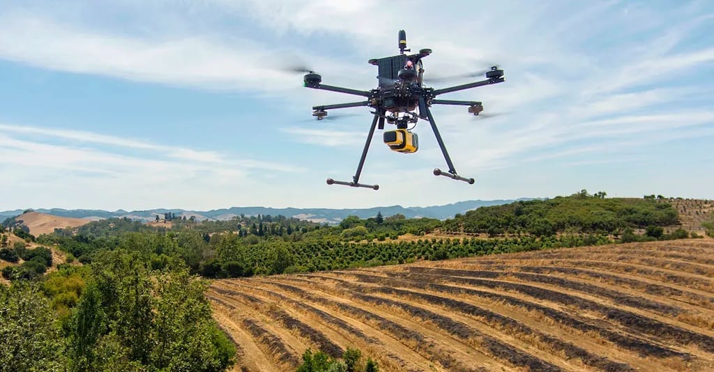
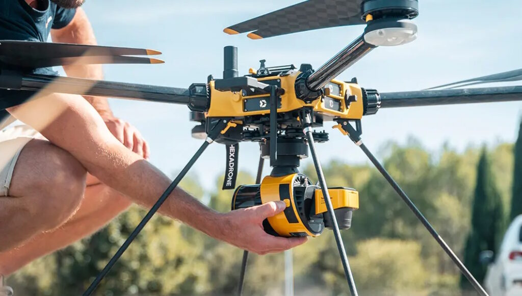
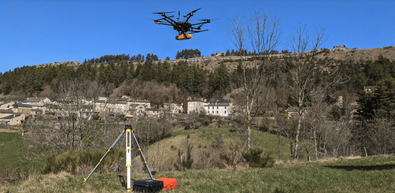
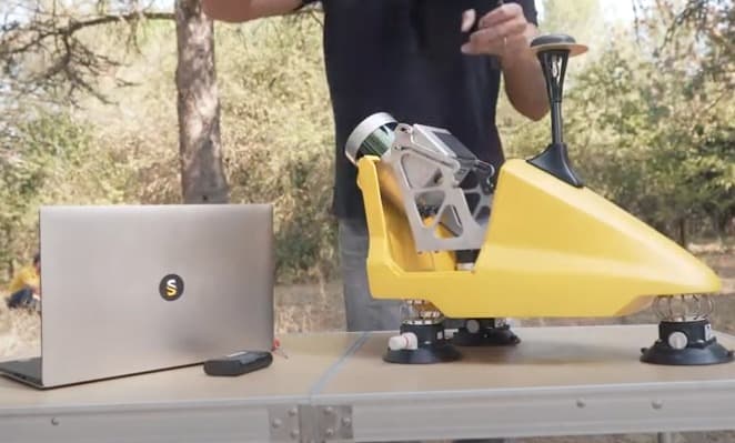
The YellowScan Voyager is a powerful UAV LiDAR scanning solution designed to capture complex and vertical targets. With a data acquisition rate of up to 1800 kHz, it is ideal for applications requiring the highest possible point density.
With a wide field of view, all 1.5 million points per second are oriented towards the ground, making all points entirely usable. Detection and processing of up to 15 target echoes per laser pulse also provides unparalleled vegetation penetration.
The Voyager is our longest-range UAV LiDAR solution, and can be configured to suit a variety of different platforms and mission requirements.
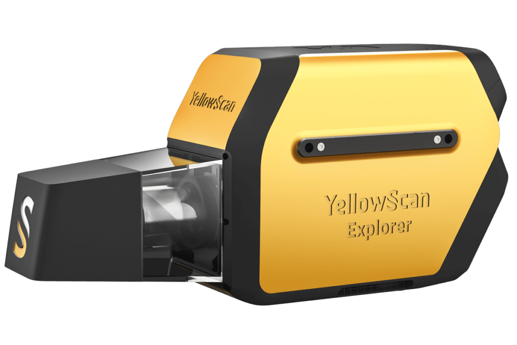
The Yellowscan Explorer is a versatile LiDAR solution designed to be fitted to a range of UAV platforms, including multirotors, unmanned helicopters, and fixed-wing drones.
Featuring a built-in Applanix APX-20UAV GNSS-inertial system, the Yellowscan Explorer delivers high-accuracy scanning at altitudes of up to 300m AGL and ranges of up to 600m.
Striking a balance between size, range, accuracy and weight, the system is ideal for a variety of LiDAR scanning applications, including surveying, forestry, environmental research, archaeology, industrial inspection, civil engineering, and mining.
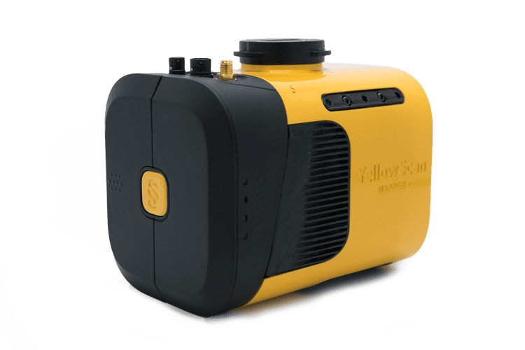
The YellowScan Mapper+ is a compact UAV LiDAR solution combining a Livox AVIA laser scanner with a high-performance GNSS-aided inertial navigation system.
The highly versatile system can be fitted to almost any UAV, and features a choice of three power methods – DJI Skyport/Gremsy gimbal port, external UAV power source, or the included field-swappable battery. An RGB camera can also be attached concurrently with the laser scanner for dual-sensor operation.
The easy-to-use Mapper+ features single-button operation and convenient data storage and retrieval via USB stick. A single stick can store data from a 3-hour LiDAR survey.
The YellowScan Mapper is an advanced UAV LiDAR solution based around the Livox Horizon laser scanner. With an excellent point density, the system can be flown easily at 70m AGL with a 120m swath.
The self-powered unit can be easily integrated into almost any UAV, including multirotor, fixed-wing and helicopter drones. Batteries can be quickly swapped in the field, providing increased productivity.
The YellowScan Mapper features IPW55-rated protection, allowing you to launch missions when weather reports are ambiguous and easily fly home should rain occur.
Surveyor Ultra is a high-point density 360-degree UAV LiDAR mapping solution, incorporating a Hesai XT32M2X LiDAR sensor and an Applanix APX-15 UAV GNSS-Inertial system for highly accurate position and orientation.
The system is ideal for high-speed VTOL drones and unmanned helicopters, providing rapid and fully autonomous data gathering with maximised range.
The compact, lightweight LiDAR package provides sub-decimetre accuracy and the highest data density for demanding mapping and surveying applications.
The YellowScan Vx15-100 is a long-range, high-precision UAV LiDAR mapping solution, incorporating a Riegl Mini-VUX-1UAV LiDAR sensor and an Applanix APX-15 UAV GNSS-Inertial system for highly accurate point cloud production.
Ideal for VTOL UAVs and unmanned helicopters, the fully integrated easy-to-use system provides rapid and fully autonomous data gathering with short processing times.
The compact, lightweight UAV LiDAR package provides survey-grade precision and accuracy even with demanding mapping and surveying targets such as uneven landscapes and vegetation.
Long-range, high-precision drone LiDAR system with the miniVUX-3UAV
The YellowScan Vx15-300 is the most powerful of the Vx15 systems, providing the same high precision while upgrading to a Riegl Mini-VUX-3UAV LiDAR sensor for three scanning frequency options and the highest possible point cloud density.
The LiDAR system can be easily mounted onto a wide range of multirotor drones and unmanned helicopters, flying at heights of up to 100m while maintaining accuracy throughout the point cloud.
The lightweight, long range LiDAR package is ideal for high-altitude UAV mapping and surveying projects requiring sharp, high-accuracy detail.
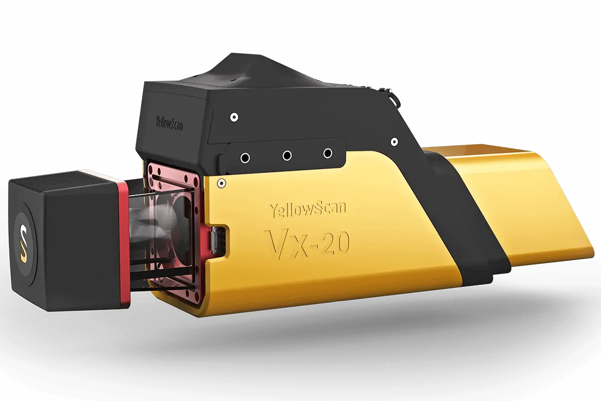
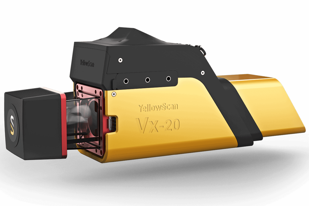
The YellowScan Vx20-100 is our most accurate LiDAR UAV mobile mapping system, incorporating a Riegl Mini-VUX-1UAV LiDAR sensor and an Applanix APX-20 UAV GNSS-Inertial system for highly accurate point cloud production.
Featuring easy mounting onto VTOL UAVs and unmanned helicopters, the fully integrated, easy-to-use mapping system can operate at altitudes of up to 100m while maintaining accuracy throughout the point cloud.
The compact, lightweight LiDAR package provides sharp, accurate detail for demanding mapping and surveying targets such as uneven landscapes and vegetation.
High-accuracy & high-precision LiDAR system incorporating the miniVUX-3UAV
The YellowScan Vx20-300 is the most powerful of the Vx20 systems, featuring the same best-in-class accuracy while upgrading to a Riegl Mini-VUX-3UAV LiDAR sensor for three scanning frequency options and the highest possible point cloud density.
The system can be easily mounted onto quadcopters, other multirotor drones and unmanned helicopters for fully autonomous mapping and surveying at heights of up to 100m.
The compact, lightweight LiDAR package provides long-range operation and sharp, high-accuracy detail for reliable results even on uneven landscapes and vegetation, and is also optimized for measurement of snowy or icy terrain.
Multi-platform LiDAR for Geospatial Survey scanning from Air to Ground
YellowScan Fly & Drive is a multi-platform geospatial LiDAR surveying solution allowing you to easily transfer your sensor from air to ground and vice versa in less than 5 minutes.
Utilising either our Surveyor or Suryeyor Ultra lightweight integrated LiDAR systems, the Fly & Drive car pod can be conveniently mounted to any land vehicle. Sensors are compatible with a range of multicopter, fixed-wing and VTOL UAVs.
The versatile multi-scope solution combines high-resolution laser scanning and precise positioning for highly accurate geo-referenced point cloud measurement for a wide variety of applications.
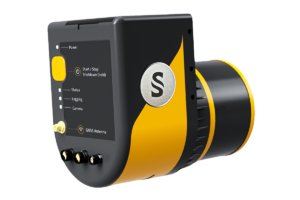
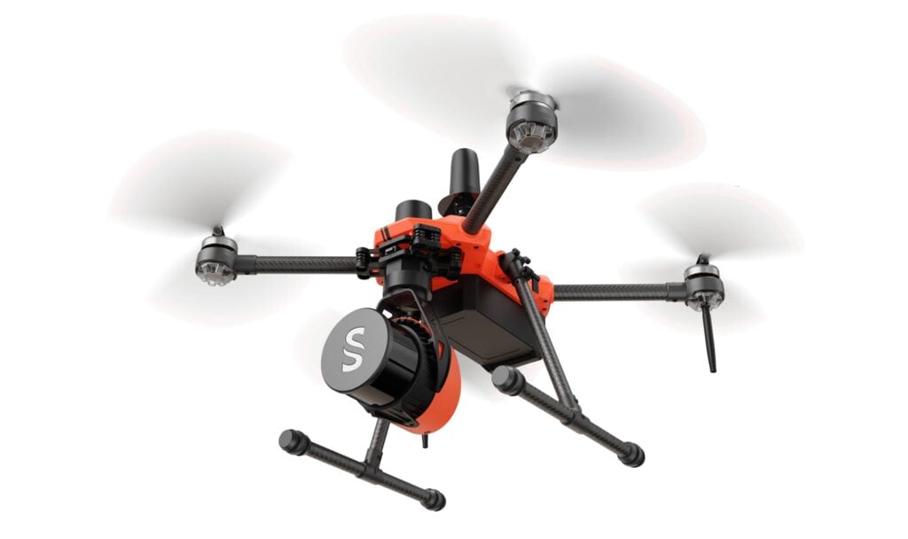
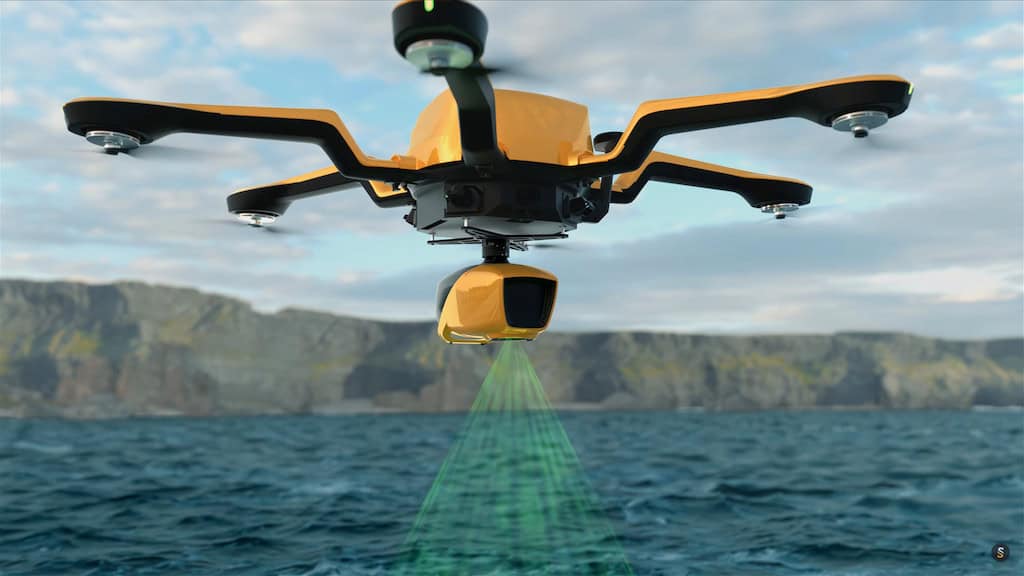
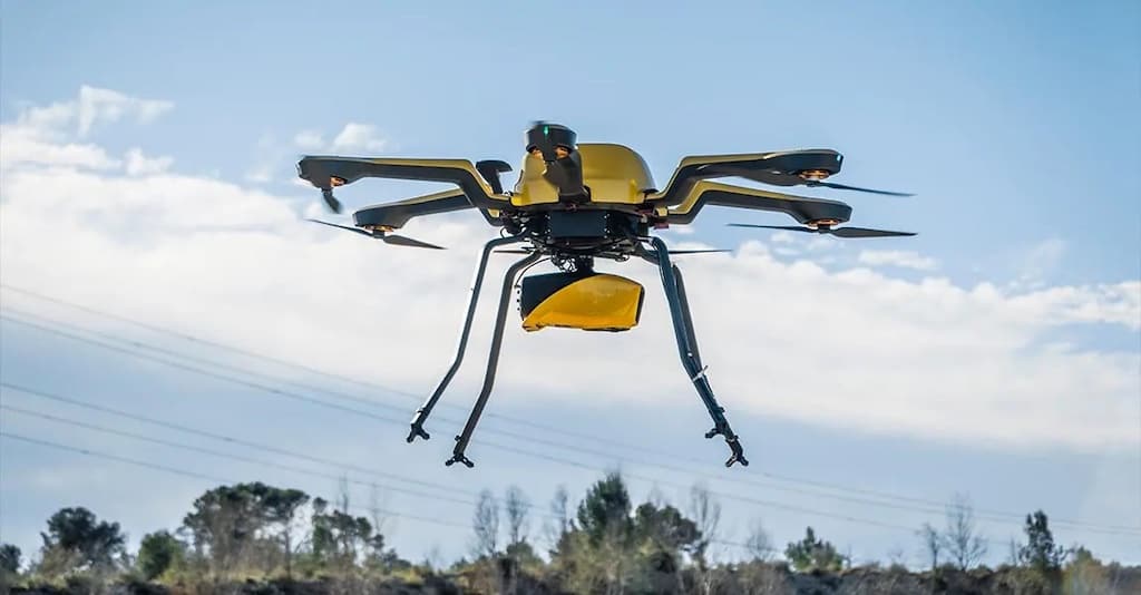
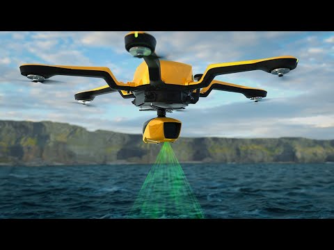
The YellowScan Navigator is a combined bathymetric and topographic measurement solution that allows simultaneous surveying of land and water. Intended specifically for UAV deployment, it can be easily integrated into a wide range of drone platforms.
The system incorporates an advanced laser scanner, a high-accuracy SBG Quanta Micro IMU, and an embedded RGB camera for colorization purposes. Designed for conducting bathymetric measurements in shallow waters, it ensures continuity between underwater points and the surrounding terrain.
The YellowScan Navigator provides up to 45 minutes of mission time on a single battery charge, enabling extended underwater data collection in a variety of marine environments.
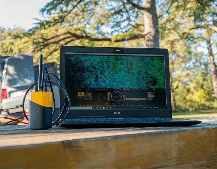
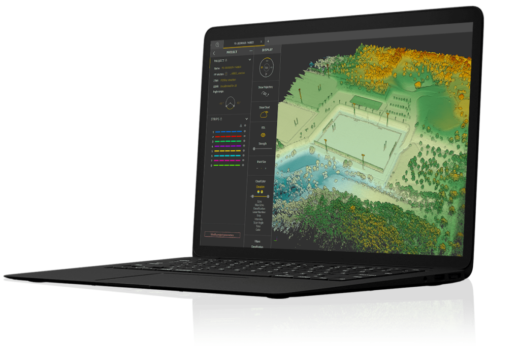
CloudStation is an advanced software package that allows users to easily generate and visualize point clouds from UAV LiDAR data. With a user-friendly interface, it provides the ability to extract, process and display data immediately after flight.
Auto-generation of strips and the production of LAS files can be performed in just a few clicks, providing a faster workflow and enhanced productivity. Advanced visualization tools include 3D viewing, EDL filtering and vertical slicing.
CloudStation also includes a number of optional modules:
Strip Adjustment – simplified point cloud enhancing toolbox with seamless adjustment of strips
Terrain – export classified point clouds from CloudStation and create DSMs/DTMs/DHMs
Colorization – export colorized point clouds from simultaneous LiDAR + camera acquisition
Real time in-flight monitoring for UAV LiDAR missions
YellowScan LiveStation is a software solution for professional drone surveyors that enables the real-time monitoring of data validity and quality during complex and long-endurance LiDAR scanning flights.
Designed to work with YellowScan LiDAR systems, it provides a three-dimensional representation of the gathered pointcloud during flight, and allows users to zoom, translate and rotate.
The intuitive user interface provides a comprehensive status summary, including speed and altitude, IMU and GNSS data, and radio signal.
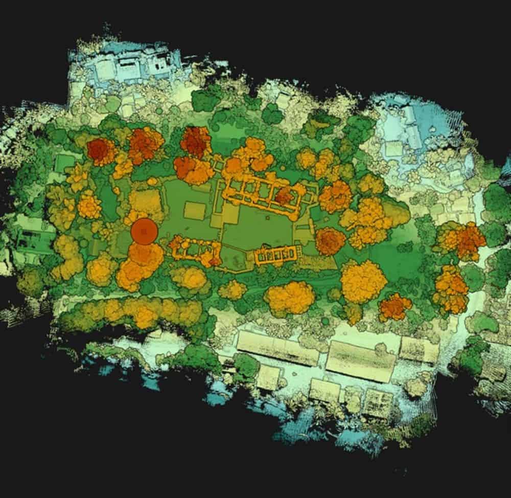
Our UAV LiDAR scanning solutions enable quick, accurate 3D archaeological surveying, with the ability to penetrate vegetation and explore areas inaccessible on foot. Our systems have been used to map Iron Age settlements and World War I battlefields.
The real-time aerial imagery provided by our lightweight UAV surveying solutions allows construction and engineering professionals to quickly obtain the data they need for feasibility studies, earthwork planning, volumetric calculations, BIMs and more.
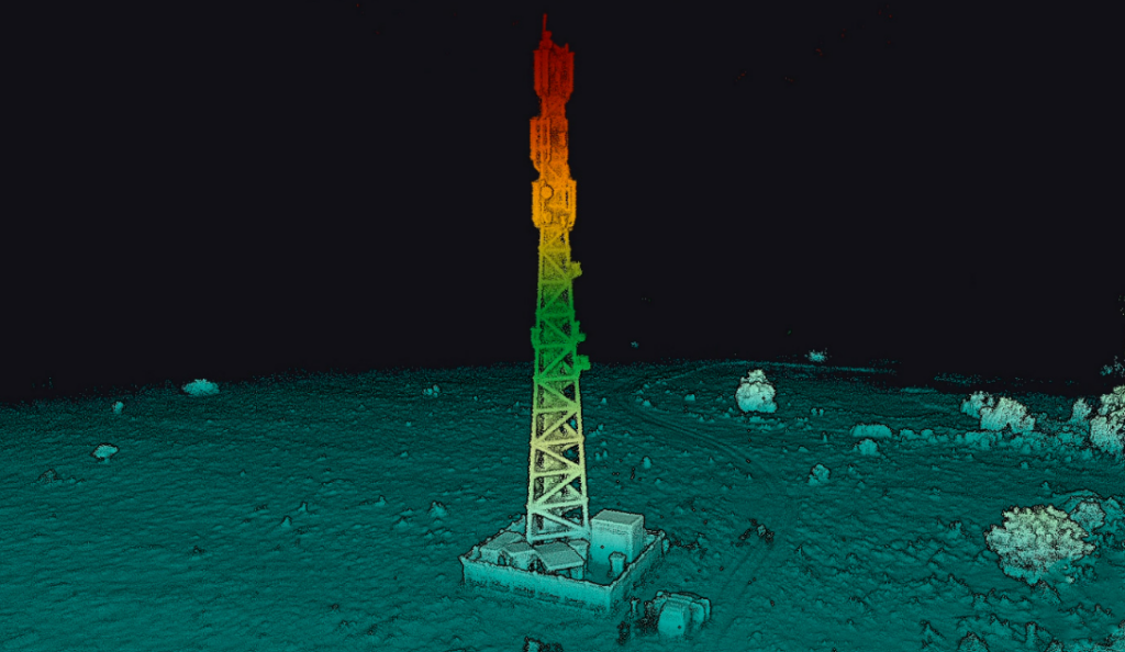
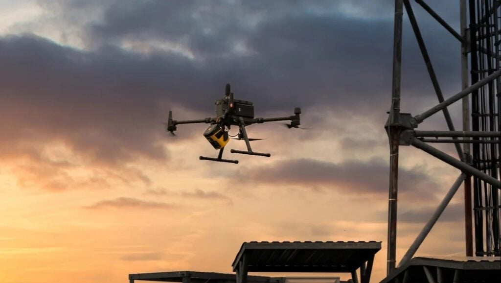
Our UAV LiDAR solutions are ideal for quickly surveying power lines and other linear networks, even in hard-to-access areas or in regions of fast-growing vegetation.
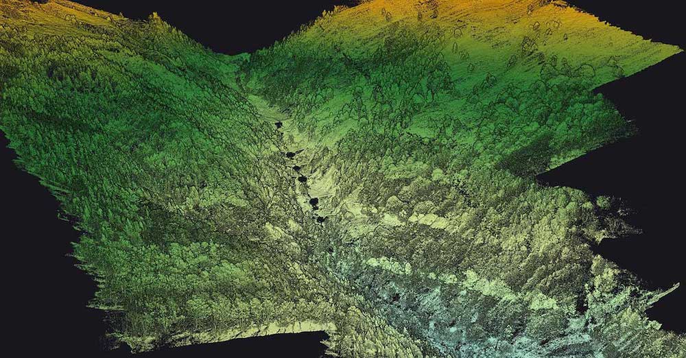
Airborne LiDAR surveys can be utilised in a range of environmental and climate change research applications, such as tree canopy mapping and digital terrain model generation.
With the ability to penetrate vegetation and to fly lower and slower than other airborne LiDAR systems, Yellowscan systems provide better classification of trees, more accurate modelling of the canopy layers and ground topography, and better estimation of biomass.
Yellowscan UAV LiDAR mapping and surveying solutions ensure proper planning and decision making for the mining industry, providing precise inventory information, accurate pit models and contour maps while reducing human and environmental risk.
YellowScan recently hosted its sixth LiDAR Convention in Aix-en-Provence, bringing together a global audience of surveyors, engineers, researchers, drone manufacturers, and industry partners
YellowScan LiDAR Convention 2026 will bring industry professionals together in France to explore market trends, real-world applications, and the latest developments in LiDAR technology and workflows
YellowScan debuted a new survey-grade solution at Geo Week 2026 focusing on local data processing and universal UAV compatibility for demanding environments
YellowScan and Drone Rescue Systems have partnered to enhance UAV LiDAR mission safety, regulatory compliance, and operational reliability in demanding environments
YellowScan demonstrated its Navigator Bathymetric LiDAR system at the 5th Grande Exposition du Fabriqué en France, showcasing French-made drone technology for coastal mapping developed with local partners and recognized by French authorities for innovation and industrial excellence
YellowScan, with Australian distributor Sphere Drones, demonstrated the YellowScan Navigator in real-world coastal conditions, providing rapid, high-resolution mapping of artificial reefs with efficient deployment and safe, practical operation
YellowScan is hosting a live demo of its topo-bathymetric LiDAR, showcasing data collection, processing, and CloudStation software for streamlined survey workflows
YellowScan’s new Smoothing feature enhances point cloud data by reducing noise, improving accuracy, and preserving critical details for better geospatial analysis
YellowScan and Argosdyne have partnered to deliver C2 Class-certified EasyMapper drone solutions, expanding global reach and ensuring compliance with EU drone regulations
YellowScan's CEO Tristan Allouis will participate in a panel discussion at Geo Connect Asia 2025, where their bathymetric LiDAR technology will also be displayed from April 9-10
The integration of YellowScan's Surveyor Ultra with the DeltaQuad Evo brings new levels of productivity, allowing users to gather data faster and more efficiently than ever before
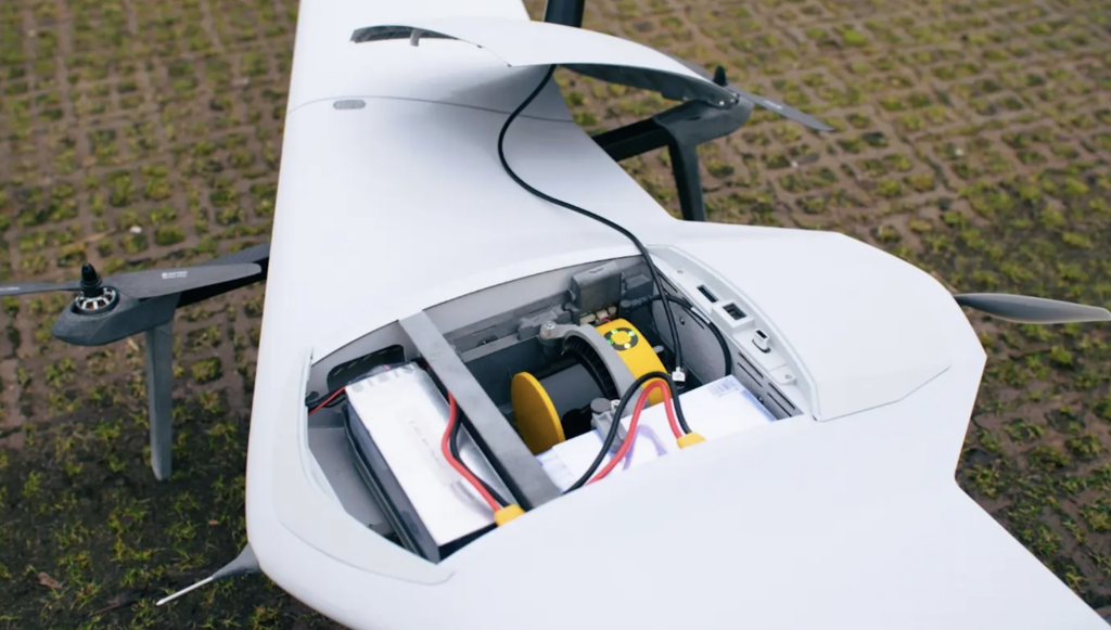
Unveilled at INTERGEO 2024, DELAIR and YellowScan’s new DT46 drone integrates the Voyager LiDAR system with a long-endurance fixed-wing platform, enhancing aerial inspection capabilities
YellowScan and WISPR’s new partnership will aid industries requiring high-precision aerial data, including infrastructure inspection, land surveying, agriculture, mining, and more
YellowScan’s high-performance LiDAR systems have been integrated with Freefly’s top-tier UAVs, combining for accuracy, reliability, and efficiency in aerial surveying and data acquisition
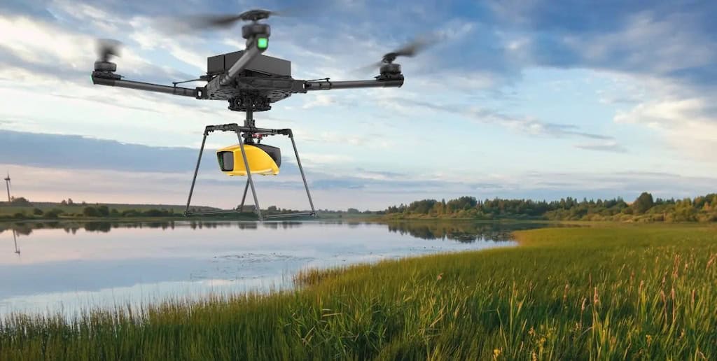
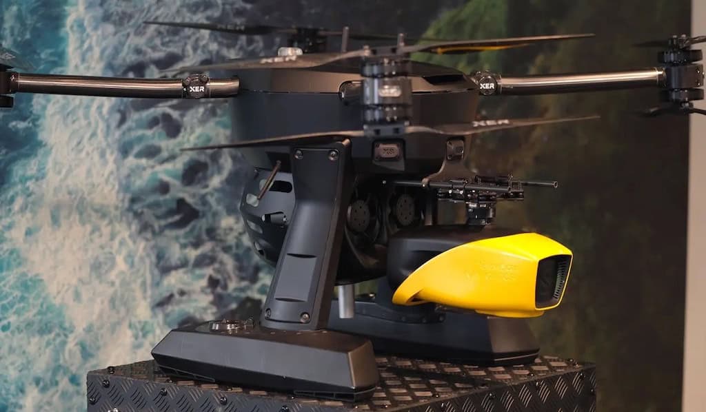
YellowScan’s Navigator bathymetric system has been integrated into Xer Technologies’ drones, creating a vital solution for coastal management, environmental monitoring, and more
YellowScan have released an article outlining the use of flight planners in unmanned aerial vehicle-based LiDAR surveys, exploring the benefits and future directions of the technology
The YellowScan Navigator is an innovative bathymetric LiDAR solution featuring a laser scanner fine-tuned to map waterbeds within a depth range of 0-3m from up to 100m above the water
YellowScan’s Mapper+ can cover a designated area in a short time, and high-quality imagery acquired by both LiDAR solutions allows for accurate counting of shrubs
Professional integrated UAV LiDAR solutions developer YellowScan will be exhibiting and providing live demonstrations at Commercial UAV, DroneX, Intergeo, UAV Show, and GoGeomatics Expo
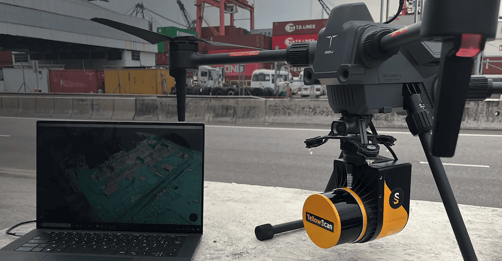
This partnership with GDU Tech will enable the companies to offer more comprehensive solutions to customers and widen the spectrum of industrial solutions
YellowScan is a leading developer of professional integrated UAV (unmanned aerial vehicle) LiDAR solutions for surveying. Our LiDAR sensor packages for fixed-wing and multirotor drones are ideal for mappers, surveyors, UAV service providers and drone OEMs. Our lightweight survey-grade LiDAR technology has been used for a diverse range of drone mapping and surveying applications, including civil engineering, forestry, environmental research, mining and archaeology. Please get in touch for help with
Advancing Unmanned Systems Through Strategic Collaboration
UST works with major OEMs to foster collaboration and increase engagement with SMEs, to accelerate innovation and drive unmanned systems capabilities forward.


 Voyager