


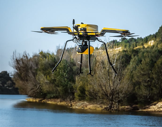
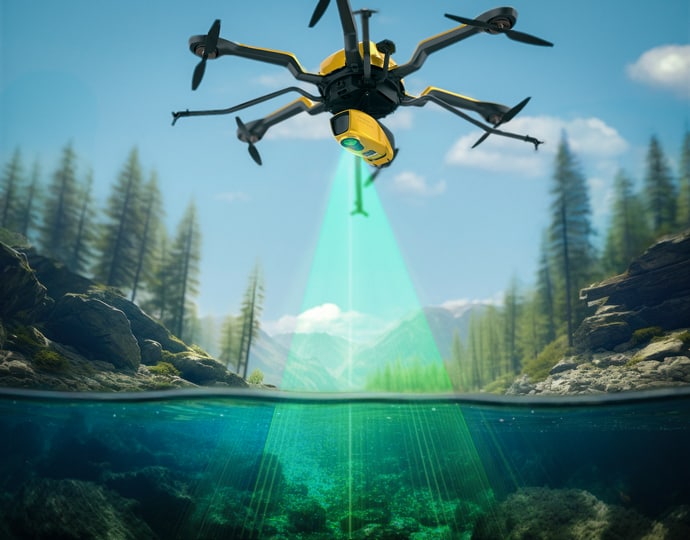
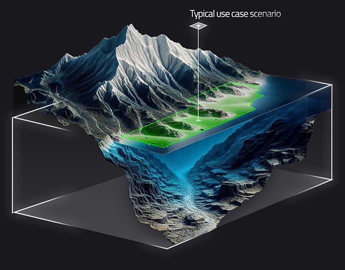
The YellowScan Navigator is a combined bathymetric and topographic measurement solution that allows simultaneous UAV-based surveying of land and water. The compact and lightweight unit can be integrated into a wide range of drone platforms, and features a quick-release Gremsy attachment for easy mounting.
The system incorporates an advanced laser scanner, a high-accuracy SBG Quanta Micro IMU, and an embedded RGB camera for colorization purposes. Designed for conducting bathymetric measurements in shallow waters, it ensures continuity between underwater points and the surrounding terrain.
The YellowScan Navigator provides up to 45 minutes of mission time on a single battery charge, enabling extended underwater data collection in a variety of marine environments, including shorelines, rivers, lakes, estuaries, ponds and reservoirs.


