Find suppliers of Photogrammetric Software for images captured by unmanned aerial vehicles; drones, UAVs, RPAS. For mapping, modeling, ISR and military applications.
If you design, build or supply Drone Photogrammetry Software, create a profile to showcase your capabilities and connect with visitors who have an active requirement for your solutions.
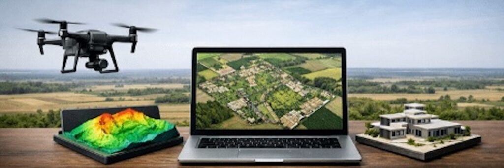
Photogrammetry is defined as the science of making accurate measurements from photographs, and can be used to produce outputs such as 2D and 3D maps and models. As part of a wider UAV data workflow, drone photogrammetry software can be integrated with other types of drone software to support mission planning, data capture and analysis.
Aerial Photogrammetry
Aerial photogrammetry software enables data collected by drones and UAVs using LiDAR scanners, cameras, heat sensors and infrared imaging systems, to be used to calculate precise photogrammetric measurements concerning the surveyed topography as well as buildings, landmarks and other manmade and geographic points of interest.
Drones, UAVs and remotely piloted aerial systems (RPAS) are used to take regular aerial images whilst flying autonomously along pre-set flight paths, following a series of waypoints. Location data is collated using geotags which assign GNSS co-ordinates to each image.
Photogrammetric Processing
From the input data, drone photogrammetry software can provide a number of different outputs. One of the most common output deliverables is a geo-referenced orthophoto or orthomosaic, which is a photo or series of stitched-together photos that has been adjusted for topographic relief, lens distortion and camera tilt, thus providing a uniform scale across the entire image. These allow mappers and surveyors to perform highly accurate measurements of distances and surfaces.
Applications for Drone Photogrammetric Software
The accurate creation of detailed terrain models alongside specific distance and surface measurements can provide useful intelligence for military applications. Photogrammetric software is widely used in military applications to process data collated by military drones, UAVs and RPAS. Safer and requiring considerably less resource than traditional reconnaissance methods, the application of photogrammetry to aerial data provides military forces with a useful advantage in the field. Photogrammetry software can also be used to simulate flight plans and other mission critical simulations.
Drone photogrammetric software is also used within industry, for example by farmers for precision agriculture, by planners and architects for urban planning purposes and by fuel companies with interests in mining, solar farms and the extraction and delivery of oil and gas.
Available with on-the-fly editing tools and cloud-based processing, drone photogrammetry software can also include intelligent features such as extraction algorithms and feature identification programs.
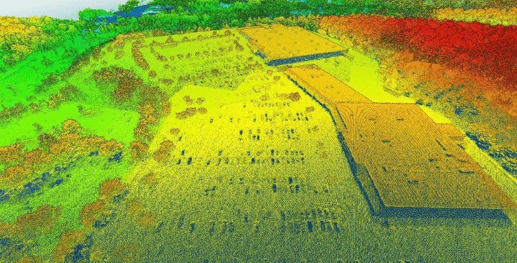
Blue Nose Aerial Imaging outlines the core principles of drone mapping, explaining how photogrammetry and LiDAR workflows are used to generate accurate geospatial deliverables for analysis and decision-making
Blue Marble Geographics highlights its Online Classroom, featuring new self-paced courses in point cloud processing that cover core workflows, feature extraction, and advanced analysis using Global Mapper tools
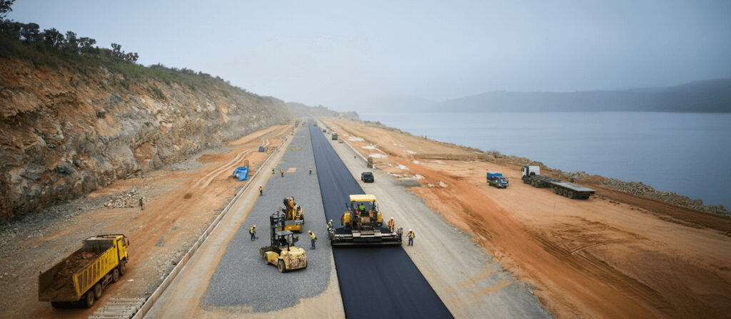
Blue Marble Geographics details how PT Waskita Karya (Persero) Tbk is using drone-based photogrammetry and watershed analysis within Global Mapper® to support environmentally responsible design and risk mitigation for a road project in Indonesia
A topographic map can be created from a point cloud in Global Mapper Pro, learn how to create your own in the latest article from Blue Marble Geographics
Pierre Tilak, Director and founder of Tilak.io. talks to UST about the company's achievements in working on PX4, ArduPilot, QGroundControl, streaming video to the ground, and adding new features to DJI drones
Blue Marble Geographics details a new tool in Global Mapper Pro v25.1 that automatically identifies and marks Ground Control Points in images making the process faster and less time-consuming
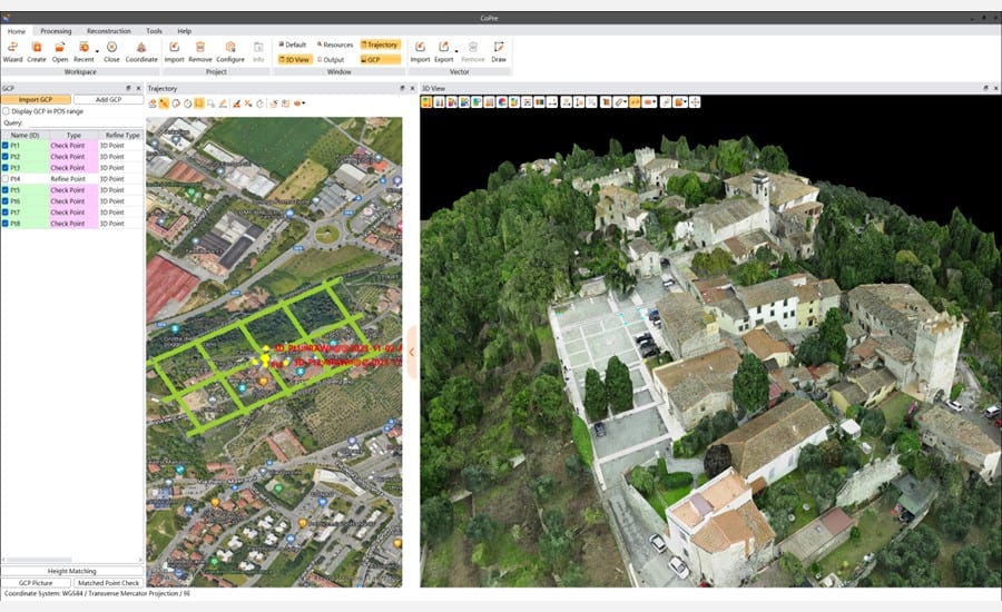
CHCNAV's CoPre provides an end-to-end solution for rapid georeferencing, analysis, and modeling of high-quality 3D point cloud data captured by UAV LiDAR scanners and imaging systems
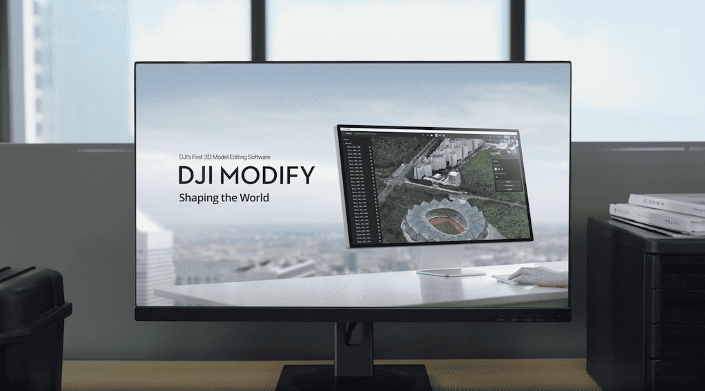
This solution pairs with DJI’s enterprise drones and 3D modeling and mapping software, forming a comprehensive solution for aerial surveying, modeling, and model editing
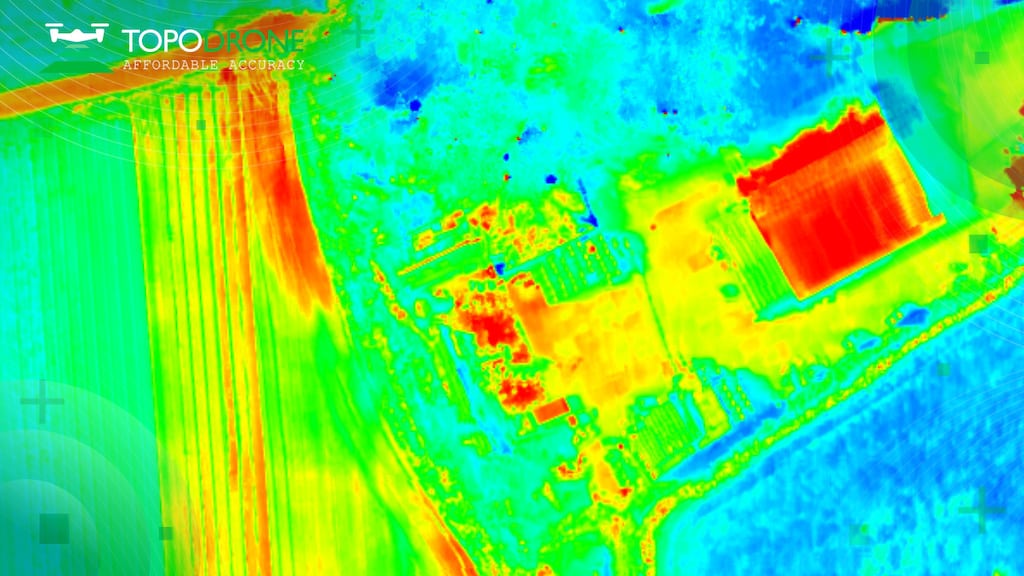
TOPODRONE and AGROWING’s PT61 camera can perform detailed surveys and deliver thermal orthomosaic maps obtaining accurate 3D models
Dec 12, 2023
Advancing Unmanned Systems Through Strategic Collaboration
UST works with major OEMs to foster collaboration and increase engagement with SMEs, to accelerate innovation and drive unmanned systems capabilities forward.