


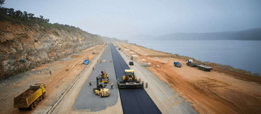
Blue Marble Geographics explains how drone-based photogrammetry and watershed modeling within Global Mapper® are supporting the environmentally responsible design of the Jalan Kretek–Girijati Road, a critical segment of Indonesia’s South Coast Road (Jalur Lintas Selatan Jawa). Read more >>
PT Waskita Karya (Persero) Tbk is using these capabilities to improve connectivity between Yogyakarta, regional airports, and southern coastal tourism destinations, significantly reducing travel times while supporting economic growth and poverty reduction.
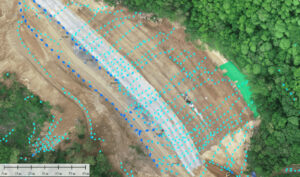
Waterflow analysis output.
The project corridor traverses steep terrain, variable elevations, volcanic geology, and areas subject to intense seasonal rainfall, creating inherent risks of landslides, erosion, and flooding. To address these challenges, high-resolution drone imagery and surveyed ground control points are processed using Global Mapper Pro’s Pixels to Points® photogrammetry module to generate 3D point clouds, Digital Elevation Models (DEMs), and orthophotos that accurately represent site conditions.
Based on the generated terrain models, watershed analysis is performed using the Create Watershed tool to identify surface water flow paths, runoff patterns, and catchment areas. This information highlights locations susceptible to water accumulation, localized flooding, and slope instability, allowing engineers to proactively refine road alignment, drainage design, and earthworks to reduce environmental impact and improve long-term roadway resilience.
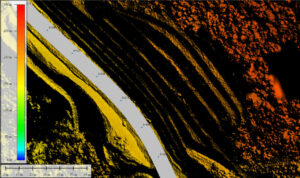
WMS overlaid over the generated DTM.
The workflow is further strengthened through the integration of internal project datasets, such as stationing points, road alignments, project boundaries, and right-of-way limits, using custom Web Map Services (WMS) accessed via Global Mapper’s Online Data Sources tool. Overlaying photogrammetric outputs, hydrologic analysis, and authoritative GIS layers in a single 2D and 3D environment provides a comprehensive view of terrain conditions, design elements, and risk factors.
Field observations during a significant rainfall event confirmed the accuracy of the watershed analysis, with water pooling occurring at the same locations identified in Global Mapper. These results enable targeted drainage enhancements and slope stabilization measures to be implemented before construction issues arise.
This integrated geospatial workflow demonstrates how drone imagery, photogrammetry, watershed modeling, and GIS visualization within Global Mapper can support more sustainable and resilient road design, while providing a repeatable framework for infrastructure projects across Indonesia.


