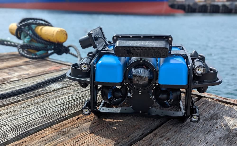
Cerulean Sonar’s Omniscan FS was used to support identification of the Steinbrenner during a recent deepwater ROV expedition near Isle Royale in Lake Superior. The mission highlighted how compact sonar systems are helping smaller teams conduct underwater inspection and exploration operations in challenging deepwater environments.
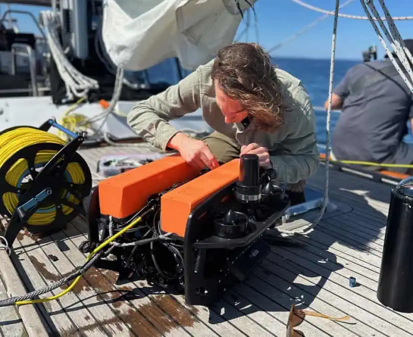
The expedition was carried out from a 52-foot Vagabond staysail schooner using a purpose-built Remotely Operated Vehicle (ROV) assembled only weeks before deployment. Working within a limited weather window and without large-scale research infrastructure, the team aimed to locate and document the wreck site in approximately 700 feet of water using sonar imaging, live video, and tethered vehicle operation.
Compact Sonar Technology and Small-Team ROV Operations
Deepwater wreck surveys have traditionally depended on specialized vessels and expensive subsea equipment. More compact sonar and underwater sensing technologies, however, are increasingly allowing smaller operators and independent teams to undertake missions that were previously difficult to attempt without institutional resources.
Cerulean Sonar develops modular sonar systems intended for use with ROVs, Autonomous Underwater Vehicles (AUVs), and Unmanned Surface Vessels (USVs), supporting underwater imaging, positioning, and inspection tasks across a range of subsea applications.
During the Lake Superior mission, Omniscan FS was used alongside SonarView software during the successful identification of the Steinbrenner wreck site.
With calm conditions at the start of the deployment, the ROV entered the water near the estimated wreck coordinates south of Isle Royale. Sonar quickly detected the wreck site as the vehicle descended while tether was steadily deployed from the surface vessel.

Successful Identification of the Steinbrenner Using Omniscan FS and SonarView.
Tether Behavior Changes at Operational Depth
As the vehicle approached approximately 700 feet, conditions began affecting the tether differently than during earlier shallow-water testing.
Pressure changes altered the tether’s buoyancy characteristics as trapped air compressed at depth. What had behaved predictably near the surface began sinking and folding through the water column before settling onto the wreck debris below.
The tether became caught across multiple sections of jagged wreckage scattered on the lakebed, trapping the ROV among fragmented remains of the structure.
Video from the vehicle showed low-light conditions and limited visibility around the wreck, making orientation increasingly difficult during recovery attempts.
Recovery Through Incremental Vehicle Control
Without an autonomous recovery function available, the vehicle had to be manually maneuvered free using live sonar and video feeds viewed from the surface.
Using a handheld control interface, the operator worked gradually through the entanglement points, carefully adjusting the ROV’s position to avoid worsening the tether’s placement within the debris field.
The recovery process depended on slow, controlled movement rather than forceful extraction. Sudden maneuvers risked increasing the entanglement while also disturbing visibility around the vehicle.
After a prolonged recovery effort, the tether eventually drifted free from the wreck structure and the ROV was returned safely to the surface.
Refining the Second Descent
By the time the vehicle was recovered, wind conditions on Lake Superior had begun strengthening and the return trip to Eagle Harbor remained several hours away.
Rather than ending the mission, the team adjusted tether handling procedures and vehicle approach methods before beginning a second deployment. Using sonar guidance and lessons from the earlier dive, the ROV descended toward the wreck site with improved control during the second attempt.
During this deployment, Omniscan FS and SonarView supported successful identification of the Steinbrenner.
Combining Sonar Imaging with Live Video
At depth, the wreck appeared primarily as a dispersed debris field rather than a clearly preserved structure. Visibility limitations reduced the effectiveness of video imagery alone, particularly around scattered wreckage and low-light areas near the lakebed.
Sonar imaging provided structural reference and object positioning while live video offered localized visual confirmation where conditions allowed. Together, the two systems helped the team build a clearer understanding of the wreck environment during the operation.
Rather than relying on a single uninterrupted visual scene, the expedition depended on combining multiple partial observations gathered throughout the dive.
Expanding Practical Access to Deepwater Missions
The operation demonstrated how compact sonar systems and portable ROV technologies are broadening access to deepwater underwater missions beyond large institutional programs.
At the same time, the expedition reinforced the continued importance of operator experience and real-time decision-making in subsea operations. Tether dynamics, changing weather conditions, and restricted visibility all required continuous adjustment throughout the mission.
For smaller ROV teams conducting inspection and exploration work, systems such as Cerulean Sonar’s Omniscan FS are contributing to more accessible deepwater capability while maintaining the operational demands associated with challenging underwater environments.