


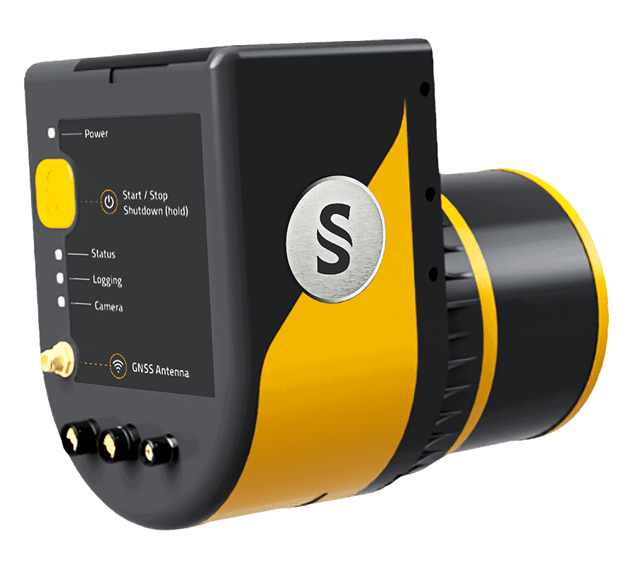
YellowScan Surveyor Ultra
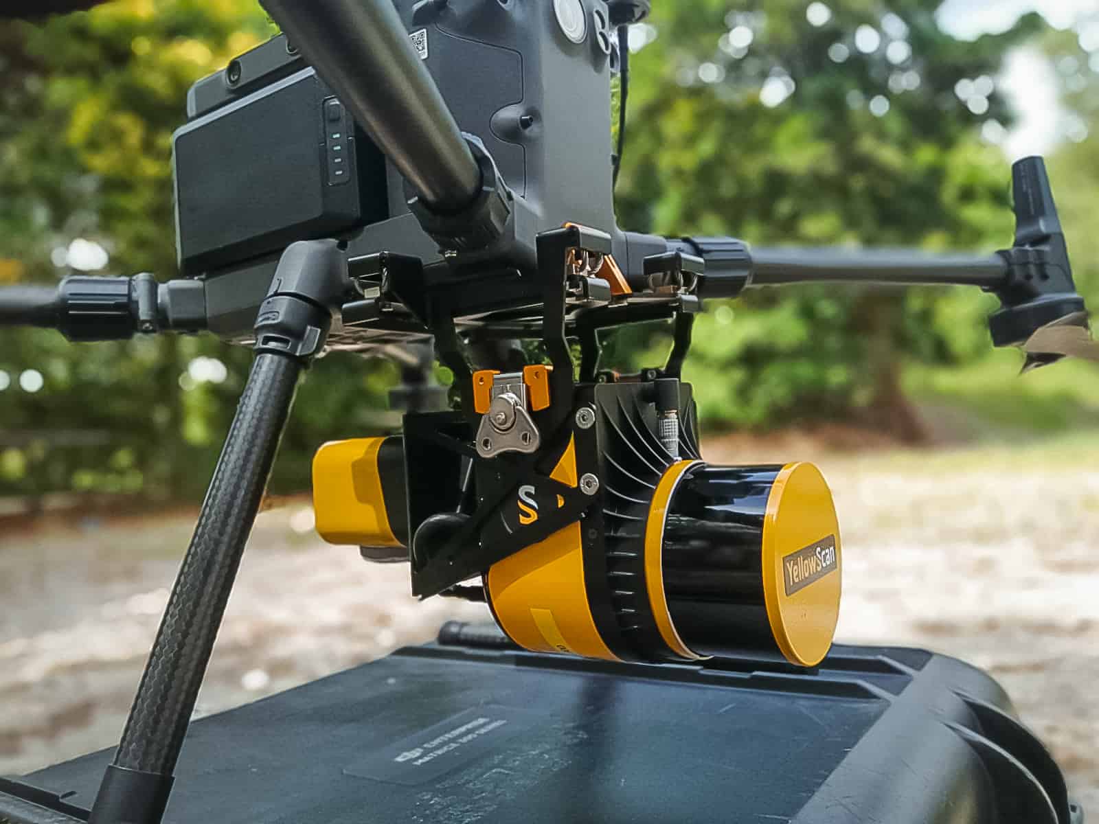
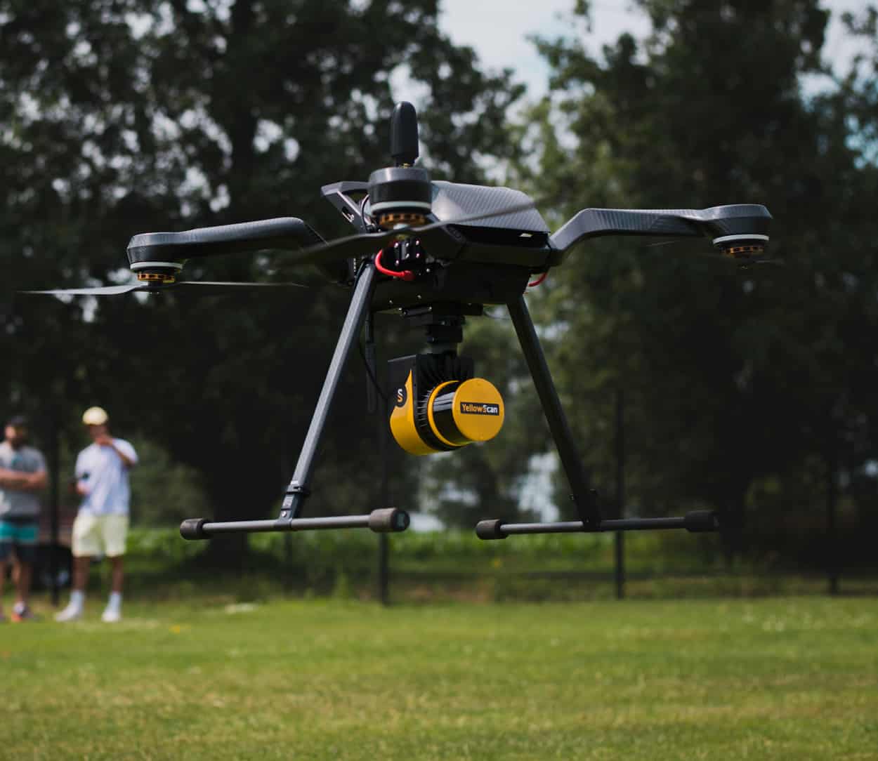
Surveyor Ultra is a high-point density 360-degree UAV LiDAR mapping solution, incorporating a Hesai XT32M2X LiDAR sensor and an Applanix APX-15 UAV GNSS-Inertial system for highly accurate position and orientation.
The system is ideal for high-speed VTOL drones and unmanned helicopters, providing rapid and fully autonomous data gathering with maximised range. The compact, lightweight LiDAR package provides sub-decimetre accuracy and the highest data density for demanding mapping and surveying applications.
With its 360° field of view, the YellowScan Surveyor Ultra answers vertical mapping and mobile mapping needs when combined with Fly&Drive. Expect unparalleled vegetation penetration thanks to this system’s 32 laser beams.
Package includes- YellowScan Surveyor Ultra
- Charger and 2 batteries
- GNSS antenna and cable
- 2 USB flash drives
- Documentation
- Applanix POSPac UAV software to post-process GNSS and inertial data for highest accuracy
- YellowScan CloudStation software to generate and visualize your georeferenced point cloud
- Boresight calibration certificate
- 1-year warranty
- In-person training
- Worldwide technical and operational support
| Scanner | Hesai XT32M2X |
|
Laser range @10% target reflectivity |
140 m |
| Precision | 3 cm |
| Accuracy | 3 cm |
| Scanner field of view | 360° |
| Shots per second | 640k |
| Echoes per shot | Up to 3 |
| GNSS-Inertial solution | Applanix APX-15 UAV |
| Weight | 1.32 kg (2.92 lbs) battery included |
| Autonomy | 1:20 hour typ. |
| Power consumption | 22 W |
| Operating temperature | -10 to +40 °C |
| Size | L 16 x W 10.3 x H 13.8 cm |


