YellowScan will host a live demonstration of its advanced topo-bathymetric LiDAR system, the YellowScan Navigator, on Thursday June 26th in Montpellier, France.
Running from 9:30am to 4pm, the event offers professionals in geospatial surveying and remote sensing the opportunity to see the solution in action.
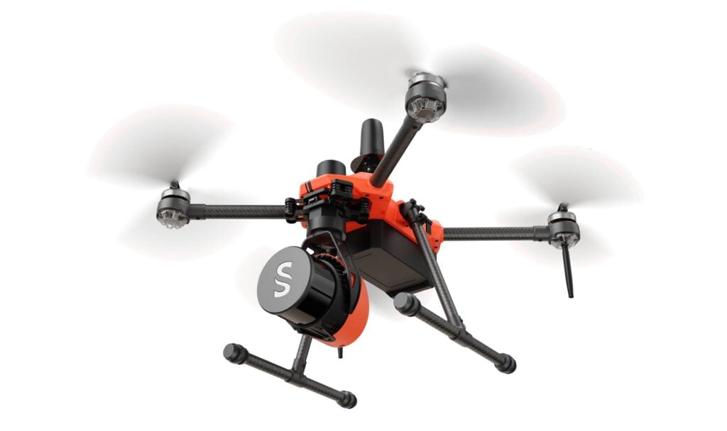
Designed for both topographic and bathymetric mapping, the YellowScan Navigator delivers accurate and efficient data collection in complex environments. Attendees will witness firsthand the system’s user-friendly single-button operation, which simplifies data acquisition for a wide range of surveying missions.
A highlight of the event will be the demonstration of YellowScan’s CloudStation software. Developed to streamline the post-processing workflow, CloudStation enhances productivity with automated water classification and underwater point correction, delivering high-quality data with minimal manual input.
The agenda includes a live data acquisition session, real-time data processing demonstrations, and a detailed presentation of YellowScan’s products. Attendees will also have the opportunity to engage with YellowScan experts in a dedicated Q&A session, offering insight into system capabilities and deployment scenarios.
YellowScan specializes in the design and manufacture of UAV LiDAR solutions that integrate seamlessly into aerial platforms. With a strong focus on performance, reliability, and ease of use, the company’s solutions are used globally across applications in forestry, environmental monitoring, civil engineering, and coastal mapping.
This live event presents a valuable opportunity for industry professionals to explore how the YellowScan Navigator can enhance survey efficiency and accuracy in both land and water environments.