verifiedThis business has been claimed by AirData UAV and verified by UST.Verified companies work with us to ensure we display the most up-to-date and comprehensive product information, articles and other material to help you choose the right solution for your requirements.
Comprehensive Drone Flight Data Management & Analysis Platform United States of America
Comprehensive Drone Flight Data Management & Analysis Platform
AirData is the world’s most deployed commercial drone operations platform, with over 60M flights logged. The comprehensive platform provides a wide range of features that keep your drones airworthy and maximize the efficiency of your operations, and is used by hundreds of thousands of pilots and fleet operators in over 200 countries around the world.
Advanced data analysis for mission-critical drone flight intelligence
The AirData UAV software automatically logs all the pilot and drone data required, analyzing it to provide timely and actionable flight intelligence. Pilots can gain immediate visibility of flight parameters and aircraft and battery health, enabling critical failure prediction and optimized flight performance.
The platform’s powerful data analytics can also be used to track maintenance requirements, manage your drone fleets and equipment inventory, generate customized reports, and comply with regulatory requirements. AirData UAV also offers a real-time streaming service with ultra-low latency, enabling you to broadcast from controllers, phones and tablets to multiple viewers with no specialized hardware required.
AirData UAV supports a constantly expanding range of industry-leading drone platforms and flight apps, allowing you to benefit from its powerful capabilities with virtually any setup.
Flight Analysis
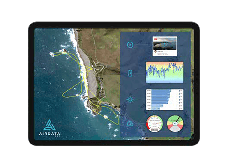
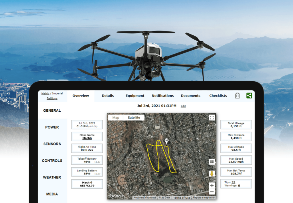
AirData UAV enables easy importing from a variety of drones and apps, plotting flight paths on an intuitive map interface with downloadable reports. A wide range of data is available at your fingertips, including flight time, battery levels and temperatures, distance, altitude, GPS satellite count and much more.
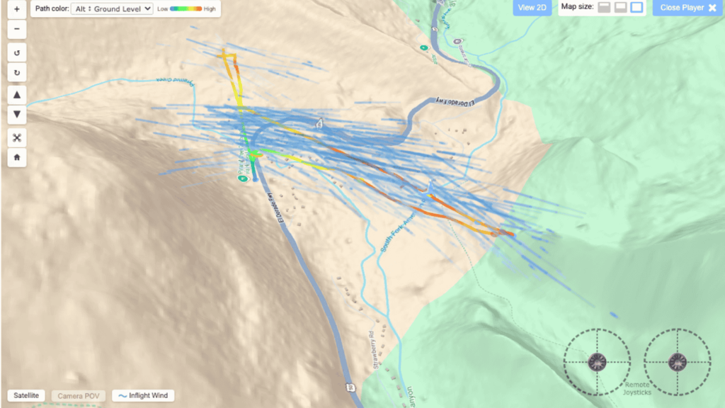
New 3D Flight Player
Replay flights in full 3D with terrain awareness, camera cone visualization, and color-coded flight paths displaying key metrics such as altitude, speed, battery performance, and more.
Mission Planning
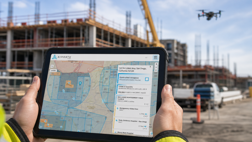
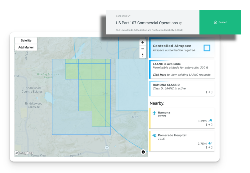
Operators and teams can proactively and collaboratively plan missions, with the ability to assign pilots and equipment, complete risk assessment checklists, and access airspace and weather information. An integrated approval system ensures compliance with all required protocols and regulations.
New Flight Insights
AirData UAV provides enhanced flight intelligence with detailed terrain analysis, population density information, maximum height above ground, and awareness of nearby hazards. Operators can identify potential risks including powerlines, airports, cell towers, and military zones, helping teams plan safer and more informed missions.
Live-Streaming AirData UAV’s live-streaming service allows you to broadcast the screen of your device from any flight app, with latency of just 1 second and setup times of less than 10 seconds. Streams can be securely shared with third parties outside of your organization via a unique URL and configurable pin code.
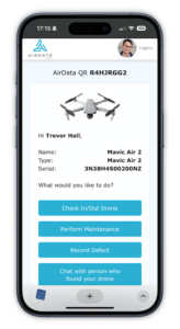
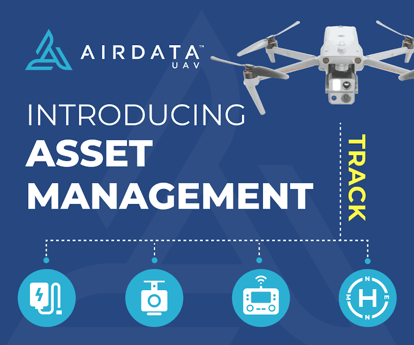
Asset Management
Fleet owners and operators can easily track and manage their drone platforms and associated equipment, saving time and minimizing losses. The system uses customizable QR code labels for easy check in/check out, secure lost and found reporting, and historical location tracking.
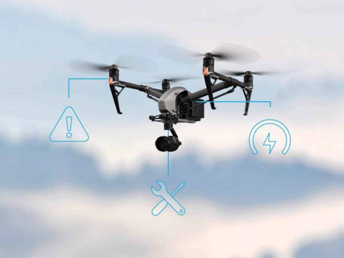
Maintenance
Keep on top of drone, battery and equipment maintenance with AirData UAV’s comprehensive record-keeping and tracking features. The software notifies users of upcoming services, generates reports, and provides detailed service templates based on manufacturer recommendations and professional experience.
Defect Management
Log, track, and manage drone defects, including damage, manufacturing faults, and hardware or software issues. AirData UAV helps teams maintain accurate equipment records and stay on top of issues throughout the lifecycle of their fleet.
Compliance & Reporting
AirData UAV offers a range of easy-to-use compliance tools that allow you to meet regulatory reporting requirements, including automated scheduling and generation of maintenance and FAA COA reports. A variety of file formats are supported, and templates can be saved for easy access and reuse.
Weather Service
AirData UAV’s Ok to Fly service utilizes a combination of regular weather data and algorithms extracted from flight data to provide up-to-the minute information and forecasting, ensuring safe operations.
LAANC
For U.S.-based pilots and operators, Airdata UAV offers in-app LAANC (Low Altitude Authorization and Notification Capability) support in partnership with CAL Analytics, enabling you to fly in controlled airspace with automated approval.
Certification Management
Easily manage pilot skills and training, with automatic detection of hundreds of certification types. Certificates can be uploaded via web or by email to AirData UAV, and the system also provides automatic document expiration alerts.
Get to know AirData
Explore each feature at your own pace — everything you need to manage your fleet starts here… Take the Platform Tour today!
Versatile subscription options to suit any drone operator
AirData UAV is available in a range of different subscription services, from a free plan for personal non-commercial use through to a fully-fledged professional membership for large-scale drone programs and fleets.
A free trial is also available for the Enterprise plan, allowing you to evaluate all the features of AirData UAV with no commitment.
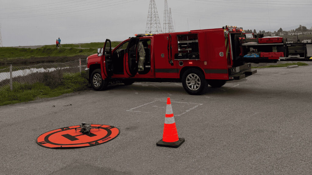
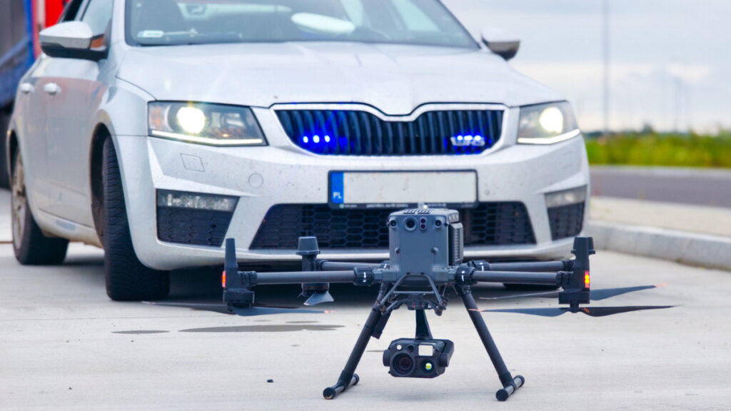
How AirData Simplifies Operations for Public Safety Drone Programs
The administrative side of running a drone program can be just as demanding as the missions themselves. That’s exactly what AirData’s Public Safety Program is built to address. Start your free trial and explore the platform today.
How AirData Simplifies Operations for Energy Drone Programs
Managing a drone program across critical infrastructure takes more than successful flights. From compliance and maintenance to fleet oversight and reporting, the administrative workload can quickly become overwhelming. That’s exactly what AirData’s Energy platform is built to streamline. Start your free trial and see how AirData helps you centralize operations, automate documentation, and keep your program audit-ready.
Menlo Park Fire Protection District (MPFPD) has integrated AirData's technology to enhance its public safety drone operations, optimizing live video streaming, proactive battery tracking, and automated performance reporting for leadership
As the inspection drone market undergoes rapid growth, AirData UAV is expanding its operational footprint to support utility organizations navigating complex fleet management demands and upcoming regulatory changes
LeoSight and AirData UAV integrate drone telemetry and flight data into LeoCommand to support coordinated public safety operations and shared situational awareness across teams
AirData UAV transforms drone analytics by introducing advanced 3D aerodynamic modeling to derive accurate wind data directly from actual flight behavior
AirData and BRINC have integrated the AirData platform with BRINC’s Lemur 2 and Responder drones to automatically capture and organize flight data, creating searchable mission records with tracking for pilot activity, equipment, and maintenance
AirData UAV has introduced a 3D Flight Player that converts drone flight logs into interactive 3D visualizations, enabling detailed flight reconstruction, pilot input analysis, and telemetry-driven playback for training and review
AirData has launched a Public Safety Program enabling law enforcement, fire departments, and emergency response agencies to manage drone operations with automated flight data tracking, compliance reporting, and real-time video streaming
AirData adds multilingual platform support, helping international drone teams manage flight operations, reporting, and regulatory compliance across global fleets worldwide
PG&E uses AirData’s automated platform to ensure safe, compliant BVLOS drone operations, enhancing efficiency and wildfire risk management across California
AirData UAV has introduced an Enterprise Asset Management suite designed to streamline tracking and allocation for commercial drone fleets, offering new efficiencies and insights
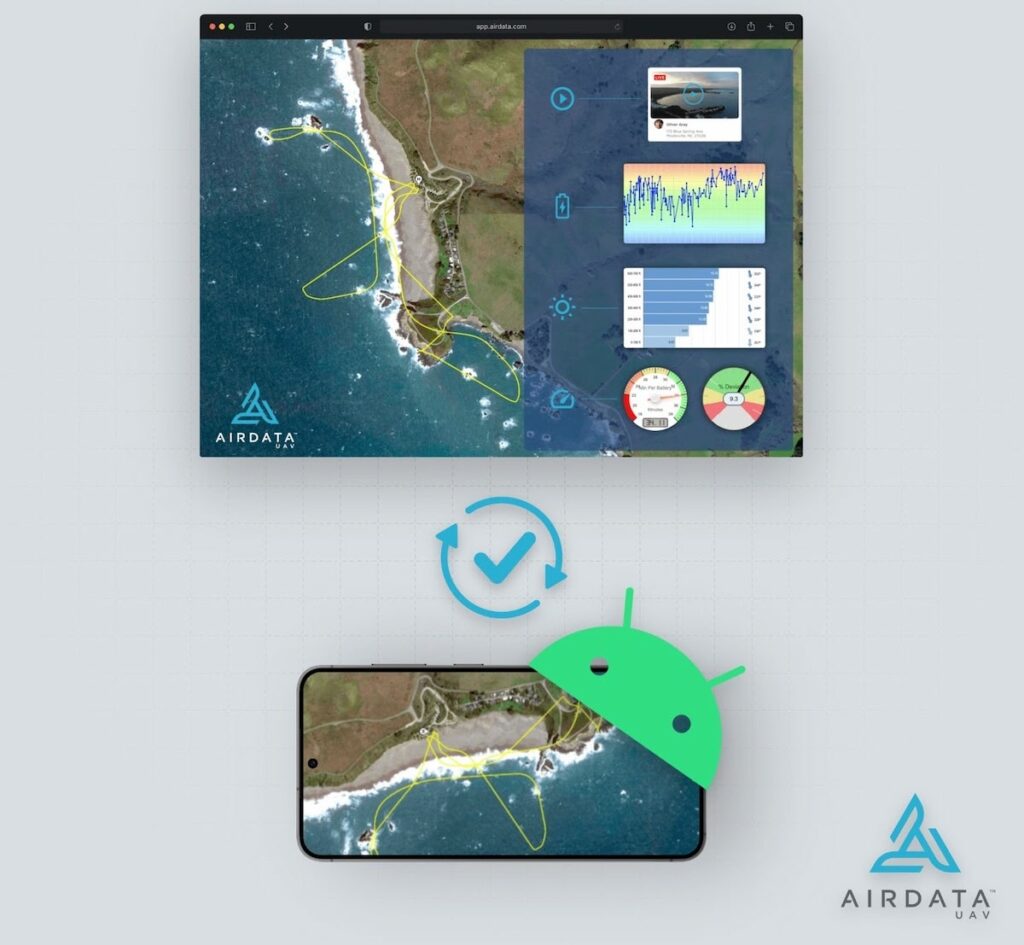
Recent updates to the AirData UAV app enhance flight syncing for Android users worldwide, particularly benefiting US drone pilots impacted by DJI’s upcoming removal of historical flight data
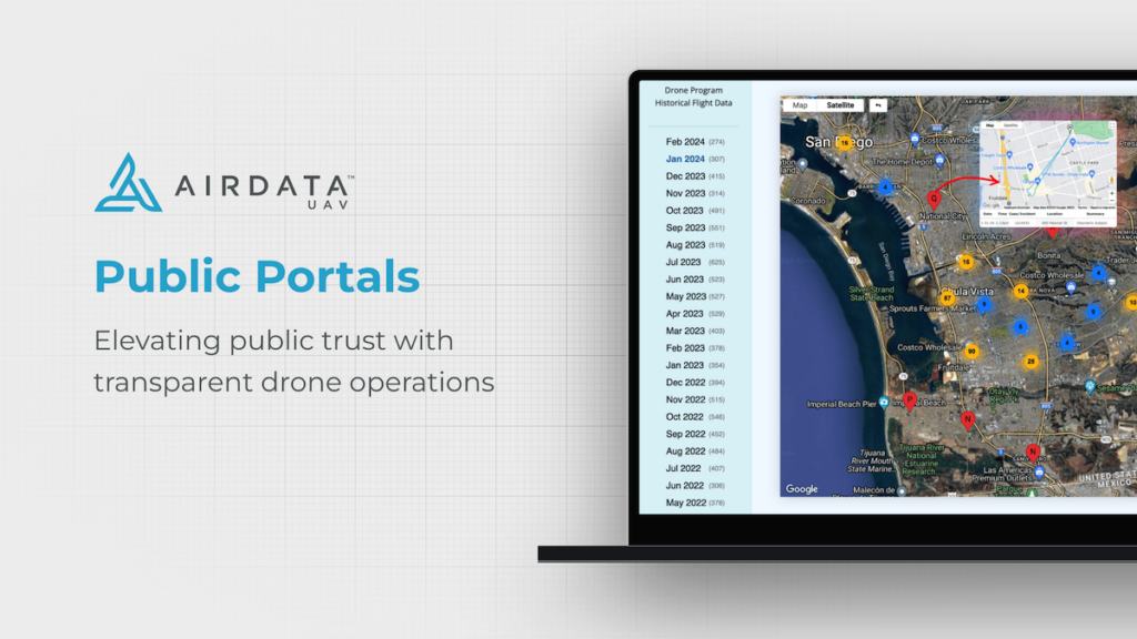
AirData’s Public Portal is a powerful new tool for building public trust and engagement with drone programs used by law enforcement and first responders
AirData UAV will provide fleet data management to the Airpeak S1, reportedly the smallest drone capable of carrying Sony’s line of full-frame Alpha mirrorless cameras
AirData to provide unified enterprise solution for Low Altitude Authorization and Notification Capability (LAANC) authorization through integration with Acubed’s unmanned traffic management software
The partnership will incorporate AEE Technology’s innovative lineup of first responder-centric aircraft into AirData’s comprehensive flight data management system
Advancing Unmanned Systems Through Strategic Collaboration
UST works with major OEMs to foster collaboration and increase engagement with SMEs, to accelerate innovation and drive unmanned systems capabilities forward.