New Public-Facing Features for First Responder Drone Programs

AirData’s Public Portal is a powerful new tool for building public trust and engagement with drone programs used by law enforcement and first responders By Sarah Simpson / 08 Mar 2024

Mission Planning Software

Discover cutting-edge solutions from 7 leading global suppliers
SUPPLIER SPOTLIGHT
New Public-Facing Features for 1st Responder Drone Programs
Follow UST

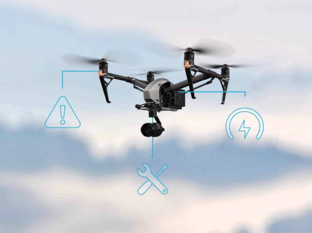
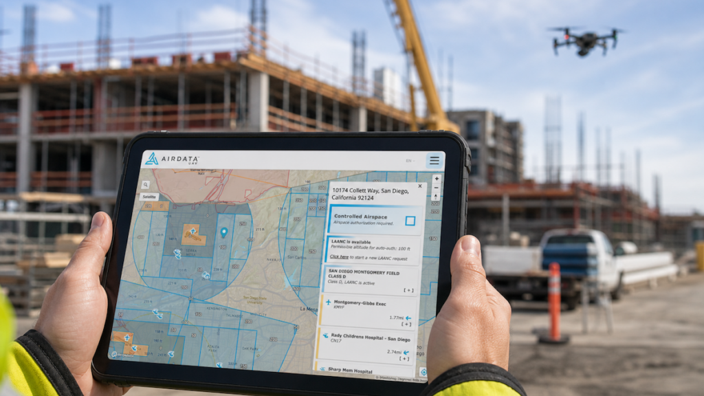
AirData, an industry-leading drone fleet management and live streaming platform, provides detailed data tracking as one of its core feature sets.

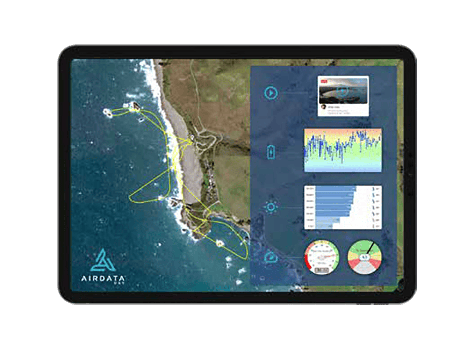
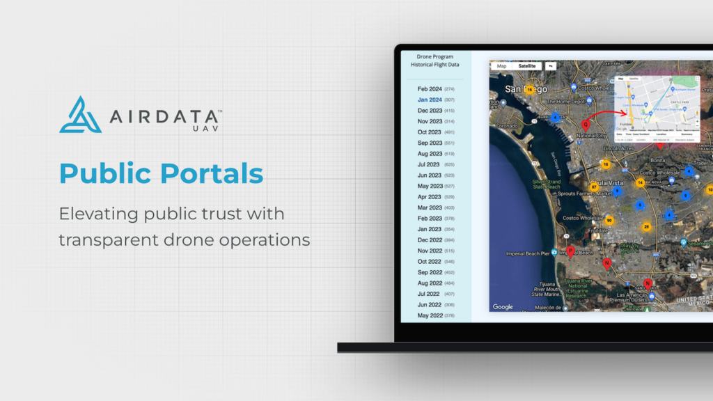
Law enforcement agencies can choose to publicly share drone flight information using their custom-configured AirData Public Portal websites. These sites provide the public with transparent access to public safety flight paths and locations, enabling viewers to search for missions by address or time period.

The data shared is tailored to the needs of each department and can be automatically filtered to protect confidentiality. AirData has drawn on the expertise of pioneering agencies across the country, such as Chula Vista PD, Sacramento PD, and Las Vegas Metro PD, to develop and grow the Public Portal program as a way toward safer, more community-focused policing.

Implementing AirData’s Public Portal into our UAS program has revolutionized the way we share our drone operations with the community,” said Detective Steven Oscar (Program Coordinator) and Chief UAS Pilot at LVMPD. “It’s transparent, user-friendly, and bridges the gap between technology and public trust.”

With real-time data sharing, we’re not just flying drones; we’re fostering an environment of openness and accountability. AirData has enabled us to elevate our program’s transparency to new heights, ensuring our community is always in the loop and fully aware of the benefits our UAS initiatives bring.”

Privacy, officer safety, and operational security are serious concerns that agencies must balance with the need to build public trust and engagement. AirData has a powerful set of backend features that enable agencies to adjust parameters as appropriate for their operations.

One important feature was the option to delay flight sharing by a customized time period. While this provides a blanket layer of security, checklists and flight tags offer individual pilots granular controls over how their data is shared. For example, pilots on sensitive missions can keep their flights confidential by quickly completing a post-flight checklist from the AirData UAV mobile app.

We’re thrilled to be able to provide such a key service in the public safety space,” said AirData CEO Eran Steiner. “The agencies we work with are dedicated to incorporating the most advanced technologies and practices in public safety. At the same time, transparency is a top priority, as they look to build engagement and trust within their communities. We’ve seen a great response to our Public Portals, especially from our customers who use drones as first responder solutions. We’re excited to help agencies grow and succeed with these transformative programs.”

Posted by Sarah Simpson Specialising in digital copy Sarah is an experienced copywriter and researcher. Working with Unmanned Systems Technology Sarah has developed a passion for sourcing unique digital content and a talent for writing about the latest technical innovations in the unmanned sector. Connect & Contact

Latest Articles

High-Precision Three-Axis FOG from MostaTech to Debut at XPONENTIAL Europe

MostaTech is launching the G321M three-axis Fiber Optic Gyroscope (FOG) at XPONENTIAL Europe, delivering enhanced performance, compact design, and magnetic immunity for SWaP-sensitive applications

Feb 12, 2025
IMSAR & TEKEVER Partner to Enhance UAS with Advanced SAR Technology

IMSAR and TEKEVER are set to integrate advanced Synthetic Aperture Radar (SAR) technology into unmanned aerial systems, enhancing surveillance, intelligence, and reconnaissance capabilities for defense and security operations

Feb 11, 2025
UAV Navigation-Grupo Oesía provides its autopilot for the MCSD Demonstrator

UAV Navigation-Grupo Oesía supports SATNUS in advancing Manned-Unmanned Teaming (MUT) technology with its autopilot system for the Manned-Unmanned Teaming & Common Systems Demonstrator (MCSD)

Feb 11, 2025
ParaZero Enables BVLOS Drone Operations with Advanced Safety Systems

ParaZero’s advanced safety technology has enabled an Federal Aviation Administration (FAA) waiver for BVLOS drone operations, marking a significant step toward safer, more expansive commercial drone applications in various industries

Feb 11, 2025
New CTD Cell Developed for Oceanography

With WHOI and BIOS, D-2 Inc. has developed, tested, and produced for field testing a new and more precise version of the company’s flow through closed field conductivity cell

Feb 11, 2025
75,000 Flight Hours and Counting as Volatus Expands Aerial Monitoring Capabilities

Volatus Aerospace has reached 75,000 flight hours in pipeline monitoring, showcasing its expertise in aerial inspections and commitment to advancing real-time, data-driven infrastructure safety solutions

Feb 11, 2025

Featured Content

Ellipse Series Enhanced with Latest Firmware Upgrade

The new firmware update from SBG Systems integrates the latest World Magnetic Model (WMM) to improve navigation precision, even for first-generation Ellipse sensors

Feb 11, 2025
Advanced FOG-Based Inertial Sensing Solutions for Drones & Robotics

Aegiverse's products feature a multi-layered architecture that combines multiple elements into a compact module, providing significant, size, weight and cost reductions

Feb 06, 2025
Vertiq’s 81-08 G2 Module Added to DIU’s Blue UAS Framework

Vertiq's 81-08 G2 servo motor and control system for Group 2 sUAS has become the first motor and ESC combination to be approved under the U.S. government's Blue UAS Framework

Feb 05, 2025