DJI Flight Data Removal: AirData & Google Provide Solution for Drone Pilots

Recent updates to the AirData UAV app enhance flight syncing for Android users worldwide, particularly benefiting US drone pilots impacted by DJI’s upcoming removal of historical flight data By William Mackenzie / 27 Sep 2024

Drone Fleet Management

Discover cutting-edge solutions from 4 leading global suppliers
SUPPLIER SPOTLIGHT
Follow UST

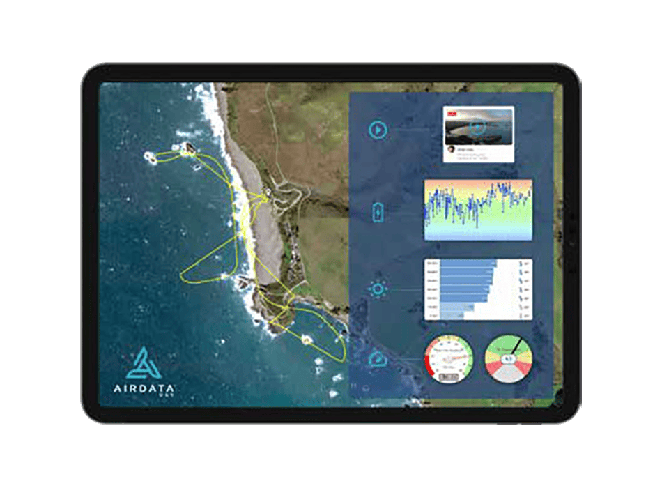
AirData, the provider of AirData UAV—an online platform for drone fleet data management and real-time flight streaming—has partnered with Google to deliver advanced flight syncing capabilities for users of newer Android phones and tablets.

A permissions breakthrough in the latest version of the AirData UAV mobile app significantly improves the flight upload experience by allowing automated syncing from all major commercial flight apps on Android. 

DJI Flight Data Removal: AirData & Google Provide Solution for Drone Pilots

These updates bring improved flight syncing capabilities to users worldwide, and help US-based drone pilots affected by DJI’s imminent removal of historical flight data.

With extended permissions granted to the AirData mobile app by Google, Android users can now automatically and easily sync data directly to their AirData accounts, even on the latest Android versions. 

This feature bypasses the need to upload flights to the DJI cloud. AirData provides the option for direct-from-device upload of flight logs from a multitude of commercial flight apps.

This ability is especially important to US-based pilots of DJI aircraft, as DJI announced that as of October 2024, historical flight logs from US customers will be deleted from the DJI cloud.

Users with phones and tablets running Android 13, 14, and 15 can enable auto sync by installing the latest version of AirData UAV from the Google Play Store.

Alternatively, users of manufacturer remote controllers with built-in screens that don’t have Google Play Store access can benefit from automated syncing by using the standalone version of AirData UAV.

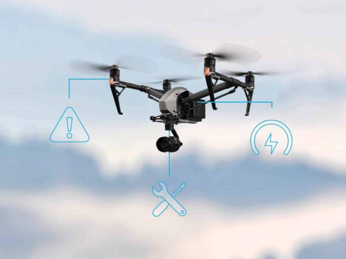
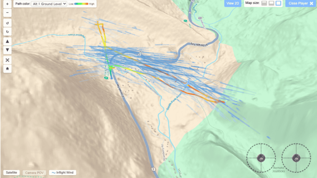
Automated syncing through the AirData UAV app creates a seamless and secure flight upload process that saves valuable personnel hours for pilots and fleet managers. This data is used throughout AirData to provide fleet administrators with valuable under the hood crash prevention information, tools for compliance reporting, pilot activity tracking, and maintenance scheduling. 

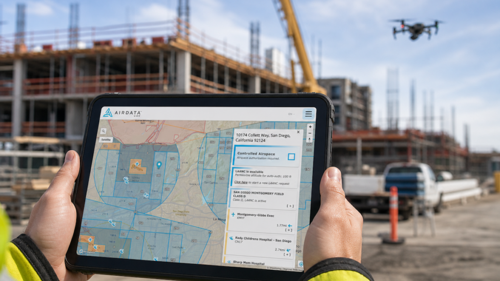
The AirData UAV mobile app also allows users to perform essential mission functions such as completing checklists, checking weather and airspace conditions, requesting LAANC authorization, and live streaming of drone footage.

AirData CEO, Eran Steiner, commented, “Our highest priority is to ensure our customers continue to have straightforward and secure access to their flight data. DJI’s decision to delete flight logs very soon could potentially affect many US-based drone pilots and fleet operators. As AirData is the only platform out there that offers direct-from-device flight log syncing, we are thrilled to be able to enhance our platform to address this critical need.”

Find suppliers and manufacturers of Drone Fleet Management Systems >>

Posted by William Mackenzie Edited by William Mackenzie, Junior Editor and Copywriter practised in digital content creation and writing about defense and marine technology. Connect & Contact

Latest Articles

ARK FPV Flight Controller Now Supports Betaflight

The ARK FPV Flight Controller, a leading flight control solution for FPV drones, now officially supports Betaflight firmware

Feb 06, 2025
Aurora’s Energy Lab Pushing Limits of Battery & Fuel Cell Tech

Explore how Aurora Flight Science's advanced energy lab is enhancing battery efficiency, extending flight endurance, and revolutionizing fuel cell technology

Feb 06, 2025
Volatus Aerospace Partners to Introduce Heavy-Lift Hybrid-Electric Drone

Volatus Aerospace partners to introduce Dufour Aerospace's Aero2 heavy-lift, hybrid-electric VTOL drone, enhancing UAV capabilities for cargo transport, surveillance, and critical aerial operations in remote regions

Feb 06, 2025
New AI-Driven Counter-Drone Technology Enhances Threat Detection

Sentrycs’ introduces HORIZON, an advanced AI-powered solution for detecting DIY drones in real-time, offering impressive detection, tracking, and mitigation capabilities against emerging drone threats

Feb 06, 2025
The Importance of Hardware Redundancy in UAS Autopilots

Embention outlines how hardware redundancy in autopilot systems enhances the reliability and resilience of control systems in UAS, eliminating single points of failure and ensuring uninterrupted missions

Feb 06, 2025
New Indoor Inspection Drone Released for Cost-Effective Surveys

Terra Drone is introducing the Terra Xross 1, an indoor inspection drone featuring LiDAR, visual odometry, and a tiltable 4K camera for improved safety and efficiency

Feb 06, 2025

Featured Content

Compact Remote ID Receiver Released for Enhanced Drone Safety

Dronetag has introduced RIDER, a pocket-sized, drone-agnostic Remote ID receiver designed to improve airspace situational awareness and support commercial and public safety applications

Jan 30, 2025
New GCS Software Released for C100 Quadcopter

Performance Drone Works introduces PDW CORE, a comprehensive software bundle enhancing the C100 quadcopter's capabilities with a new UI, flight simulator, mission planner, ATAK integration, and fleet management tools

Jan 29, 2025
Advanced Signal Mapping Tool Released for Effective UAV Flight Planning

Elsight has launched HeatSight, a signal strength mapping tool that provides UAV operators with reliable cellular coverage data, improving flight planning efficiency and safety for BVLOS missions

Jan 28, 2025
Doodle Labs Unveils Mobile App for Managing Mesh Networks

Doodle Labs is introducing the Mesh Rider® Mobile App, providing intuitive tools for managing wireless mesh networks across devices such as ground control stations (GCS) and UAVs

Jan 23, 2025
Advanced FOG-Based Inertial Sensing Solutions for Drones & Robotics

Aegiverse's products feature a multi-layered architecture that combines multiple elements into a compact module, providing significant, size, weight and cost reductions

Jan 21, 2025
“Surveillance as a Service” UAV Solution Launched

Volatus Aerospace’s “Surveillance as a Service" solution will use drone technology to provide secure, multi-modal surveillance for faster response times and actionable intelligence

Jan 16, 2025