Showcase your capabilities
If you design, build or supply Computer Vision, create a profile to showcase your capabilities and connect with visitors who have an active requirement for your solutions.


Computer vision enables unmanned systems to interpret visual data from their surroundings, allowing for autonomous navigation, object detection, and real-time decision-making. In UAVs, UGVs, and UUVs, it supports tasks such as target tracking, terrain mapping, obstacle avoidance, and infrastructure inspection. These capabilities are essential for operating in complex or dynamic environments with minimal human intervention. Computer vision systems are used across defense, industrial, agricultural, and public safety applications where situational awareness and precision are critical.
Read the Technology Overview
Cutting-Edge Unmanned Systems-based Sensing Solutions & Counter-UAS Systems for Military & Defense Forces
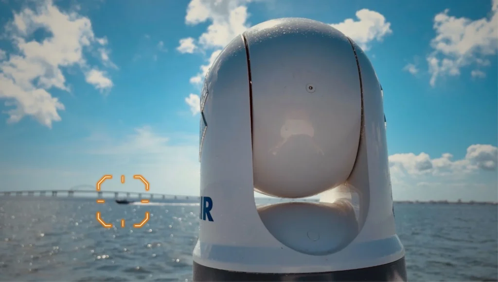
Smart Marine Radar Processing Solutions: Advanced Perception & Situational Awareness for Uncrewed & Autonomous Vessels
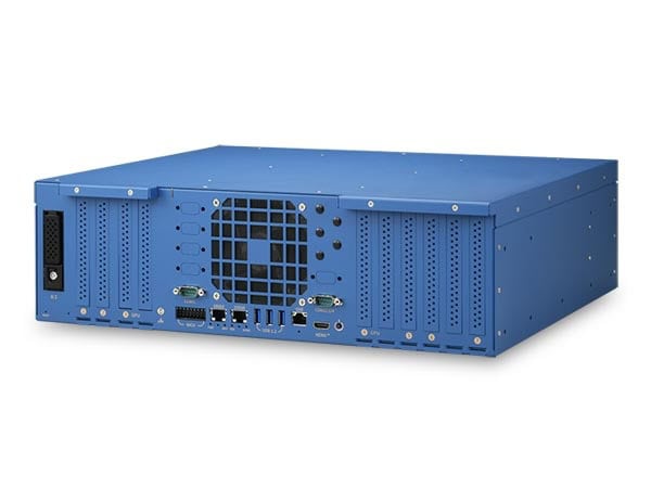
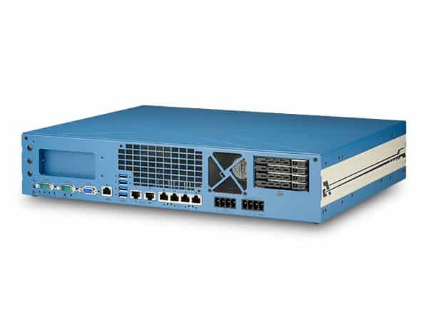
Industrial-Grade Embedded Computer Systems for AI Edge Computing & Machine Learning

Advanced Imaging & Sensor Autonomy for Time-Critical Airborne Intelligence Missions

Cutting-Edge AI-powered Drone Video Analytics Solutions for Object Detection
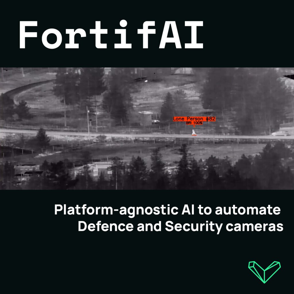
Edge-Based Visual AI Software Platform for Defence & Security Camera Automation
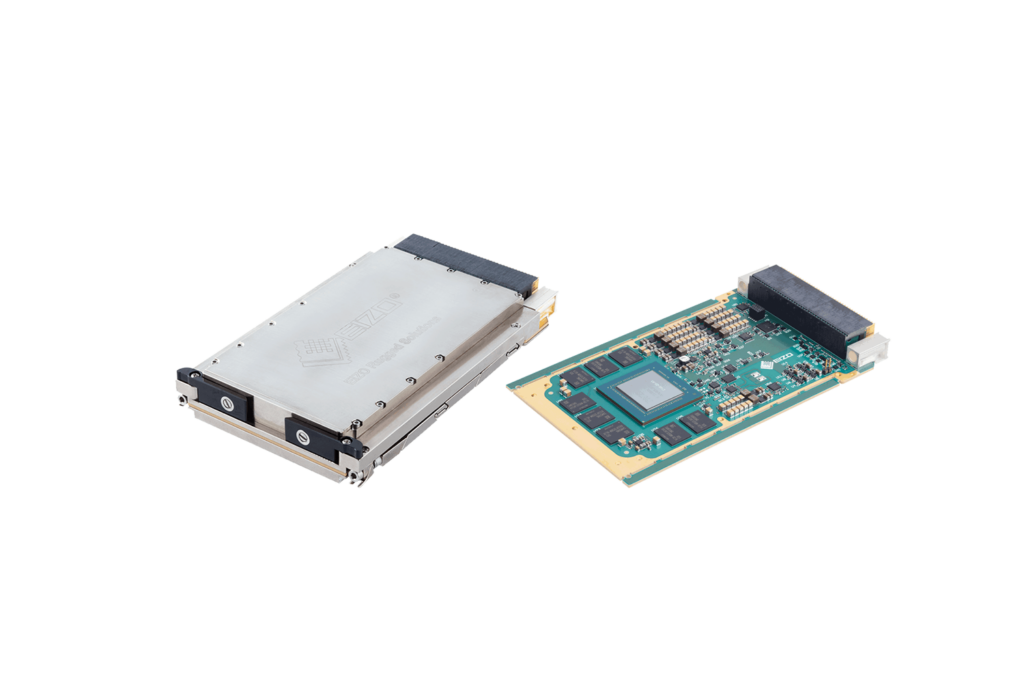
High-Performance Video Graphics, GPGPU, AI/ML Processing & Display Solutions for C5ISR Applications

If you design, build or supply Computer Vision, create a profile to showcase your capabilities and connect with visitors who have an active requirement for your solutions.

Integrating computer vision with unmanned systems elevates their ability to perform complex tasks autonomously or semi-autonomously. These systems fuse image data with other onboard sensors, such as GNSS/GPS, IMUs, LiDAR, and thermal cameras, to interpret surroundings and execute precise actions. Whether enhancing surveillance missions, optimizing agricultural yields, or enabling automated inspections, computer vision plays a central role in driving efficiency and intelligence in unmanned operations.
Computer vision refers to the field of artificial intelligence (AI) and machine learning that enables machines to process and interpret visual data from the world. In unmanned systems, computer vision enables drones and other platforms to identify features, make sense of their surroundings, and respond accordingly. Through techniques like object recognition, motion detection, target tracking, and 3D mapping, computer vision allows drones to operate with a high degree of autonomy.
Drones with computer vision can detect humans, vehicles, infrastructure anomalies, or even specific crop conditions. This visual intelligence enables functionalities such as obstacle avoidance, automated landing, real-time mapping, and behavior monitoring. From autonomous navigation in GPS-denied environments to enhancing search and rescue missions, the spectrum of computer vision applications in unmanned platforms is expanding rapidly.
Computer vision applications span various unmanned missions across both civilian and defense sectors. These include:

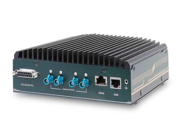
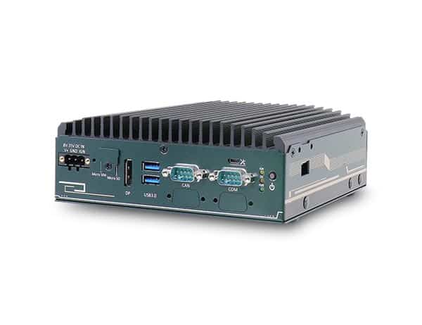
NRU-52S+ Series AI Computer by Neousys Technology
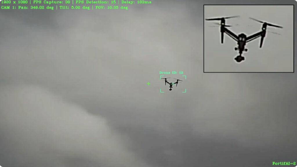
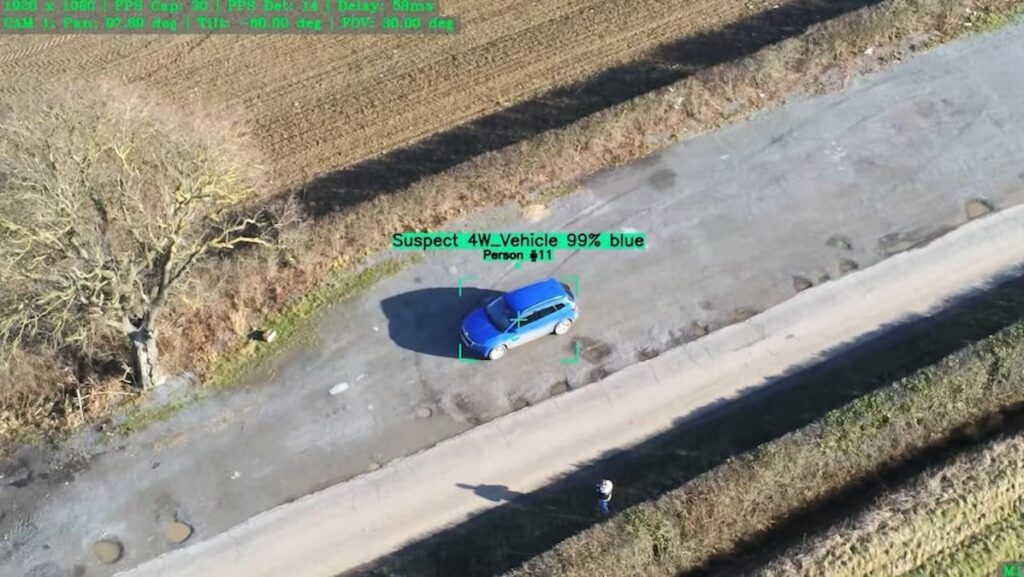
Unmanned systems with advanced computer vision algorithms are widely used for surveillance and reconnaissance tasks. These systems can detect, classify, and track multiple targets in real time, even in complex or cluttered environments. Facial recognition and visual tracking capabilities enable persistent monitoring of individuals or vehicles across borders and high-security zones. This automation reduces human workload while increasing situational awareness and response speed.
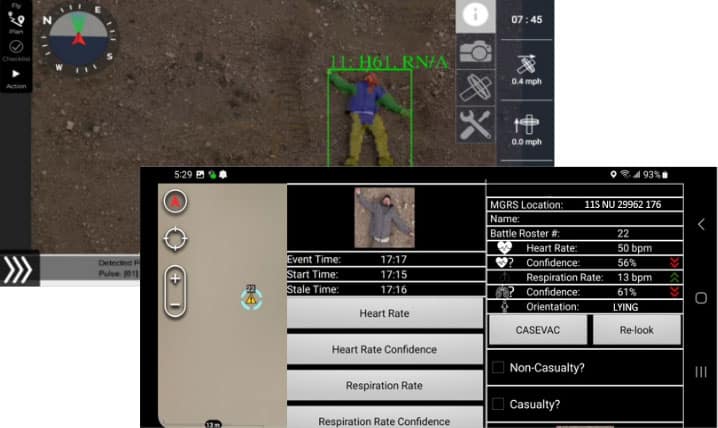
Drones outfitted with thermal cameras and AI-powered anomaly detection play a critical role in search and rescue operations. Computer vision helps identify heat signatures, detect movement, or highlight inconsistencies in landscapes that might indicate the presence of missing persons. These systems can operate in challenging weather or terrain where human access is limited. Their ability to quickly survey large areas enhances response times and increases the chance of successful recoveries.
Computer vision supports various agricultural applications, collectively known as precision agriculture. Agricultural drones can monitor crop health using multispectral imaging, detect weeds, assess irrigation needs, and estimate yields with high accuracy. By analyzing visual data across large fields, farmers can optimize resource use and improve productivity. This technology also supports long-term land management and early detection of disease or infestation.
Inspection drones rely on computer vision to autonomously scan infrastructure such as bridges, pipelines, wind turbines, and solar panels. Using techniques like 3D reconstruction, object detection, and crack identification, these systems can detect structural issues with minimal human input. Vision-based inspection reduces downtime and improves safety by removing the need for manual access to hazardous areas. The data collected can also feed into digital twin systems for lifecycle asset management.
In logistics, computer vision enables unmanned systems to handle package tracking, inventory scanning, and automated routing. Drones can navigate warehouses, monitor stock levels, and optimize delivery paths in real time using object recognition and collision avoidance. This results in improved supply chain efficiency and reduced human labor. The technology also supports last-mile delivery for cargo drones, with vision-based landing and drop-off precision.
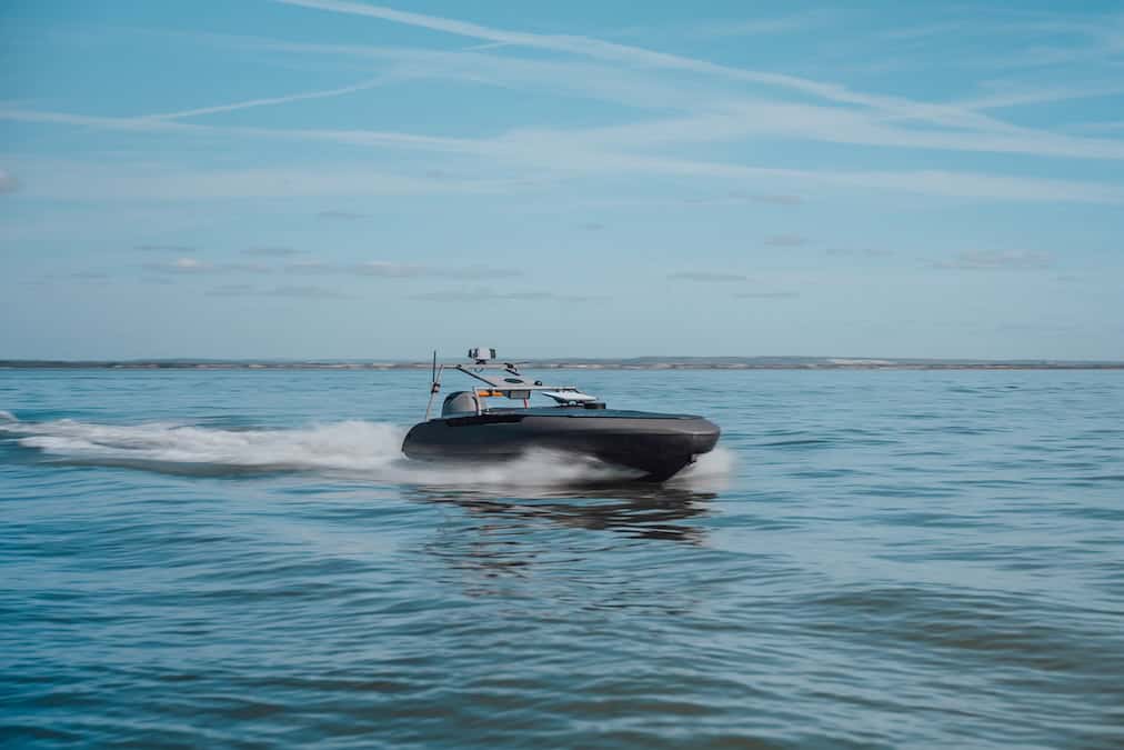
Maritime surveillance drones use computer vision to track vessels, detect oil spills, and monitor marine wildlife. Infrared and multispectral imaging allow for day/night operation and data collection in remote or hazardous maritime zones. The same vision systems can detect illegal fishing or support conservation efforts. These applications contribute to environmental protection and compliance with international maritime regulations.
A computer vision system on a drone typically includes several integrated components working together:
At the heart of any computer vision system are the visual sensors that capture the environment. These may include standard RGB cameras for general imaging, stereo vision systems for depth perception, or thermal and hyperspectral cameras for specialized analysis. Each sensor type brings unique capabilities for mission profiles, from crop analysis to night surveillance. Selection of the right sensor is critical to system performance and operational success.
To handle the computational load of AI inference and image processing, drones are equipped with onboard processing units. These processors must deliver high performance while managing power consumption and thermal constraints in compact UAV airframes. By processing data locally, latency is minimized, and autonomy is increased, especially in scenarios with limited connectivity. This allows for real-time decision-making without reliance on external servers or networks.
Computer vision software includes a suite of AI algorithms trained for specific tasks such as object detection, anomaly recognition, and target tracking. These models are often customizable and can be trained with mission-specific datasets for improved accuracy. In more complex scenarios, software may support simultaneous localization and mapping (SLAM), 3D reconstruction, or pattern analysis. Open-source frameworks and proprietary platforms are both common, depending on system requirements.
Computer vision is most effective when integrated with data from other onboard sensors such as GNSS receivers, inertial measurement units (IMUs), barometers, and magnetometers. This sensor fusion enables accurate localization, terrain following, and obstacle avoidance even in GPS-denied environments. Navigation systems use visual odometry and SLAM to maintain situational awareness in real time. The result is improved flight path reliability and mission continuity under dynamic conditions.
Stabilizing gimbals are critical in ensuring high-quality visual data by minimizing the effects of drone movement and vibration. These systems keep cameras focused on targets regardless of platform orientation or environmental turbulence. Active gimbals with inertial feedback allow for precise adjustments during flight. This is especially important in surveillance, inspection, or mapping applications where image clarity directly affects data utility.
For many applications, visual data must be transmitted to ground control stations or remote operators in real time. Computer vision systems integrate with telemetry modules to support secure and reliable data transfer, even across long distances. Communication protocols are often optimized to prioritize critical information, such as object detection alerts or system anomalies. Some systems also support cloud integration for remote data storage and post-mission analysis.
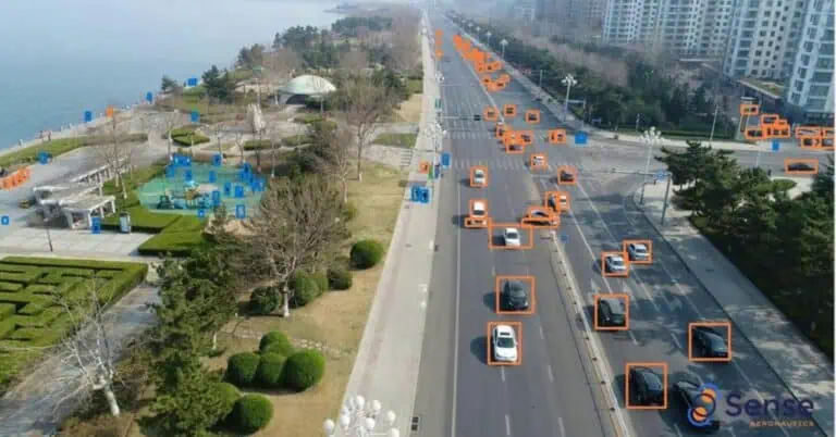
AI-Powered Automatic Target Recognition (ATR) Solution from Sense Aeronautics
Key functions of computer vision systems include:
Many drone-based computer vision systems process visual data directly onboard, minimizing latency through edge computing. This allows time-critical functions, such as obstacle avoidance, anomaly detection, and moving target tracking, to occur without reliance on remote servers or external communication. In environments where rapid decision-making is essential, real-time processing ensures reliable autonomy and responsive behavior.
Simultaneous localization and mapping (SLAM) is often used to support autonomous navigation, particularly in GPS-denied or indoor environments. Computer vision enables SLAM by identifying visual landmarks, analyzing depth, and maintaining spatial awareness as the unmanned system moves through unfamiliar terrain.
Object recognition allows drones and other unmanned platforms to distinguish between relevant environmental features, from people and vehicles to infrastructure and vegetation. Using deep learning models and image segmentation techniques, these systems classify objects and assign contextual meaning to the visual data they capture.
Motion analysis—through optical flow, temporal tracking, and velocity estimation—further enables the system to follow moving targets or avoid dynamic obstacles. These capabilities support various tasks, including surveillance, inspection, and autonomous navigation.
Computer vision does not function in isolation. It interacts with other onboard systems such as:
Choosing the right computer vision solution for an unmanned platform involves several critical factors:
Suppliers often offer full-stack computer vision platforms that include both hardware and AI software optimized for drone deployment. Other vendors may specialize in plug-and-play cameras, modular vision processors, or software-only solutions.
As the demand for smarter, more autonomous unmanned systems grows, the role of computer vision will continue to expand. Its ability to replicate human-level perception and augment decision-making enables unmanned platforms to perform tasks once thought impossible without human oversight. From detecting structural faults in inaccessible locations to tracking wildlife populations across vast terrains, computer vision is shaping the future of unmanned operations with efficiency, intelligence, and scalability.

 Searching Companies & Products

 Subscribe to the Weekly eBrief
The latest engineering and technical developments straight to your inbox - join thousands of engineers who receive it.
Subscribe to the Weekly eBrief
The latest engineering and technical developments straight to your inbox - join thousands of engineers who receive it.