


HP MJF for Unmanned Systems
WOLF Advanced Technology
Leading Suppliers in Iceland

Underwater Mapping Software Suppliers in Iceland

Discover Iceland-based suppliers of Underwater Mapping Software

Suppliers: Underwater Mapping Software

1 Leading Supplier
Filtered by:
Teledyne Marine
Teledyne Marine
Iceland (Office) HQ: USA

Autonomous and Unmanned Marine Vehicles: USV, AUV, Marine ROV; Profiling Floats & Towed Systems

Browse suppliers by country
Showcase your capabilities

If you design, build or supply Underwater Mapping Software, create a profile to showcase your capabilities and connect with visitors who have an active requirement for your solutions.
Create Supplier Profile

Products

1 Cutting-edge Solution
Add your solutions
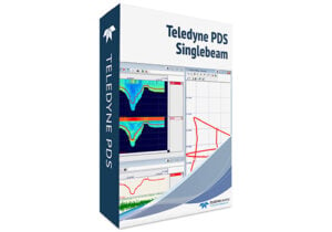
PDS Hydrographic Software

Data acquisition and processing for marine surveys

Data acquisition and processing for marine surveys
... Windows-based software for hydrographic survey and dredging operations. It reads data from sensors,...

Related Articles

Blue Marble Releases Global Mapper 27 Integrating GeoCalc & LiDAR Validation

Blue Marble Geographics has launched Global Mapper 27, integrating the GeoCalc geodetic library as a standard feature alongside enhancements to LiDAR validation, automated terrain modeling, and expanded geospatial data format support

Apr 24, 2026
3D Mapping & Reconstruction of Blücher Shipwreck Using Voyis Imaging Technology

Voyis explains how its Discovery Stereo camera and VSLAM technology were used to produce a high-resolution 3D reconstruction and true-scale digital twin of the German cruiser Blücher in Oslo Fjord, offering detailed historical and environmental insights

Dec 03, 2025
High-Resolution Seafloor Intelligence Solutions for Construction, Biodiversity & Defense

PlanBlue’s fully-automated technology can be easily deployed on board AUVs, ROVs and USVs

Nov 21, 2025
Exploring the Differences Between LiDAR & Photogrammetric Point Clouds

Blue Marble Geographics compares LiDAR and photogrammetric point clouds, outlining their collection methods, advantages, and integration within Global Mapper Pro®

Nov 07, 2025
Global Mapper v26.2 Delivers User-Driven UI & Advanced Visualization Tools

Blue Marble Geographics' latest update to GIS software focuses on efficiency, enhanced data display, and broader file format compatibility including Phase One's IIQ

Oct 27, 2025
New Partnership Enhances Seafloor Intelligence with Autonomous Surveys & AI

PlanBlue and Bedrock are collaborating to combine AI-driven hyperspectral imaging with autonomous underwater vehicles, delivering high-resolution seafloor data and actionable insights for sustainable ocean infrastructure

Oct 21, 2025
Blue Marble Releases Global Mapper v26.1 with Advanced GIS Tools and Vehicle Detection

Blue Marble’s Global Mapper® v26.1 introduces powerful new tools for data editing, deep-learning advancements, and model fine-tuning, enhancing vehicle detection, point cloud management, and user customization for GIS professionals

Feb 26, 2025
New Features in Global Mapper SDK v26.0

Blue Marble Geographics has released Global Mapper SDK v26.0, featuring updated format support, faster drone image processing, and innovative solar analysis

Nov 05, 2024
Top New Features in Global Mapper v25.1 Standard

Global Mapper version 25.1 hillshade tool now boasts the ability to create shadows across the terrain layer based on location and time of day, the ability to crop a mesh feature, and receive location data from GNSS devices over TCP and UDP

Feb 29, 2024

THE WEEKLY eBRIEF

The latest unmanned systems news, straight to your inbox.

Get our weekly roundup of technology developments, new products and industry news.

By subscribing, you agree to receive the weekly UST eBrief newsletter from EchoBlue Ltd. Unsubscribe at any time using the link in every email. See our Privacy Notice.

Advancing Unmanned Systems Through Strategic Collaboration UST works with major OEMs to foster collaboration and increase engagement with SMEs, to accelerate innovation and drive unmanned systems capabilities forward.