If you design, build or supply GNSS Correction Services, create a profile to showcase your capabilities and connect with visitors who have an active requirement for your solutions.
Global GNSS RTK corrections for autonomous navigation & aerial surveying
Global GNSS RTK corrections for autonomous navigation & aerial surveying
...eter-level RTK corrections by aggregating multiple correction networks into one global access layer.... ...With real-time correction data transmitted over RTCM 3.2 and NTRIP protocols, users can maintain...
The Complete Guide to GNSS Correction Services for Drones & Autonomous Vehicles
Overview by
Summer James
Updated:
Introduction to GNSS Correction Services
GNSS correction services enhance navigation, guidance, and control for unmanned and autonomous systems across defense, commercial, and scientific sectors. GPS correction services may also be used where platforms rely on GPS as part of a wider multi-constellation receiver architecture. These services improve the reliability and precision of satellite positioning, supporting consistent performance in real time and post-mission. Delivery options include satellite broadcasts, terrestrial networks, and embedded technologies, selected according to operational needs and available infrastructure.
TerraStar® PPP Correction Services from NovAtel
Core Methods of GNSS Correction
GNSS correction methods vary by architecture, delivery mode, and positioning accuracy. Each method is tailored to specific operational environments and system constraints.
Real-Time Kinematic (RTK)
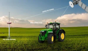
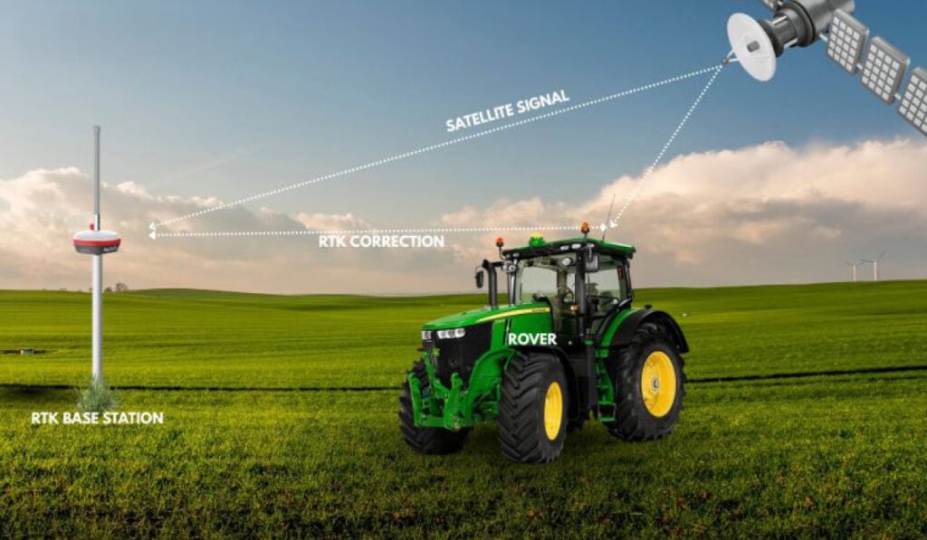
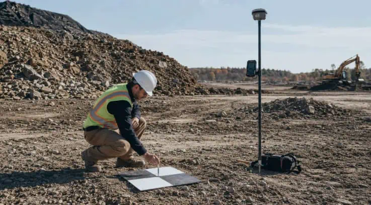
RTK correction services use measurements from a fixed base station to correct the position of a moving GNSS receiver, typically called a rover. This technique enables high-precision, centimeter-level positioning in real time by transmitting correction data via radio frequency or internet-based protocols such as NTRIP. RTK receivers are commonly integrated into unmanned ground vehicles (UGVs), unmanned aerial vehicles (UAVs), and other autonomous platforms where precise localization is critical. These receivers continuously compare their satellite signals against reference data from the base station to reduce common GNSS errors, making RTK particularly suited to localized, networked environments. In GPS-dominant configurations, the same infrastructure can support GPS corrections for localized high-accuracy positioning.
Virtual Reference Station (VRS)
RTKdata GNSS Correction Service
VRS builds on RTK by creating a synthetic reference station near the rover using a network of real base stations. It provides continuous positioning corrections over broader geographic areas than a single-base RTK setup, supporting more consistent accuracy for mobile systems operating across regional networks.
Post-Processed Kinematic (PPK)
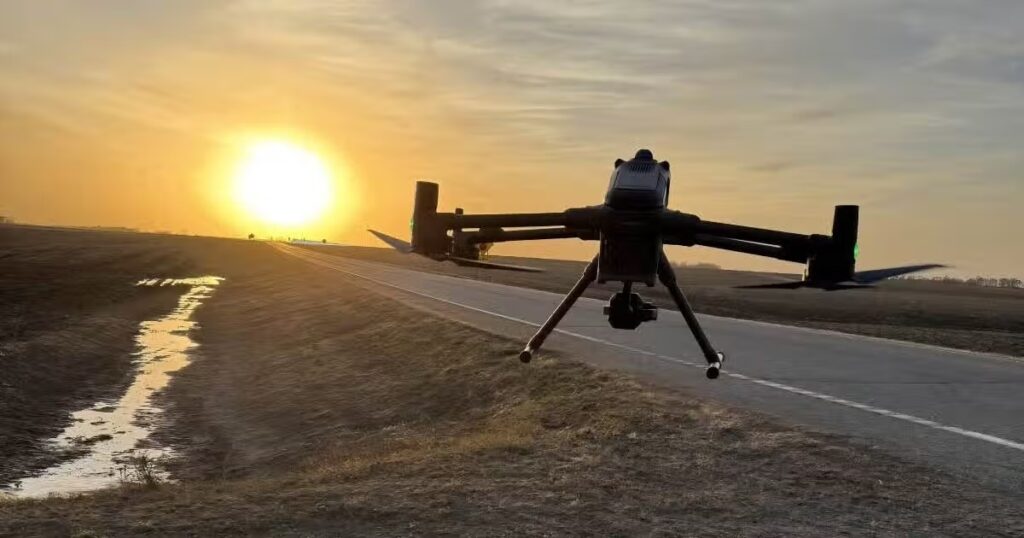
Post-Processed Kinematic (PPK) applies GNSS corrections after data collection, using positional data recorded by both a moving receiver and a reference station. Unlike RTK, PPK does not require a continuous communication link during operation. Corrections are computed in post-mission processing, enabling accurate position estimation without real-time connectivity. PPK is widely used in aerial mapping, remote sensing, and autonomous missions where real-time infrastructure is limited or unavailable.
Satellite-Based Augmentation Systems (SBAS)
SBAS, such as WAAS and EGNOS, transmit correction and integrity information via geostationary satellites. These systems compensate for errors such as satellite clock, orbit, and ionospheric effects to improve GNSS accuracy and reliability across wide regional coverage areas. For some applications, GPS correction through SBAS may provide sufficient accuracy without the complexity of localized RTK infrastructure.
State Space Representation (SSR)
SSR-based correction models separate different GNSS error sources, including satellite orbit, clock, and atmospheric effects, and deliver them to the receiver. The receiver then applies the relevant corrections using its own processing capability, making SSR suitable for scalable correction delivery over large areas.
Precise Point Positioning (PPP)
PPP computes high-accuracy positions using a single GNSS receiver and globally or regionally available satellite corrections. It does not require a local base station, but typically requires longer convergence time than RTK before the highest accuracy is achieved. PPP is commonly used where a global GNSS correction service is required for wide-area, offshore, remote, or infrastructure-limited operations.
PPP with RTK Enhancements (PPP-RTK / PPP-C)
Combining PPP’s wide-area correction model with RTK-like rapid convergence, PPP-RTK improves accuracy and startup time through SSR-based regional corrections delivered via networks or satellites. This approach can provide high-precision positioning without requiring a nearby local base station.
Differential GNSS (DGNSS)
DGNSS uses corrections from reference stations to improve positional accuracy. While generally less precise than RTK, it supports broader-area correction use cases and legacy systems where sub-meter or meter-level positioning may be sufficient.
Embedded and Offline Corrections
Embedded GNSS corrections use integrated modules, onboard data, or preloaded correction information to improve GNSS performance without relying on continuous external connectivity. Offline correction techniques are applied post-mission using recorded GNSS data, supporting accurate reconstruction of routes, sensor positions, and mission logs.
Cloud-Based GNSS Corrections
Cloud-based correction services stream correction data via internet-connected networks, often using protocols such as NTRIP. These services support scalable deployments where multiple vehicles, receivers, or operators require centralized access to correction data.
Applications Across Unmanned & Autonomous Systems
GNSS correction technologies are integrated across air, land, and maritime domains to support accurate positioning, navigation, mapping, mission coordination, and post-mission data analysis for unmanned and autonomous platforms.
ISR and Targeting Support
Corrected GNSS positioning supports consistent flight paths, repeatable surveillance routes, and accurate georeferencing of intelligence data. For ISR and reconnaissance missions, GNSS correction services help improve target location confidence, sensor alignment, route reconstruction, and the reliability of time-stamped mission data. High-accuracy corrections can also support targeting workflows by improving the positional accuracy of platforms, payloads, and sensor-derived coordinates, provided GNSS signals remain available and are supported by resilient navigation architectures.
Autonomous Navigation and Fleet Coordination
Autonomous navigation systems use GNSS corrections to improve route following, path prediction, waypoint accuracy, and vehicle localization. When combined with inertial navigation, perception sensors, and obstacle avoidance systems, corrected GNSS data helps autonomous platforms operate more reliably in structured and semi-structured environments. The same positioning data can support drone fleet management, swarm UAV operations, multi-vehicle coordination, and centralized mission control.
Aerial Mapping and Long-Range UAV Operations
GNSS corrections are widely used for aerial photogrammetry, unmanned aerial surveys, environmental monitoring, and remote sensing missions. Corrected positioning enables accurate image geotagging, repeatable survey lines, precise sensor placement, and high-quality geospatial outputs without relying solely on ground control points. Commercial UAV and long-range UAV surveillance platforms may use RTK, PPK, PPP, SBAS, or cloud-based corrections depending on accuracy, coverage, convergence time, and connectivity requirements.
Marine Robotics and Connectivity-Limited Missions
GNSS corrections support autonomous marine surface vessels and marine robotic systems that require accurate route keeping, survey line control, station keeping, and sensor georeferencing. In EW-affected environments or communications-limited missions, correction strategies may include embedded correction capability, inertial integration, offline processing, and post-mission analysis. Offline and post-processed GNSS solutions allow operators to reconstruct mission paths, geotag sensor data, validate vehicle performance, and generate accurate geospatial records after a mission.
GNSS Correction Delivery Architectures
The method of delivering GNSS corrections varies based on infrastructure, latency requirements, and resilience. Depending on receiver design and network access, a GPS correction service may be delivered through local base stations, satellite broadcasts, internet-based correction streams, or cloud infrastructure:
Base Stations and VRS Networks: Terrestrial infrastructures like RTK networks and VRS provide low-latency, high-frequency updates, ideal for operations in networked environments.
NTRIP Casters and Internet Links: Correction data can be distributed via cellular or satellite IP links, enabling mobile receivers to pull live updates from centralized sources.
Satellite Link Services: Wide-area augmentation and PPP-RTK corrections are transmitted directly from satellite, supporting global or off-grid operations without ground networks.
Cloud Distribution and Network Managers: Networked fleets can share corrections from cloud systems, allowing distributed autonomous assets to coordinate positioning.
Onboard and Encrypted Modules: Systems operating in adversarial environments use encrypted correction modules and embedded error models to maintain secure and robust navigation.
Performance Considerations & Tradeoffs
Selecting the right GNSS correction approach involves evaluating key performance metrics. Operators comparing a GPS corrections service or GNSS corrections service should assess whether the mission requires real-time accuracy, post-processed accuracy, wide-area coverage, low latency, or secure correction delivery:
Accuracy and Convergence Time: PPP and SSR solutions offer global coverage but require longer startup, whereas RTK provides rapid updates with local base station dependencies.
Latency and Data Link Resilience: ISR and targeting systems demand low-latency updates via radio, NTRIP, or satellite link, with backup paths for failover.
Bandwidth and Power Efficiency: Autonomous platforms may rely on offline or embedded corrections to reduce data link usage and conserve onboard resources.
Security and Integrity: Military navigation systems integrate secure correction channels with spoofing resistance, encryption modules, and anti-jam techniques.
Multi-Sensor Fusion: Corrections may be integrated into broader sensor networks (IMUs, LiDAR, odometry) for robust position estimation in degraded environments.
GNSS Correction Trends in Unmanned Systems
Emerging innovations in GNSS correction aim to improve flexibility, resilience, and scalability:
AI-Driven Error Modeling: Adaptive correction algorithms enhance performance under dynamic ionospheric and multipath conditions.
Multi-GNSS Integration: Corrections across GPS, GLONASS, Galileo, and BeiDou provide redundancy and improved availability.
Edge Processing: Local GNSS correction computation reduces reliance on data links and supports faster decision cycles.
Swarm Synchronization: Cloud and mesh-networked corrections enable coordinated movements across multiple unmanned platforms.
Post-Quantum Encryption: Next-gen GNSS correction protocols are exploring secure delivery mechanisms to protect against future cyber threats.
RTKsub examines how real-time kinematic correction delivers continuous centimeter-level positioning accuracy for autonomous equipment, drones, and field operations, eliminating traditional post-processing delays through stable NTRIP mobile network streams
RTKdata examines the engineering considerations behind GCP-free UAV mapping, from antenna-camera integration and vertical references to correction reliability, PPK, and datum management
AeroAg Drone Services adopted RTKdata’s NTRIP corrections to support accurate agricultural mapping, reliable flight operations, and a planned 200,000-acre deployment
RTKdata explains how robust GNSS correction pipeline design improves RTK reliability, positioning accuracy, and operational resilience for autonomous mobile robots
RTKdata explores the growing role of accessible NTRIP RTK correction services in supporting centimeter-level GNSS positioning across drones, robotics, construction, agriculture, and other precision-focused applications
RTKdata details the key components and considerations involved in building a DIY tractor autosteer system, including GNSS positioning, RTK corrections, steering control, and system setup
RTKdata examines how U.S. drone approval restrictions and federal compliance rules affect RTK workflows, highlighting procurement limits, DJI fleet considerations, and the role of NTRIP RTK in maintaining positioning consistency
The latest unmanned systems news, straight to your inbox.
Get our weekly roundup of technology developments, new products and industry news.
THANK YOU FOR SIGNING UP
Thanks for joining us. Check your inbox.
We've sent you an email. Click the confirmation link to complete your subscription to the weekly eBrief. In the meantime, explore the latest news, suppliers and technologies on UST.
Advancing Unmanned Systems Through Strategic Collaboration
UST works with major OEMs to foster collaboration and increase engagement with SMEs, to accelerate innovation and drive unmanned systems capabilities forward.