
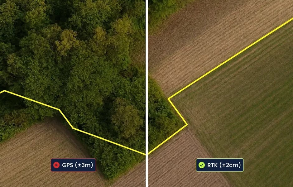
RTKsub delivers real-time GNSS correction data via NTRIP, enabling centimeter-level positioning for drones, robots, autonomous vehicles and other RTK-capable systems.
Unmanned Systems Technology (UST) is pleased to announce the addition of RTKsub to our global supplier ecosystem. Their new Gold profile showcases a professional RTK correction service designed for OEMs, system integrators and operators requiring accurate and repeatable GNSS positioning for unmanned and autonomous applications.
RTKsub provides real-time correction data via the standard NTRIP protocol, removing the need for users to deploy and maintain their own local base station. Supporting GPS, Galileo, GLONASS and BeiDou, the service connects compatible RTK-capable equipment to a global network of more than 22,000 base stations across over 170 countries, supporting precision navigation, surveying, mapping, inspection and automated operations.
Key capabilities of the RTKsub service include:

Centimeter-Level Positioning: Real-time GNSS corrections enable precise and repeatable positioning for RTK-capable drones, robots, vehicles and surveying equipment.
Low-Latency NTRIP Corrections: Correction streams are delivered in real time using the widely adopted NTRIP protocol, supporting mobile and autonomous systems operating in motion.
Broad Global Coverage: Users can access correction data through a network of more than 22,000 base stations spanning over 170 countries, subject to local network availability.

Multi-Constellation Support: RTKsub supports GPS, Galileo, GLONASS and BeiDou for compatibility with a wide range of professional GNSS equipment.
Flexible Subscription Options: Monthly, annual and enterprise plans support requirements ranging from temporary projects to continuous operations and larger multi-license deployments.
RTKsub supports positioning workflows across drone mapping and inspection, aerial and land surveying, precision navigation, automated vehicle control, construction, agriculture and mobility applications. A 30-day trial allows operators to evaluate equipment compatibility, local coverage and positioning performance before selecting a subscription.
To learn more about RTKsub’s real-time GNSS correction services and global RTK coverage, visit their full profile on Unmanned Systems Technology.