WOLF Advanced Technology
HP | MJF for Unmanned Systems
Leading Suppliers in United Kingdom

LiDAR Software Suppliers in United Kingdom

Discover United Kingdom-based suppliers of LiDAR Software

Suppliers: LiDAR Software

1 Leading Supplier
Grid List
Filtered by:
CHC Navigation
CHC Navigation

GNSS Positioning & Navigation Systems, Mobile Mapping UAV LiDAR & Unmanned Surface Vehicles

Browse suppliers by country
Showcase your capabilities

If you design, build or supply LiDAR Software, create a profile to showcase your capabilities and connect with visitors who have an active requirement for your solutions.


Create Supplier Profile

Products

4 Cutting-edge Solutions
Add your solutions
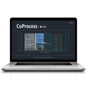
CoProcess 2025
CoProcess 2025

All-in-one CAD platform for point cloud processing

All-in-one CAD platform for point cloud processing
...r professional LiDAR and photogrammetry data workflows. Built on CHCNAV’s advanced software... ...es. By merging LiDAR and image-derived models, the software ensures continuous, occlusion-free...
CHCNAV CoCloud
CHCNAV CoCloud

Scalable platform for real-time 3D geospatial data processing and collaboration

Scalable platform for real-time 3D geospatial data processing and collaboration
...and management software engineered for survey-grade applications requiring high-fidelity...
CoProcess
CoProcess

Advanced post-processing software for massive point cloud datasets

Advanced post-processing software for massive point cloud datasets
...is an advanced software package designed for the post-processing of massive point cloud datasets,...
CoPre
CoPre

Quick and efficient processing of UAV & mobile mapping data

Quick and efficient processing of UAV & mobile mapping data
... and intuitive software ecosystem for quick and user-friendly processing of geospatial data gathered...

Related Articles

YellowScan: Bringing a Community Together

YellowScan recently hosted its sixth LiDAR Convention in Aix-en-Provence, bringing together a global audience of surveyors, engineers, researchers, drone manufacturers, and industry partners

Apr 30, 2026
YellowScan LiDAR Convention Returns for Sixth Edition

YellowScan LiDAR Convention 2026 will bring industry professionals together in France to explore market trends, real-world applications, and the latest developments in LiDAR technology and workflows

Apr 01, 2026
Advancing Point Cloud Processing Skills with Blue Marble Geographics’ Online Classroom

Blue Marble Geographics highlights its Online Classroom, featuring new self-paced courses in point cloud processing that cover core workflows, feature extraction, and advanced analysis using Global Mapper tools

Mar 18, 2026
Blue Marble Geographics Extracting Railroad Tracks from Lidar with Global Mapper Pro

Blue Marble Geographics outlines how Global Mapper Pro processes lidar point clouds, creates detailed elevation models, and extracts railroad tracks through breakline analysis to support dependable interpretation of rail corridors

Dec 11, 2025
Using Global Mapper for Terrain Modeling & Hydrological Analysis

Blue Marble Geographics’ Global Mapper software is used by Egis teams to process LiDAR and topographic data, create 3D terrain models, and perform hydrological analyses for environmental and hydraulic projects

Nov 25, 2025
Blue Marble Geographics’ Global Mapper® Supports Vegetation Risk Assessment

Global Mapper® provides automated point cloud classification and lidar analysis tools that help users identify and assess vegetation encroachment, improving efficiency in utility and asset management operations

Oct 23, 2025
Volatus Aerospace Delivers Drone Mapping Fundamentals in Photogrammetry & LiDAR Course

Volatus Aerospace’s intermediate online course provides professional drone pilots with essential photogrammetry and LiDAR skills, combining theoretical instruction and applied learning to enhance precision in aerial mapping and geospatial data acquisition

Oct 07, 2025
YellowScan Navigator Demonstrates Coastal Reef Mapping Capabilities

YellowScan, with Australian distributor Sphere Drones, demonstrated the YellowScan Navigator in real-world coastal conditions, providing rapid, high-resolution mapping of artificial reefs with efficient deployment and safe, practical operation

Sep 23, 2025
Blue Marble Geographics Demonstrates Global Mapper Contour Capabilities

Blue Marble Geographics’ Global Mapper® provides streamlined contour map generation from grids, point clouds, and LiDAR, with customizable intervals and advanced features for efficient, accurate terrain representation across industries

Sep 18, 2025

THE WEEKLY eBRIEF

The latest unmanned systems news, straight to your inbox.

Get our weekly roundup of technology developments, new products and industry news.

By subscribing, you agree to receive the weekly UST eBrief newsletter from EchoBlue Ltd. Unsubscribe at any time using the link in every email. See our Privacy Notice.

Advancing Unmanned Systems Through Strategic Collaboration UST works with major OEMs to foster collaboration and increase engagement with SMEs, to accelerate innovation and drive unmanned systems capabilities forward.