


Blue Marble Geographics provides advanced point cloud processing and analysis capabilities within its Global Mapper® software, enabling efficient detection of vegetation encroachment on infrastructure and other assets.

Vegetation points within 2m of the power lines have been automatically detected and highlighted, as shown in 2D and 3D views.
Excess vegetation growth near power lines, buildings, or roadways poses significant operational and safety risks, making early identification and management essential.
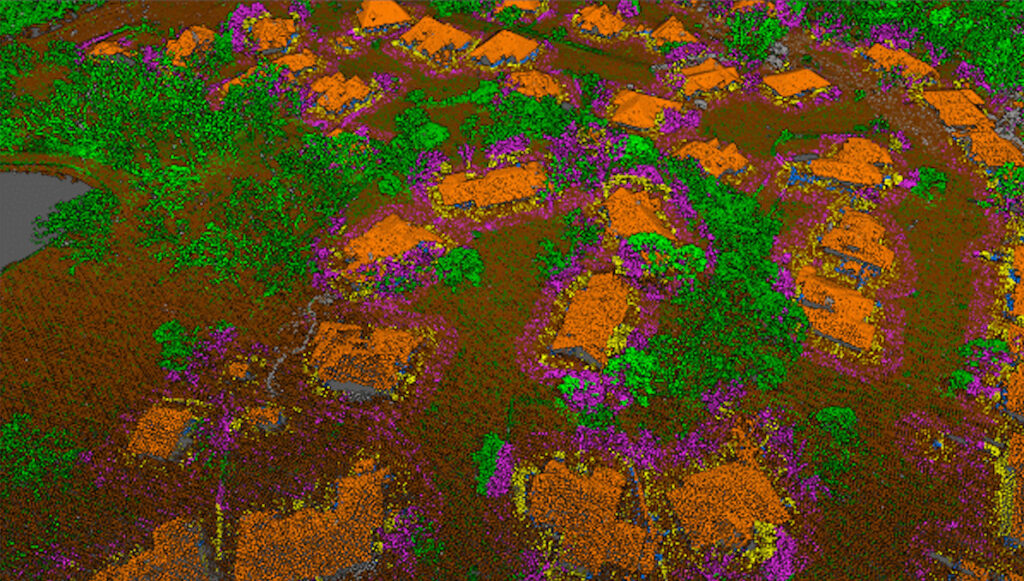
Global Mapper’s suite of automatic classification tools allows users to accurately categorize lidar data, distinguishing features such as vegetation, power lines, and buildings. The software’s Automatic Point Cloud Classification and Max Likelihood tools help define vegetation height thresholds, allowing operators to isolate areas of concern while excluding non-critical ground cover. For utilities, power line features can be extracted as 3D vector line features to support detailed encroachment assessments and ensure precise measurements.

Once the data is classified, encroachment detection can be automated using the Select Lidar by Distance function, which identifies vegetation located within defined proximity thresholds. These highlighted areas can then be exported to Global Mapper Mobile® for verification and field inspection, providing a seamless link between office-based analysis and on-site validation.
Through these integrated desktop and mobile tools, Global Mapper streamlines vegetation risk monitoring and mitigation workflows, supporting safer and more efficient asset management operations.
For more information on how Global Mapper can assist with vegetation encroachment analysis and lidar data processing, visit Blue Marble Geographics.


