


Showcase your capabilities
If you design, build or supply LiDAR SLAM Technology, create a profile to showcase your capabilities and connect with visitors who have an active requirement for your solutions.



Light Detection and Ranging (LiDAR) Simultaneous Localization and Mapping (SLAM) combines laser-based distance measurements with algorithms that allow drones, robots, and other autonomous platforms to estimate position while building maps of their surroundings. Systems may use 2D or 3D LiDAR, mechanical or solid-state scanners, multiple LiDAR units, or LiDAR-inertial sensor fusion.
This page showcases suppliers of LiDAR SLAM technology for autonomous navigation, obstacle avoidance, surveying, inspection, logistics, and mapping.
Read the Technology Overview

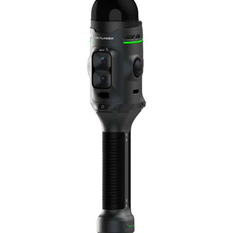


GNSS Positioning Systems, 3D SLAM & Mobile Mapping, Unmanned Surface Vehicles

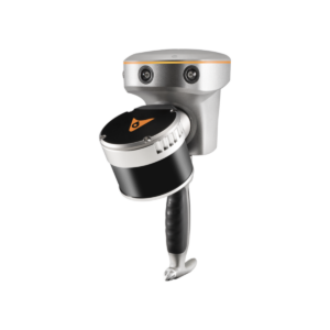
GNSS Positioning & Navigation Systems, Mobile Mapping UAV LiDAR & Unmanned Surface Vehicles

If you design, build or supply LiDAR SLAM Technology, create a profile to showcase your capabilities and connect with visitors who have an active requirement for your solutions.

Light Detection and Ranging (LiDAR) Simultaneous Localization and Mapping (SLAM) combines laser-based distance measurements with algorithms that allow an autonomous system to estimate its position while building a map of the surrounding environment. It is particularly useful where reliable external positioning is unavailable, degraded, or unsuitable, including indoor spaces, tunnels, industrial facilities, forests, and complex urban environments.
A LiDAR SLAM system processes successive laser scans to estimate changes in position and orientation, align point cloud data, and continuously update its representation of the environment. Through scan matching, motion estimation, and map optimization, the system can generate both a map and an estimate of the platform’s trajectory or pose, supporting applications such as autonomous navigation, obstacle avoidance, surveying, inspection, and robotic mapping.
LiDAR SLAM estimates the position and orientation of a drone, robot, or other autonomous platform as it moves through an environment. By matching current LiDAR measurements against previous scans or an evolving map, the system can continuously update the platform’s pose without relying solely on a Global Navigation Satellite System (GNSS), while map optimization and recognition of previously mapped areas can help limit accumulated localization drift.
LiDAR-based SLAM can create two-dimensional occupancy maps or detailed three-dimensional point clouds depending on the sensor configuration and processing method. 3D LiDAR SLAM is particularly useful in environments containing complex structures, changes in elevation, overhead features, or obstacles that cannot be represented adequately in a flat map.
Continuous LiDAR scanning provides distance measurements to surrounding surfaces and objects, giving the autonomous platform an updated view of nearby geometry as it moves. These measurements and the resulting SLAM maps can be used by navigation software to identify free space, detect obstacles, and maintain awareness of surrounding structures.
LiDAR SLAM enables autonomous systems to maintain a local position estimate in environments where satellite navigation is unavailable or unreliable. Typical applications include indoor facilities, tunnels, mines, dense urban areas, and other locations where GNSS signals may be obstructed, reflected, degraded, or completely absent.
Maps generated through SLAM can provide the spatial information required by path-planning systems to determine how an autonomous platform should move through its surroundings. Robots and drones can use this information to identify traversable areas, avoid obstacles, select routes, and update planned movement as new environmental data becomes available.
Because localization and mapping occur simultaneously, LiDAR SLAM is well suited to environments that have not been mapped in advance or that may change over time. A LiDAR SLAM robot or drone can build its own spatial representation while moving through an unfamiliar area and update that map as structures, obstacles, or other features change.
LiDAR SLAM systems can be categorized according to sensing geometry, scanner architecture, and the additional sensors used to support pose estimation, with each configuration offering different trade-offs in coverage, detail, payload requirements, and processing demand.
| LiDAR SLAM Type | Characteristics | Typical Strengths | Common Unmanned Platforms |
| 2D LiDAR SLAM | Uses planar laser scans | Lower processing requirements and efficient indoor localization | Mobile robots and unmanned ground vehicles |
| 3D LiDAR SLAM | Produces volumetric point clouds | Detailed mapping of complex environments | Unmanned aerial vehicles, unmanned ground vehicles, and inspection robots |
| Mechanical Scanning LiDAR SLAM | Uses moving optical or sensor components to scan the environment | Wide field of view and dense spatial coverage | Drones, mobile robots, and survey platforms |
| Solid-State LiDAR SLAM | Uses non-rotating or reduced-mechanical scanning architectures | Compact form factor and potential reductions in size and weight | Small drones, robots, and embedded systems |
| Multi-LiDAR SLAM | Combines data from multiple LiDAR units | Wider coverage and reduced blind areas | Larger autonomous robots and vehicles |
| LiDAR-Inertial SLAM | Fuses LiDAR measurements with inertial motion data | Improved pose estimation during rapid or complex movement | Drones, ground vehicles, and handheld mapping systems |
The chosen sensor architecture directly affects environmental coverage, mapping detail, payload requirements, and the computational workload required to maintain localization in real time.
Different LiDAR sensor configurations are selected according to the platform, operating environment, required mapping detail, and available processing capacity, with each design affecting range, field of view, point density, and system integration.
Selecting an appropriate SLAM LiDAR sensor therefore requires balancing measurement performance against platform constraints such as payload capacity, power consumption, processing resources, and the conditions of the operating environment.
Autonomous Mobile Robots (AMRs) use LiDAR SLAM to localize within warehouses, factories, and logistics facilities while building or referencing maps of aisles, storage areas, and workspaces. The same spatial information can support route planning, obstacle avoidance, and autonomous navigation where GNSS is unavailable indoors.
SLAM scanning can capture three-dimensional site data as operators, robots, or drones move through construction environments, allowing measurements to be collected without relying on a fixed scanning position. LiDAR SLAM survey outputs can then support progress monitoring, dimensional checks, as-built documentation, and comparison with Building Information Modeling (BIM) data.
Robotic and aerial platforms equipped with LiDAR SLAM can map unfamiliar or damaged environments where visibility, access, or external positioning may be limited. Point clouds and localization data can support navigation through buildings, tunnels, debris fields, and other complex operational areas while providing responders with a developing spatial representation of the environment.
LiDAR SLAM can support mobile mapping beneath or around vegetation where GNSS reception may be inconsistent or partially obstructed. Drones and ground robots can use SLAM LiDAR scanners to map terrain, vegetation structure, tree geometry, crop environments, and routes through areas with substantial visual or physical obstruction.
LiDAR SLAM can support unmanned reconnaissance, mapping, and navigation in GNSS-denied or GNSS-degraded environments. Unmanned Aerial Vehicles (UAVs) and Unmanned Ground Vehicles (UGVs) can use the technology to build three-dimensional representations of buildings, tunnels, urban terrain, and other areas while maintaining local position estimates for autonomous or remotely supervised movement.
LiDAR SLAM development is increasingly focused on reducing sensor size, improving localization resilience, and extracting more useful information from mapped environments while maintaining real-time performance on autonomous platforms.
Together, these developments are expanding the role of LiDAR SLAM beyond basic localization and mapping toward more capable autonomous navigation, inspection, surveying, and robotic perception.


 Searching Companies & Products