


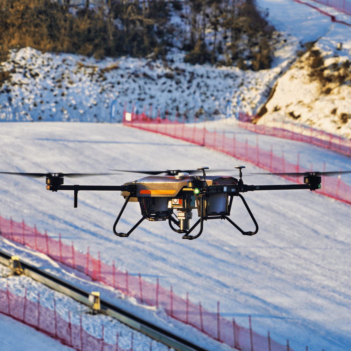
The AlphaUni 20 is an advanced LiDAR solution designed to suit both aerial and ground mobile mapping applications. Providing an ideal balance of point cloud density, accuracy, and quality, it delivers absolute accuracy of 2 to 5 cm even in highly challenging environments, and features long-range scanning capabilities of up to 1450 metres.
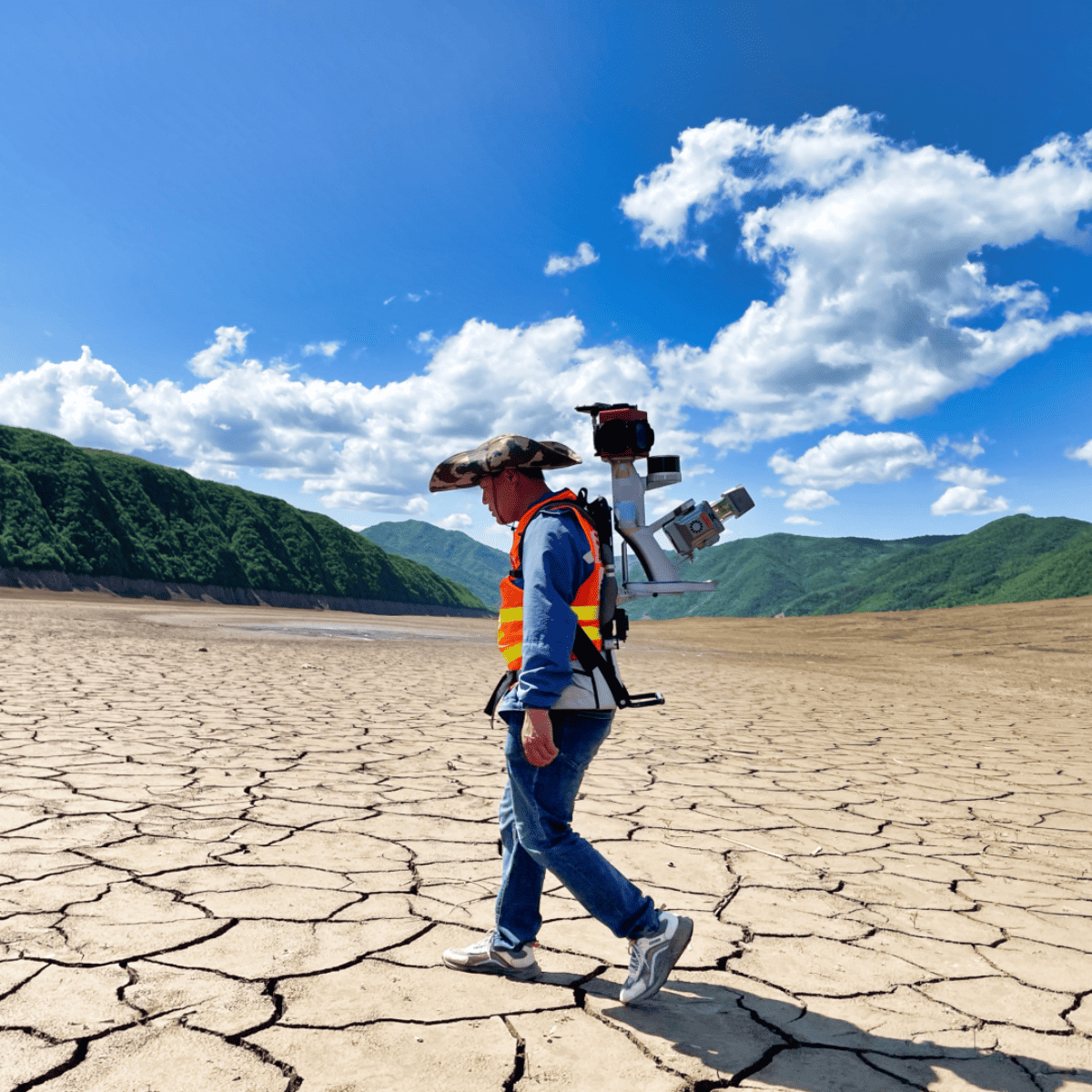
The versatile LiDAR scanner's advanced multi-target capability supports up to 16 target returns for advanced vegetation penetration, making it ideal for high-accuracy Digital Elevation Model (DEM) and Digital Surface Model (DSM) generation. It can be easily fixed to a variety of UAV platforms, as well as ground vehicles and USVs.
The rugged unit is IP64-rated, ensuring high reliability in the field even under harsh weather conditions.
| Absolute Hz & V accuracy | < 0.025 m RMS @ 30 m range < 0.050 m RMS @ 150 m range |
| Accuracy conditions | Without control points, UAV survey with 7 m/s speed, car survey wihout DMI with 9.7 m/s speed |
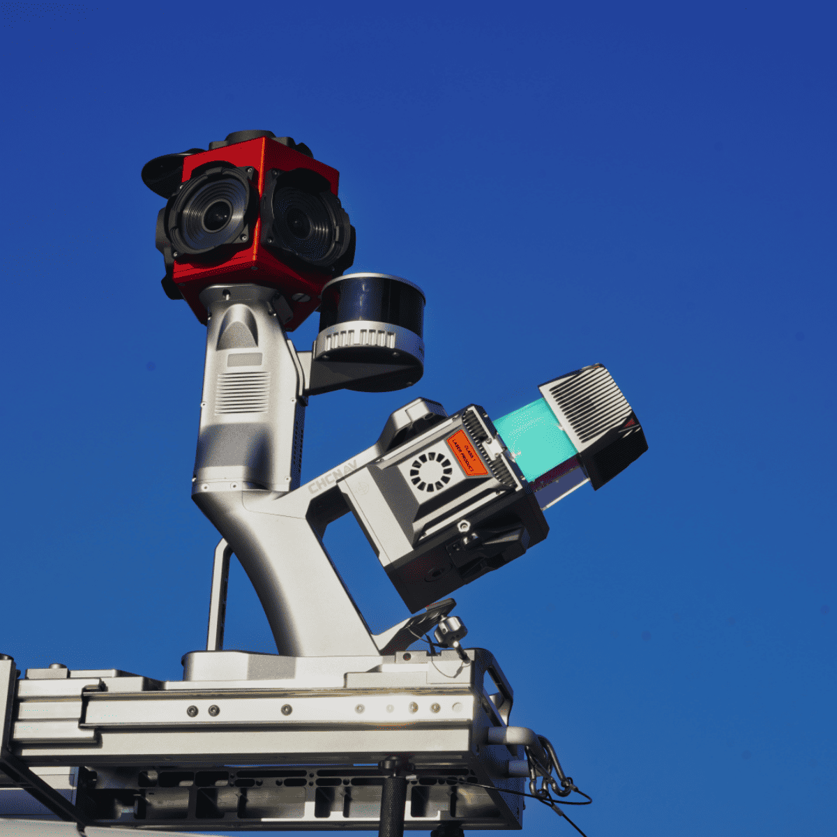
| Mounting | Multi-platform, quickly install & release design, easily switch between airborne, vehicle and backpack mode |
| SLAM | AlphaPano vechicle installation platform which include panoramic camera and SLAM scanner integration for optimised position in challenging for trajectory environment |
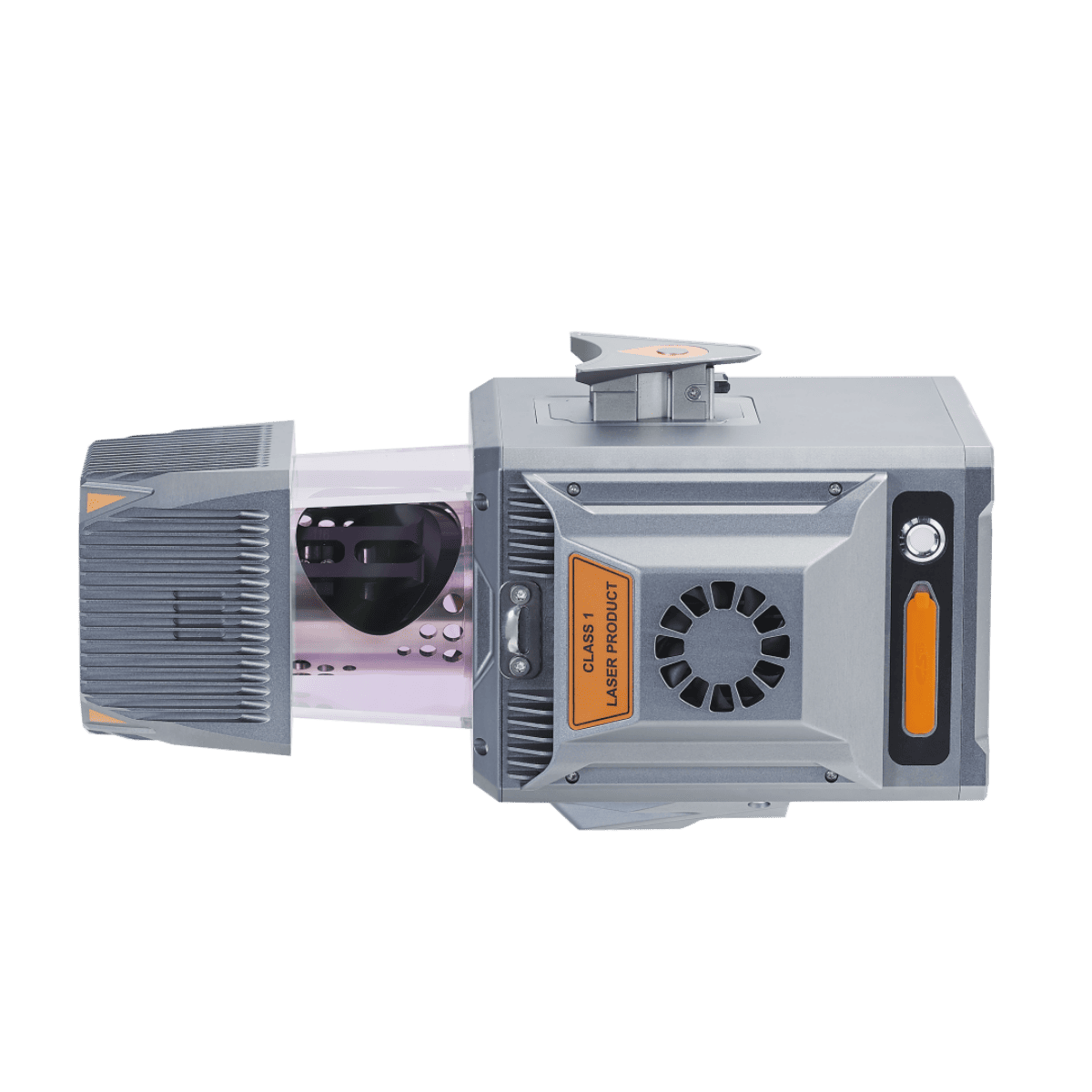
| Weight of instrument | 2.82 kg / 3.12 kg (with C5 camera) 10.97 kg AlphaPano vechicle platform |
| Dimensions of instrument | 262.3 × 141.5 × 161 mm |
| Data storage | 512 G (Optional for 1 T) |
| Coping speed | 80 Mb/s |
| GNSS system | Multiple GPS, GLONASS, Galileo, BeiDou, SBAS and QZSS constellation, L-Band |
| IMU update rate | 600 Hz |
| Attitude accuracy after post-processing | 0.005° RMS pitch/roll 0.010° RMS heading |
| Position accuracy after post-processing | 0.010 m RMS horizontal 0.020 m RMS vertical |
| Operating temperature | -20 °C to +50 °C |
| Storage temperature | -20 °C to +65 °C |
| IP rating | IP64 |
| Humidity (operating) | 80%, non-condensing |
| Imaging system UAV Resolution | 45 MP |
| Focal length | 21 mm / 35 mm |
| Sensor size | 36 mm x 24 mm (8184 x 5460) |
| Pixel size | 4.4 μm |
| Min photoing interval | 1 s |
| FOV | 81.2*59.5 / 53.4*37.8 |
| Airborne optional camera setup | Calibrated Sony 7 RIV (7952 x 5304, 61 MP, 10 fps) |
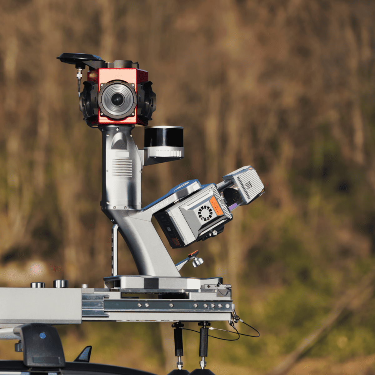
| AlphaPano Imaging system Camera type | 360° Spherical camera, additional adjustable external cameras as option |
| Numbers of camera | 6 sensors |
| CCD size | 2048 × 2448, 3.45 μm pixel size |
| Lens | 4.4 mm |
| Resolution | 30 MP (5 MP × 6 sensors), 10 FPS JPEG compressed |
| Coverage | 90% of full sphere |
| High Dynamic Range (HDR) | Cycle 4 gain and exposure presets |
| Dimensions of AlphaPano | 530 x 214.5 x 592 mm (With installed AU20) |
| Electrical Input voltage | 24 V (Range 15 - 27 V) |
| Power consumption | 60 W |
| Power source | Depending on UAV battery. External battery in for car setup, also support direct vehicle power source |
| CoPre Intelligent Processing SW | Data copy, POS process, Adjust & Refine, Generate point cloud |
| CoProcess Efficient Feature Extraction SW | Terrain module, Road module, Volume module |
| Laser product classification | 0.032° |
| Minimum range | 1.5 m |
| Accuracy | 15 mm (1σ,@ 150 m range) 5 mm (1σ,@ 30 m range) |
| Precision | 5 mm (1σ,@ 150 m) |
| Multi-Period capability | Up to 7 zones |
| Field of view | 360°, selectable |
| Scanning mechanism | rotating mirror |
| Max. effective measurement rate | 2 000 000 meas./sec (depending on the mode) |
| Scan speed (selectable) | 10 - 200 scans/sec |
| Return numbers | Up to 16 |
| Angular resolution | 0.001° |


