




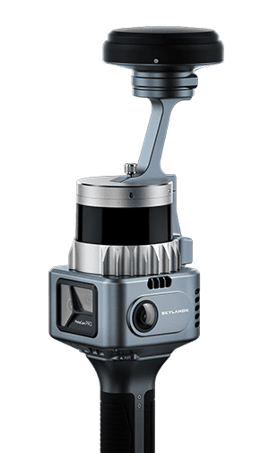
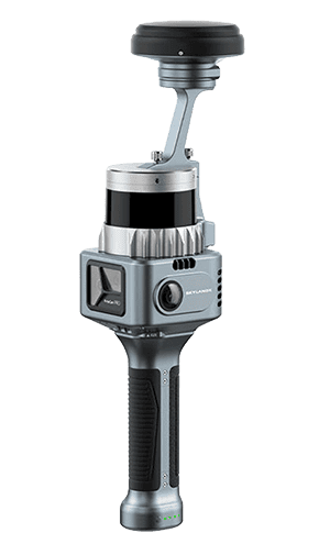
MetaCam Pro is a survey-grade scanning solution developed for high-density capture across large and complex environments. Its non-rotating LiDAR engine records 2.62 million points/sec as standard and up to 5.24 million points/sec, capturing detailed geometry at walking or mobile speed with reduced vibration.
The five-sensor configuration combines LiDAR with two panoramic cameras, a dedicated 48 MP high-definition camera and a V-SLAM camera. This arrangement records dense spatial data, panoramic imagery and detailed visual data during the same survey.
AI-driven SOTA-SLAM combines visual and LiDAR data to maintain stable positioning throughout high-speed surveys and extended routes. TimeSync 3.0 aligns every sensor with microsecond precision, creating consistent data for fusion and third-party processing. RTK, PPK and GCP observations can be fused with SLAM data to correct drift and anchor scans to real-world coordinates.
Specifications:
| Dimensions | 105 x 168 x 424 mm overall 104.6 x 112.5 x 134.4 mm main unit |
| Weight | 1,160 g without RTK 1,325 g with RTK |
| Power Consumption | <26 W |
| LiDAR Point Rate | 2,620,000 points/sec; up to 5,240,000 points/sec |
| LiDAR Scan Rate | 20 Hz |
| LiDAR Measurement Range | 0.5 to 90 m at 10% reflectivity 0.5 to 170 m at 80% reflectivity |
| LiDAR Field of View | 360 degrees horizontal x 42.4 degrees vertical (-21.2 to +21.2 degrees) |
| RTK Accuracy | 0.8 cm + 1 ppm horizontal 1.5 cm + 1 ppm vertical |
| Panoramic Camera Sensor Size | 1/2 in |
| Panoramic Camera Field of View | 200 degrees horizontal x 200 degrees vertical |
| HD Camera Resolution | 48 MP |
| HD Camera Field of View | 67.2 degrees horizontal x 53.2 degrees vertical |
| HD Camera Aperture | F1.8 |
| HD Camera Focal Length | 4.7 mm |
| V-SLAM Camera Resolution | 1.3 MP |
| V-SLAM Camera Field of View | 110 degrees horizontal x 80 degrees vertical |
| Point Cloud Thickness | 5 mm |
| Relative Accuracy | 5 mm |
| Absolute Accuracy | <3 cm |





