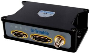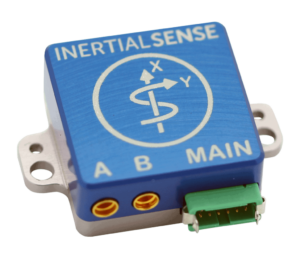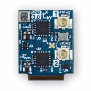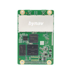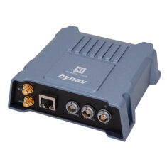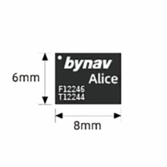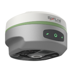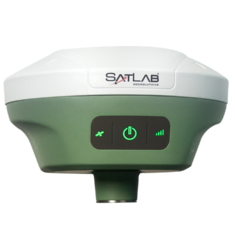
PolyExplore is a leading developer of inertial navigation solutions. Our innovative sensors and RTK positioning systems are ideal for demanding unmanned systems applications such as UAVs (unmanned aerial vehicles) and UGVs (unmanned ground vehicles), as well as the next generation of high-performance autonomous driving systems.
GNSS Inertial Navigation Systems (INS)
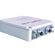
PolyNav 2000H/P
Dual Frequency Real Time Kinematic GNSS INS
The PolyNav 2000H/P high-precision GNSS-aided Inertial Navigation System (INS) leverages the advantages of both GNSS and INS to provide centimeter-level position and velocity measurement accuracy for UAVs and other unmanned vehicles.
The system offers dual frequency Real Time Kinematic (RTK) positioning and tightly-coupled GNSS and INS systems to provide superior performance even during GNSS signal outages.
The RTK positioning system continuously generates highly accurate attitude measurements whether the platform is moving or static, and is highly effective even in urban environments. Automotive Dead Reckoning (ADR) technology maintains position for up to 30 seconds during GNSS outages that may occur under bridges or inside tunnels, making the PolyNav 2000H/P ideal for autonomous driving applications.
The PolyNav 2000H/P offers a choice of three grades of inertial sensor performance:
- Ultrahigh-performance “H” version
- High-performance “P” version
- Budgetary, high-performance “E” version.
The system is packaged in a ruggedized 145mm x 120 mm x 45mm enclosure, and features CAN, Ethernet and USB interfaces, 2 UARTs, and one PPS output.
Specifications:
PolyNav 2000H | PolyNav 2000P | |
Gyro Dynamic Range | 125 °/s | 125 °/s |
Accelerometer Dynamic Range | 8g | 8g |
Gyro Bias Instability | 0.8°/h | 2°/h |
Accelerometer Bias Instability | 3.2ug | 3.6ug |
Gyro Random Walk | 0.09°/√h | 0.15°/√h |
Accelerometer Random Walk | 0.08m/s/√h | 0.12m/s/√h |
Position Accuracy | 1.6 m CEP SPS, 0.02 m RTK | |
Velocity Accuracy | 1 cm/s | |
Roll/Pitch | 0.02° | 0.035° |
Heading | 0.1° |
Find out more: PolyNav 2000H/P
PolyNav 2000S – MEMS dual-antenna RTK GNSS-INS
MEMS Inertial Navigation System
The PolyNav 2000S is a compact state-of-the-art GNSS-aided MEMS Inertial Navigation System (INS) that provides near-FOG performance and centimeter-level positioning. It outputs precise attitude and heading data for UAVs and unmanned vehicles, as well as an optional heave measurement for USVs (unmanned surface vehicles) and other marine platforms.
The dual-antenna system tracks GPS, GLONASS, Beidou and Galileo, supports SBAS and QZSS, and features dual frequency (L1 & L2) RTK. Capable of generating continuous high-accuracy attitude measurements for both moving and static platforms, the PolyNav 2000S provides superior performance during GNSS signal outages.
The PolyNav 2000S is ideal for a wide variety of unmanned systems applications including RTK mapping, bathymetry, autonomous driving, and more.
Specifications:
Gyro Dynamic Range | 400 °/s |
Accelerometer Dynamic Range | 10g |
Gyro Bias Instability | 0.3°/h |
Accelerometer Bias Instability | 0.03ug |
Gyro Random Walk | 0.015°/√h |
Accelerometer Random Walk | 0.015m/s/√h |
Position Accuracy | 1.6 m CEP SPS, 0.02 m RTK |
Velocity Accuracy | 0.02 m/sec HRMS 1 cm/s |
Roll/Pitch | 0.015° |
Heading | 0.08° (1m base) |
Find out more: PolyNav 2000S
PolyNav 2000F
FOG based UAV RTK Positioning System
The PolyNav 2000F is a tactical-grade Fiber Optic Gyro (FOG)-based GNSS Inertial Navigation System (INS) that provides extremely accurate attitude and heading data for UAVs and unmanned vehicle applications. The sensor offers dual frequency RTK positioning and tightly-coupled GNSS and INS systems to provide superior performance even during GNSS signal outages.
With high-accuracy attitude and heading outputs on both stable and moving platforms, the PolyNav 2000F is ideal for high-performance navigation for UAVs and self-driving systems. Communication capabilities include two serial ports, one Gigabit Ethernet port, one CAN bus and one USB port.
Specifications:
Gyro Dynamic Range | 490 °/s |
Accelerometer Dynamic Range | 10g |
Gyro Bias Instability | 0.05°/h |
Accelerometer Bias Instability | 15ug |
Gyro Random Walk | 0.015°/√h |
Accelerometer Random Walk | 0.07m/s/√h |
Position Accuracy | 1.6 m CEP SPS, 0.02 m RTK |
Velocity Accuracy | 1 cm/s |
Roll/Pitch | 0.01° |
Heading | 0.01° (5m base) |
Find out more: PolyNav 2000F – FOG-based dual antenna GNSS-INS
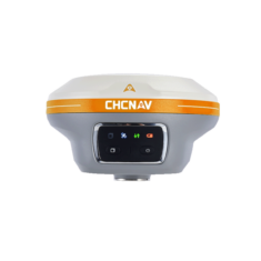
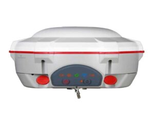
The PolyNav 2000B GNSS Base Station is a ruggedized dual-frequency multi-constellation GNSS base station that broadcasts real-time RTCM corrections for any RTK-capable unmanned vehicles. The RTK base station can be quickly and easily configured using an intuitive GUI via a local radio link or NTRIP caster/client (network RTK).
The PolyNav 2000B features a fast search engine to improve Time to First Fix (TTFF), with a configurable update rate of up to 50 Hz. It can be configured to record all tracked dual frequency multi-constellation measurements for post-processing.
Specifications:
GNSS Signals | GPS L1+L2, QZSS L1+L2, BeiDou B1+B2, GLONASS G1+G2 FDMA,GALILEO E1+E5b, SBAS L1 |
Position Accuracy (HRMS), SBAS | 0.50 m |
Velocity Accuracy (HMRS) | 0.02 m/sec |
RTK Positioning Accuracy (HRMS) | 8 mm + 1 ppm |
Operating Range | > 40 km |
Find out more: PolyNav 2000B – RTK Base Station
PolyNav 2000P OEM – High-Performance GNSS-INS
The PolyNav 2000P OEM is a high-performance high-precision GNSS-INS, offering dual frequency RTK positioning for centimeter level accuracy. The tightly coupled GNSS and INS systems provide superior performance during GNSS signal outages, and the system is capable of continuously generating highly accurate attitude measurements whether the platform is moving or static.
The tactical grade IMU sensors offer 2°/h gyro bias instability.
Specifications:
GNSS Signals | GPS L1+L2, GLONASS, Beidou, Galileo, and SBAS |
Position Accuracy | 1.6 m CEP SPS, 0.02 m RTK |
Velocity Accuracy | 1 cm/s, 0.02 m/sec (HMRS) |
Roll/Pitch | 0.05° |
Heading | 0.05° |
Dimensions | 80 x 60 x 22 mm |
Weight | 75g |
Find out more: PolyNav 2000P OEM – High-Performance GNSS-INS
LiDAR HD Aerial Scanner
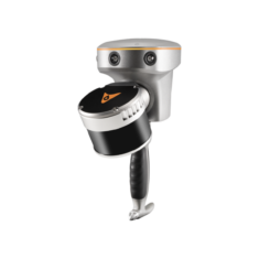
PolyScanner LM – Integrated 3D LiDAR Mapping Payload for UAVs
High-performance, ultra-lightweight HD aerial scanner
The PolyScanner LM integrates long-range LiDAR and an HD global shutter camera with state-of-the-art GNSS/INS technology to provide superior performance for UAV 3D mapping and surveying.
Precision inertial sensing allows the system to accurately maintain position during GNSS outages.
The onboard computer, tightly coupled with the GNSS/INS system, fuses data from the LiDAR and camera to create a single time- and geo-tagged raw output file, which can be post-processed to provide highly accurate color point cloud data files.
The PolyScanner LM is also available as part of the complete PolyMapper solution, which integrates the LidAR mapping system with a DJI Matrice 600 drone.
LiDAR Specifications
Model Name | Velodyne VLP-16 | Velodyne VLP-32C |
Channels | 16 | 32 |
Measurement Range | 100m | 200m |
Accuracy | ±3 cm | ±3 cm |
Field of View (Vertical) | +15° to -15° | -25° to +15° |
Angular Resolution (Vertical) | 2° | Minimum 0.33° (non-linear distribution) |
Field of View (Azimuth) | 360° | 360° |
Angular Resolution (Azimuth) | 0.1° – 0.4° | 0.1° – 0.4° |
Rotation Rate | 5 – 20 Hz | 5 – 20 Hz |
Return Modes | Single/Dual | Single/Dual |
Points/Second | ~0.3/0.6 million | ~0.6/1.2 million |
Camera Specifications
Sensor Type | CMOS |
Readout Method | Global Shutter |
Sensor Format | 1” |
Pixel Resolution | 12.94mm @ 60m |
Pixel Size | 3.45μm |
Resolution | 4096 × 2160 |
Hardware Specifications
Recording time | up to 2 hours |
Weight | 2.3 kg |
Dimensions | 260 mm x 150 mm x 145 mm |
Output | Ethernet |
GNSS Characteristics
Constellations | GPS/GLONASS/Beidou/Galileo |
Satellite signals | L1 & L2 |
Position accuracy | 1.6 m CEP SPS, 0.02 m RTK |
Velocity (RTK) accuracy | 1 cm/s |
Roll/Pitch (RTK) | 0.01° |
Heading | 0.1° (1 m base), |
Measurement rate | 100 Hz |
Sensitivity | -160 dBm |
Number of antennas | 2 |
Find out more: PolyScanner LM – Integrated 3D LiDAR Mapping Payload
Inertial Sensing Applications
Autonomous Driving
Autonomous automotive systems such as self-driving cars require accurate and reliable navigation solutions that are also suitable for mass production. Our inertial navigation sensors are based on high-volume production devices and are ideal for GNSS-denied environments and other challenges faced by autonomous vehicles.
Drones & UAVs
Safe drone operation and navigation relies on accurate position, velocity, and attitude information. Precise pitch, roll, and yaw measurement enables stable flight dynamics, and accurate position estimation is critical for motion and path planning in autonomous flight. Polynesian Exploration’s high-performance UAV RTK positioning systems and advance GNSS INS are designed to provide smarter, safer navigation for UAVs.
Aerial Mapping
GNSS-integrated inertial navigation systems reduce the need for ground control points (GCPs) in aerial mapping performed by manned or unmanned aircraft. 3D maps with centimeter-level accuracy are essential for autonomous driving environments, requiring multiple sensors working together. Polynesian Exploration’s inertial sensors are ideal for facilitating a wide range of aerial mapping applications.