Inertial Labs, a VIAVI Solutions Company

verified This business has been claimed by Inertial Labs, a VIAVI Solutions Company and verified by UST.
Verified companies work with us to ensure we display the most up-to-date and comprehensive product information, articles and other material to help you choose the right solution for your requirements.
Inertial Navigation Sensors: MEMS IMU, Accelerometers, Gyroscopes, AHRS, GPS-INS & Point Cloud Generation United States of America
Visit Website
Saved
Save
Contact
Inertial Labs, a VIAVI Solutions Company

Inertial Navigation Sensors: MEMS IMU, Accelerometers, Gyroscopes, AHRS, GPS-INS & Point Cloud Generation

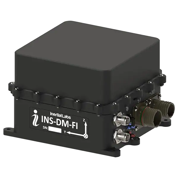
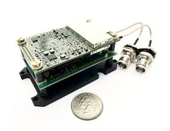
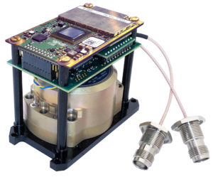
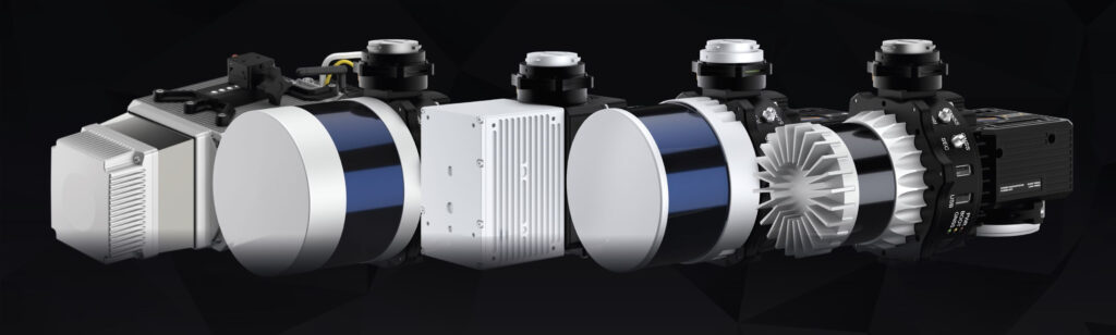
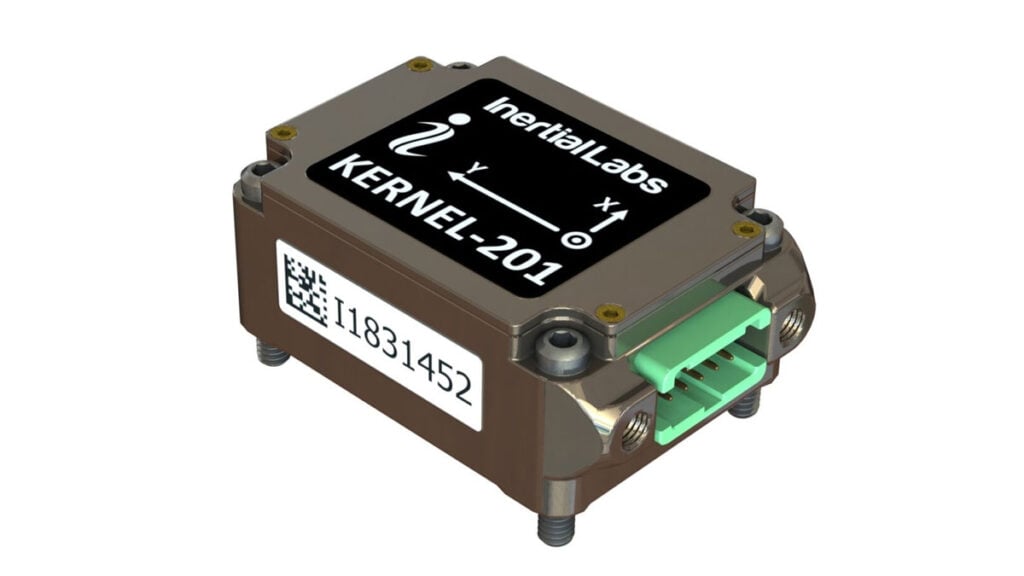
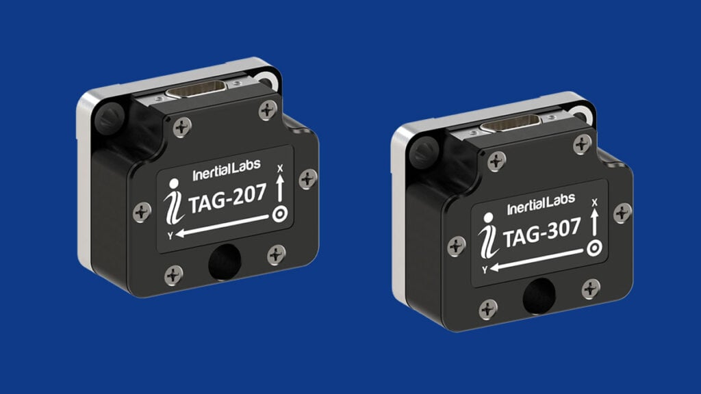
Inertial Labs is a leading designer and manufacturer of position and orientation tracking systems for unmanned vehicles. Our high accuracy solutions are based on the fusion of inertial navigation sensors with a range of other cutting-edge sensing technologies, including MEMS-IMU, accelerometers, gyroscopes and AHRS. With our engineering expertise, we create high-performance inertial sensor systems with small size and low power requirements.

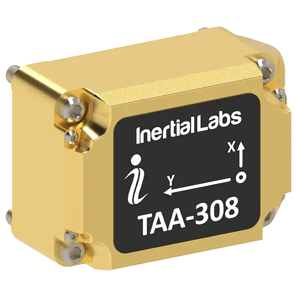
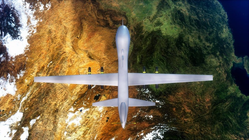
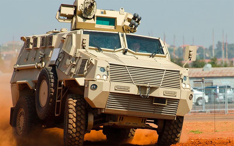
Our products are ideal for a variety of unmanned systems applications, including motion tracking, weapon orientation tracking, payload stabilization, and inertial position tracking for GPS-denied environments.

Inertial Measurement Units (IMU)

IMU-FI-200T Inertial Measurement Unit

Tactical-grade FOG-based IMU

IMU-FI-200The IMU-FI-200T is a compact tactical-grade IMU that incorporates three-axis FOGs and three-axis high-precision MEMS accelerometers, delivering highly accurate linear acceleration and angular rate data with low noise and excellent reliability.

The sensor is fully calibrated and temperature compensated, and has been thoroughly tested to perform under significant variations in temperature, high vibration, and shock.

Highly suited to both motionless and high dynamics applications, the IMU-FI-200T is ideal for UAV and UUV navigation and control, platform and antenna stabilization, and incorporation into AHRS and INS.

IMU-NAV-100 Inertial Measurement Unit

Navigation-grade high accuracy IMU

IMU-NAV-100-AThe IMU-NAV-100 is a lightweight and compact high accuracy IMU based on state-of-the-art MEMS sensor technologies, providing three-axis linear accelerations and angular rates with very low noise and high reliability.

Fully calibrated, temperature compensated, and mathematically aligned to an orthogonal coordinate system, the IMU-NAV-100 is highly accurate MEMS IMU in both static and dynamic conditions.

Featuring continuous Built-in Test (BIT), configurable communications protocols, electromagnetic interference (EMI) protection, and flexible input power requirements, the unit is ideal for UAV, AUV & ROV navigation and control, platform orientation and stabilization, and more. It is available in two performance variants.

IMU-P Inertial Measurement Unit (IMU)

High Performance Tactical Grade & Industrial IMU

IMU-PThe IMU-P is a light-weight and compact high performance Inertial Measurement Unit, designed for a number of applications including UAV and AUV/ROV navigation and control.

The MEMS IMU contains three highly accurate Advanced MEMS gyroscopes and three ultra high performance accelerometers for precise linear acceleration and angular rate measurements.

The IMU-P is an ITAR free inertial solution, that is fully calibrated and compensated over its operating temperature range. Both Industrial and Tactical grade units are available.

Compact size (39 x 45 x 22 mm) and low weight (70 gram) – ideal for integrated system applications.

IMU-P Applications:

  • Antenna and Line of Sight Stabilization Systems
  • Motion Reference Units (MRU)
  • Motion Control Sensors (MCS)
  • Gimbals, EOC/IR, platforms orientation and stabilization
  • UAV & AUV/ROV navigation and control

Kernel Inertial Measurement Units

Fully-integrated industrial and tactical-grade IMUs

IMU-Kernel-100The Kernel series of strapdown three-axis IMUs features the latest in MEMS IMU sensor technology, providing a number of options to suit both industrial and tactical-grade requirements.

Providing linear acceleration and angular rate outputs with three-axis MEMS accelerometers and gyroscopes, the fully-integrated IMUs are compact and lightweight and have been thoroughly tested to withstand large variations in temperature, high vibration, and shock.

The fully-calibrated tactical and industrial IMUs can be integrated into MRUs, AHRS and GNSS-INS, and are also ideal for a wide variety of drone and robotics applications such as autonomous vehicles, antenna and line of sight stabilizations systems, and vessel motion monitoring.

Attitude and Heading Reference Systems (AHRS)

AHRS-10 – High Accuracy AHRS

AHRS-10BThe AHRS-10 is a high-accuracy AHRS that outputs absolute orientation (heading, pitch and roll) for both motionless and dynamic applications. It integrates precision 3-axis accelerometers, magnetometers and gyroscopes to provide absolute pitch and roll data, real time device rotation data and ongoing gyroscope corrections.

The AHRS-10 utilizes our high-performance Fluxgate Magnetometer technology for superior stability and repeatability, making it an ideal solution for unmanned systems applications where superior accuracy is required.

Applications:

  • Point-to-point antenna stabilization and motion control
  • Antenna Reference Units (ARU)
  • Radar Reference Units (RRU)

AHRS-II – Absolute Orientation AHRS

AHRS-II-PThe AHRS-II is our family of next-generation AHRS featuring state-of-the-art algorithms for a wide range of dynamic motions of unmanned vehicles. Precision 3-axis accelerometers, magnetometers and gyroscopes provide heave, heading, pitch and roll data, as well as high-frequency real time device rotation data and ongoing gyroscope corrections.

OptoAHRSTM-II works through the use of reference images. A reference image is literally a picture of the horizon in a given direction. Within the reference image the system identifies a constellation of identifiable features.

Applications:

  • Antenna pointing systems
  • Geospatial systems

miniAHRS – Miniature AHRS

miniAHRSThe miniAHRS is a lightweight, compact AHRS that is ideal for integration into small drones and unmanned systems. The device combines 3-axis accelerometers, magnetometers and gyroscopes to provide absolute pitch and roll data, real-time three-axis rotation measurement, and ongoing gyroscope corrections.

The miniAHRS features advanced Kalman filter-based sensor fusion techniques as well as state-of-the-art algorithms for the dynamic motions of different unmanned vehicles and robotic platforms in land, sea and air domains.

miniAHRS Applications:

  • Low-SWaP UAVs and unmanned systems
  • Weapons systems fire control

More Information: miniAHRS – Miniature AHRS

GPS-Aided Inertial Navigation Sensors

GPS-INS for Unmanned Vehicles

INS-DUOur family of GPS-Aided Inertial Navigation Systems combines support for multi-GNSS constellation signals (L1 & L2 GPS, GLONASS, GALILEO and BEIDOU) with state-of-the-art 3-axis accelerometers, magnetometers and gyroscopes to provide accurate position, velocity, heave and absolute orientation data for both unmanned aircraft and ground robotics. Both single- and dual-antenna GPS-INS are available.

Single-Antenna GPS-INS

Our single-antenna GPS-aided INS is available in three models. Both the INS-P and INS-U incorporate an embedded high-precision gyro-compensated magnetic compass for enhanced heading performance in GNSS-denied environments, even under highly challenging environmental conditions.

The INS-U also features an integrated Air Data Computer (ADC) that outputs parameters such as static and dynamic pressure, airspeed, Mach number and angle of attack.

Specifications:

INS-B INS-P INS-U
Model INS-B (Basic) INS-P (Professional) INS-U
Size 120 x 50 x 53 mm 120 x 50 x 53 mm 82.0 x 40 x 26 mm
Weight 220g 280g < 200g
Position Accuracy 1.5 m (GPS L1)
1.2 m (GPS L1&L2)
0.6 m (SBAS)
0.4 m (DGPS)
0.05 m (PP)
0.01 m + 1 ppm (RTK)
1.5 m (GPS L1)
1.2 m (GPS L1&L2)
0.6 m (SBAS)
0.4 m (DGPS)
0.05 m (PP)
0.01 m + 1 ppm (RTK)
1.5 m (GPS L1)
1.2 m (GPS L1&L2)
0.6 m (SBAS)
0.025 m (PPP)
0.01 m + 1 ppm (RTK)
Heading Accuracy
(static | dynamic)
1 deg | 0.1 deg 0.4 deg | 0.1 deg 0.3 deg | 0.6 deg
Velocity Accuracy 0.03 m/sec 0.03 m/sec 0.05 m/sec
Pitch & Roll Accuracy
(dynamic)
0.1 deg 0.1 deg 0.08 deg
Gyroscope Bias in-run Stability 1 deg/hr 1 deg/hr 2 deg/hr
Accelerometer Bias in-run Stability 0.005 mg 0.005 mg 0.01 mg (±8g)
0.03 mg (±15g)
0.05 mg (±40g)

Dual-Antenna GPS-INS

Our dual-antenna GPS-aided INS sensors provide enhanced accuracy for unmanned vehicle positioning and heading in both static and dynamic conditions.

Specifications:

INS-BU INS-D INS-DL INS-DU INS-DM INS-FI INS-DM-FI
Model INS-BU INS-D INS-DL INS-DU INS-DM INS-FI INS-DM-FI
Size 120 x 50 x 53 mm 120 x 50 x 53 mm 120 x 50 x 53 mm 120 x 50 x 53 mm 160.4 x 141.2 x 61.1 mm 88.9 x 127.5 mm 160 x 149 x 96mm
Weight 320g 320g 320g 320g 1345g typical
(depends on configuration)
950g 2100g
Horizontal Position Accuracy 1.5m (GPS L1)
1.2m (GPS L1&L2)
0.005 m (PP)
0.01 m + 1 ppm (RTK)
1.5m (GPS L1)
1.2m (GPS L1&L2)
0.6 m (SBAS)
0.4 m (DGPS)
0.005 m (PP)
0.01 m + 1 ppm (RTK)
1.5m (GPS L1)
1.2m (GPS L1&L2)
0.4 m (DGPS)
0.005 m (PP)
0.01 m + 1 ppm (RTK)
1.5m (GPS L1)
1.2m (GPS L1&L2)
0.005 m (PP)
0.01 m + 1 ppm (RTK)
1.2 m (SP)
0.6 m (SBAS)
0.4 m (DGPS)
0.005 m (PP)
0.01 m + 1 ppm (RTK)
1.2 m (SP)
0.6 m (SBAS)
0.4 m (DGPS)
0.025 m (PPP)
0.01 m (RTK)
1.2 m (SP)
0.6 m (SBAS)
0.4 m (DGPS)
0.025 m (PPP)
0.01 m (RTK)
Heading Accuracy
(static | dynamic)
0.6 deg | 0.3 deg 0.15 m | 0.08 m
(1m | 2m baseline)
0.2 m | 0.08 m
(1m | 2m baseline)
0.2 m | 0.2 m
(2m baseline)
0.4 m | 0.4 m
(1m baseline)
0.15deg | 0.15deg
(1m baseline)
0.08deg | 0.08deg
(2m baseline)
0.15deg | 0.15deg
(1m baseline)
0.08deg | 0.08deg
(2m baseline)
0.15deg | 0.15deg
(1m baseline)
0.08deg | 0.08deg
(2m baseline)
Velocity Accuracy 0.05 m/sec 0.03 m/sec 0.03 m/sec 0.05 m/sec 0.03 m/sec or 0.05 m/sec
(depending on receiver)
0.03 m/sec or 0.05 m/sec
(depending on receiver)
0.03 m/sec or 0.05 m/sec
(depending on receiver)
Pitch & Roll Accuracy
(dynamic)
0.03 deg RMS 0.08 deg RMS 0.1 deg RMS 0.2 deg RMS 0.01 – 0.05 deg
(depending on IMU)
0.01 deg 0.01 deg
Gyroscope Bias in-run Stability 2 deg/hr 1 deg/hr 3 deg/hr <2 deg/hr 0.25 – 2 deg/hr
(depending on IMU)
0.025 deg/hr 0.025 deg/hr
Accelerometer Bias in-run Stability 0.01 mg (±8 g) 0.005 mg (±8 g) 0.005 mg (±8 g) 0.005 mg (±8 g) 0.003 – 0.025 mg
(depending on IMU)
0.005 mg (±8 g) 0.005 mg (±8 g)

Dual Antenna GPS-Aided INS OEM

OEM INS Solutions

OEM versions of our INS-B, INS-D and INS-DL industrial and tactical grade GPS-aided INS are also available. Measuring just 85 x 47 x 36 mm and weighing from 115 to 160g, they can be easily integrated onto SWaP-conscious platforms.

INS-DH-OEM dual antenna GPS-aided INSThe INS-DH-OEM is a next-generation dual antenna GPS-aided INS that features state-of-the-art sensor fusion, navigation and guidance algorithms, and incorporates an advanced NovAtel GNSS receiver and Honeywell HG4930 IMU.

INS Applications:

  • UAV/drone flight control systems in GPS-denied environments
  • Remote sensing
  • Low altitude photogrammetry
  • Law enforcement
  • Autonomous Vehicle Navigation Systems
  • Aerial Inspections – roads, bridges, power lines
  • Surveying / 3D mapping
  • Precision Agriculture
  • Military inspections
  • ADAS – Advanced Driver-Assistance Systems

LEO-Aided INS for Assured PNT in Contested Environments

IRINS LEO-Aided INS

IRINSInertial Labs Unveils IRINS LEO-Aided Navigation System is a compact assured navigation system integrating an INS and AHRS with an embedded Iridium STL-2600 LEO PNT receiver to maintain position, velocity, attitude, and time when GNSS is degraded or denied. Tightly coupled MEMS inertial sensors, LEO-based timing and navigation, and anti-jam GNSS support via a CRPA port provide resilient performance across land, air, and maritime platforms, with compliance to IP67 and MIL-STD-810G.

The system delivers GNSS-denied accuracy of 80 m RMS position and 2 m/s velocity, supported by integrated barometer and magnetometer sensors and an optional onboard air-data computer. IRINS is offered in enclosure, OEM, and deck-mount variants, supports RS-232/RS-422, CAN, and Ethernet interfaces, and combines assured PNT and navigation in a single unit.

Two and Three Axis Gyroscopes (TAG)

Tactical-grade multi-axis Gyros for stabilization & pointing

The TAG-207, TAG-307 and TAG-304 are tactical-grade two- and three-axis MEMS gyroscopes designed for stabilization and pointing.

With low SWaP, noise and latency as well as a wide bandwidth, they are ideal for complex unmanned systems applications.

TAG-207
TAG-307
TAG-304

TAG gyros are engineered to withstand the harshest environments, with no moving parts and tested to MIL-STD-810 levels of shock and vibration. They are factory-calibrated over the entire operation temperature range, and precision-machined to ensure extremely low non-orthogonality and misalignment between sensitive elements.

TAG Multi-Axis Gyro Applications:

  • Remote Weapons Stations (RWS) stabilization and pointing
  • Electro-Optical Systems (EOS) image stabilization
  • Offsetting UGV and land vehicle pitch and roll.

More Information: TAG Multi-Axis Gyros

Three-Axis Accelerometers (TAA)

Navigation-grade MEMS accelerometers for UAVs & robotics

TAA-308Inertial Labs’ TAA (Three Axis Accelerometer) series provides high-precision navigation-grade linear acceleration data with low noise and excellent repeatability in both static and dynamic applications.

The self-contained devices are fully calibrated, temperature-compensated and mathematically aligned to an orthogonal coordinate system, and are ideal for a wide range of unmanned systems applications including UAV flight stabilization, AUV/ROV navigation and control, and gimbal and antenna orientation.

The TAA series features ITAR-free and export-controlled models, with three measurement range options for each.

More Information: Three Axis Accelerometers (TAA)

Motion Reference Units (MRU)

High Performance Motion Sensors

MRU-EOur Motion Reference Units are high-performance strapdown motion sensors specifically designed for marine applications such as ROVs. Utilizing precision solid state 3-axis accelerometers, magnetometers, gyroscopes and barometric sensors, the units output highly accurate position, velocity, acceleration, heading, pitch & roll, and heave, sway & surge data.

The Motion Reference Units are available in three different models – Basic, Enhanced and Professional – to provide desired levels of accuracy and stability as well as the required outputs for your particular application.

MRU Applications:

  • Marine surveys
  • Hydrography
  • Bathymetry

Video: MRU Qualification Tests

More Information: Motion Reference Units

Wave Sensors (WS)

High performance Wave, Direction & Motion Sensors

WS-EThe WS-E (Enhanced) and WS-PD (Professional Dual) are high-performance strapdown wave direction and motion sensors that provide accurate wave characteristics as well as heave, sway, surge, pitch and roll data for USVs and other floating marine platforms.

The Wave Sensors can be interfaced with external GNSS receivers, gyro compasses and Doppler Velocity Logs (DVL), and can output spectral data as a complete set of Fourier coefficients and energies.

Wave Sensor Applications:

  • Ocean monitoring on buoys, USVs and AUVs

More Information: Wave Sensors

RMCU – Railway Motion Control Unit

RMCUThe RMCU is a high-performance strapdown system specially designed to determine absolute orientation (heading, pitch and roll) and parameters of motion (angular rates and linear acceleration) for railway platforms in both static and dynamic situations.

The system is compliant with EN 45545, EN 50155 and EN 50011 railway standards and features state-of-the-art embedded algorithms for different railway platforms.

RMCU Applications:

  • Railway crack detection analysis
  • Safer and more reliable components for the railway industry
  • Aiding data for robust railway navigation systems

RESEPI – Remote Sensing Payload Instrument

Flexible LiDAR point cloud generation solution for UAVs

RESEPI Remote Sensing Payload Instrument

RESEPI is a range of high-accuracy LiDAR point cloud generation solutions designed for Inertial Labs partners and resellers to white-label, allowing them to customize both the hardware and software with their own branding and focus on their core competencies without worrying about additional development.

Built around a Linux-based processing platform, the modular systems include Inertial Labs’ own high-performance single- or dual-antenna GPS-aided inertial navigation systems (INS) with high-end RTK/PPK GNSS receivers, as well as Wi-Fi communications and an embedded cellular modem for in-flight RTCM RTK corrections.

The RESEPI range includes two product lines – the original LITE models, and the GEN II line that offers more powerful onboard computing as well as tight platform integration thanks to MAVLink and DJI Payload SDK compatibility.

UAV remote sensing payload

Thanks to Inertial Labs’ cutting-edge orientation and positioning technology, RESEPI produces extremely thin point clouds even at a high AGL. RESEPI’s software suite features fully-automated RTK LAS file generation, as well as a one-click command line interface for post-processing.

The RESEPI product range is ideal for a wide range of UAV remote sensing applications, including:

  • Mapping and Scanning
  • Precision Agriculture
  • Simultaneous Localization and Mapping (SLAM) Algorithm Development
  • Infrastructure and Utilities Inspection
  • Construction Site Monitoring

Products

INS-DM-FI GPS-Aided INS

IP68-rated dual-antenna FOG GNSS-INS

RESEPI GEN II LiDAR Scanning Solutions

Next-generation sensor fusion platform for UAV remote sensing

IMU-H100

Tactical-Grade MEMS IMU for UAVs, Missiles & Guided Systems

M-AJ-QUATRO

Advanced CRPA anti-jamming antenna for assured GNSS PNT in hostile environments

Teledyne EchoONE

Ultra-lightweight Airborne LiDAR System

Vision-Aided Inertial Navigation System (VINS)

High-accuracy inertial navigation system engineered for GNSS-denied environments

IRINS

LEO-aided INS for assured PNT in contested domains

INS-FI GPS-Aided-INS

Dual-antenna tactical-grade FOG-based GNSS-INS

Air Data Computer (ADC)

Air data parameter calculations for UAV flight control

Three Axis Accelerometers (TAA)

Navigation-grade MEMS accelerometers for UAVs & robotics

WS Wave Sensors

Wave direction and motion sensors for marine platforms

RESEPI Lite LiDAR Scanning Solutions

High-accuracy sensor fusion platform for UAV remote sensing

IMU-NAV-100

High-performance navigation-grade IMU

INS-U

GPS-Aided INS with Air Data Computer - Single Antenna

INS-B

Basic Single GNSS Antenna Inertial Navigation System

INS-BU

Basic single-antenna GNSS-aided INS with u-blox receiver

INS-DU

Dual-antenna GNSS-aided INS with u-blox receiver

INS-DM

Rugged IP68 dual-antenna GNSS-aided INS

IMU-P

Advanced three-axis MEMS IMU with external GNSS capability

Kernel IMUs

Fully-integrated industrial and tactical-grade inertial measurement units

IMU-FI-200T

Fiber Optic Gyroscope (FOG) and MEMS accelerometer-based Inertial Measurement Unit (IMU)

AHRS-10

High-accuracy heading, pitch & roll data for static & dynamic applications

miniAHRS

Miniature low-SWaP AHRS for air, sea and land applications

AHRS-II-P

Tactical-grade AHRS for air, sea and land applications

OptoAHRS-II - Optical AHRS

Optically-enhanced AHRS for antenna and platform pointing & stabilization

RMCU

Railway Motion Control Unit

Two & Three Axis Gyroscopes (TAG)

Tactical-grade multi-axis gyros for stabilization & pointing

MRU-B

Basic Motion Reference Units (MRU) for naval and marine applications

MRU-E

Advanced Motion Reference Units (MRU) for naval and marine applications

MRU-P

Advanced Motion Reference Units (MRU) with DGPS & RTK capabilities

MRU-PD

Motion reference, positioning and HDT solution for naval and marine applications

WOM3

Weapons orientation module (WOM) with real-time movement tracking

OptoWOM-II

Optically Enhanced Weapon Aiming System

INS-P

Professional tactical-grade multi-constellation GPS-aided INS for UAV, UGV, AGV and GPS-denied

INS-D

Dual-antenna tactical-grade multi-constellation GPS-aided INS for UAVs and ground robots

INS-DL

Low Cost Dual GNSS Antenna Inertial Navigation System for drones, ground robots

Articles

Latest
Inertial Labs Outlines VINS for Enhanced UAV Navigation in GNSS-Denied Environments

Inertial Labs outlines its visual inertial navigation system, combining inertial sensing with visual odometry to improve unmanned aerial vehicle navigation accuracy and reduce drift in GNSS-denied, degraded, and contested operational environments

Apr 09, 2026
Flight Testing of Vision Aided Inertial Navigation in GNSS Denied Conditions

Inertial Labs outlines the integration and flight-tested performance of visual-aided inertial navigation with vision-based positioning, combining inertial measurement data with visual inputs to support accurate localization in GNSS-denied conditions

Mar 27, 2026
Inertial Labs Unveils IRINS LEO-Aided Navigation System

Inertial Labs unveils IRINS LEO-aided inertial navigation system integrating inertial navigation, altitude and heading reference, and resilient timing for assured positioning across land, air and sea in denied environments

Feb 03, 2026
Advancing Wildfire Disaster Recovery with PNT & Drone-Based Technologies

Inertial Labs, a VIAVI Solutions company, highlights how its drone-based reality capture technologies, integrating PNT, LiDAR, and cameras, are being used to map and support post-wildfire recovery and rebuilding efforts in Lahaina, Hawaii

Nov 18, 2025
Advancing Navigation with Inertial Measurement Units & Inertial Navigation Systems

Inertial Labs explores how Inertial Measurement Units and Inertial Navigation Systems deliver precise, reliable navigation across air, land, and sea, especially in GNSS-denied environments

Nov 06, 2025
How Survey Grade INS Improves UAV Performance

Discover how survey-grade Inertial Navigation System (INS) technology enhances UAV accuracy, reliability, and data quality, with insights into Inertial Labs’ INS-P and Pixhawk integration benefits

Sep 22, 2025
Inertial Labs Explores Map Projections and Coordinate Systems Ahead of InterGEO 2025

Inertial Labs’ whitepaper on map projections and coordinate systems, together with the RESEPI Lite LiDAR platform, highlights data accuracy in UAV-based remote sensing ahead of InterGEO 2025

Aug 20, 2025
USAF Uses Inertial Labs Drone Lidar for Tree Obstruction Survey

The US Air Force successfully used Inertial Labs drone Lidar and cloud software to quickly map tree obstructions at Joint Base Lewis-McChord (JBLM), improving airfield safety

Jul 11, 2025
Transforming Security with LiDAR & Drone Technology

Explore how LiDAR and Inertial Labs' RESEPI GEN-II payload are enhancing security operations with precise mapping, real-time monitoring, and drone integration

Jun 25, 2025
Inertial Labs Launches VINS to Counter Rising GPS Threats for UAV Navigation

Inertial Labs has unveiled a visual-aided inertial navigation system (VINS) that enables UAVs to maintain precise navigation during GPS-denied missions, addressing rising jamming threats in global airspace

Jun 03, 2025
New Tactical Grade IMU from Inertial Labs for UAVs & Guided Munitions

Inertial Labs has launched the IMU-H100, a compact, tactical-grade MEMS IMU designed to enhance precision navigation for UAVs and guided systems

May 08, 2025
Inertial Labs Introduces M-AJ-QUATRO Anti-Jamming Antenna for A-PNT Security

Inertial Labs has introduced the M-AJ-QUATRO, an advanced anti-jamming antenna system designed to enhance A-PNT reliability in GPS/GNSS-compromised environments

Apr 02, 2025
Inertial Labs Attends IDEX 2025

Inertial Labs will be showcasing its latest technologies at IDEX 2025 this week on Booth 14-A20, featuring its range of cutting-edge positioning, navigation, and orienting solutions

Feb 19, 2025
VIAVI Acquires Inertial Labs to Expand Market Reach

Strategic acquisition of Inertial Labs for up to $325 million extends VIAVI's reach into aerospace, defense, and industrial end markets

Dec 20, 2024
Lightweight LiDAR & Camera Payload Unveiled

Inertial Labs’ new RESEPI Ultra LITE is the company’s lightest complete payload to feature both LiDAR and camera technology, offering ease of use, precision, and adaptability

Nov 06, 2024
New Compact Inertial Measurement Unit Unveiled

The new KERNEL-201 miniature MEMS sensor-based IMU from Inertial Labs delivers ultra-low noise, high bandwidth, and minimal latency, aiming to redefine precision and reliability

Oct 24, 2024
Advanced Navigation Solutions Displayed at ION GNSS+ 2024

Inertial Labs showcased its advanced navigation solutions at ION GNSS+ 2024, including the company’s GNSS Compass, RESEPI products, GNSS-aided INS, and more

Oct 04, 2024
Inertial Navigation Systems & Elevating UAV Performance

Inertial Labs discusses the role of inertial navigation systems in aiding UAVs maintain accurate flight paths, stabilize in turbulence, and execute complex missions autonomously

Oct 03, 2024
The Role of Accelerometers in Inertial Navigation Systems

Inertial Labs outlines the critical role of accelerometers in the company's navigation systems, highlighting applications across UAVs, marine navigation, and robotics for precise motion tracking

Sep 20, 2024
New Robust Gyroscopes Launched for Enhanced Stabilization & Pointing Accuracy

Inertial Labs has introduced the TAG-307 and TAG-207 gyroscopes, offering enhanced stabilization and pointing accuracy for guidance systems, gimbals, and electro-optical platforms

Sep 17, 2024
Inertial Labs’ GPS-Denied Navigation Solution: Reliable and Versatile for Various Applications

Inertial Labs has released an article on the company's GPS-denied navigation solutions, including how they work, the benefits, and applications

Sep 03, 2024
Inertial Measurement Units vs Gyroscopes: Advantages & Disadvantages

Inertial Labs explores the intricacies of Inertial Measurement Units (IMU) and gyroscopes, their distinct roles and benefits, and how the right system can make all the difference in precision and performance

Aug 22, 2024
Understanding Inertial Measurement Units

Inertial Labs discusses how Inertial Measurement Units (IMUs) work, applications, and what sets the company's IMUs apart in the industry

Aug 06, 2024
The Impact of Inertial Navigation Systems on Precision Farming

Inertial Labs explains how the company’s INS technology is transforming farming practices, offering unparalleled precision and efficiency in agricultural operations

Jul 26, 2024
Partnership for Innovative UAV-Based LiDAR Solutions

Inertial Labs’ RESEPI LiDAR solution is being integrated into ideaForge’s high-performance unmanned aerial vehicles for aerial data collection and precise 3D mapping capabilities

Jul 23, 2024
Advancing Autonomous Vehicle Navigation with Inertial Systems

Inertial Labs has discussed the role of its Kernel IMUs, INS, and AHRS in autonomous vehicle navigation, bringing enhanced orientation and positioning capabilities to self-driving systems

Jul 09, 2024
The Reasons that Make a LiDAR Payload Essential

Learn about the reasons that make a LiDAR payload a must-have, from enhanced safety in hazardous areas, unmatched precision and accuracy, and more

Jun 25, 2024
Next-Gen GPS-Aided INS Introduced by Inertial Labs

Inertial Labs has introduced the INS-FI, the company’s latest GPS-Aided Inertial Navigation System developed using Tactical-grade Fiber Optic Gyroscope technology

Jun 18, 2024
Latest Inertial Navigation Systems to be Showcased at Eurosatory

Visit Inertial Labs’ booth at Eurosatory 2024 to discover advanced inertial navigation systems, precision targeting solutions, and innovative motion-tracking devices for unmanned systems

Jun 12, 2024
New Inertial Labs INS Integration with Meridian by Mosaic

Mosaic's Meridian mobile mapping system pairs the MosaicX camera with a precision INS/LiDAR device from Inertial Labs, making high-accuracy mapping more accessible than ever

Jun 07, 2024

Videos

Regional Offices & Locations
Inertial Labs United States of America 39959 Catoctin Ridge Street, Paeonian Springs, VA 20129 U.S.A. +1 703-880-4222 Contact Website
Advancing Unmanned Systems Through Strategic Collaboration UST works with major OEMs to foster collaboration and increase engagement with SMEs, to accelerate innovation and drive unmanned systems capabilities forward.