


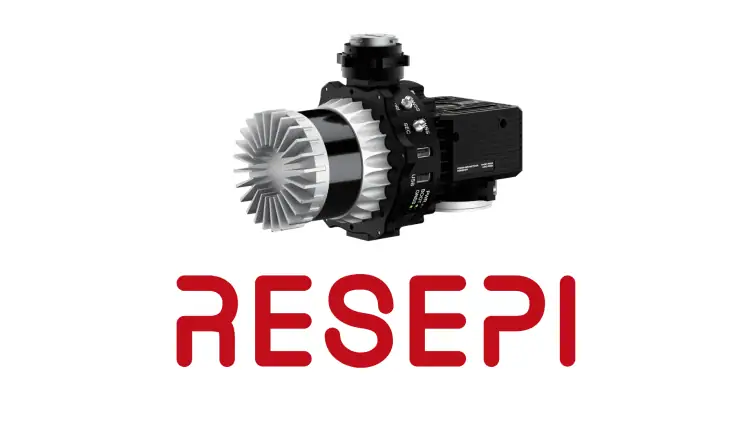
LiDAR (Light Detection and Ranging) technology has revolutionized how we capture and understand the world around us. From autonomous vehicles to environmental monitoring, LiDAR’s ability to generate precise, three-dimensional information about the shape and surface characteristics of the Earth has made it an indispensable tool in various fields. Among the leading innovators in this space, Inertial Labs stands out with its RESEPI products, designed to enhance the performance and application of LiDAR systems.
Unmatched Precision and Accuracy
LiDAR payloads offer unparalleled precision and accuracy in mapping and surveying tasks. They can detect minute differences in elevation, making them ideal for applications such as topographic mapping, forestry management, and infrastructure inspection. RESEPI further enhances this precision by incorporating advanced inertial navigation systems (INS) that ensure the LiDAR sensors maintain accurate positioning and orientation data, even in challenging environments.
Versatility Across Environments
One of the key advantages of LiDAR technology is its versatility. LiDAR payloads can be deployed across various platforms, including drones, aircraft, and ground vehicles, allowing for flexible operation in diverse environments—from dense urban areas to remote wilderness. RESEPI, with its robust design and compatibility with multiple LiDAR systems, ensures that users can easily integrate these payloads into their existing operations, regardless of the application or environment.
Efficiency and Time Savings
LiDAR payloads dramatically reduce the time and effort required for data collection and analysis. Traditional surveying methods are labor-intensive and time-consuming, whereas LiDAR can cover vast areas quickly, delivering high-resolution data in a fraction of the time. Integrating RESEPI further optimizes this process by providing advanced data processing capabilities that streamline the workflow from data capture to final analysis, significantly reducing project timelines.
Enhanced Safety in Hazardous Areas
Surveying hazardous or inaccessible areas poses significant risks to personnel. LiDAR payloads can be operated remotely, allowing for safe data collection in environments such as disaster zones, active construction sites, and areas with extreme topography. RESEPI enhances safety by offering precise control and reliable performance, ensuring that data collection missions can be conducted without risking human lives.
Cost-Effectiveness
Despite the advanced technology and benefits it provides, a LiDAR payload, particularly when complemented with RESEPI, represents a cost-effective solution over the long term. These systems’ efficiency, speed, and accuracy can significantly reduce the overall costs of large-scale surveying and mapping projects. Users can achieve substantial savings by minimizing the need for repeated site visits and reducing the human resources required for data collection.


