Showcase your capabilities
If you design, build or supply Drone GIS, create a profile to showcase your capabilities and connect with visitors who have an active requirement for your solutions.


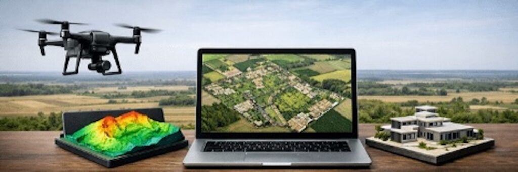
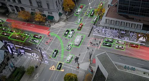
GIS and geospatial technology enable unmanned systems to collect, interpret, and act on spatial data with high accuracy. These tools are critical for applications such as mapping, surveillance, disaster response, and environmental monitoring.
Read the Technology Overview

Precision Positioning & Orientation Solutions for Unmanned Applications

GNSS Positioning Systems, 3D SLAM & Mobile Mapping, Unmanned Surface Vehicles

Geospatial Software for Real-Time Mapping, Data Visualization & Situational Awareness

Connecting High-Performance Spatial Analysis in the Office with Reliable Execution in the Field

GNSS Positioning & Navigation Systems, Mobile Mapping UAV LiDAR & Unmanned Surface Vehicles
If you design, build or supply Drone GIS, create a profile to showcase your capabilities and connect with visitors who have an active requirement for your solutions.

Geospatial technology enables unmanned systems to collect, interpret, and act on spatial data with high accuracy. These tools are critical for applications such as mapping, surveillance, disaster response, and environmental monitoring.
Geospatial tools are integrated into various unmanned platforms, including UAVs (unmanned aerial vehicles), autonomous drones, and remotely operated systems to deliver location-based intelligence in real time. These technologies encompass a variety of systems such as GNSS receivers, LiDAR sensors, IMUs, SLAM modules, photogrammetry software, multispectral and hyperspectral cameras, and GIS platforms.
Whether used in agriculture, defense, urban planning, or environmental science, geospatial technologies allow unmanned systems to navigate with precision, map terrain accurately, and monitor changes in complex environments.

Geospatial technology, Global Mapper Mobile, from Blue Marble. Geographics.
Geospatial technologies expand the capabilities of unmanned systems by providing detailed, accurate, and time-sensitive spatial data. Common applications include:
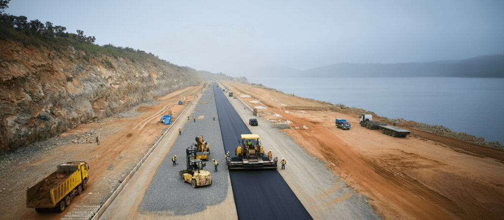
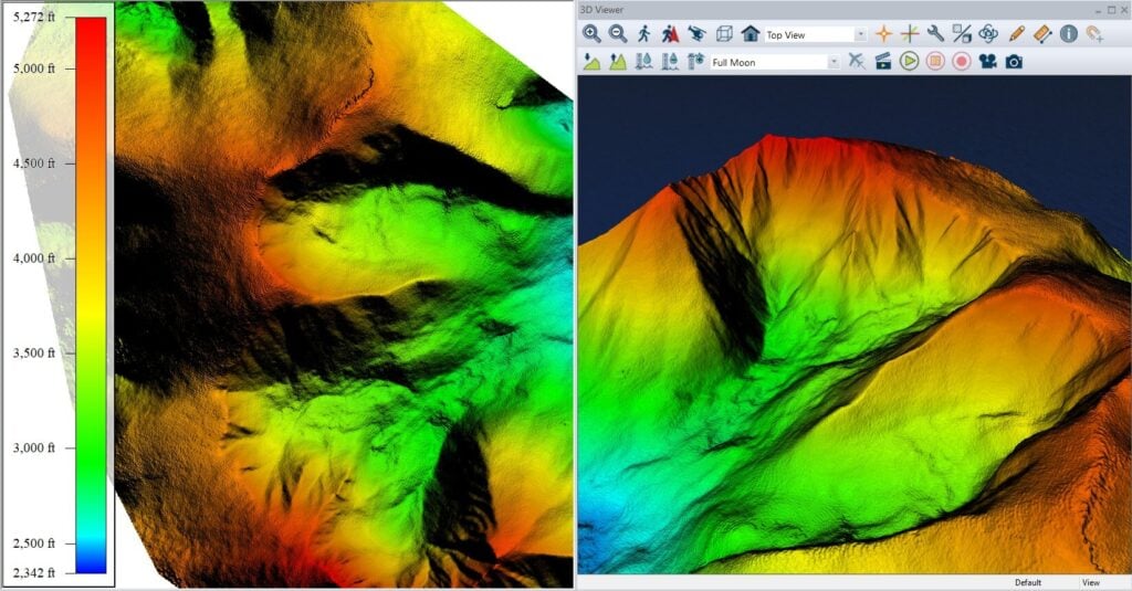
UAVs with LiDAR or high-resolution optical cameras capture topographic and spatial data for generating digital elevation models (DEMs), 3D terrain reconstructions, and orthomosaics. These outputs are essential for construction site planning, flood mapping, mining operations, and transportation infrastructure development.
Agricultural UAVs deploy multispectral and hyperspectral imaging systems to monitor crop health, soil moisture, and plant vigor. By integrating this data with geographic information systems (GIS), operators can perform targeted irrigation, fertilizer application, and disease detection.
Unmanned systems support collecting spatial data for forest management, wildlife tracking, coastal erosion studies, and habitat mapping. Aerial data contributes to long-term environmental monitoring and real-time intervention strategies during wildfires, oil spills, or deforestation.
Geospatial tools help map disaster zones, identify safe access routes, and locate survivors. UAVs can deploy quickly after earthquakes, floods, or hurricanes to provide situational awareness, assess structural damage, and guide rescue operations.
Defense operations use geospatial tools for terrain analysis, surveillance, and border monitoring. UAVs equipped with RTK, thermal cameras, and SLAM modules provide actionable intelligence in dynamic environments, including urban conflict zones and remote surveillance sites.
Infrastructure inspection applications include bridge assessments, pipeline integrity analysis, and powerline monitoring. High-precision geospatial systems combined with onboard cameras, LiDAR, and non-destructive testing (NDT) improve safety and reduce costs by eliminating the need for manned inspections.
The geospatial ecosystem for unmanned systems includes a suite of technologies, each tailored for specific operational needs.
Global Navigation Satellite Systems (GNSS) provide baseline location data. Real-Time Kinematic (RTK) positioning enhances this accuracy to within centimeters by using differential correction data, ideal for surveying, construction layout, and agricultural automation.

Geospatial technologies, CoCloud, from CHCNAV.
IMUs detect changes in orientation and movement. Combined with GNSS data, IMUs allow drones to fly autonomously and ensure consistent sensor alignment during aerial data collection.
SLAM technology enables UAVs to map unknown environments while estimating their own position within that space. Useful in GPS-denied environments such as tunnels, mines, or dense forests, SLAM modules use LiDAR or vision-based sensors.
Photogrammetric processing converts overlapping aerial images into georeferenced 3D maps. These models are used in civil engineering, asset management, and land-use planning.
Light Detection and Ranging (LiDAR) sensors emit laser pulses to calculate distances, producing detailed 3D point clouds. LiDAR is highly effective in dense vegetation or rugged terrain where visual data may be limited.
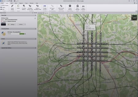
Secure telemetry and high-bandwidth data links transmit real-time spatial data from UAVs to ground control stations. These systems support continuous communication for mission updates, emergency control, and remote sensor management.
Geospatial solutions are implemented across multiple classes of unmanned systems:
Unmanned Ground Vehicles (UGVs): Map indoor or underground environments with SLAM and LiDAR.
| Method | Accuracy | Use Case | Real-Time Capability |
|---|---|---|---|
| RTK GNSS | ±2 cm | Surveying, precision agriculture | Yes |
| LiDAR | ±5–10 cm | Forestry, infrastructure, terrain mapping | Yes |
| Photogrammetry | ±20 cm | Urban planning, construction | Post-Processed |
| SLAM | ±10–30 cm | Indoor, GPS-denied zones | Yes |
| Thermal Imaging | Variable | Rescue, inspection | Yes |
| Hyperspectral Imaging | High spectral | Mineral analysis, vegetation health | Yes |
Compliance with international standards ensures interoperability, reliability, and data integrity:
Geospatial data collected by unmanned systems is typically integrated into geographic information systems (GIS) for spatial analysis, visualization, and modeling. Modern GIS platforms allow users to overlay aerial maps, terrain models, and sensor data for informed decision-making.GIS tasks powered by UAV-collected data include:
Modern unmanned systems often operate in networked environments where multiple platforms contribute to a unified operational picture. Geospatial technologies underpin this interoperability by providing a common spatial framework, standardized data formats, and shared visualization environments. Whether for multi-drone swarm operations or integration with manned control centers, geospatial data enables coordination, reduces response times, and enhances mission outcomes.

 Searching Companies & Products


 Subscribe to the Weekly eBrief
The latest engineering and technical developments straight to your inbox - join thousands of engineers who receive it.
Subscribe to the Weekly eBrief
The latest engineering and technical developments straight to your inbox - join thousands of engineers who receive it.