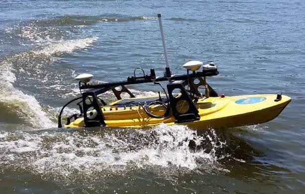
Showcase your capabilities
If you design, build or supply USV Survey Services, create a profile to showcase your capabilities and connect with visitors who have an active requirement for your solutions.




USV survey services use Unmanned Surface Vessels (USVs) to collect hydrographic, bathymetric, geophysical, environmental, and visual data across marine and inland-water environments. Survey USVs may carry multibeam or single-beam echosounders, side-scan sonar, sub-bottom profilers, magnetometers, ADCPs, GNSS/INS, LiDAR, cameras, and water-quality sensors.
This page features USV survey services for seabed mapping, offshore infrastructure assessment, coastal and port surveys, oceanographic research, and search and detection missions.
Read the Technology Overview
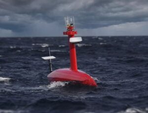
Cutting-Edge Acoustic Positioning & Subsea Imagery Solutions for Unmanned & Robotic Systems

GNSS Positioning Systems, 3D SLAM & Mobile Mapping, Unmanned Surface Vehicles

If you design, build or supply USV Survey Services, create a profile to showcase your capabilities and connect with visitors who have an active requirement for your solutions.

USV survey services use Unmanned Surface Vessels (USVs) to collect hydrographic, bathymetric, geophysical, environmental, and visual data across marine and inland-water environments. Equipped with survey sensors, positioning and motion-reference systems, autonomous navigation, and remote communications, these vessels can carry out repeatable, georeferenced data collection without a crew onboard.
USV survey operations are used for seabed mapping, offshore infrastructure assessment, coastal surveys, oceanographic research, search and detection, and other marine survey tasks. Depending on mission requirements, a survey USV may operate autonomously along pre-planned routes, under remote supervision, or as part of a coordinated mission involving crewed vessels, Autonomous Underwater Vehicles (AUVs), or Remotely Operated Vehicles (ROVs).
Hydrographic survey USVs collect measurements relating to water depth, seabed form, navigation hazards, and other features required for charting, marine engineering, dredging, coastal management, and port operations. By following tightly controlled survey lines while carrying acoustic sensors, positioning equipment, and motion-reference systems, USVs can collect data that is accurately corrected and georeferenced for subsequent processing.
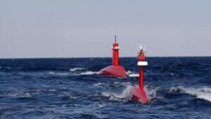
Hydrographic survey USV, DriX, from Exail.
Bathymetric survey USVs measure the depth and shape of the seabed using single-beam or multibeam echosounders, producing data that can be used to generate detailed representations of underwater terrain. These systems support surveys in coastal waters, rivers, reservoirs, harbors, and offshore areas, including locations that may be difficult or inefficient to access using larger crewed vessels.
Geophysical survey USVs use sensors such as side-scan sonar, sub-bottom profilers, and marine magnetometers to investigate seabed characteristics and shallow subsurface conditions. The resulting data can support site characterization, route assessment, offshore development, unexploded ordnance detection, and geohazard investigation across a range of marine environments.
USV seabed mapping combines acoustic sensing with positioning and motion data to produce georeferenced representations of seafloor topography and surface characteristics. Surveying USVs can also repeat predefined routes or areas, allowing changes in seabed morphology, sediment distribution, or infrastructure condition to be identified over time.
Oceanographic survey USVs can carry water-quality instruments, current profilers, meteorological sensors, and other scientific payloads to collect data across coastal and offshore environments. These systems can measure currents, waves, temperature, salinity, dissolved oxygen, turbidity, and other physical or environmental parameters while following repeatable autonomous survey patterns.
USV survey services can support inspection and mapping around offshore platforms, wind farms, bridges, ports, pipelines, subsea cables, and other marine infrastructure. Surface-based sensors provide broad-area coverage and situational data, while USVs can also operate alongside submerged platforms where closer inspection or underwater intervention is required.
Search and detection missions use sonar, magnetometers, cameras, and other sensors to locate wrecks, debris, obstructions, lost equipment, unexploded ordnance, and other underwater or surface objects. Autonomous route following allows systematic coverage of defined search areas, helping ensure that survey lines and sensor coverage remain consistent across the mission.
The payload fitted to a USV depends on the required measurements, survey environment, platform capacity, and desired data resolution. Survey measurements are typically combined with positioning, heading, timing, and vessel-motion information so that the resulting data can be accurately located, corrected, and integrated during processing.
Multiple payloads may be operated together when a mission requires synchronized acoustic, positioning, environmental, and visual datasets, allowing several complementary measurements to be collected during the same survey run.
USV survey technology continues to develop as autonomy, communications, onboard processing, and sensor integration improve, allowing increasingly complex survey tasks to be conducted with less continuous human intervention.
Together, these developments are expanding the role of USV survey services across hydrographic, bathymetric, geophysical, environmental, and oceanographic survey operations.


 Searching Companies & Products