Underwater survey services use Remotely Operated Vehicles (ROVs) and Autonomous Underwater Vehicles (AUVs) to collect geospatial, acoustic, visual, environmental, and structural data below the surface. These services typically use multibeam echosounders, side-scan sonar, sub-bottom profilers, cameras, laser systems, magnetometers, and oceanographic sensors for survey operations.
This page showcases ROV and AUV survey services for hydrographic and bathymetric survey, seabed mapping, pipeline and cable survey, environmental monitoring, and search operations.
If you design, build or supply ROV & AUV Survey Services, create a profile to showcase your capabilities and connect with visitors who have an active requirement for your solutions.
The Comprehensive Guide to ROV, AUV & UUV Survey Services
Overview by
William Mackenzie
Updated:
Introduction to ROV & AUV Survey Services
Underwater survey services use Remotely Operated Vehicles (ROVs) and Autonomous Underwater Vehicles (AUVs) to collect geospatial, acoustic, visual, environmental, and structural data below the surface, supporting underwater surveys in locations where direct access is difficult, hazardous, costly, or impractical.
ROV survey services are commonly used where real-time control and close examination are required, while AUV survey services are well suited to repeatable or wide-area autonomous data collection. USV survey services can complement these underwater approaches by collecting survey data from the surface, making them suitable for applications where operations can be conducted without deploying an underwater vehicle. Both approaches are used for subsea survey, marine survey, offshore asset survey, pipeline and cable work, seabed characterization, environmental assessment, and other underwater survey operations.
Key Types of AUV & ROV Survey Services
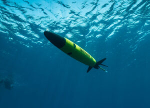
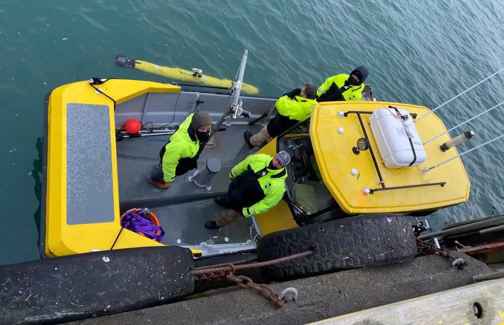
USV survey with ALSEAMAR SEAEXPLORER glider.
Hydrographic Survey
Hydrographic survey services use acoustic and positioning systems to measure water depth, seabed form, underwater hazards, and other features relevant to navigation, engineering, construction, and marine operations. ROVs and AUVs can extend this data collection into areas that are difficult to reach using surface vessels alone, particularly around structures, confined areas, or complex seabed terrain.
Bathymetric Survey
Bathymetric surveys map seafloor depth and topography using sensors such as multibeam echosounders, producing detailed representations of underwater terrain. AUV surveys are particularly effective for maintaining consistent altitude and line spacing across larger areas, while ROV surveys can provide detailed bathymetric coverage around structures and complex subsea features.
Geophysical Survey
Geophysical subsea survey services investigate the characteristics and shallow structure of the seabed using instruments such as sub-bottom profilers, side-scan sonar, and magnetometers. The resulting data can support route planning, offshore construction, site assessment, and the identification of buried or exposed objects that may affect marine operations.
Seabed Mapping
Seabed mapping combines acoustic, optical, positioning, and navigation data to characterize terrain, sediment features, objects, and other seafloor structures. Depending on the required resolution and sensor package, underwater surveys may generate bathymetric surfaces, sonar mosaics, imagery, or three-dimensional representations of the seabed.
Subsea Infrastructure Survey
ROV and AUV survey services can be used to assess offshore structures, foundations, moorings, subsea production equipment, and other installed assets, providing both positional and condition-related information. Survey data may document asset location, surrounding seabed conditions, visible damage, deformation, marine growth, scour, or other changes affecting the infrastructure.
Pipeline and Cable Survey
ROV pipeline survey and AUV pipeline survey operations collect data along subsea pipelines, power cables, and telecommunications routes to assess both the asset and its surrounding environment. An underwater pipeline survey may document position, burial, exposure, free spans, seabed interaction, and nearby objects, supporting installation, maintenance, and integrity-management activities.
Environmental and Habitat Survey
Environmental underwater surveys use cameras, sonar, and oceanographic sensors to document habitats, seabed conditions, water properties, and biological features across the survey area. AUVs can provide repeatable coverage across larger regions, while ROVs are better suited to detailed visual examination of specific habitats, features, or sampling locations.
Search and Detection Survey
Search and detection surveys are used to locate and investigate objects such as debris, wrecks, lost equipment, unexploded ordnance, and other seabed targets. Wide-area AUV surveys can first identify anomalies using sonar or magnetic sensing, after which an ROV may be deployed for closer examination where detailed confirmation is required.
Sensors and Payloads Used for ROV & AUV Surveys
ROVs and AUVs can carry different combinations of survey sensors and supporting systems depending on the survey objective, required resolution, water depth, and operating environment.
Survey Payload
Primary Measurement
Typical Output
Suitable Applications
Multibeam Echosounders
Water depth and seabed geometry
Bathymetric grids, point clouds, and terrain models
Seabed mapping, search, and pipeline or cable survey
Sub-Bottom Profilers
Shallow subsurface structure
Sediment profiles and buried-feature data
Geophysical survey, route assessment, and buried-object detection
Forward-Looking Sonar
Objects and terrain ahead of the vehicle
Real-time acoustic imagery
Navigation, inspection, and obstacle detection
Acoustic Doppler Current Profilers
Water velocity
Current profiles
Environmental surveys and oceanographic data collection
Magnetometers
Magnetic anomalies
Magnetic field and target data
Ferrous object detection, selected cable surveys, and geophysical surveys
Optical Cameras and Video Systems
Visual condition and appearance
Images and video
Hull survey, close inspection, and habitat assessment
Laser Scanners and Laser Profilers
Shape and dimensions
Profiles, point clouds, and 3D models
Structural survey, dimensional measurement, and asset inspection
Environmental and Oceanographic Sensors
Water properties
Temperature, conductivity, depth, turbidity, and other datasets
Marine surveys and environmental monitoring
Positioning and Navigation Systems
Vehicle position, depth, motion, and trajectory
Georeferenced vehicle tracks and positioning data
Survey georeferencing, mapping, route survey, and repeat surveys
Payload selection determines both the type of information collected and the level of detail available during processing. Sensor measurements are typically time-synchronized with vehicle positioning and navigation data so that observations can be accurately located and converted into georeferenced maps, models, imagery, and other survey deliverables.
AUV & ROV Survey Deliverables
AUV and ROV surveys can produce a range of processed datasets and reporting outputs for engineering, scientific, environmental, and operational use, with the final products depending on the sensors, positioning accuracy, survey design, and processing workflow.
Bathymetric maps: Georeferenced depth and seafloor elevation products derived from acoustic survey data.
Sonar mosaics: Continuous representations of seabed features generated from overlapping sonar coverage.
Sub-bottom profiles: Cross-sectional data showing shallow geological layers and buried features.
Pipeline and cable route data: Position, condition, burial, exposure, and surrounding seabed information.
Georeferenced imagery: Still images and video linked to underwater position and survey coordinates.
3D models and point clouds: Spatial representations of structures, terrain, or assets generated from optical, acoustic, or laser data.
Target lists and anomaly reports: Coordinates and classifications for detected objects or features requiring further investigation.
Geographic Information System (GIS)-ready datasets: Processed survey information prepared for integration into geographic information systems.
ROV vs AUV Survey Services
ROVs and AUVs support many of the same marine survey tasks, but their operating methods make them better suited to different mission profiles, particularly in terms of control, coverage, endurance, communications, and proximity to subsea infrastructure.
ROV Survey Operations
AUV Survey Operations
Direct operator control through a tether
Autonomous operation using programmed mission plans
Well suited to wide-area mapping and repeatable survey lines
Continuous real-time video and sensor feedback
Survey data are often stored primarily onboard during the mission
Tether can provide power and high-bandwidth communications
Endurance depends primarily on onboard energy capacity
Effective around infrastructure where deliberate maneuvering is required
Effective for systematic coverage over extended routes
Launch, recovery, and tether management may require vessel support
Launch and recovery requirements vary with vehicle size and mission
Tether interaction can affect operations in confined or high-current areas
Navigation accuracy and autonomous obstacle avoidance are important in complex environments
For some projects, the two approaches are complementary rather than interchangeable, with an AUV first conducting a broad subsea survey before an ROV is deployed for detailed examination of selected targets or areas of interest.
Emerging Developments in ROV & AUV Survey Services
ROV and AUV survey services are increasingly incorporating higher levels of autonomy, onboard processing, and advanced mapping technologies to improve survey efficiency, repeatability, and the amount of useful information that can be collected during each mission.
Greater vehicle autonomy: Increased onboard decision-making can support adaptive navigation, survey execution, and target investigation, allowing vehicles to respond more effectively to changing mission conditions.
Artificial Intelligence (AI)-assisted data processing: Automated workflows can help detect, classify, and prioritize features within large sonar and optical datasets, reducing the amount of routine manual review required after a survey.
Resident subsea vehicles:Docking and charging systems can support repeated underwater surveys without requiring the vehicle to be recovered to the surface after every mission.
Improved 3D mapping: Higher-resolution sonar, photogrammetry, and laser systems are increasing the level of detail available for seabed, structure, pipeline, hull survey, and offshore asset survey applications.
Together, these developments are expanding the scale, repeatability, and level of detail achievable across modern underwater survey and subsea survey services.
The service centre will support Teledyne Gavia's AUVs, known for a low logistics modular design and ability to be rapidly transported and maintained for good operational reliability
Blue Essence from Fugro is believed to be the first USV to receive approval from the Maritime and Coastguard Agency to operate fully remotely with an electric ROV and undertake surveys in UK waters
Teledyne Marine has confirmed that maritime data collection and management company Terradepth has acquired three Teledyne Marine Gavia autonomous underwater...
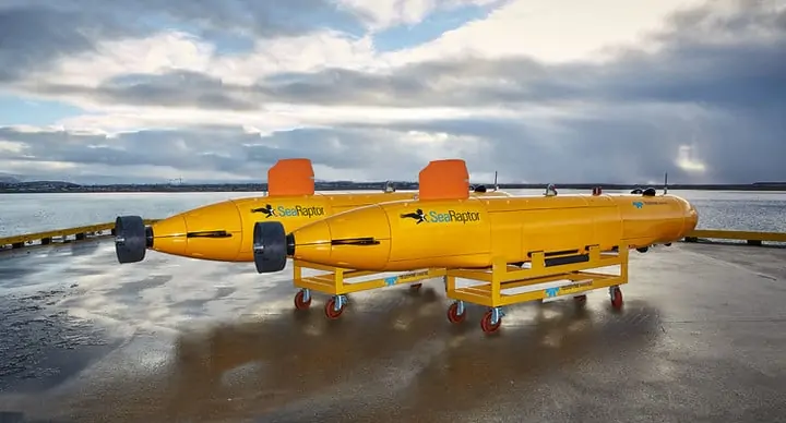
Teledyne Marine has provided two SeaRaptor 6000-metre rated AUVs (autonomous underwater vehicles) to subsea offshore services company Argeo of Norway....
Kraken Robotics has announced that its wholly-owned subsidiary, Kraken Robotic Systems Inc., has entered a strategic partnership with Avitas Systems,...
The latest unmanned systems news, straight to your inbox.
Get our weekly roundup of technology developments, new products and industry news.
THANK YOU FOR SIGNING UP
Thanks for joining us. Check your inbox.
We've sent you an email. Click the confirmation link to complete your subscription to the weekly eBrief. In the meantime, explore the latest news, suppliers and technologies on UST.
Advancing Unmanned Systems Through Strategic Collaboration
UST works with major OEMs to foster collaboration and increase engagement with SMEs, to accelerate innovation and drive unmanned systems capabilities forward.