If you design, build or supply Navigation & Control Software, create a profile to showcase your capabilities and connect with visitors who have an active requirement for your solutions.
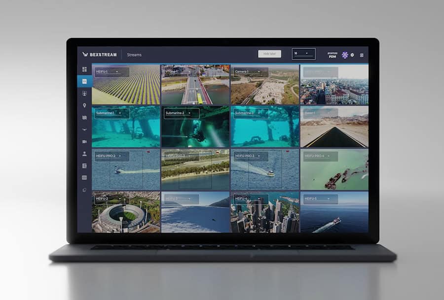
beXStream Remote Control & Management Software by Beyond Vision
Drone control software allows UAS (unmanned aerial system) operators and pilots to plan and execute missions with both remote-controlled and autonomous aircraft. Typically installed on either a dedicated ground control station (GCS) or a laptop, tablet or mobile phone, the software will use a wireless datalink to communicate with the drone’s autopilot or provide control of the aircraft and its sensor payloads.
UAV control software may integrate payload actions into flight planning, with the ability to take pictures and sensor readings or drop a cargo payload at a predetermined waypoint. Enhanced functionality for photogrammetry missions may also be built into the drone control software, including the ability to calculate an optimal flight path based on camera and survey settings such as GSD (ground sample distance), altitude and overlap.
Drone Navigation Software
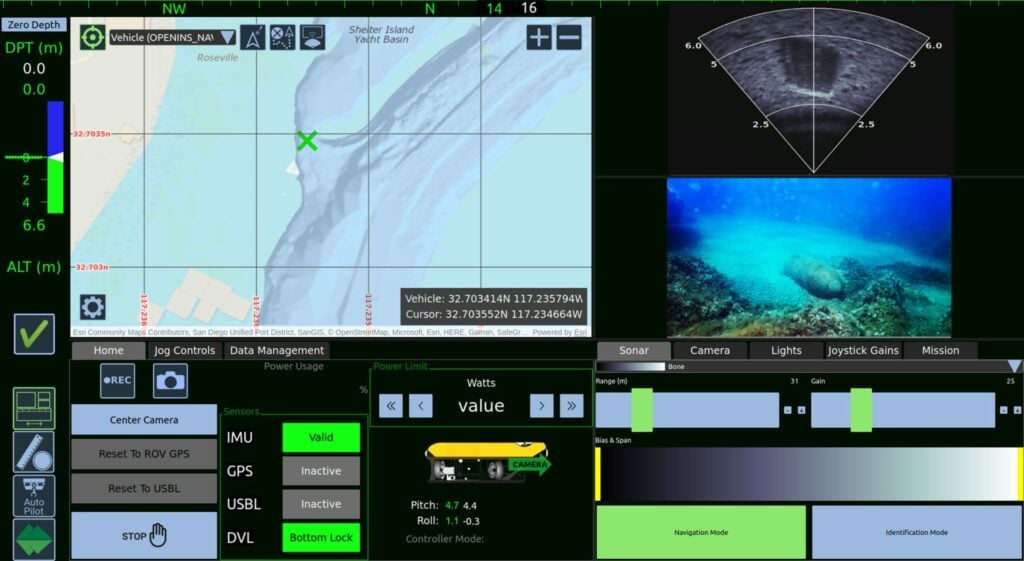
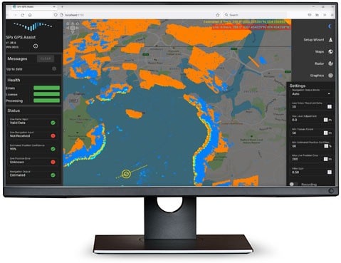
Drone navigation software interfaces will be centred around a digital map that shows the drone’s real-time position in flight, and may also feature overlays of the aircraft’s telemetry data as well as feeds from any sensors. 3D map views may also be available that allow operators to take into account buildings, trees and other obstacles. This functionality is useful for obstacle avoidance as well as for drone missions that involve vertical scanning and imaging.
Drone Navigation Software Applications
GPS Assist Navigation Software by Cambridge Pixel
UAV navigation software may also allow users to import more detailed map overlays, as well as high-precision DEM (digital elevation model) data. This allows users to account for constantly-changing terrain that may not always be up-to-date on standard maps, and provides more precise terrain following and collision avoidance.
Drone navigation software provides functionality for defining the route taken by a drone during its mission. This will commonly involve selecting waypoints on the map for the drone to follow, or by defining the boundaries of an area that the drone is to survey. The drone may also be programmed to follow certain scan patterns such as corridor mapping, or to operate in different flight modes such as hovering in place or returning to a predefined home location.
Autonomous Navigation Software
Autonomous navigation software may provide automatic geotagging of collected images, synchronising the image timestamps with the autopilot’s GPS data. Many autonomous navigation software platforms will be compatible with RTK GNSS, providing enhanced accuracy for drone mapping and surveying.
Additional software features that are useful for drone pilots include information about no-fly zones, the ability to request flight authorization under LAANC (Low Altitude Authorization and Notification Capability) or similar schemes, live weather updates, and the ability to record and export log files. Autonomous navigation software may also be part of a larger integrated suite of UAV software that includes fleet management, analytics and other features.
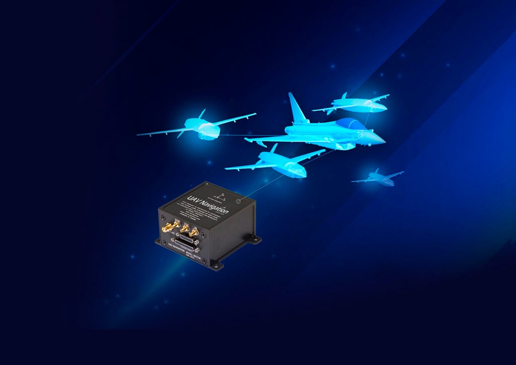
UAV Navigation-Grupo Oesía outlines how its Guidance, Navigation, and Control systems enable UAS to deliver persistent and safe Intelligence, Surveillance, and Reconnaissance operations, supporting autonomous flight and continuous monitoring in complex environments
UAV Navigation-Grupo Oesía explores advanced flight control systems that enable UAS to intercept aerial threats through precise navigation, camera-based guidance, and coordinated swarm operations
Advanced Navigation successfully demonstrates its Boreas D90 inertial navigation system at a U.S. Army exercise, achieving 7.5 metres of drift over 65 kilometres in satellite-denied conditions using fused inertial and laser sensors
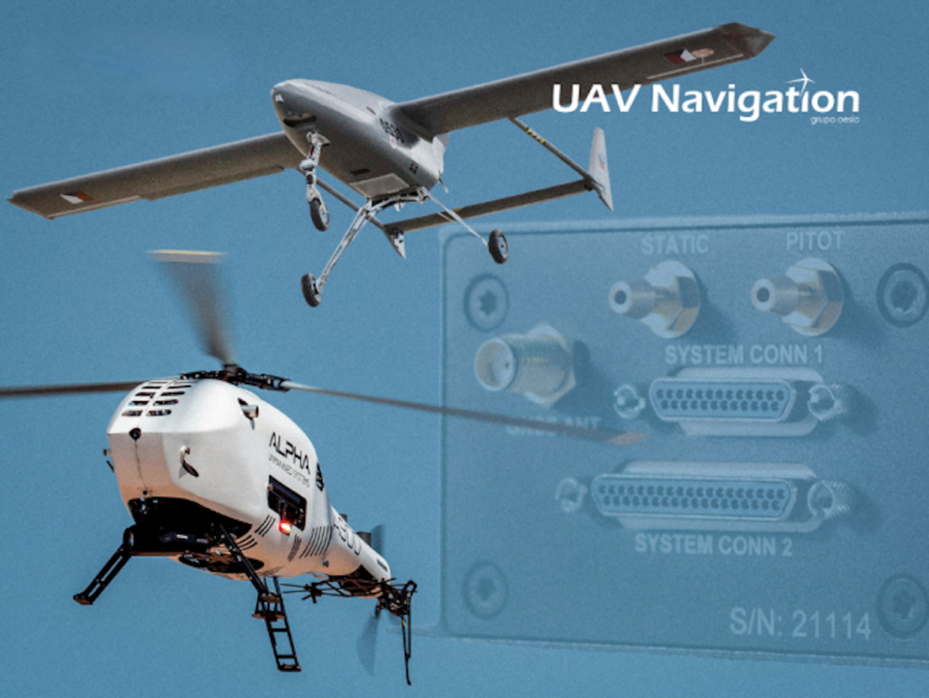
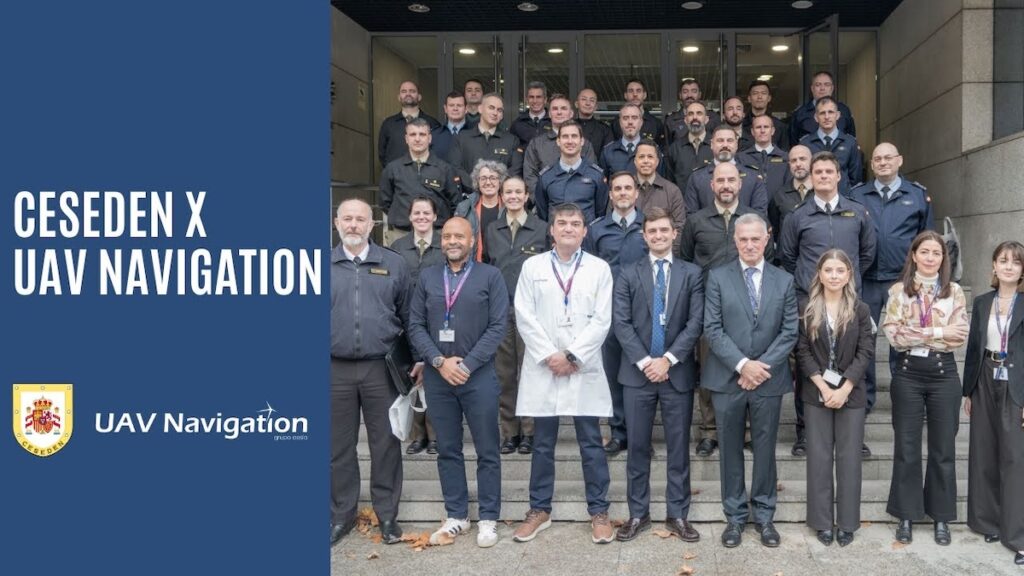
Senior military officers from the Spanish Armed Forces and international allies visited UAV Navigation to examine critical guidance systems for complex operational environments
UAV Navigation-Grupo Oesía combines resilient guidance, navigation and control system design with in-house cybersecurity expertise to ensure autonomous mission continuity for unmanned systems in contested, GNSS-degraded environments
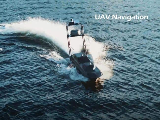
UAV Navigation-Grupo Oesía’s autopilot integration enables NEWT21’s FOG USV to conduct autonomous navigation, collision-avoidance, and fault-tolerant operations during demanding maritime and defense missions
SteerAI combines a hardware kit, software stack, and fleet management tools to enable precise autonomous ground operations, using technology developed by experts at the Technology Innovation Institute
Robosys has entered into an agreement to integrate its advanced maritime autonomy software into the Australian Maritime College’s WAMV-16 USV for remote operator courses
Oct 28, 2025
Advancing Unmanned Systems Through Strategic Collaboration
UST works with major OEMs to foster collaboration and increase engagement with SMEs, to accelerate innovation and drive unmanned systems capabilities forward.