verifiedThis business has been claimed by Black Swift Technologies and verified by UST.Verified companies work with us to ensure we display the most up-to-date and comprehensive product information, articles and other material to help you choose the right solution for your requirements.
Autonomous UAS, Research & Inspection UAVs for Industrial Inspection, Survey & Mapping United States of America
Autonomous UAS, Research & Inspection UAVs for Industrial Inspection, Survey & Mapping
Black Swift Technologies is a leading developer of specialized state-of-the-art unmanned aerial systems (UAS) for flying scientific payloads in the most demanding of atmospheric environments and weather conditions.
Our purpose-built research UAVs are utilised around the world for a variety of missions, including the monitoring and assessing of wild fires, volcanoes, tornadoes, and hurricanes.
Our autonomous UAS feature onboard augmented intelligent learning capabilities that provide early warning and diagnostics to predict system failures before they happen. This advanced technology allows for active navigation around obstacles and rugged terrain, making our systems ideal for safe and efficient beyond-visual-line-of-sight (BVLOS) operations.
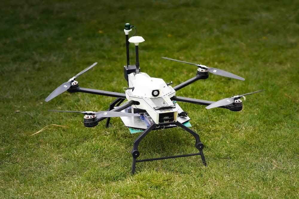
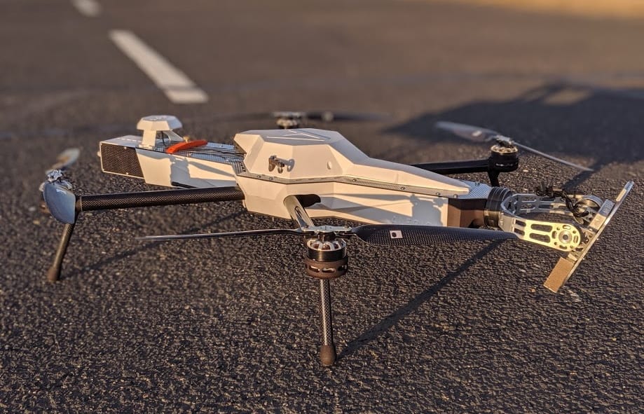
Black Swift E2™ Inspection UAS
Autonomous quadcopter aerial inspection UAV
The Black Swift E2 is an advanced quadcopter inspection UAV that has been specifically engineered for high-accuracy, up-close structural and industrial inspections. Capable of fully autonomous operation, the E2 is able to leverage powerful computer vision and machine learning technologies to provide precise, reliable and safe navigation in complex environments while delivering real-time actionable data.
The Black Swift E2 carries its payload at the nose of the aircraft instead of the underside, allowing operators to obtain full sensor field-of-view even when looking vertically.
Both the payload and UAV battery are easily field-swappable, and the battery position can also be adjusted depending on the weight the aircraft is carrying. A typical loadout for the E2 includes an RGB camera, laser positioning and guidance system and radio modem, but can be customized to individual mission requirements to include LiDAR, thermal and multi-spectral cameras, trace gas sensors, radiometers and more.
The highly mobile E2 can be easily folded down and fits into a custom carrying case for convenient transport and protection from potential damage during transit.
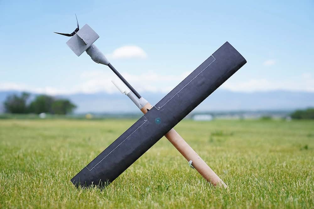
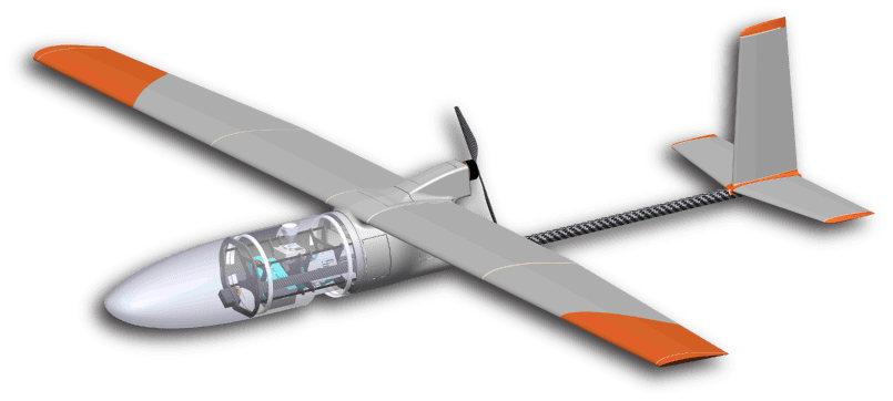
Scientific research UAV for demanding data collection applications
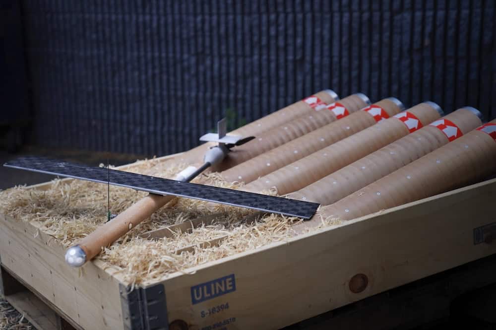
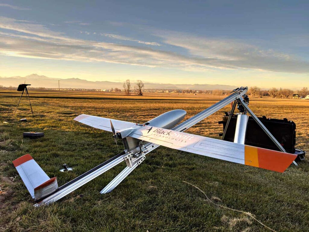
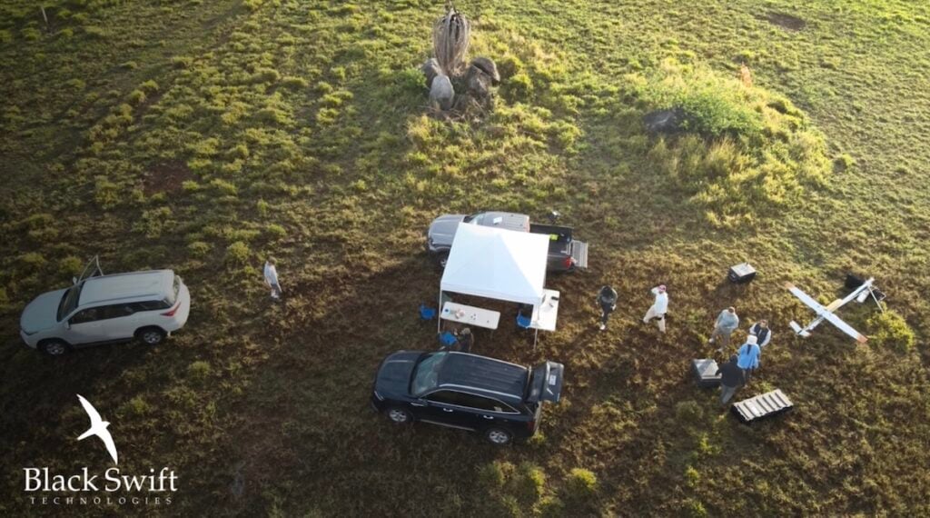
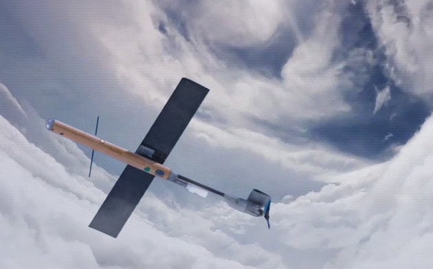
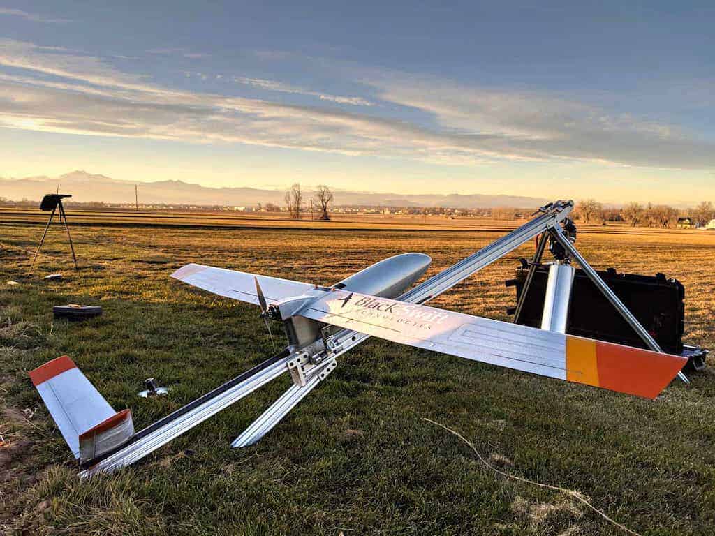
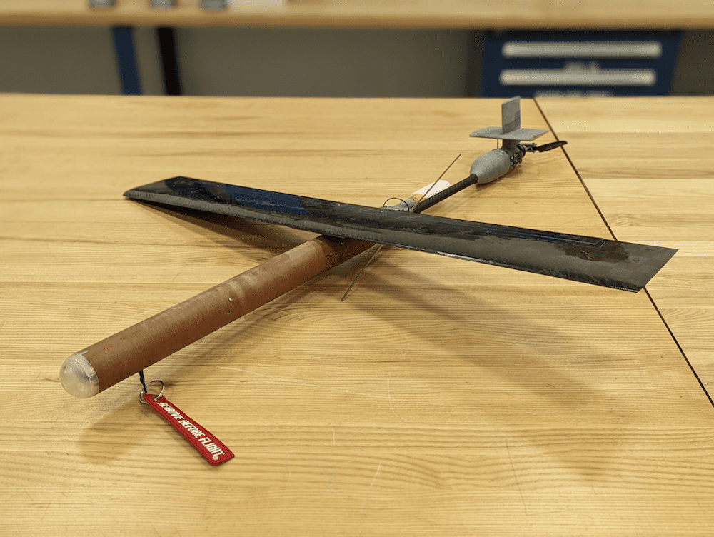
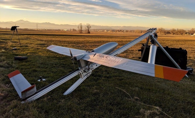
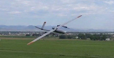
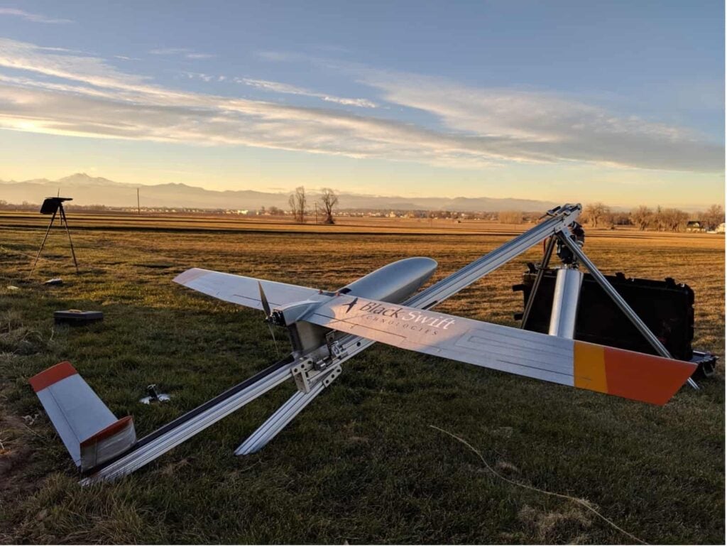
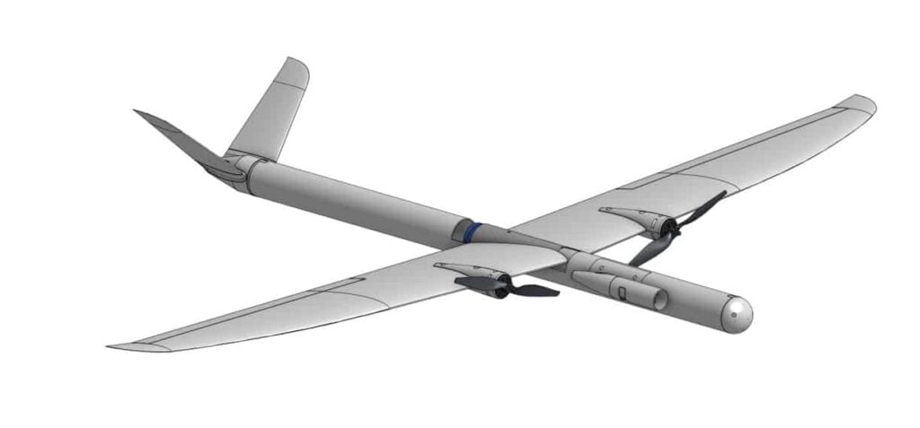
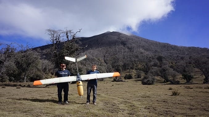
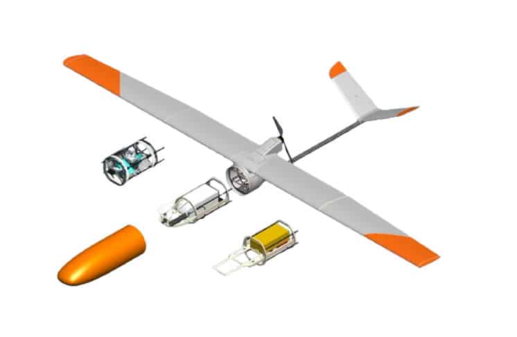
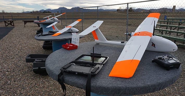
The Black Swift S2 is an advanced fixed-wing research UAV that has been custom-built for scientific research in demanding atmospheric conditions such as high altitudes, high levels of corrosive particulates, and strong turbulence. With a rugged airframe, high flight ceiling and extended endurance and range, the S2 is capable of autonomous launch, flight, and landing even in difficult mountainous regions.
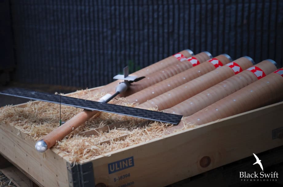
The S2 features a convenient field-swappable payload system that encloses the sensor suite within the nose cone in front of the propeller, ensuring clean and uncontaminated measurements of the atmosphere. With a common power, data, and mechanical interface, different payloads can be rapidly swapped in the field without any specialized tools. Payloads can thus be field-calibrated separately from the aircraft, and different sensor suites can be rapidly deployed in successive missions using the same UAV extending the versatility of the aircraft.
Black Swift Technologies has incorporated a variety of modular payload sensors for specialized applications onto the S2™, including:
Soil Moisture Mapping (L-band radiometer)
Wildfire Monitoring (CO2, CO, aerosol, RH, p and T trace gas sensors, multispectral camera)
Multi-Angular Remote Sensing (531nm band monitor, Tetracam Mini-Multiple Camera Array Imaging System, multispectral camera)
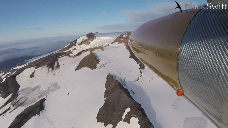
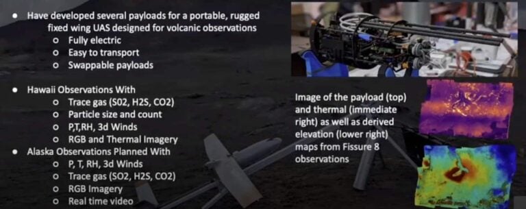
Volcano Monitoring (CO2 trace gas sensor, nephelometer, temperature, pressure, humidity and wind sensors)
Specifications
Wingspan
3.0 m (10.0 ft)
Aircraft Weight
5.2 kg (11.5 lbs) nominal
6.6 kg (14.5 lbs) max
Max Payload Weight
1.4 kg (3 lbs) hand launch
2.3 kg (5 lb) rail launch
Powering all our autonomous UAVs, the SwiftCore™ Flight Management System (FMS) delivers sophisticated real-time control, communication, and command. An intuitive interface for flight monitoring and mapping is provided via an Android tablet with our SwiftTab™ software. With easy gesture-based controls, SwiftCore™ FMS is designed for users to deploy their UAS in minutes and begin collecting data for immediate analysis and decision making.
Advanced smart control systems and application-specific sensor integrations provide industry-leading sensor-based control of the UAS, minimizing operator workload while improving the quality of the observed data by autonomously modifying the flight path based on sensor inputs.
SwiftCore™ has been approved and used for major scientific and research missions by NASA, NOAA and a growing list of commercial users. The fully customizable solution can be integrated into any UAS platform and customized to meet specific application requirements.
Our autonomous UAS solutions, featuring easily interchangeable payloads, are ideal for measuring selected gases and atmospheric parameters such as temperature, pressure, humidity, and 3D winds as well as more advanced measurements such as particle sizing and trace gases. These abilities add an invaluable contribution to the calibration and validation of data collected from ground and satellite-based methods.
The Black Swift S2 has been selected by the National Oceanic and Atmospheric Administration (NOAA) as its official sUAS Observation System (sUASOS) for wildfire measurements. The inspection UAV is fitted with specialist sensors for capturing and measuring a variety of gases, including CO2, CO, aerosol, RH, p, and T found in the wildfire plumes. The S2 also provides multispectral high-resolution maps of wildfires.
Utilising the Black Swift S2 UAS with a passive microwave radiometer for soil moisture mapping provides a level of spatial and temporal resolution that has been previously unobtainable through traditional satellite-based remote sensing techniques. This allows specialists such as agronomists, crop consultants and farmers to diagnose problems and better understand the dynamics of soil drainage and moisture retention at typical root depths.
Our fully-integrated precision mapping and surveying solutions save time and costs and provide enhanced accuracy compared to traditional methods. Black Swift’s SwiftCore Flight Management System has been proven in a recent study to be the most accurate and precise FMS on the market today, making it ideal for gathering accurate data for precision photogrammetry.
Our autonomous UAV can provide a host of benefits for project managers, mine engineers and other professionals working in labour-intensive industries. Applications include real-time data collection, stockpile monitoring, equipment tracking and site surveying, all while reducing risk, maximising safety and improving efficiency.
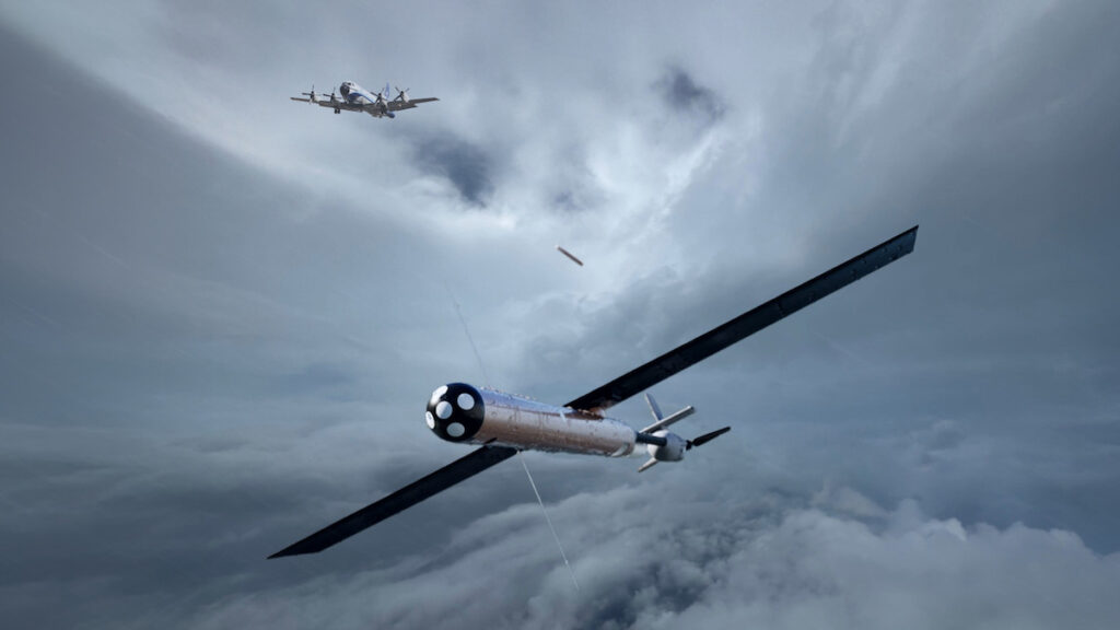
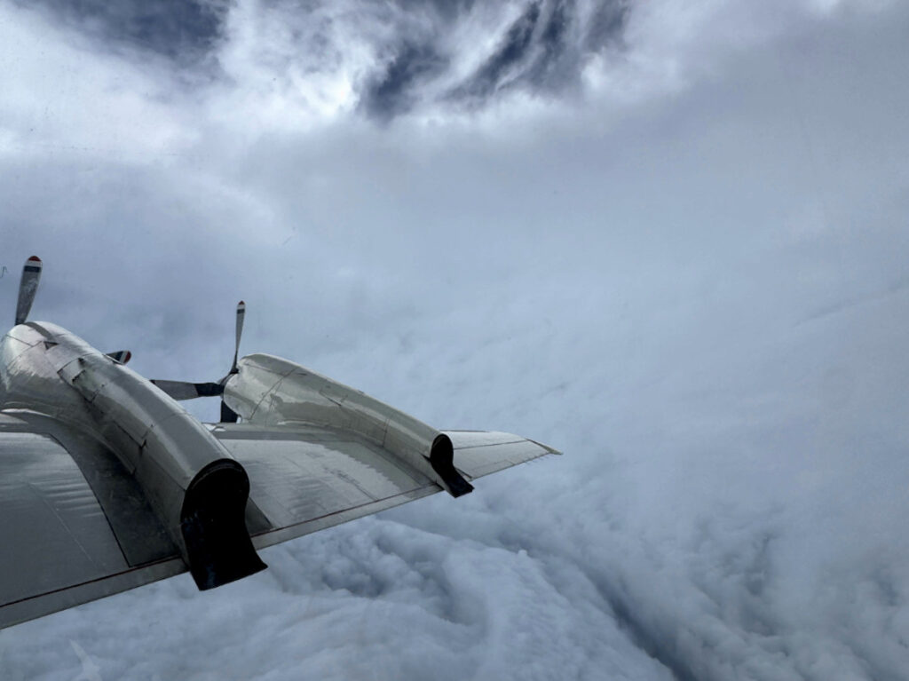
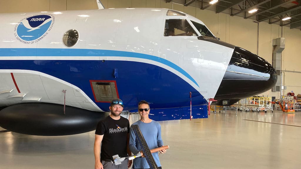
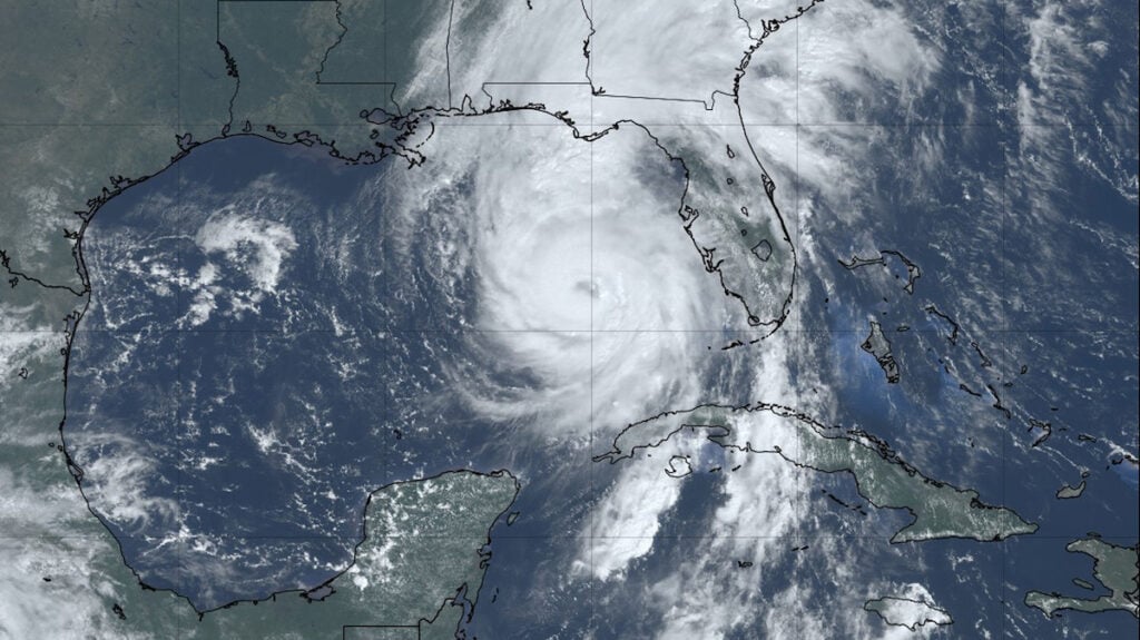
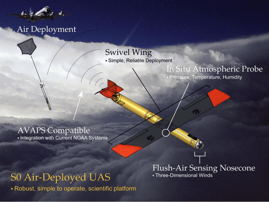
Black Swift Technologies’ S0 unmanned aircraft system has contributed data to NOAA’s Hurricane Analysis and Forecast System following evaluation of the platform’s storm data collection capabilities
Black Swift Technologies and NOAA have demonstrated simultaneous multi-UAS hurricane sensing launched from a crewed aircraft, enabling persistent, low-altitude atmospheric data collection to improve tropical cyclone forecasting
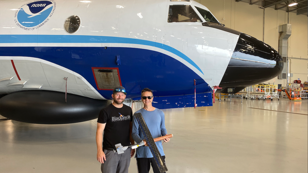
Black Swift Technologies highlights its 2025 UAS operations, detailing the S0 flights into Hurricane Melissa, Project CRATER S2 missions in Costa Rica collecting volcanic and ecological data, and hands-on training provided to research teams worldwide
Black Swift Technologies discusses the CRATER mission at Poás, using robust sensor platforms, high-resolution DEMs, and the SwiftCore autopilot to maintain reliable data collection and control during multi-aircraft UAS flights in a terrain-occluded volcanic crater
Black Swift Technologies wins NASA SBIR Phase I contract to advance SwiftCore, a modular, AI-ready flight management system for secure, autonomous UAS operations
Black Swift Technology has finished the CRATER mission, with its Black Swift S2 UAS crucial to exploring volcanic gas emissions and the effect on ecosystems
Black Swift Technologies has secured the Small UAS of the Year – Commercial Applications award at the inaugural Innovation Vanguard Awards during XPONENTIAL 2025, recognising the company’s pioneering unmanned aircraft systems
Explore Black Swift Technologies’ SØ UAS, which provides cost-effective, autonomous storm data collection, advancing tropical cyclone research and improving forecasting in hazardous environments
AOML partnered with Black Swift Technologies, among other companies, to set new records in tropical cyclone research that enhances hurricane forecasting and understanding
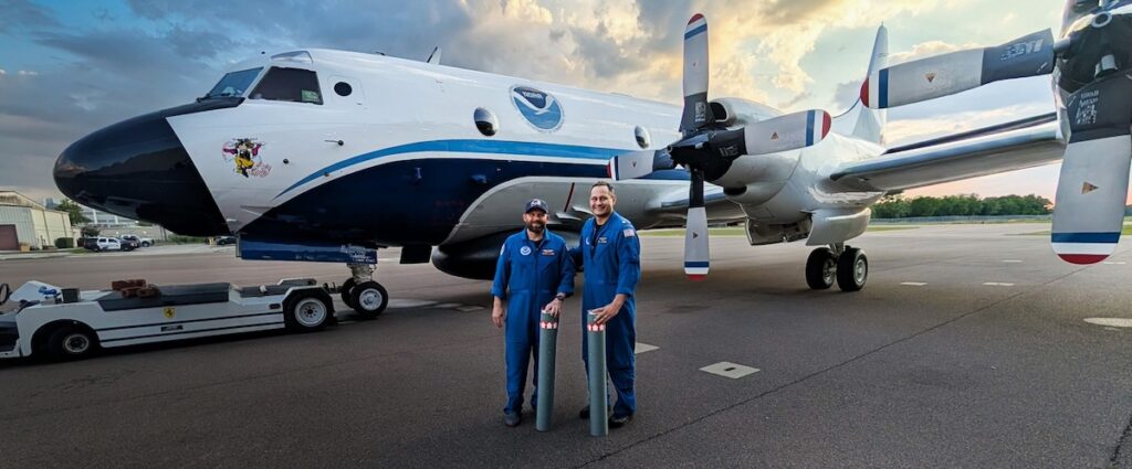
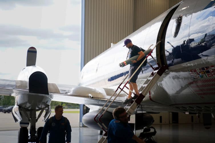
Researchers from NOAA deployed Black Swift S0 drones during Hurricane Helene to gather key atmospheric data, enhancing the understanding of the storm's structure and aiding forecasting efforts
NOAA and Black Swift Technologies successfully deployed four Black Swift S0 drones into the heart of Hurricane Ernesto, setting new records in hurricane data collection and enhancing forecast accuracy
Innovation leaders Black Swift Technologies sit down with UST to discuss the latest development of unmanned systems for cutting-edge scientific applications
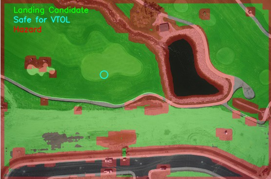
Black Swift Technologies and Orbital Micro Systems will use UAVs and radiometer soil moisture sensing solutions to scan soil moisture and integrity of potential landing strips
The company was selected from a pool of accomplished applicants as one of five winners for the Humanitarian and Public Safety Awards during AUVSI XPONENTIAL 2022 in Orlando
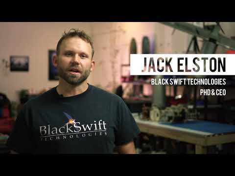
Jack Elston, CEO of Black Swift Technologies discusses the challenges, successes and remarkable impact BST unmanned aerial systems are having on scientific and academic research around the world.
Black Swift Technologies (BST) has released the following article detailing its proposed artificial intelligence-based solution for detecting anomalies in unmanned...
Black Swift Technologies, a leading developer of specialized state-of-the-art unmanned aerial systems (UAS) for flying scientific payloads, has partnered with...
Black Swift Technologies is a leading developer of specialized state-of-the-art unmanned aerial systems (UAS) for flying scientific payloads in the most demanding of atmospheric environments and weather conditions. Our purpose-built research UAVs are utilised around the world for a variety of missions, including the monitoring and assessing of wild fires, volcanoes, tornadoes, and hurricanes. Our autonomous UAS feature onboard augmented intelligent learning capabilities that provide early warning and diagnostics to
Advancing Unmanned Systems Through Strategic Collaboration
UST works with major OEMs to foster collaboration and increase engagement with SMEs, to accelerate innovation and drive unmanned systems capabilities forward.