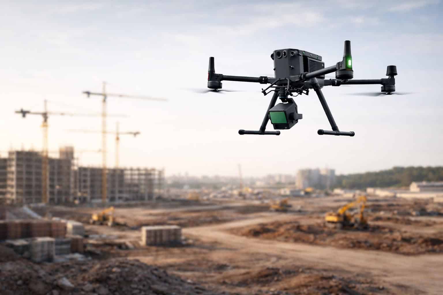
Drone inspection services utilize Unmanned Aerial Vehicles (UAVs) to deliver aerial imaging, surveys, and asset assessments across industrial environments. Deployed for utilities, construction, energy, agriculture, and transport infrastructure, these aerial inspection services capture high-resolution visual, thermal, and LiDAR data to support maintenance, compliance, and risk management.
This page highlights leading drone inspection companies providing power line and pipeline assessment, wind turbine and solar farm monitoring, construction progress tracking, and bridge surveys.
If you design, build or supply Drone Inspection Services and Aerial Imaging, create a profile to showcase your capabilities and connect with visitors who have an active requirement for your solutions.
Drone services for aerial data collection & inspection operations
Drone services for aerial data collection & inspection operations
... comprehensive droneservices for commercial and industrial projects requiring aerialimaging,... ...space delivers drone-based solutions for construction and engineering, defense, infrastructure,...
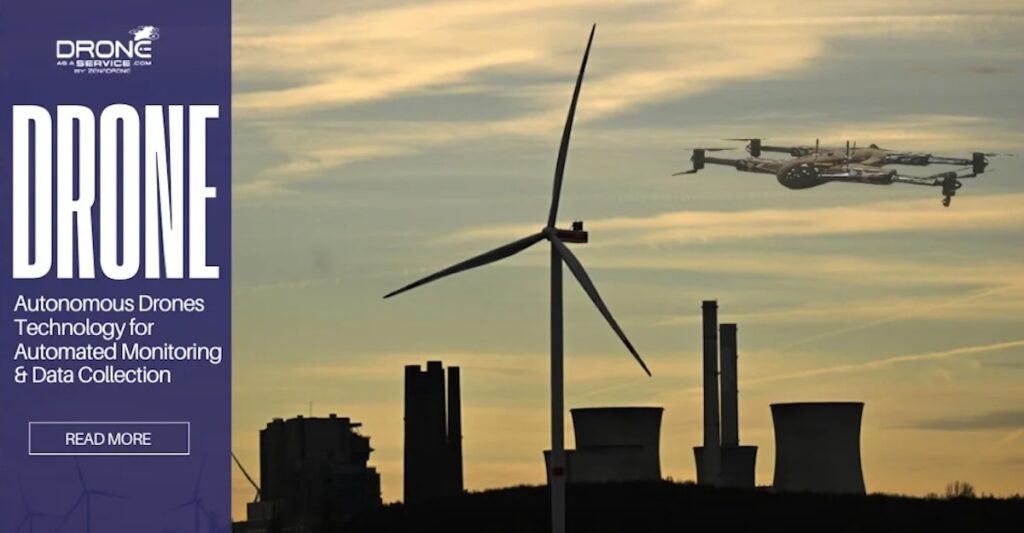
AI-enabled aerial intelligence service for connected urban and regional operations
AI-enabled aerial intelligence service for connected urban and regional operations
...le Drones as a Service (DaaS) platform tailored for smart-city and regional networks. The AI-enabled... ...d right-of-way inspection; flood and storm assessment; traffic monitoring....
Drone inspection services leverage Unmanned Aerial Vehicles (UAVs) for aerial imaging and surveys across a broad range of industries. By utilizing drones equipped with high-resolution cameras, sensors, and software, these services provide valuable insights that support maintenance, compliance, and risk management efforts.
The precision and versatility of drone technology makes it an ideal solution for any industry where visual data and situational awareness are crucial. Providing drones as a service, UAV inspection companies enhance safety, improve operational efficiency, and deliver high-precision data for projects in sectors like construction, energy, agriculture, and infrastructure.
Key Advantages of Drone Inspection Services
Enhanced Safety
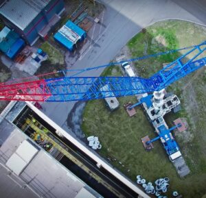
Infrastructure Drone Inspection Services by Drohnen Expertise Solutions GmbH
UAV inspection services offer an unmatched level of safety by eliminating the need for personnel to access potentially hazardous areas. Inspection drones can operate in challenging environments such as high-voltage power lines, offshore oil rigs, wind turbine blades, and skyscraper exteriors. By reducing human exposure to high-risk zones, these drones significantly lower the likelihood of accidents and incidents, promoting safer working conditions.
Operational Efficiency
Drone inspection technology enables rapid deployment and swift data acquisition, streamlining the inspection process. Traditional inspections often involve scaffolding, cranes, or rope access, which require substantial setup and execution time.
In contrast, drones can be deployed quickly, providing real-time aerial views and precise measurements in a fraction of the time. This reduction in inspection duration minimizes operational disruptions and allows industries to conduct more frequent assessments, ensuring optimal performance and early detection of potential issues.
High-Quality Data Collection
Equipped with advanced imaging technologies, drones capture high-resolution photographs, 4K video, and even infrared and LiDAR data, offering a wealth of information in a single flight. These aerial inspections provide detailed visual data that can be analyzed to assess wear and tear, detect faults, or monitor changes over time. Inspection data from drones supports accurate decision-making, enhancing asset management and maintenance planning.
Applications of Aerial Inspection Services Across Industries
Aerial Utility Inspection
Utility companies increasingly rely on drones for inspecting power lines, transmission towers, and substations. Traditional utility inspections are resource-intensive and require specialized equipment and personnel, often resulting in service interruptions.
Aerial utility inspection services using drones enable swift and detailed assessment without disrupting service, capturing images and thermal data to identify signs of corrosion, overheating, or structural damage.
These drones provide utility companies with valuable information for maintaining operational continuity, managing vegetation encroachment, and identifying wear or damage that could result in outages or equipment failure.
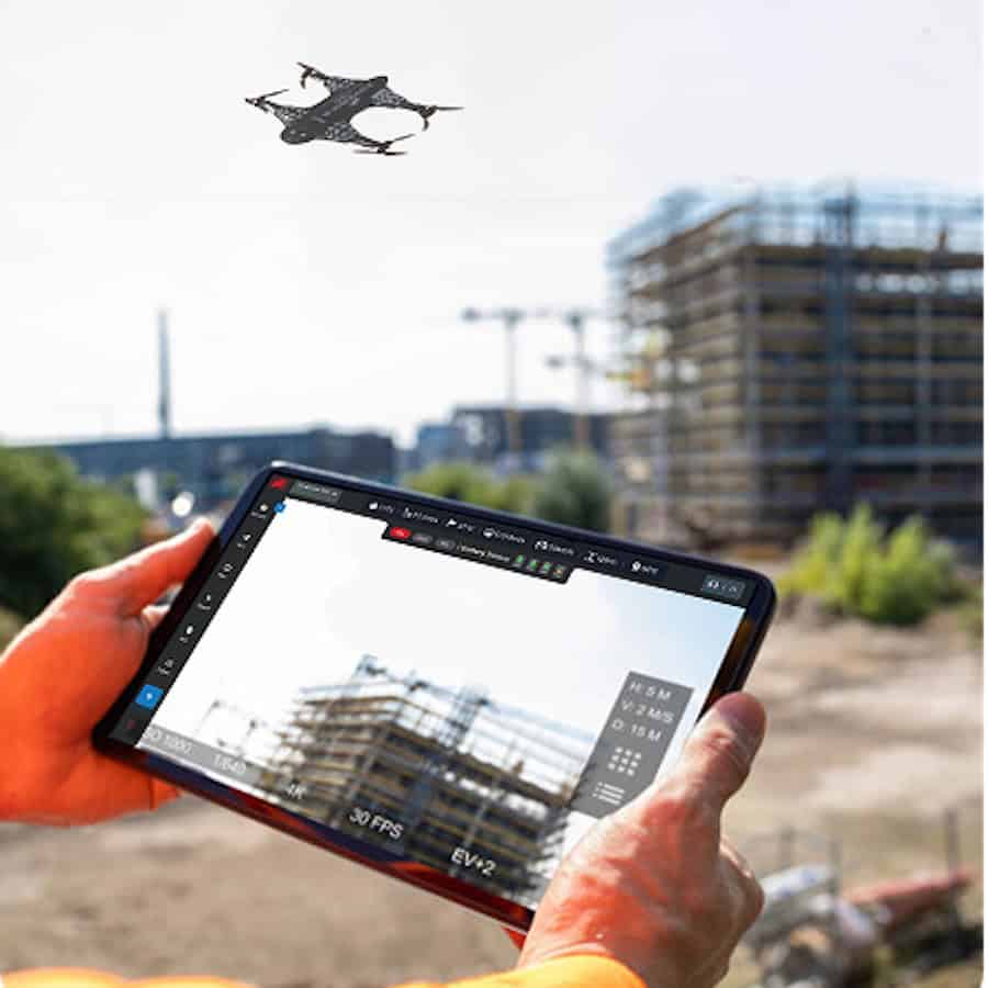
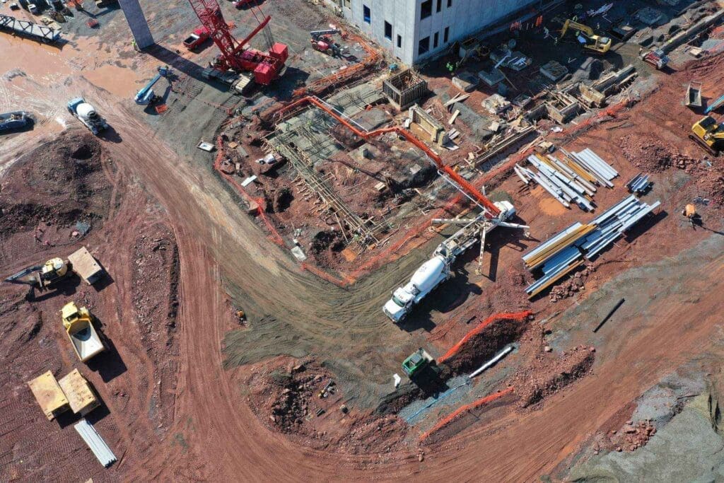
Construction Site Surveys and Inspections
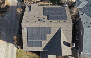
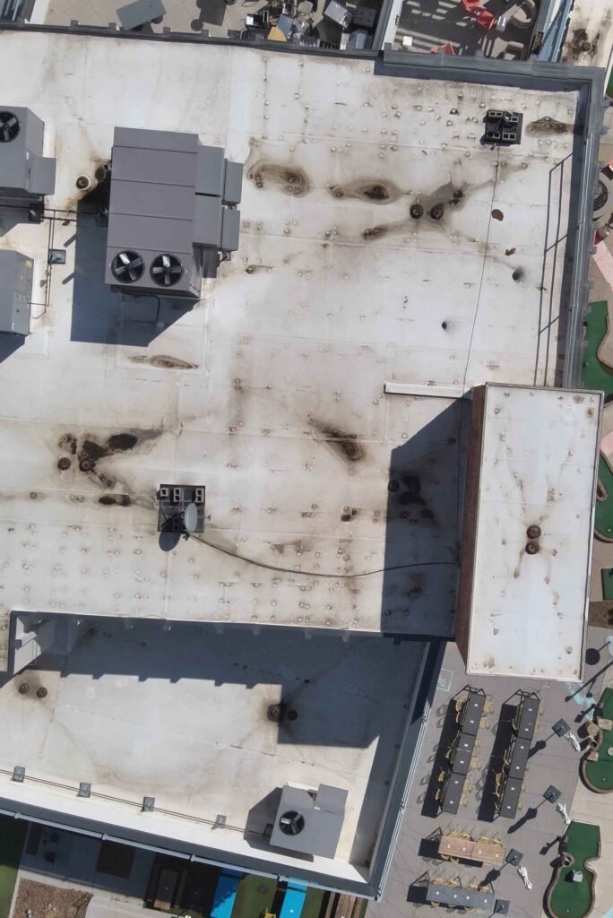
Drone Aerial Imaging Services for Property & Roof Inspection Blue Nose Aerial Imaging
Drone inspection services are transforming construction site management by providing regular aerial surveys that monitor progress and assess safety compliance. Survey drones for construction capture aerial images and 3D maps of construction sites, allowing project managers to track developments in real time and identify potential hazards or bottlenecks. Drones can easily access tight or high-risk areas such as rooftops and scaffolding, capturing details that ground-based inspections might miss.
Additionally, drone-based aerial surveys streamline the process of creating as-built models, which provide a visual reference of construction phases and can be used for quality assurance and regulatory compliance. The efficiency and precision of such industrial drone inspection in construction contribute to improved project timelines and better budget management.
Wind Turbine and Renewable Energy Inspections
Renewable energy sectors benefit significantly from UAV inspection services, particularly for wind turbines and solar farms. A drone for inspection can navigate the height and reach required to inspect turbine blades, offering close-up views of any erosion, cracking, or structural issues. This drone-based approach eliminates the need for climbing personnel or costly lift equipment, reducing both risk and cost.
In solar farm inspections, drones equipped with thermal cameras detect hotspots in photovoltaic panels, indicating underperforming cells that may require maintenance. These aerial inspection services support energy companies in maximizing output and efficiency, ensuring that their renewable assets are operating at full capacity.
Agricultural and Farmland Inspections
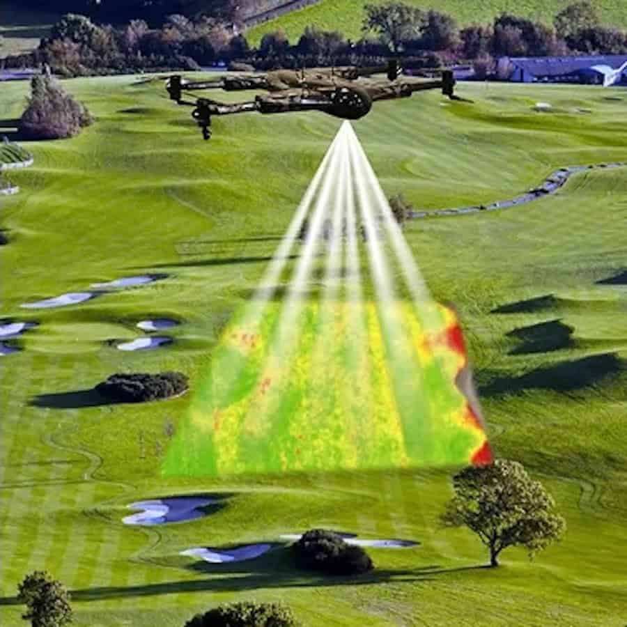
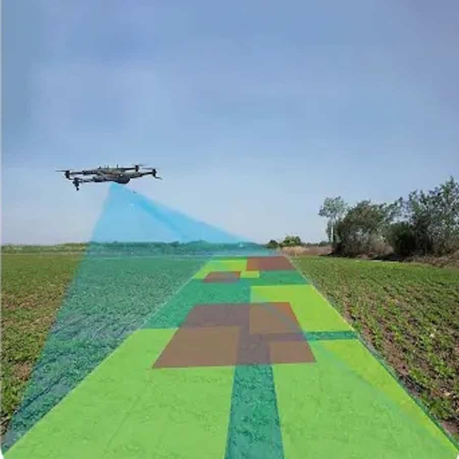
Drone inspection services revolutionize agriculture by providing aerial imaging for crop health assessments, field mapping, and livestock monitoring. Equipped with multispectral and thermal cameras, drones enable precise monitoring of crop conditions, identifying issues like water stress, pest infestations, and nutrient deficiencies. These inspections help farmers boost yield, optimize irrigation, and apply targeted treatments, reducing waste and improving crop quality.
Agricultural drones efficiently survey vast fields, generating detailed field maps that support irrigation planning, soil health analysis, and growth monitoring throughout the season. This data-driven approach allows farmers to optimize harvest timing and allocate resources effectively. Additionally, drones assist in livestock management, tracking herd locations, monitoring pasture health, and identifying animals in distress.
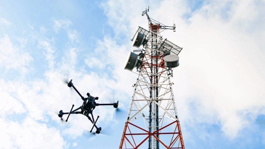
Pipeline and Infrastructure Inspections
Drone inspection companies provide critical support in monitoring extensive infrastructure such as pipelines, bridges, and railways. UAVs travel quickly across long distances, offering a comprehensive view of pipeline conditions and identifying leaks, corrosion, or encroaching vegetation.
Drone inspections are also widely used for bridge inspections, where drones can access tight or difficult-to-reach spaces, capturing high-resolution images of joints, cables, and support structures.
By delivering regular visual data on asset conditions, aerial inspection services help ensure infrastructure safety, reduce maintenance costs, and extend the lifespan of key assets.
Key Features of Drones Used in Aerial Imaging
High-Resolution and Thermal Imaging
UAV inspection companies employ drones equipped with high-resolution cameras that deliver clear, detailed images, ideal for identifying small defects or changes over time. Many drones also feature thermal imaging capabilities, which detect temperature variations on surfaces.
This feature is especially useful in electrical inspections, where hot spots can indicate faulty components, or in solar farm inspections, where anomalies in panel temperatures may signal underperformance.
LiDAR and 3D Mapping
Some drones are equipped with LiDAR (Light Detection and Ranging) sensors, which emit laser pulses to measure distances and generate highly accurate 3D models. LiDAR data is invaluable in applications like topographical mapping, volumetric analysis, and environmental monitoring. With LiDAR, survey drones capture precise measurements even in low-visibility conditions, offering a versatile solution for complex inspections.
Real-Time Data Transmission
Drone inspection services often rely on real-time data transmission, allowing operators to view inspection footage and data as it is collected. This immediate access to information allows for dynamic inspection adjustments, optimizing data acquisition and providing prompt updates on asset conditions.
Emerging Trends in UAV Inspection Services
UAV inspection companies are set to become increasingly involved within industries that prioritize safety, efficiency, and precision. As drone technology advances, new inspection capabilities continue to emerge, including AI-powered image analysis and fully autonomous inspection workflows. These innovations promise even greater accuracy and efficiency, empowering industries to detect and address potential issues before they become costly problems.
With high-quality imaging, advanced data processing, and the ability to access challenging environments, UAV inspection services are redefining aerial inspection, survey, and monitoring standards. Whether deployed for utility infrastructure, construction sites, or renewable energy assets, drones deliver valuable data that supports safe, efficient, and sustainable operations across various industries.
Choosing the Right Drone Inspection Service
Choosing between drone inspection service providers requires consideration of factors such as the specific inspection needs, environmental conditions, and the quality of data required. Drones can be customized with a range of imaging technologies, from high-resolution cameras to specialized sensors, depending on the application.
Whether performing utility inspection, pipeline monitoring, or construction surveying, partnering with a reliable drone inspection company ensures consistent data quality, operational efficiency, and regulatory compliance.
Experienced drone operators trained in aerial inspection techniques are essential for obtaining high-quality data and adhering to industry safety standards. Additionally, providers with expertise in data analysis can offer insights derived from drone inspection data, enhancing decision-making and enabling proactive maintenance strategies.
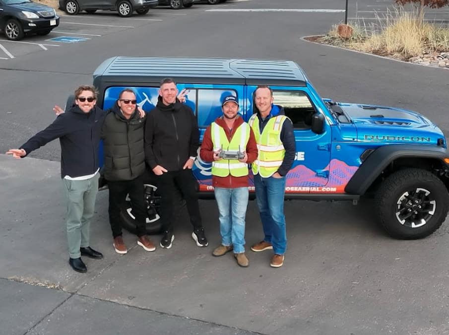
Tanner Harris, Founder & Managing Member of Blue Nose Aerial Imaging, discusses scaling nationwide drone operations and using thermal imaging and LiDAR to improve inspection safety, efficiency, and asset management
Drone as a Service by ZenaDrone examines how aerial 3D scanning improves construction progress tracking, quantity verification, and site accuracy through photogrammetry, LiDAR, and survey-grade data collection
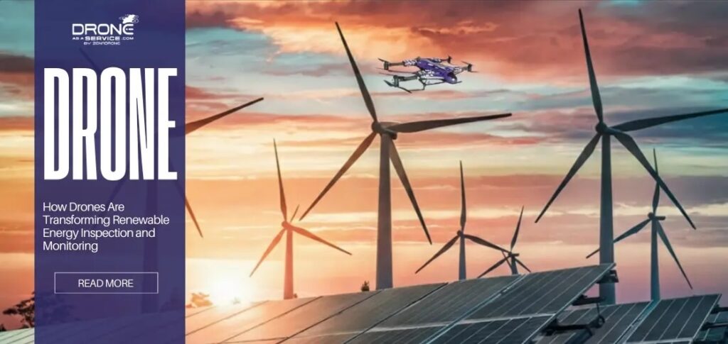
Drone as a Service by ZenaDrone outlines how drone-based inspection improves safety, reduces downtime, and enhances monitoring across large-scale renewable energy infrastructure
Drone-as-a-Service by ZenaDrone outlines how drone data analytics transforms aerial data into actionable insights, enabling predictive maintenance, improved safety, and greater operational efficiency across renewable energy assets
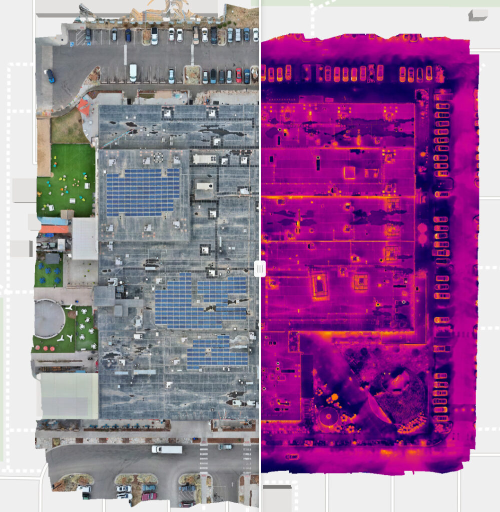
Blue Nose Aerial Imaging explains how drone technology enables safer, faster, and more cost-effective commercial roof inspections, providing detailed aerial imagery and data collection without requiring inspectors to physically access rooftops
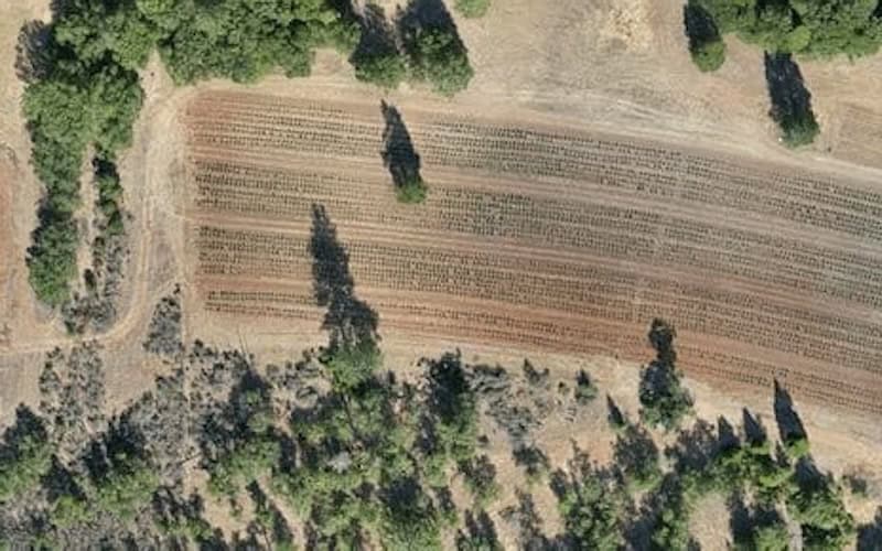
Blue Nose Aerial Imaging highlights how drone-based aerial mapping provides Ventura County growers with clear visual insight into irrigation performance, helping identify uneven watering patterns and reduce nitrogen movement below the root zone
Blue Nose Aerial Imaging outlines its drone-based roof inspection services in Chandler, Arizona, supporting owners and facility teams in identifying roof issues, reducing fall risk, and carrying out leak checks, photo surveys, or thermal scans ahead of winter rains
Blue Nose Aerial Imaging has collaborated with Inotek to strengthen U.S. drone inspection services by combining nationwide aerial data capture with engineering-led analysis to deliver insights into building condition, defects, energy loss, and risk
Feb 12, 2026
Advancing Unmanned Systems Through Strategic CollaborationUST works with major OEMs to foster collaboration and increase engagement with SMEs, to accelerate innovation and drive unmanned systems capabilities forward.