Case Study
The Security Challenge Behind FIFA World Cup 2026 & LiveU Technology
LiveU explores the security realities of FIFA World Cup 2026, as Global Defense & Security Specialist Kevin Cresswell examines emerging threats, policing challenges, and the role of real-time intelligence
Revealing Hidden Terrain Features with Airborne & UAV LiDAR Scanning
RIEGL discusses how its airborne and UAV LiDAR scanning technologies are helping researchers reveal concealed terrain features beneath dense vegetation and identify wartime relics and heritage sites across Hong Kong and Malaysia
Deep Trekker ROV: Supporting Oyster Reef Restoration and Aquaculture Monitoring
Project REPARE leverages advanced Deep Trekker ROV technology and aerial photogrammetry to restore native flat oyster populations in Southern Brittany through comprehensive underwater monitoring and assessment
Adaptive Frequency Tracking for GNSS Interference Mitigation
EDGE Microwave examines a GNSS interference mitigation method that uses adaptive frequency tracking and an Adam-based adaptive notch filter architecture to improve suppression of rapidly changing narrowband jammer signals
Custom Protective Case Development for Mobile DNA Analyzer in Field Environments
Pelican Products details the development of a custom protective case for ANDE’s Mobile DNA Analyzer, supporting reliable transport and protection against shock, vibration, and extreme weather in field environments
How Drone OEMs Are Designing Systems for Rapidly Evolving Program Needs
The global drone industry is rapidly transforming, driven by defense demand and initiatives like the US Drone Dominance program, with companies such as Doodle Labs highlighting the growing importance of scalable manufacturing and resilient communications
Gotonomi UAV Satcom Solution Supports BVLOS Power Line Inspections for AIR6 SYSTEMS
AIR6 SYSTEMS used Gotonomi’s satcom solution during BVLOS power line inspection trials, validating reliable C2, LTE-satellite failover, and low-bandwidth video performance
RDS Portable Ground Control Station for Maritime Uncrewed Systems
Review Display Systems (RDS) details the development of a portable Ground Control Station for Uncrewed Surface Vehicles, integrating proprietary safety systems within a rugged all-in-one platform for reliable operation in marine and defense environments
UAV Navigation GNC Integration for Persistent ISR UAS Operations
UAV Navigation-Grupo Oesía outlines how its Guidance, Navigation, and Control systems enable UAS to deliver persistent and safe Intelligence, Surveillance, and Reconnaissance operations, supporting autonomous flight and continuous monitoring in complex environments
F15 Unmanned Helicopter Enables Intelligent Forest Patrol & Fire Prevention
Ziyan Tech's F15 unmanned helicopter platform supports advanced aerial surveillance and early wildfire detection for forestry management
Pelican Products Highlights Development of Integrated Case to Support GCS Operations
Pelican Products details how it developed a single integrated case for Sechan Electronics’ ground control station, improving portability, reducing size requirements, and ensuring protection in harsh military environments
Blast Zone Monitoring & Aerial Intelligence with Vesper UAV
Vantage Robotics details how its Vesper UAV provided aerial intelligence, hazard identification, and perimeter monitoring during a multi-agency response to a hazardous explosion site in Tennessee
Real Time Connectivity Enabling Data Driven Infrastructure Management for DOTs
LiveU outlines how bonded connectivity, IP-based video, and accelerated data transfer enable Departments of Transportation to achieve real-time situational awareness and more efficient infrastructure management
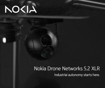
Nokia Drone Networks Supports South Carolina’s First Drone as First Responder Program
Nokia Drone Networks highlights how its hardware supported South Carolina’s first Drone as First Responder program, integrating cellular connectivity and automated deployment within a system developed alongside Motorola Solutions’ CAPE software
ROV-Based Hull Inspection & Biofouling Management for Vessel Fleets
Deep Trekker highlights how Franmarine deploys its ROVs alongside the MarineStream software platform to deliver standardized in-water hull inspections, biofouling management, and UWILD workflows
Flight Testing of Vision Aided Inertial Navigation in GNSS Denied Conditions
Inertial Labs outlines the integration and flight-tested performance of visual-aided inertial navigation with vision-based positioning, combining inertial measurement data with visual inputs to support accurate localization in GNSS-denied conditions
Septentrio Technology Strengthens AGR UAV Performance in Urban & Remote Missions
Septentrio and AGR showcase advanced GNSS-enabled UAVs performing firefighting, agriculture, logistics, and urban operations in complex, interference-prone environments
3D Printed & MIL-STD Validated: The New Standard for Monolithic TeUAS Fuselages
Explore how Hoverfly Technologies and CRP USA used 3D printing with Windform GT to create durable, lightweight fuselages for advanced tactical drones
Boxfish Robotics AUV Enables Consistent Seabed Transect Surveys
A Port of Auckland survey using a Boxfish Robotics hovering AUV demonstrates how autonomous seabed transects can improve data consistency and environmental monitoring workflows
Inspired Flight Heavy-Lift IF1200 Supports Coastal Fissure Monitoring
Southern California Edison deploys the Inspired Flight IF1200 to capture high-resolution aerial data over active coastal landslide fissures, enhancing long-term ground movement monitoring and infrastructure safety planning
Boosting Safety in BVLOS Operations with uAvionix skyAlert ADS-B
uAvionix highlights its skyAlert device and how it improves situational awareness and safety in BVLOS operations, offering reliable, real-time alerts in remote areas
HOBBYWING VTOL Motors Supporting Continuous Geological Monitoring
HOBBYWING highlights how its VTOL motors, featuring Intelligent Propeller Control for optimized propeller positioning and reduced cruise drag, enable reliable long-duration geological hazard monitoring with unattended drone-in-a-box UAV systems
Advancing Crack Inspections with Drones, AI, & High-Resolution Sensors
WISPR Systems demonstrates how the SkyScout drone, high-resolution sensors, and AI software improve the detection, measurement, and monitoring of cracks in concrete and asphalt, making inspections more efficient, accurate, and consistent
PDW Provides Training & On-Site Support to Army Transformation in Contact Units
Performance Drone Works highlights how collaboration with Army TIC units at the National Training Center provided hands-on training and gathered real-time feedback in support of ongoing Army transformation efforts
Drone-Based Photogrammetry & Watershed Analysis for Road Design in Indonesia
Blue Marble Geographics details how PT Waskita Karya (Persero) Tbk is using drone-based photogrammetry and watershed analysis within Global Mapper® to support environmentally responsible design and risk mitigation for a road project in Indonesia
Runway Pavement Assessment Using the Sentera 65R Camera
The Sentera 65R camera, integrated with the IF800 Tomcat multirotor UAS and gNext software, enables high-resolution aerial imagery for automated analysis of pavement conditions in runway assessment


Advancing Unmanned Systems Through Strategic Collaboration
UST works with major OEMs to foster collaboration and increase engagement with SMEs, to accelerate innovation and drive unmanned systems capabilities forward.