


Inspection Drones
Discover cutting-edge solutions from 30 leading global suppliers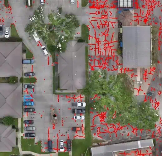
WISPR Systems, a developer of rugged, turnkey drone solutions for commercial applications, discusses how drones with high-resolution cameras and AI software improve the detection and measurement of concrete and asphalt cracks. Read more >>
Concrete inevitably cracks, whether in highways, airport runways, parking lots, dams, or other large structures. Early detection matters because cracks can indicate deeper issues such as corrosion of reinforcing steel or erosion of the base material.
The ability to identify and monitor these changes before they escalate can significantly reduce repair costs and extend the service life of a structure.
Karson Kall, Director of Sales Engineering for WISPR Systems, stated, “When reinforcing steel corrodes, it expands, and that expansion forces the concrete apart, accelerating damage. The sooner you can identify changes in crack size, the sooner you can intervene before a small issue becomes a major repair.”
Traditionally crack inspections were a time-consuming, manual, and error-prone process. Inspectors would cover extensive pavement areas, recording locations, estimating dimensions, and relying on careful observation to ensure no defects were overlooked.
Advancing Inspection with Drones & AI
WISPR Systems is advancing this process by combining its SkyScout drone with the Sony LR1 high-resolution payload, and gNext’s AI mapping software. This integration has made crack detection and monitoring faster, more accurate and more consistent.
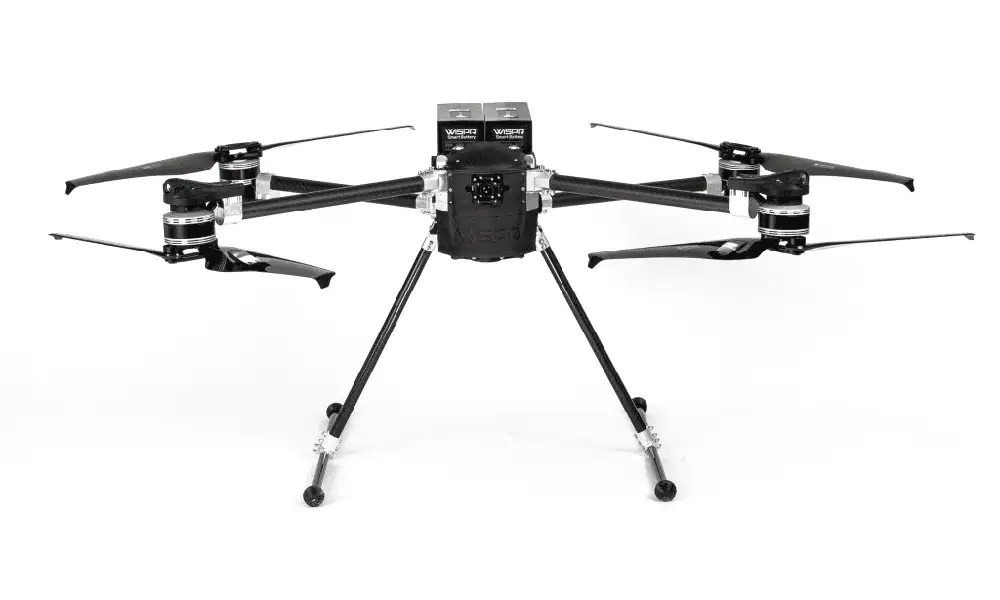
WISPR SkyScout Quadcopter Drone.
Once imagery is processed in gNext, AI automatically identifies and maps cracks, patches, areas of spalling, and vegetation encroaching on panels. Each crack receives a unique ID and dimensional data that can be exported to Excel or CAD.
Kall commented, “With the SkyScout, Sony LR1 and gNext, we’re giving inspectors and engineers a toolset that removes the guesswork. You’re not just spotting cracks – you’re measuring their length, width and even volume, all georeferenced to the exact location so you can come back to the same spot over time.”
The Sales Engineering Director added, “You can click on any crack in the system and instantly see all the data. It’s exportable to Excel or CAD, filterable by minimum width and completely georeferenced, which means you can navigate straight to it in the field using a survey rover. That’s powerful.”
The combination of the WISPR SkyScout, Sony LR1, and gNext’s AI processing also increases efficiency by accelerating inspection processes that traditionally took days or weeks to complete on large projects.
Kall said, “This isn’t just about saving time – it’s about making inspections repeatable and reliable. When you can revisit the exact same crack a year later and see how it’s changed, you’re not guessing anymore. You’re making data-driven decisions.”
Supporting Infrastructure Applications
Transportation departments, airport authorities, and facility managers face ongoing pressure to maximize asset lifespan while managing maintenance costs effectively, all of which WISPR Systems’ solutions help address.
Kall concluded, “Our goal is to give professionals the clarity and confidence they need to maintain their infrastructure proactively. This technology is another way WISPR is empowering professionals to work smarter, safer, and more effectively.”
To find out more information, read ‘Drone Technology is Transforming Concrete and Asphalt Crack Monitoring’ here >>


