If you design, build or supply Image Processing & Analysis Software, create a profile to showcase your capabilities and connect with visitors who have an active requirement for your solutions.
Comprehensive software suite for real-time video processing
Comprehensive software suite for real-time video processing
...’s Video ProcessingSoftware provides a powerful and constantly growing suite of capabilities... ...gh-performance processing in compact, power-efficient packages. Our video processing pipeline...
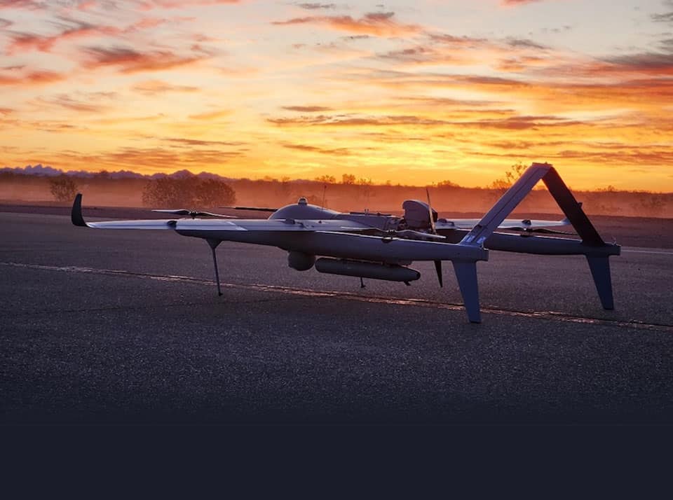
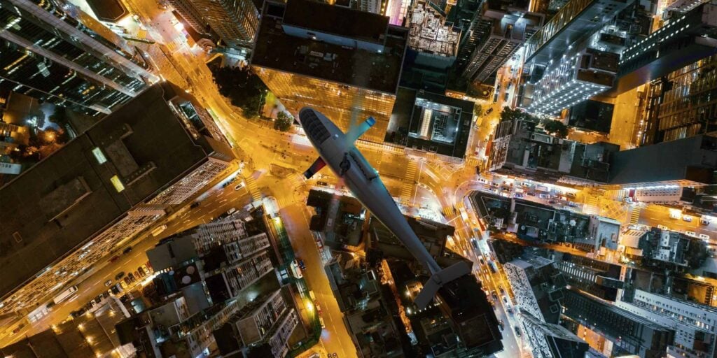
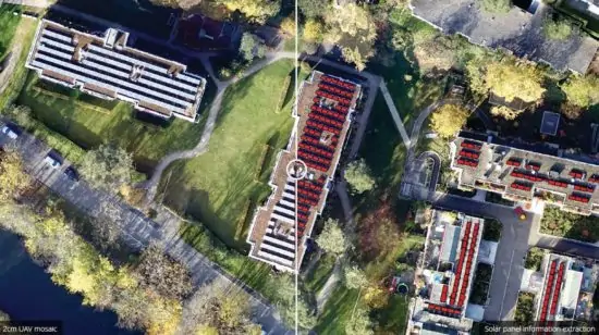
Drone image processing and analysis software allows users to perform photogrammetry on aerial imagery and LiDAR data collected by unmanned aerial vehicles such as drones, UAS, UAV and RPAS.
Aerial imagery and LiDAR data is captured by drones flying autonomously along a series of waypoints, taking images or measurements at regular intervals. Images will have an overlap to ensure no detail is missed, and will be processed by image stitching software. Images are also geotagged to provide accurate location.
Applications for Image Processing Software
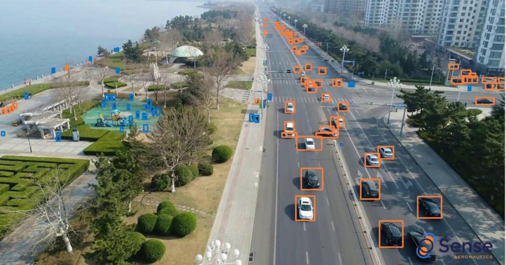
Image processing software is used by professionals in a wide variety of industries, including mapping, surveying, urban planning, precision agriculture, forestry, oil and gas, and mining.
In addition to RGB imagery, drone image processing software may also work with NDVI (normalized difference vegetation index) images and other indexes for precision agriculture, as well as thermographic images for building heat maps.
Image processing can also be used to perform volumetric calculations, which analyse volumes of features or regions of interest on the outputted maps. These are often used in the construction industry to measure amounts of material such as gravel in a stockpile, or to calculate an amount of earth to be removed or to be used to fill in a pit.
Using drones and image processing software for these types of calculation is both safer and more convenient than traditional survey methods and requires far less resource.
Image Analysis Software and Drone Mapping
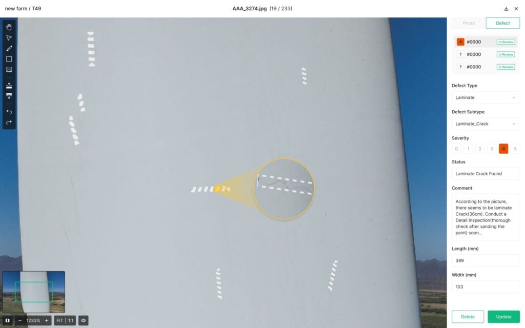
Image analysis software is used extensively to process drone acquired data in order to produce detailed and accurate maps. Capable of outputting 2D and 3D models and maps, UAV image processing software can be used to create digital models documenting the elevation, terrain and surface of photographed areas. This detailed information is invaluable to mapping drone applications and can also be used when simulating flight plans.
Advanced Drone Image Processing
Drone image processing and analysis software may include a variety of advanced features such as intelligent feature identification and extraction algorithms and on-the-fly editing tools. It may allow for scalable distributed processing across networks and multiple hardware platforms, or provide the ability to upload images to the cloud for processing, taking advantage of powerful servers instead of limited desktop computers.
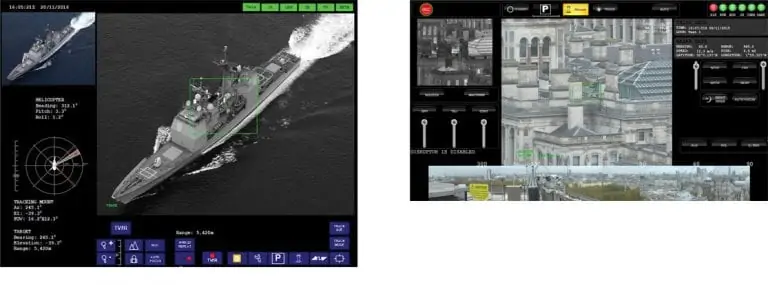
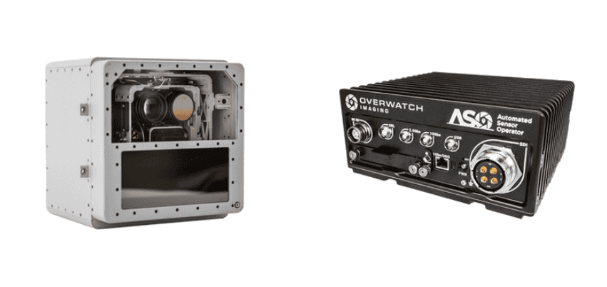
The strategic acquisition of Sightline Intelligence integrates ultra-low latency edge AI video processing with Acron Technologies’ sensing hardware to create a suite of critical technologies for autonomous and defense aircraft
The Florida State Guard is integrating Overwatch Imaging’s autonomous sensors and AI software into its aviation fleet to bolster disaster response and search and rescue operations
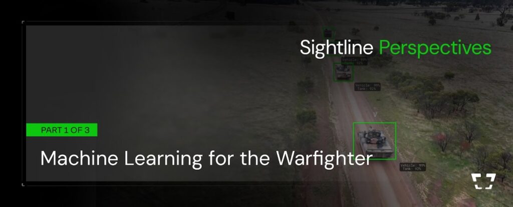
Sightline Intelligence explains how machine learning performance in defense applications is shaped by training data, performance metrics, and system architecture, with a focus on reliable edge deployment beyond model-level capability
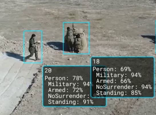
Theta Informatics LLC enters a Cooperative Research and Development Agreement with the U.S. Army Combat Capabilities Development Command Army Research Laboratory to conduct research under “Vision-Based Target Localization"
Blue Marble Geographics highlights its Online Classroom, featuring new self-paced courses in point cloud processing that cover core workflows, feature extraction, and advanced analysis using Global Mapper tools
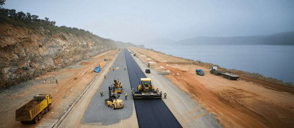
Blue Marble Geographics details how PT Waskita Karya (Persero) Tbk is using drone-based photogrammetry and watershed analysis within Global Mapper® to support environmentally responsible design and risk mitigation for a road project in Indonesia
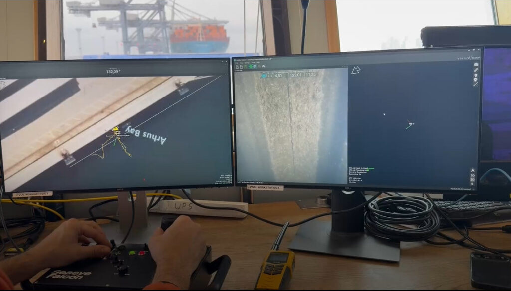
A major update to the VSLAM solution enables real-time 3D visual reconstructions to be natively aligned to global geodetic frames for the first time
Dec 19, 2025
Advancing Unmanned Systems Through Strategic Collaboration
UST works with major OEMs to foster collaboration and increase engagement with SMEs, to accelerate innovation and drive unmanned systems capabilities forward.