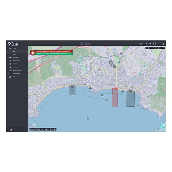
Drone flight planning software is the mission design and execution layer that translates operational objectives into structured, autopilot-executable flight paths for UAV platforms. It enables waypoint generation, area coverage patterns, terrain-following profiles, and geospatial constraint visualization to support compliant, repeatable operations.
This page showcases providers of flight planning software for drones and UAVs used across ISR, infrastructure inspection, offshore energy, and emergency response, supporting BVLOS operations, Remote ID integration, and scalable autonomy.
If you design, build or supply Drone Flight Planning Software, create a profile to showcase your capabilities and connect with visitors who have an active requirement for your solutions.
Comprehensive and scalable drone flight management & analytics platform
Comprehensive and scalable drone flight management & analytics platform
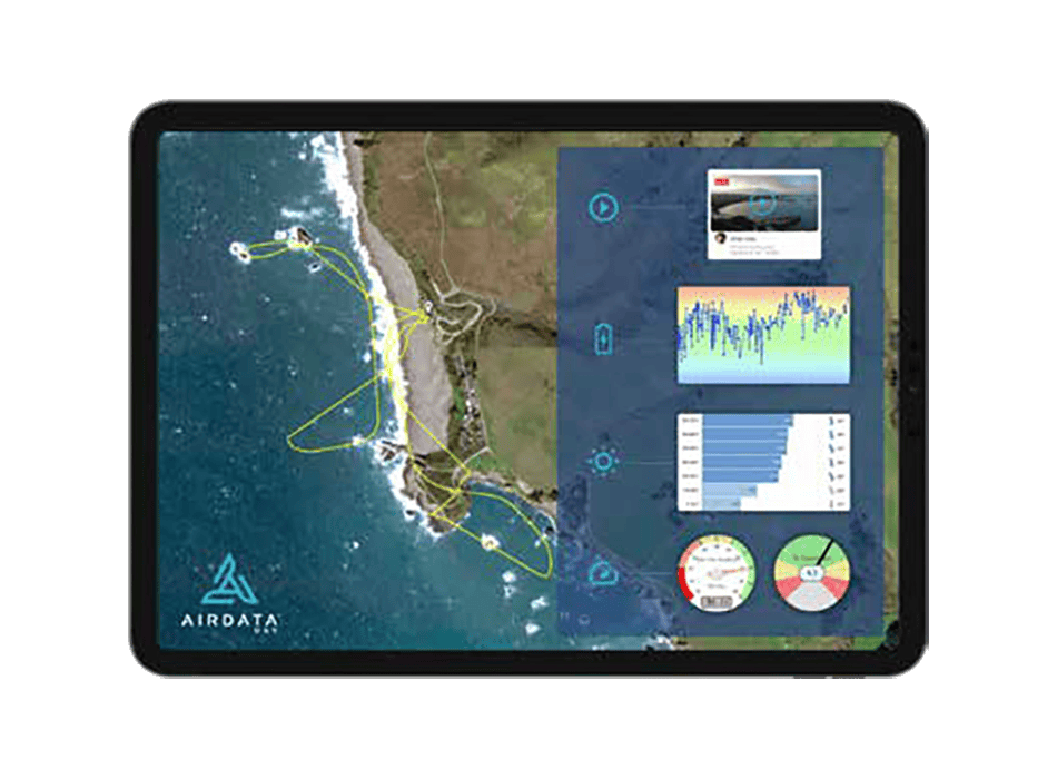
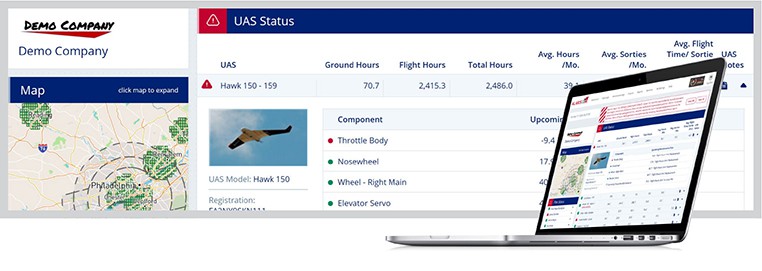
...V is a leading droneflight data management and analysis platform trusted by hundreds of thousands... ......is the world’s most deployed commercial drone operations platform, with over 60M flights...
Comprehensive software ecosystem for unmanned systems management & operations
Comprehensive software ecosystem for unmanned systems management & operations
...s DG’s IRIZI software ecosystem provides a range of essential capabilities for drone operators and... ......
Components of the IRIZI software platform include:
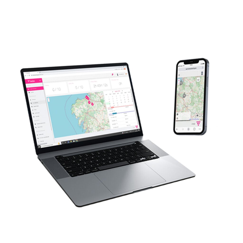
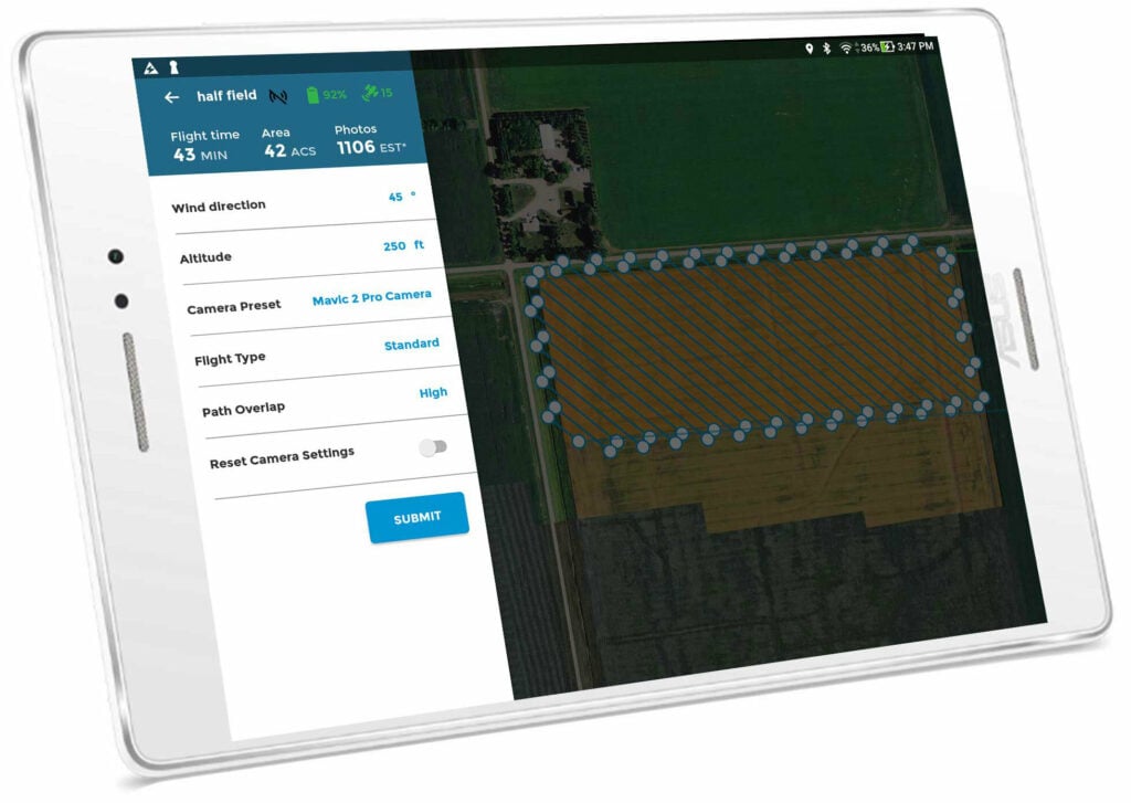
...otlink Capture droneflight management and mission planning app provides a range of powerful... ...ghly intuitive software provides adjustable survey templates to suit a range of mission...
Drone flight planning software is the mission design and execution layer that translates operational objectives into structured, executable flight paths for Unmanned Aircraft Vehicles (UAVs). It serves as the interface between mission intent and autopilot logic, defining how an aircraft navigates airspace, interacts with terrain, coordinates sensors, and complies with regulatory constraints.
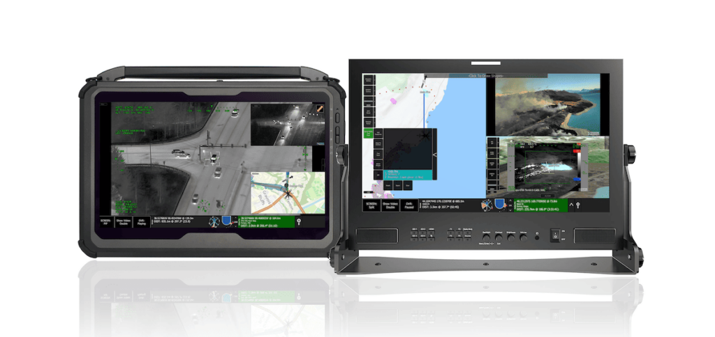
TrakkaMaps, a mission mapping & video management software for GCS, from Trakka Systems
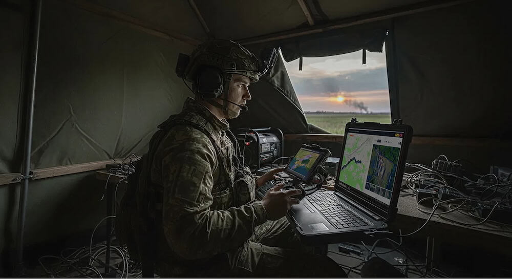
In professional unmanned systems, flight planning software is a mission assurance component. Whether supporting tactical ISR, offshore inspection, or BVLOS corridor operations, the software must ensure predictable aircraft behavior, airspace compliance, sensor optimization, and safe integration with other airspace users. It provides the structured logic that allows unmanned platforms to operate reliably in complex, dynamic environments.
Core Functions of UAV Flight Planning Software
Professional UAV flight planning software converts geographic intent into deterministic flight behavior through several technical layers. While it works in tandem with flight control software to maintain the stability of the platform, its primary focus is on the spatial and temporal parameters of the mission.
Mission Planning and Route Generation
At its foundation, flight planning involves waypoint-based design, where operators define discrete coordinates that the aircraft follows sequentially. Each waypoint includes specific parameters such as speed, heading, and payload trigger events.
For survey and mapping, the software generates area coverage patterns like grid or lawnmower paths to ensure uniform data collection. Terrain-following capabilities allow the system to reference digital elevation models and adjust altitude dynamically to maintain a consistent ground clearance or sensor standoff distance. Dedicated mission planning software is often utilized to automate these complex routes, particularly for intelligence and surveillance roles.
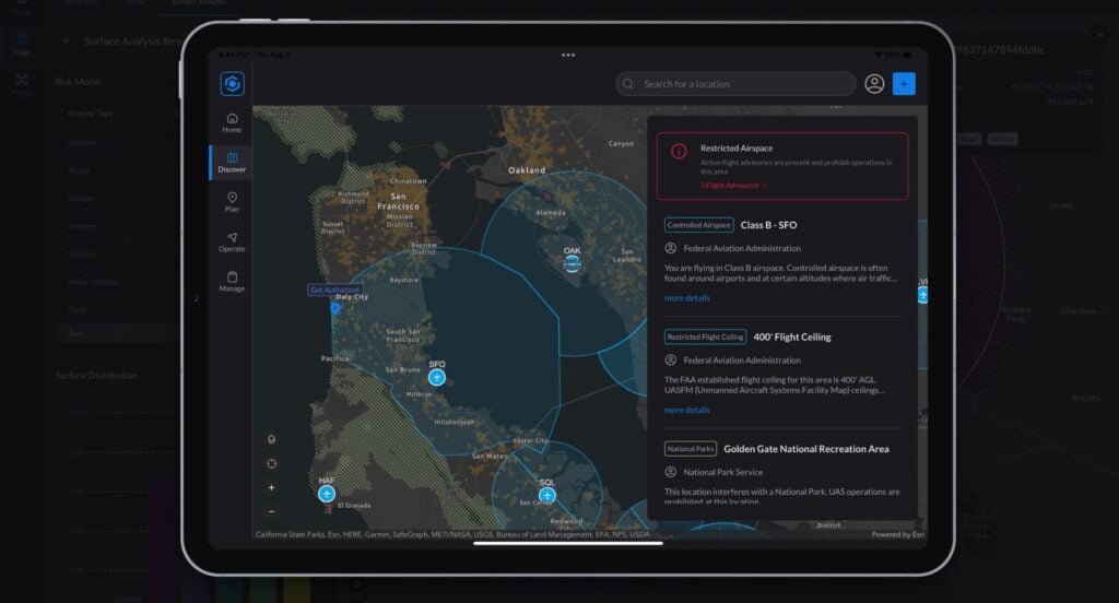
Airspace Awareness and Geospatial Integration
Flight planning suites typically incorporate aviation data layers. Integration with aeronautical charts and controlled airspace databases allows operators to design compliant missions. While drone compliance software is responsible for the actual regulatory rule-checking and audit trails, flight planning tools allow operators to visualize these constraints during the design phase.
Payload and Sensor Configuration
Botlink Capture, a drone flight planning and control app, from Packet Digital
Effective flight planning software for drones integrates payload configuration into the mission design. This includes defining EO/IR camera trigger intervals and gimbal angles. The software calculates ground sampling distance based on altitude and optics to ensure imagery meets resolution requirements. For LiDAR missions, the system manages flight speed and scan angles to maintain accurate swath width.
Real-Time Mission Re-Tasking
Operational environments are rarely static, and drone flight path software often supports in-flight modification of objectives. This includes dynamic waypoint adjustment and adaptive mission logic, such as initiating an orbit mode upon object detection or switching to contingency routes during a lost link scenario.
Multi-UAV and Swarm Coordination
As operations scale, drone flight plan management is moving beyond single-platform control. While high-level drone fleet management platforms oversee the health and logistics of an entire inventory, flight planning software handles the tactical deconfliction of multiple assets within the same airspace.
Applications of Flight Planning Software for Drones & UAVs
Military and Defense Applications
In military contexts, flight planning underpins ISR mission preparation. Route design accounts for threat envelopes, terrain masking, and communication relay requirements. Integration with broader flight control systems ensures that the aircraft can execute these tactical maneuvers with precision in contested environments.
Commercial and Industrial Applications
Infrastructure inspection relies on drone route planning software to ensure repeatable missions for asset comparison over time. Surveying and mapping operations depend on automated grid patterns and overlap calculations to produce high-quality 3D reconstructions. In energy and offshore sectors, the software accounts for wind, magnetic interference, and complex metallic structures.
Emergency Services and Public Safety
Disaster response missions require rapid area assessment. Drone flight planning enables the quick generation of search and rescue grid patterns, reducing human error and increasing the probability of detection in dynamic scenarios like wildfires or structural collapses.
Architecture & Integration Considerations
The integration of a drone flight planner depends on the hardware and software ecosystem of the system, particularly its relationship with the GCS software used at the ground station.
Ground Control Station Integration: Flight planning software must link with map rendering engines and telemetry displays to ensure uploaded plans translate into autopilot-executable commands.
Cloud-Based vs. On-Premise Architectures: Cloud systems offer centralized fleet coordination, while on-premise architectures provide the data sovereignty required for defense or critical infrastructure.
Integration with Autopilots: The software must interface with flight control stacks like PX4 and ArduPilot using standardized protocols such as MAVLink.
Remote ID and UTM Integration: Connectivity with Remote ID frameworks ensures regulatory compliance and enables digital flight authorization for BVLOS operations.
Emerging Capabilities in Drone Flight Planning
The development of UAS flight planning is trending toward higher levels of autonomy and integration:
Fully Autonomous Mission Orchestration: High-level objectives are translated into adaptive flight behaviors with minimal operator intervention.
AI-Driven Route Optimization: Artificial intelligence is used to optimize paths for energy efficiency and risk minimization.
BVLOS and Detect-and-Avoid Integration: Onboard DAA systems enable dynamic route modification in response to non-cooperative aircraft, which is fundamental to scalable long-range operations.
Autonomous Docking Station Integration: Planning software now incorporates launch, recovery, and recharge cycles for persistent operations.
AirData and BRINC have integrated the AirData platform with BRINC’s Lemur 2 and Responder drones to automatically capture and organize flight data, creating searchable mission records with tracking for pilot activity, equipment, and maintenance
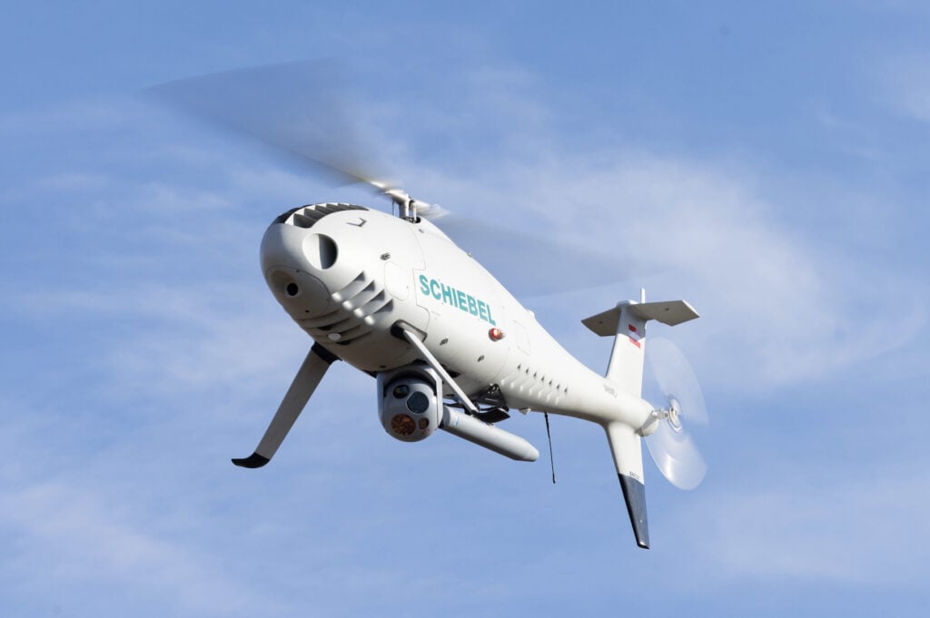
IMSAR’s NSP-3 Synthetic Aperture Radar (SAR) has been integrated with Schiebel’s CAMCOPTER® S-100 VTOL UAS, enhancing ISR capabilities with flexible payload options, extended endurance, and seamless command and control integration
Airspace Link is enhancing its AirHub® platform, introducing unmanned traffic management (UTM) capabilities to support BVLOS drone operations and compliance with regulatory standards
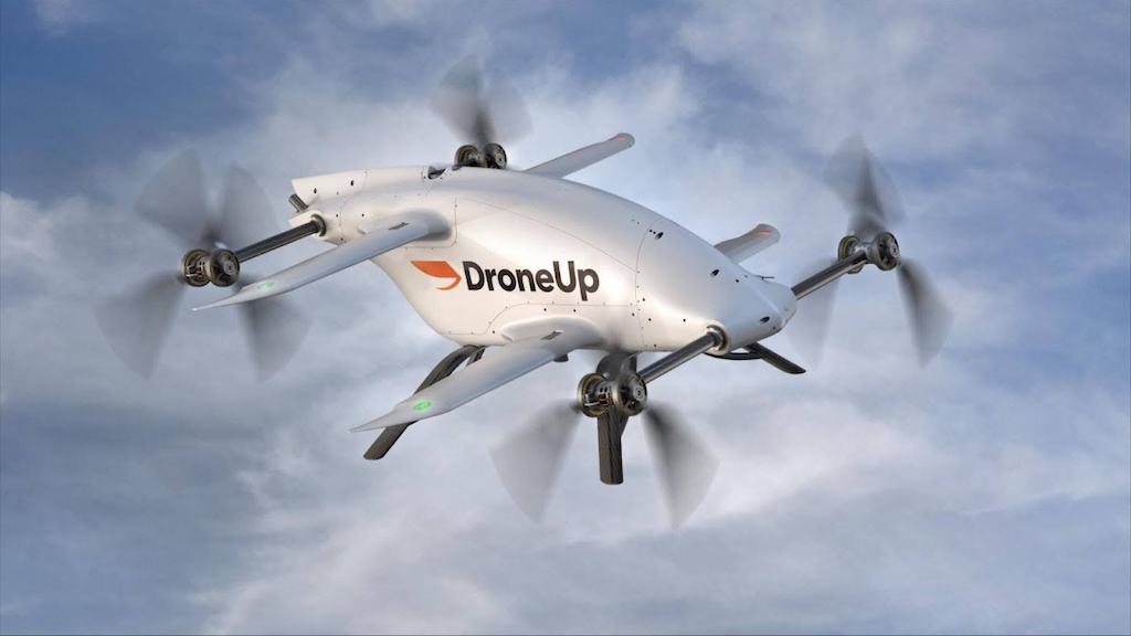
DroneUp’s autonomous Ecosystem aims to evolve last-mile logistics in a move to scalable, economically feasible drone delivery, integrating cutting-edge products into a single platform
High Lander’s Vega UTM is a software-only solution that creates control tower regions to monitor and display aerial activity within these regions in real time
Kongsberg Geospatial to integrate uAvionix FlightLine truSky™ ADS-B data for IRIS Terminal customers, providing enhanced situational awareness to uncrewed aircraft system operators
Sep 18, 2023
Advancing Unmanned Systems Through Strategic Collaboration
UST works with major OEMs to foster collaboration and increase engagement with SMEs, to accelerate innovation and drive unmanned systems capabilities forward.