Software Platform for Drone Flight Planning, Management & Community Integration

The AirHub Platform helps drone pilots, government, and business stakeholders to plan and optimize their operations while prioritizing safety By Mike Ball / 25 Sep 2023

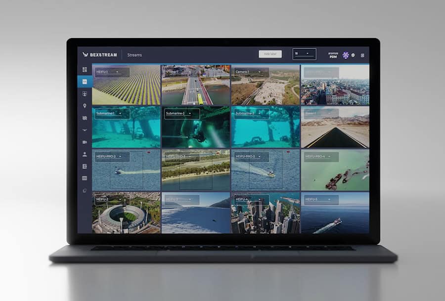
Command Control and Communications Software

Discover cutting-edge solutions from 6 leading global suppliers
SUPPLIER SPOTLIGHT
Follow UST

Airspace Link is a leading developer of digital solutions that improve situational awareness and enable UAS to be safely integrated into the national airspace. UST is delighted to welcome Airspace Link on board as a supplier partner, and we will be highlighting their unique solutions and capabilities across our channels over the next 12 months.

We’ve just launched Airspace Link’s UST supplier profile, which has been written and built by our team in collaboration with the company. The Platinum profile showcases their AirHub Platform, which provides digital infrastructure to help drone pilots, government, and business stakeholders plan and optimize their operations while prioritizing safety.

Read on to find out more:

Built on top of the Esri platform with direct integration of FAA and third-party data sets, the AirHub Platform is designed to grow as the corresponding users needs, regulations, and use cases do.

The software is also one of the only FAA-approved UAS service suppliers for LAANC (Low Altitude Authorization Notification Capability) allowing both recreational and commercial pilots to submit for authorization to fly in controlled airspace. This allows pilots using the platform to fly both safely and compliantly.

Drone Risk Assessment and Intelligent Routing

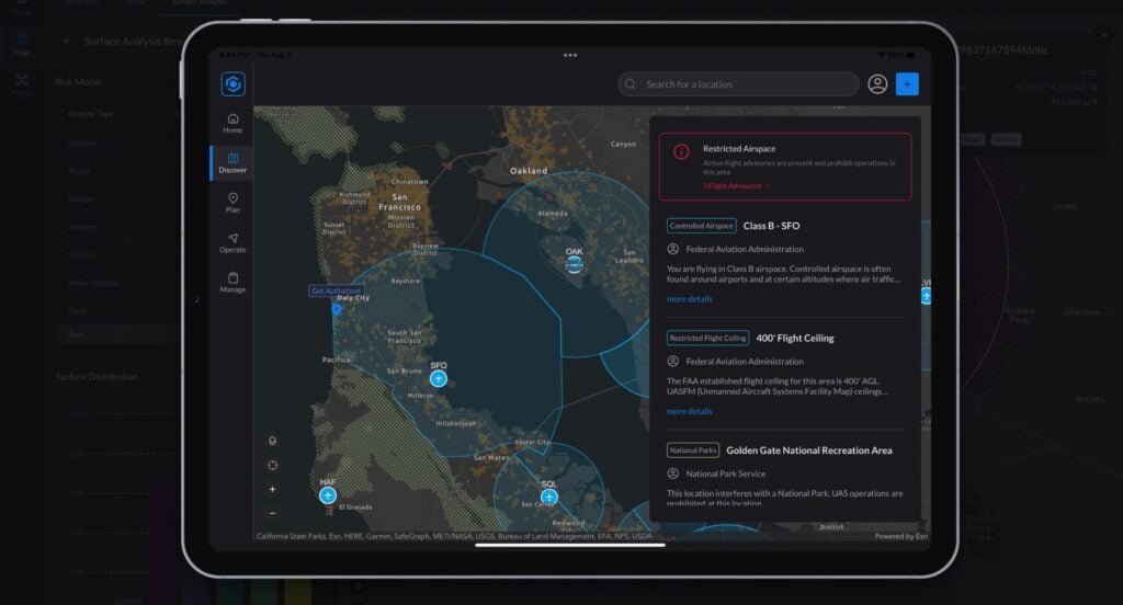
The platform’s capabilities can be accessed through AirHub Portal, a next-generation software solution that provides government planners and UAS operators alike with everything they need to plan, manage and conduct missions in one convenient and intuitive application.

By simplifying and streamlining workflows, AirHub Portal makes it easy for stakeholders to safely and efficiently integrate their drone operations into the national airspace, while understanding the unique unmanned aviation requirements of the local community. The easy-to-use application is OS-agnostic and can be installed on any mobile or desktop device, or accessed with a seamless web-based experience.

Airspace Link also provides an ever-growing collection of embeddable APIs that enable drone developers and service providers to enhance their applications with a suite of powerful capabilities. With access to these crucial services and sources of information, users can ensure that their drones operate in the local community with the utmost of safety and effectiveness.

Unmanned Traffic Management UTM SoftwareAPI capabilities include:

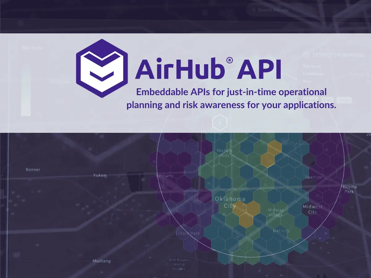
  • Map interfaces for drone hardware and software with built-in planning, routing and authorization
  • Mapping, routing, and planning for enhanced drone pilot workflows and situational awareness
  • Integration of low-altitude digital infrastructure for unmanned traffic management (UTM)
  • Up-to-date rules and regulations information to support real-time community advisories
  • Hazard and risk assessment within specific geographic boundaries
  • Complex routing algorithms and other logistical tools for advanced drone operations
Posted by Mike Ball Mike Ball is our resident technical editor here at Unmanned Systems Technology. Combining his passion for teaching, advanced engineering and all things unmanned, Mike keeps a watchful eye over everything related to the unmanned technical sector. With over 10 years’ experience in the unmanned field and a degree in engineering, Mike’s been heading up our technical team here for the last 8 years. Connect & Contact

Latest Articles

Most Read Articles on UST This Week

Here’s our round-up of the five most read articles on UnmannedSystemsTechnology.com this week

Feb 14, 2025
FlyingBasket to Discuss Drone Industry Challenges at XPO Europe

FlyingBasket CTO Matthias Moroder will join a panel at Xponential Europe to discuss the regulatory and market challenges hindering drone industry growth, and the importance of collaboration for wider adoption

Feb 14, 2025
Advanced EFI Engines for Commercial & Industrial Drones

INF Inject's 2- and 4-stroke EFI engines can be provided with a range of options such as alternators, starter-alternators and generators

Feb 14, 2025
SDO 50 UAV Completes Long-Distance BVLOS Pipeline Inspection

SwissDrones’ SDO 50 UAV has successfully carried out a 550-kilometer BVLOS pipeline inspection in Queensland, providing precise, actionable data while maintaining high safety standards

Feb 14, 2025
Enhancing Unmanned System Reliability with SCS Silicone Conformal Coatings

Specialty Coating Systems (SCS) provides advanced conformal coating solutions to protect unmanned systems’ electronics from extreme conditions, ensuring durability, reliability, and compliance with evolving industry standards

Feb 14, 2025
Explore Geospatial Tools with Blue Marble at XPONENTIAL Europe

Blue Marble Geographics will showcase advanced geospatial software at XPONENTIAL Europe 2025, featuring live demos of the Global Mapper Suite and advanced geospatial tools

Feb 14, 2025

Featured Content

Military Vehicles to Feature Small Tethered UAS from Elistair

Elistair has secured a €3 million contract to equip military vehicles with tethered UAS, enhancing real-time intelligence and operational awareness

Feb 13, 2025
Ellipse Series Enhanced with Latest Firmware Upgrade

The new firmware update from SBG Systems integrates the latest World Magnetic Model (WMM) to improve navigation precision, even for first-generation Ellipse sensors

Feb 11, 2025
Advanced FOG-Based Inertial Sensing Solutions for Drones & Robotics

Aegiverse's products feature a multi-layered architecture that combines multiple elements into a compact module, providing significant, size, weight and cost reductions

Feb 06, 2025