


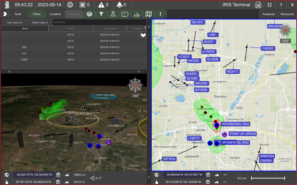
Kongsberg Geospatial and uAvionix, leading providers of software services for UAS Command and Control (C2) and Uncrewed Air Traffic Management (UTM) systems respectively, plan to integrate uAvionix’s validated FlightLine ADS-B data from cooperative aircraft, as an optional sensor feed for Kongsberg Geospatial IRIS Terminal users.
The collaboration will provide enhanced situational awareness to Uncrewed Aircraft System (UAS) operators by visualizing and deconflicting the airspace around their flights.
Reliable and trusted traffic feeds, from both cooperative and non-cooperative aircraft, are key inputs that enable the replacement of Visual Observers with Electronic Observers in the ongoing pursuit of safe and scalable BVLOS operations.
Thomas Jimenez, Market Director for UAS at Kongsberg Geospatial says, “Adding FlightLine to the suite of tools available to IRIS Terminal users provides an entirely new level of versatility and airspace information. The FlightLine system is increasingly being used in airspaces throughout North America and this new integration allows for a seamless ‘plug and play’ visualization for our IRIS Terminal users. We couldn’t be happier about deepening our relationship with the aviation professionals at uAvionix to benefit our clients.”
The uAvionix FlightLine service provides validated ADS-B track data from a first-of-its-kind high integrity surveillance network of dual-band ADS-B receivers.
FlightLine’s truSky™ validation score provides UAS operators confidence in the track data for key Detect and Avoid (DAA) functions. The cloud-based system performs at low latencies with redundancy to ensure timely and reliable delivery of ADS-B data from cooperative aircraft. With traceability to certified avionics for ADS-B, the FlightLine surveillance-as-a-service network is a trusted data feed for Beyond Visual Line of Sight (BVLOS) operations.
As with other air-traffic data feeds in the IRIS Terminal, FlightLine tracks will enjoy the same track correlation functionality available to other sensor feeds to ensure a clutter-free user interface and a reduction in cognitive load on the operator or airspace manager.
Interested clients should contact Thomas Jimenez of Kongsberg Geospatial for further information on the benefits of and how to add FlightLine to your IRIS Terminal.


