


MDCS
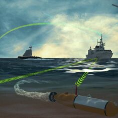
MDCS provides multi-domain command and control for BVLOS unmanned systems operating on land, at sea and in the air. It has been designed for army and naval UAVs, UGVs, USVs and UUVs, and has been heavily influenced by participation in NATO STANAG 4586 and 4817 standards groups for interoperable and multi-domain control stations.
The software provides an intuitive integrated picture of a large number of tracks at a wide range of altitudes and depths and moving at very different speeds, and includes optional cloud integration for mission planning, updating and reporting.


