Mapping & GIS News & Articles

New Mapping Payload Gimbal Released for DJI M300 Drone

Klau Geomatics has released the new KlauPPK Sony Mapping Payload, a gimbal designed to allow interfacing of Sony cameras to...

Jul 09, 2020
UAS Conducts Soil Moisture Mapping Mission

Black Swift Technologies (BST) has released a whitepaper outlining how the company’s Black Swift S2 fixed-wing UAS (unmanned aerial system)...

Jul 06, 2020
High-Definition 3D Thermal Mapping from an Autonomous Airship

Phase One Industrial has released a case study outlining how the company’s iXM-100 camera has been used by Airbus Defence...

Jun 28, 2020
High-Accuracy 3D Mapping for Autonomous Driving

Xsens has released a case study showing how its MTi-300 AHRS inertial sensor module has been integrated into a 3D...

Jun 10, 2020
RIEGL Provides Drone LiDAR Mapping & Surveying Solutions

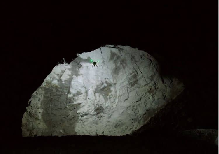
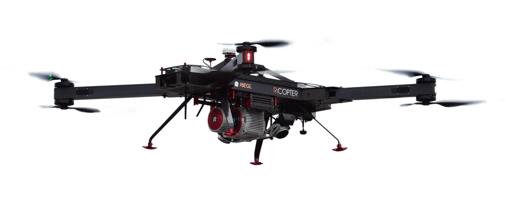
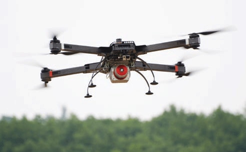
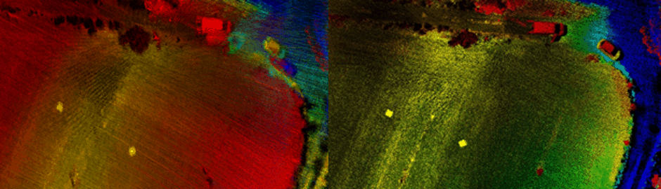
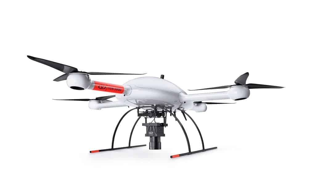
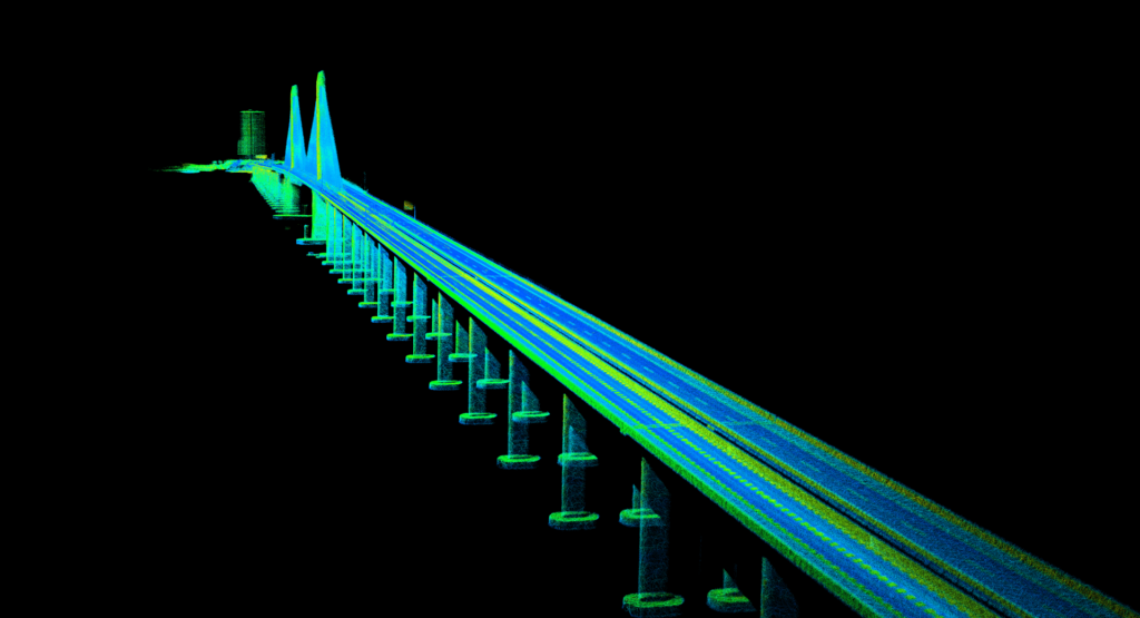
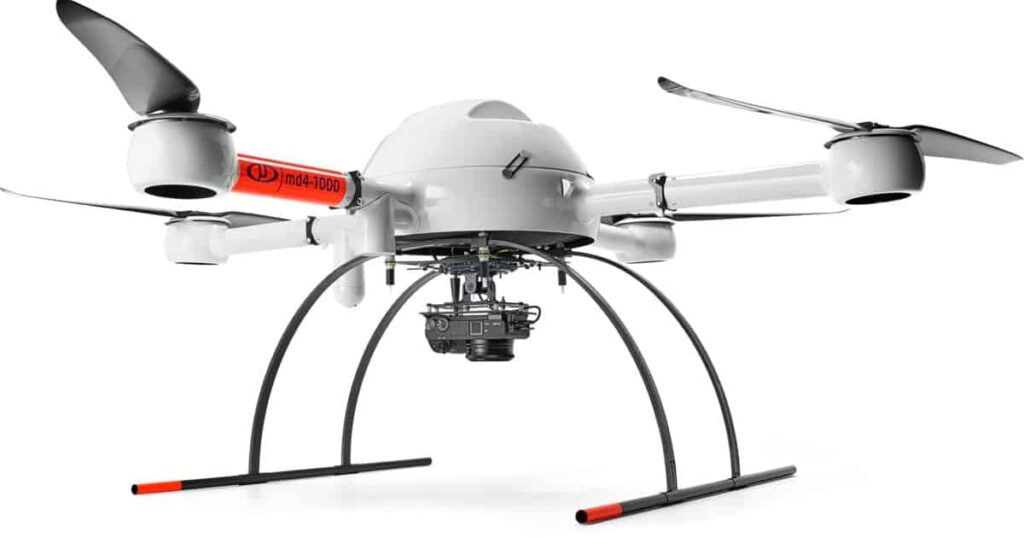
RIEGL, a leading developer and manufacturer of professional solutions for UAV (unmanned aerial vehicle)-based LiDAR surveying, has partnered with Unmanned...

Jun 05, 2020
Applanix and Riegl Develop UAV LiDAR Mapping Solution

Applanix and Riegl have collaborated to develop a LiDAR mapping solution for UAVs (unmanned aerial vehicles) that provides high accuracy...

May 31, 2020
New U.S. Distributor Selected for Microdrones Mapping & Survey Systems

Ideal Blasting Supply has joined the network of distributors for Microdrones unmanned aerial systems (UAS) and accessories for mapping and...

May 22, 2020
New Drone Mapping & Data Software Packages Released

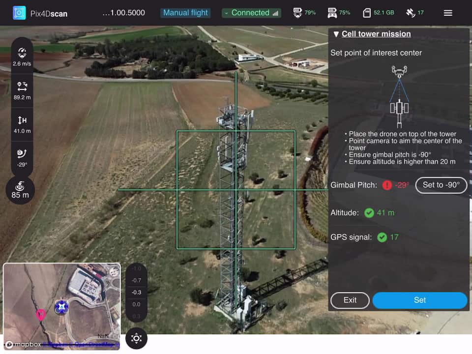
Pix4D has released the company’s latest next-generation software solutions for professional UAV (unmanned aerial vehicle) mapping, photogrammetry and data analytics....

Mar 31, 2020
FOG-Based INS for Mobile Mapping Launched

iXblue has launched a new range of FOG (fiber opic gyro)-based INS (inertial navigation systems) designed for use with land...

Mar 30, 2020
Webinar: Aerial Survey and Mapping

OxTS, a developer of inertial sensing solutions for UAVs (unmanned aerial vehicles) and robotics, has announced details of an exclusive...

Mar 17, 2020
GGS Develops UAV Mapping & Surveying Solutions

GGS, a leading developer and integrator of systems and solutions for UAS (unmanned aerial system)-based aerial surveying, has partnered with...

Mar 12, 2020
61 Megapixel Camera Integrated on VTOL Mapping UAV

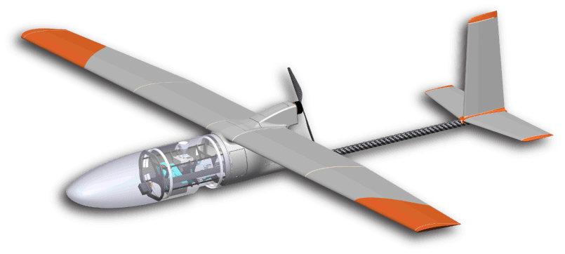
Vertical Technologies, a manufacturer of long-range unmanned aerial vehicles (UAVs) for commercial and professional applications, has announced that it has...

Dec 23, 2019
New Fixed-Wing Mapping UAS Launched

Hitec Commercial Solutions, a designer and manufacturer of professional UAV (unmanned aerial vehicle) solutions for a wide variety of aerial...

Dec 03, 2019
Microdrones Announces New Integrated UAV Systems & Geospatial Software

Microdrones has announced the release of three new integrated unmanned aerial vehicle (UAV) systems based on the company’s md4-3000 heavy-lift...

Nov 06, 2019
Long-Range 3D Mapping UAV Solution Under Development

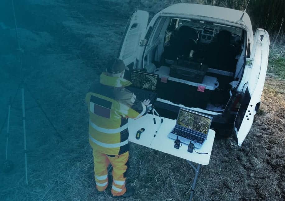
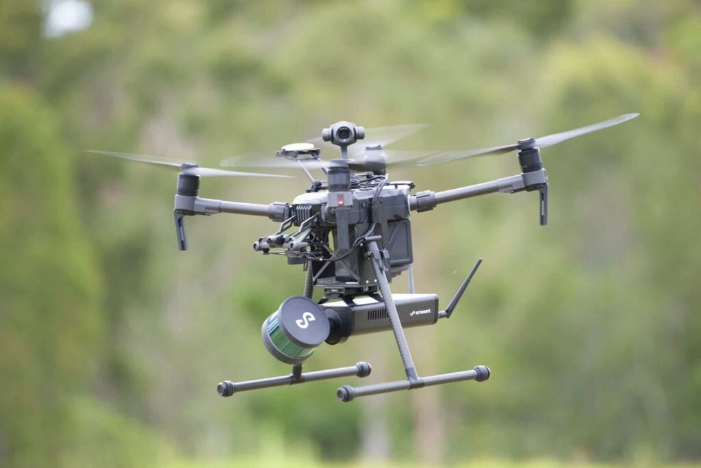
Polynesian Exploration, a developer of advanced GNSS/INS navigation technologies for unmanned systems, and UAVOS, a provider of Unmanned Aerial Vehicle...

Nov 04, 2019
Drone Mapping Software Developed for Emergency Response & Public Safety

Pix4D, a developer of professional drone mapping and photogrammetry software solutions, has announced the launch of Pix4Dreact, a 2D fast-mapping...

Oct 29, 2019
Case Study: GNSS/INS Integration for 3D Aerial LiDAR Mapping

Inertial Sense, a provider of micro inertial navigation solutions for UAVs (unmanned aerial vehicles) and autonomous systems, has released a...

Aug 23, 2019
Microdrones VTOL UAV Solutions Used for Forensic Mapping

Microdrones, a developer of professional unmanned aerial vehicle (UAV) solutions, has announced that it is partnering with CSI Mapping, a...

Jul 04, 2019
New GNSS/INS Announced for Mapping & Marine Applications

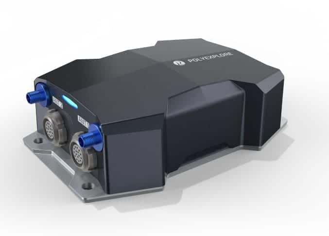
Polynesian Exploration Inc. has announced the release of a new single-body variant of its Polynav2000F high-performance GNSS-aided fiber optic gyroscope...

Jun 24, 2019
LORD Inertial Sensors Selected for LiDAR Mapping UAV Payload

LORD Corporation has confirmed that it has partnered with Emesent, a developer of autonomous technology for industrial drones, to bring...

Jun 07, 2019
PolyExplore GNSS/INS Used For Mobile High-Definition Mapping

PolyExplore Inc., a manufacturer of economical high-precision navigation solutions for unmanned systems, has announced that autonomous vehicle mapping company DeepMap...

Jun 07, 2019
Textron Introduces Flexible Geospatial Analytic Platform

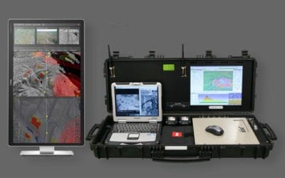
Textron Systems, a Textron, Inc. business, has announced the launch of SeeGEO™, a customizable geospatial analytic platform. SeeGEO connects geospatial...

Jun 03, 2019
Kongsberg Geospatial Updates UAS Fleet Control Station & Airspace Management System

Kongsberg Geospatial has announced the release of IRIS UxS 2.0, an updated and enhanced version of their Fleet Control Station...

May 07, 2019
3D HD Integrated Mapping & Surveying Solution Unveiled for UAVs

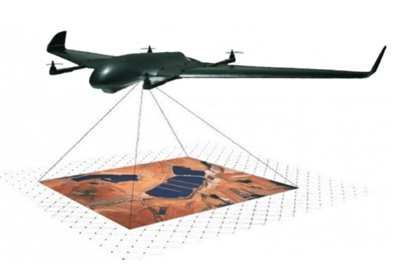
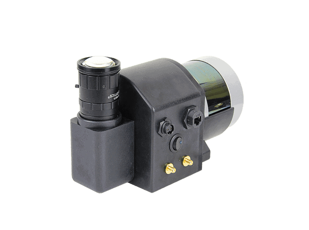
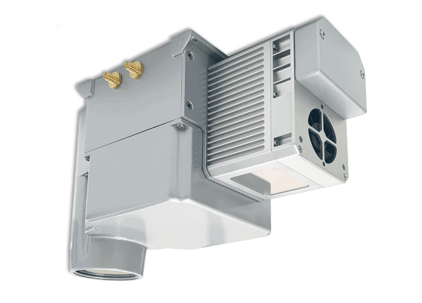
Polynesian Exploration has announced the release of PolyScanner, a high-performance, compact integrated solution for unmanned aerial vehicle (UAV) 3D HD...

Apr 28, 2019
Velodyne Lidar Sensors Selected for Aerial Mapping UAS

Velodyne Lidar has announced that Techmake Solutions, a technology development company, is including Velodyne lidar sensors in its Eagle X...

Apr 16, 2019
Advancing Unmanned Systems Through Strategic Collaboration UST works with major OEMs to foster collaboration and increase engagement with SMEs, to accelerate innovation and drive unmanned systems capabilities forward.