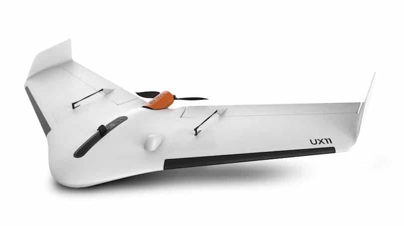
Mapping & GIS News & Articles

Icaros and Agrowing Launch Agricultural Drone Multispectral Mapping Solution

Icaros, a provider of aerial imaging software, and Agrowing, a supplier of multispectral sensors and analytics software, have announced an...

Sep 07, 2017
New Drone-Based Mapping Program Designed for Public Safety Applications

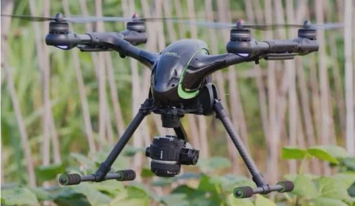
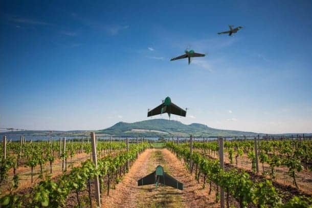
CompassDrone, a developer of unmanned aerial solutions for high-quality data collection, has announced a new comprehensive drone-based mapping program designed...

Aug 14, 2017
3DR Integrates Site Scan Mapping Software With DJI Drones

3DR has announced that it has integrated its Site Scan aerial data capture software platform with DJI to make it...

Aug 04, 2017
New Underwater Dynamic Laser Mapping Solution Will Speed Up Surveys

2G Robotics and Sonardyne International have announced that the two companies have entered into a formal collaboration agreement. The two...

Jun 24, 2017
Atmos UAV Unveils Data Gathering UAS for Mapping Applications

Atmos UAV, a start-up originating from the Technical University of Delft, has announced the launch of Marlyn, a lightweight data-gathering...

May 24, 2017
Drone Mapping Supports Search & Rescue Operations During Colombia Landslide

Pix4D has announced that its drone mapping technology has been used to support search & rescue operations in Mocoa, in...

May 22, 2017
Kongsberg Geospatial UAS Situational Awareness Software to be Certified for UTM

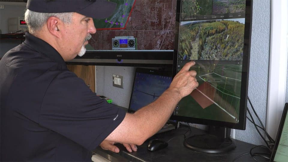
Kongsberg Geospatial, a developer of real-time geospatial visualization software, has announced that the company’s IRIS UAS Airspace Situational Awareness application...

May 02, 2017
Kongsberg Geospatial and uAvionix Announce Integrated ADS-B Drone Safety Technology

Kongsberg Geospatial and uAvionix have announced that the two companies will be integrating Kongsberg Geospatial’s IRIS UAS Airspace Situational Awareness...

Mar 27, 2017
Kongsberg Geospatial’s Software Selected for BVLOS Drone Research

Kongsberg Geospatial and the Federal Aviation Administration’s ASSURE UAS Center of Excellence, lead by Mississippi State University, have announced that...

Aug 30, 2016
Harris Geospatial Solutions to Offer Icaros OneButton Software for UAS Image Processing

Icaros Inc., a provider of aerial remote sensing services and software, has announced that Harris Geospatial Solutions, a division of...

May 18, 2016
SelectTech GeoSpatial Launches New Lightweight Fixed-Wing UAS

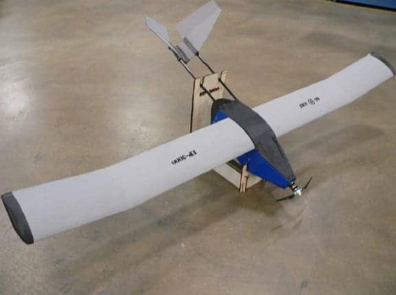
SelectTech GeoSpatial, a developer of situational awareness solutions, has announced the launch of its new custom configured EP-30000 lightweight fixed-wing...

May 12, 2016
Kongsberg Geospatial Successfully Tests Rescue Drone Technology

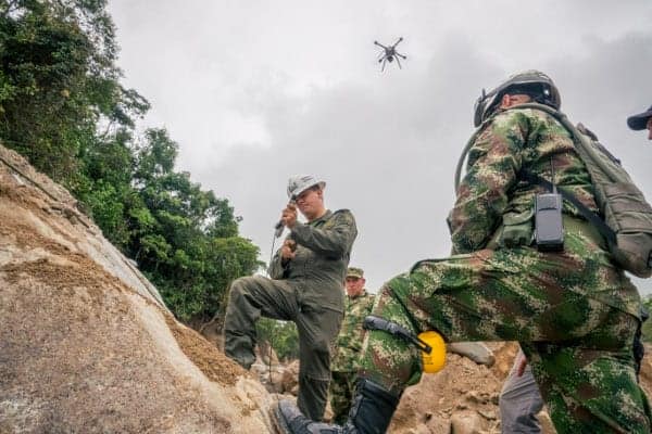
Kongsberg Geospatial, a developer of geospatial visualisation software, and the County of Renfrew Paramedic Service have announced the successful conclusion...

Mar 25, 2016
Hexagon Geospatial Announces GeoApp.UAS Data Processing App

Hexagon Geospatial, a provider of geospatial infrmation solutions, has announced the official launch of GeoApp.UAS, the company’s latest app that...

Nov 17, 2015
Transtrex Unveils Geospatial Restriction System for UAVs

Seattle-based Transtrex has released the beta version of a dynamic geospatial restriction system for Unmanned Aerial Systems (UAS), designed to...

Jul 28, 2015
Saab Seaeye Demonstrates AUV 4D Geospatial Data Acquisition System

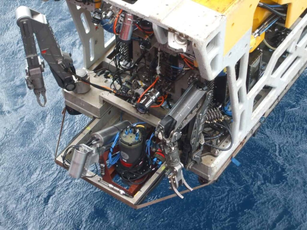
Saab Seaeye, a manufacturer of electric underwater vehicles, has demonstrated a 4D geo-spatial data acquisition system with real-time data visualisation...

Mar 13, 2015
Textron Systems Announces New Web-Based Geospatial Image Exploitation Software

Textron Systems Geospatial Solutions has announced the beta release of its newest product, the RVcloud™ web-based Electronic Light Table (ELT),...

Feb 19, 2015
Advancing Unmanned Systems Through Strategic Collaboration UST works with major OEMs to foster collaboration and increase engagement with SMEs, to accelerate innovation and drive unmanned systems capabilities forward.