


The Country of Renfrew Paramedic Service is one of the first paramedic services in Canada to use a commercial drone as a first response tool, and gained attention in the media last year when their UAV was used on an active crime scene following a triple homicide in Wilno Ontario.
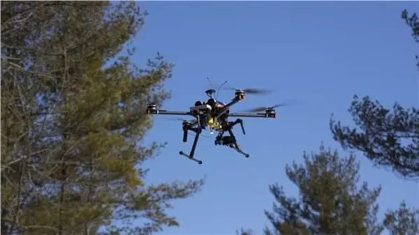
The biggest limitation that UAV operators face is the fact that for safety and regulatory reasons, civilian UAVs cannot be operated beyond line-of-sight: they have to be within view of the pilot at all times. This is especially problematic in heavily wooded areas where trees typically limit line of sight to a few tens of meters.
Kongsberg Geospatial has been providing display technology for military UAV platforms for over a decade, and is now actively working with industry and regulatory groups in the United States and Canada to develop a simple, portable unified display for civilian UAV operators that provides them with the necessary spatial awareness to safely operate UAVs beyond line-of-sight.
The display technology integrates and presents a variety of data sources to provide comprehensive information about the UAV along with other aircraft, airspace, obstacles and terrain using a single lightweight tablet. These data sources are not normally available to a UAV operator.
While the test team was restricted from actually operating beyond line-of-sight, they were able to simulate BVLOS conditions by having a second observer shadow the pilot operations and track the progress of the drone.
During repeated exercises over the course of the trial, pilot James Power was able to use the software to successfully navigate the UAV, and to help direct teams of searchers to “casualties” hidden in a heavily forested nature reserve near Cobden, Ontario. The outcome of these trials could have a significant impact on search and rescue operations in the near future. To UAV pilot James Power, the immediate value of the technology is obvious:
“We’re currently really constrained as to how far we can go with a drone – especially in forested areas” explained Mr. Power, “if we can extend the operating range of our drone, we can increase the speed and effectiveness of a search, and help guide rescue teams to casualties in remote areas far more quickly.”
County of Renfrew Paramedic Service chief Michael Nolan believes that their pioneering efforts could eventually help to transform the delivery of paramedic services throughout Canada.
“As we continue to develop effective ways to extend the delivery of emergency services, we’re developing a body of knowledge and best practices that could ultimately be applied by other paramedic services throughout Canada” said Mr. Nolan. “The results of these trials are very promising in terms of extending our operating range, and have lead to new ideas about how we can transform and apply this technology.”
However, there is still more work to be done before the County of Renfrew Paramedic Service and other similar agencies will be routinely flying UAVs beyond line-of-sight.
Allison Malloy, the program manager for the IRIS UAV platform at Kongsberg Geospatial explained: “We’re pleased at the outcome of these trials, and we’re confident in our technology, but we still have additional research and development to do before this platform can be applied commercially, and there’s still a lot of regulatory work to do to get the necessary approvals”, she said. “We’re actively engaged with Transport Canada, the FAA, and other regulatory and industry working groups, and we’re hopeful that the necessary regulatory framework to allow licensed drone pilots to work beyond line-of-sight will be put in place in the near future.”


