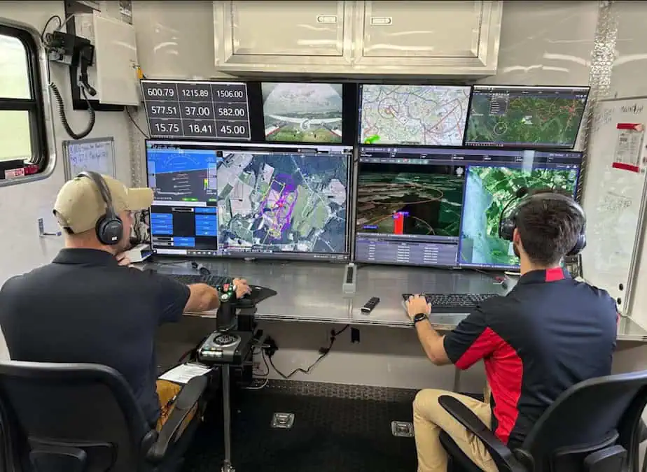
Kongsberg Geospatial has deployed its IRIS Terminal at the University of Maryland’s UAS Research and Operations Center (UROC) to support medical supply deliveries across the Chesapeake Bay to Smith Island, a community often challenged by transportation constraints.
By integrating ownship telemetry with data from Echodyne, MatrixSpace, and ADS-B receivers, IRIS provides UROC with a unified airspace picture and decision-support tools that strengthen safe and scalable beyond visual line of sight (BVLOS) operations in collaboration with UMD’s uncrewed aviation research efforts.
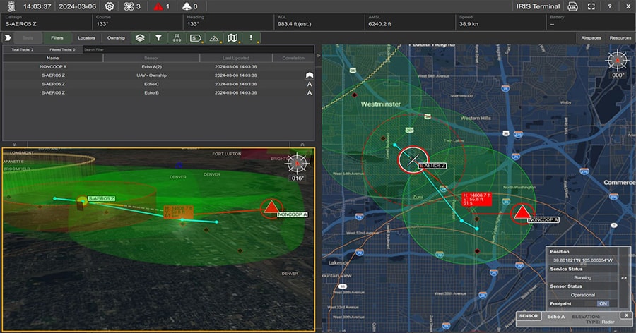
The system delivers real-time, map-centric situational awareness by combining ownship telemetry and multiple cooperative and non-cooperative surveillance feeds into a single operating picture. At UROC, the deployment integrates MAVLink ownship telemetry with Echodyne EchoGuard® and EchoShield® radars, MatrixSpace radars, and PingStation® ADS-B receivers to enhance airspace visibility and operational safety for the Smith Island medical logistics corridor.
Key capabilities delivered at UROC:
- Unified air picture: Correlates tracks from Echodyne and MatrixSpace ground radars with ADS-B feeds and MAVLink telemetry.
- BVLOS decision support: User-defined alerting, conflict cues, geofence monitoring, and mission replay.
- Scalable architecture: Sensor-agnostic ingest that enables expansion of coverage and integration of new sensors as requirements evolve.
Jordan Freed, President, Kongsberg Geospatial, commented, “The University of Maryland’s Smith Island initiative demonstrates how uncrewed systems can deliver immediate, life-improving outcomes for communities while informing the path to broader BVLOS adoption. By deploying IRIS Terminal at UROC, we’re helping operational teams see the airspace more clearly, coordinate more effectively, and make timely decisions with confidence.”
The Smith Island route connects Crisfield, Maryland, with Smith Island, where access to care is often limited by weather and transportation constraints. With multi-sensor fusion, configurable geofences, alerting, and audit-ready data logging, IRIS equips UROC’s flight operations with the situational awareness and tools needed to plan and conduct complex missions safely.